INDIANAPOLIS — In what's been a rather benign winter so far, the wind-whipped flurries and snow bursts of Monday made for an interesting day and certainly was more representative of December.
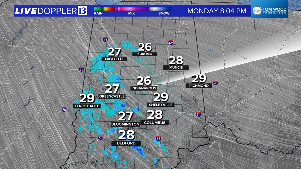
Radar this evening shows diminishing coverage of heavier snow bursts and that trend should continue overnight. The exception will be for areas in eastern/northeastern Indiana that will still be influenced some by Lake Michigan. But the wind shifting to the west by sunrise will limit lake effect in our viewing area and allow for a gradual clearing of low clouds going into the morning commute.


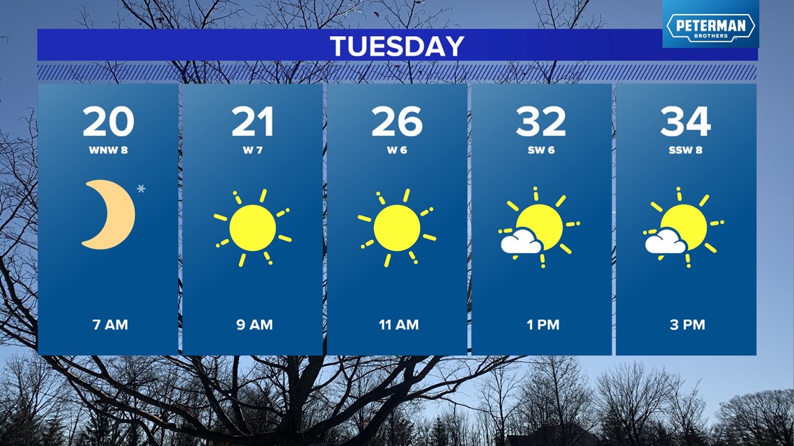

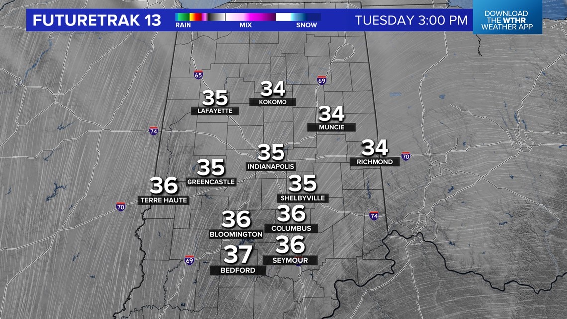
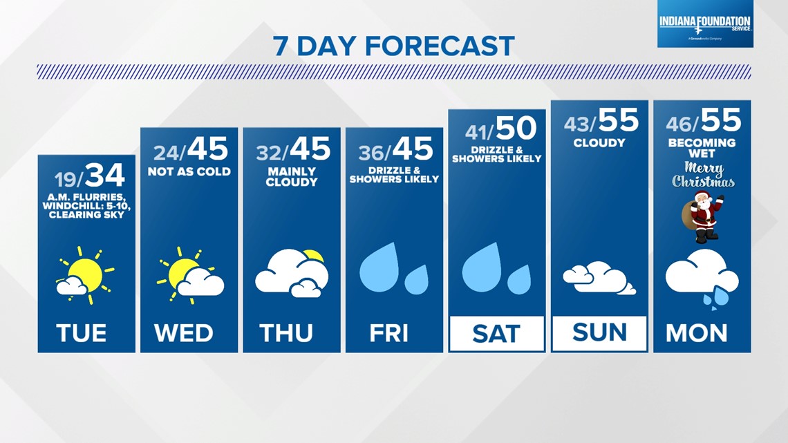
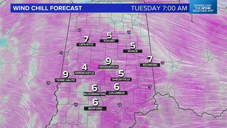
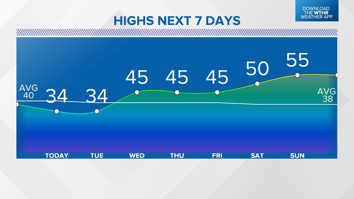
Lack of clouds sets us up for coldest lows (15 to near 20 degrees) and coldest wind chills (single digits) in nearly a month and makes for a stinger of a start in the morning. Plan to layer up for those wind chills but know that we're staring down a good dose of blue sky and Tuesday afternoon will look and feel so much better compared to Monday.

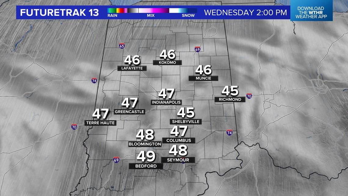

Temperatures quickly modify the remainder of the week with a southwesterly wind boasting highs into the mid/upper 40s with sun and clouds on Wednesday, making it feel some 40 degrees warmer than Tuesday morning.
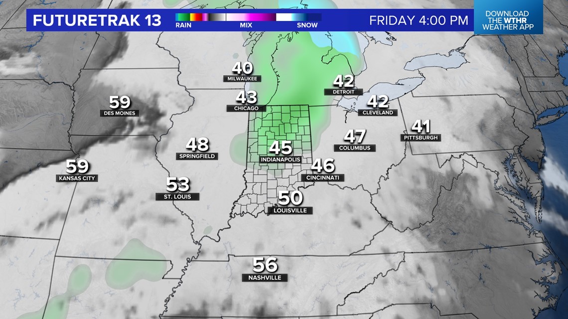
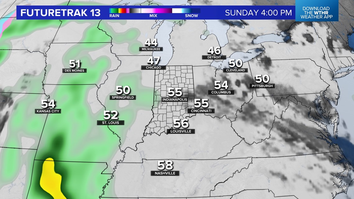
Clouds increase the rest of the week and there will be a subtle boundary that's expected to stall around the viewing area on Thursday and Friday. This may limit temperatures from reaching the 50s those days and eventually becomes an aid in increasing drizzle/showers Friday into the weekend.


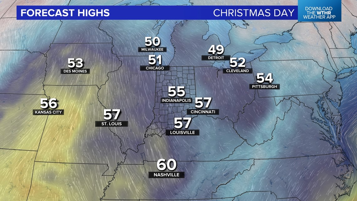

We're still forecasting mid 50s for Christmas Eve and Christmas Day. The latter would be just the 14th Christmas Day with a high of 55 degrees-plus. If our forecast low of 46 degrees verifies, it would be the warmest low temperature on December 25 since 1982 and only fourth Christmas Day with a low of 46 degrees-plus. Any way you slice it, this is a nightmare setup for chite Christmas dreams this year.
But it should be noted that central Indiana, climatologically, only has a 28% chance of having 1 inch-plus snow depth on Christmas Day (the meteorological definition of a white Christmas) though we did technically have one last year.