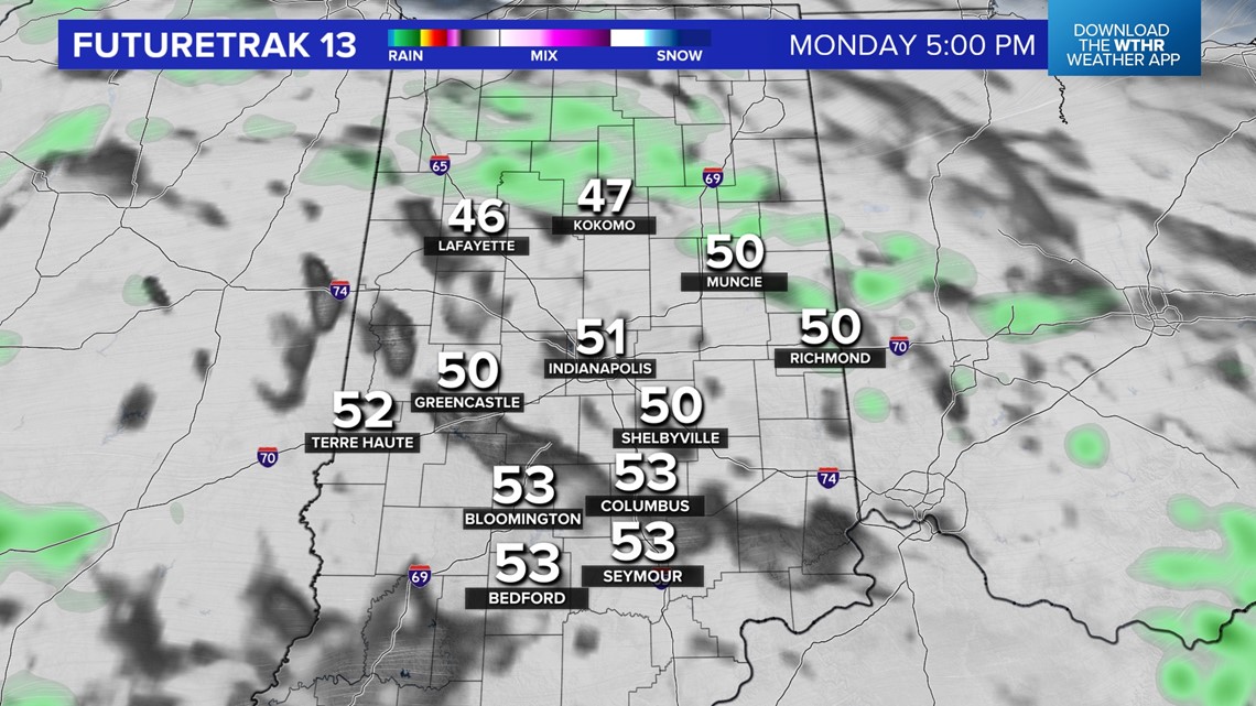
INDIANAPOLIS — It's been a day of plenty of clouds, occasional peeks of sun, and sporadic showers. All eyes remain on a potent severe weather set-up unfolding in the Deep South with a heightened risk of tornadoes/damaging wind in east Texas, Louisiana, Arkansas, and Mississippi.
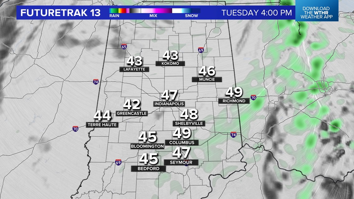
While this storm system won't bring severe weather to central Indiana, it does deliver a rainy night with some rumbles of thunder possible. The bigger byproduct, and much-needed for the parched landscape here, will be steadier, heavier rain between midnight and 7 a.m. – with the modeled heaviest axis crossing through Indy around 3 a.m.


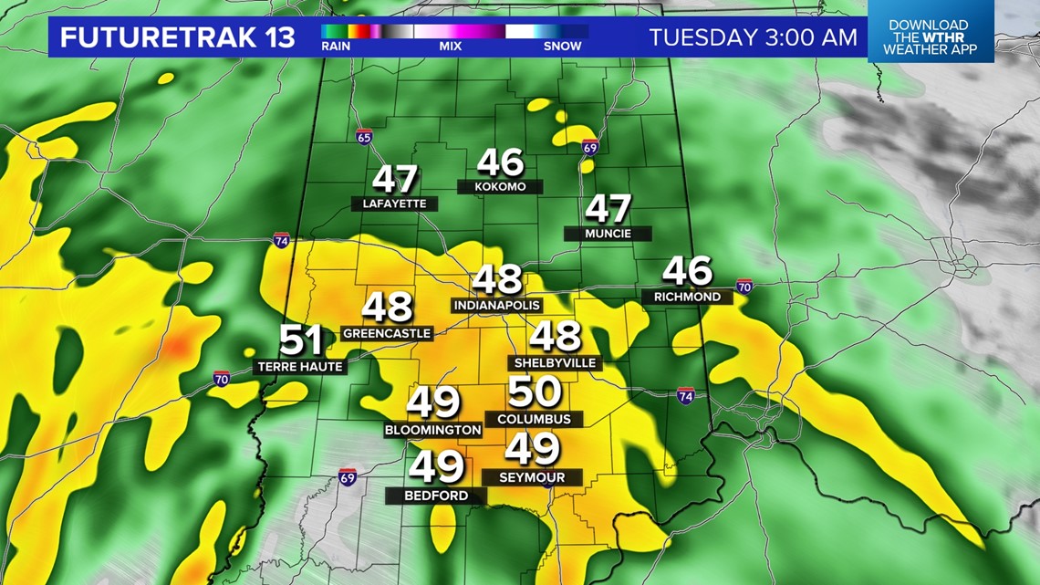

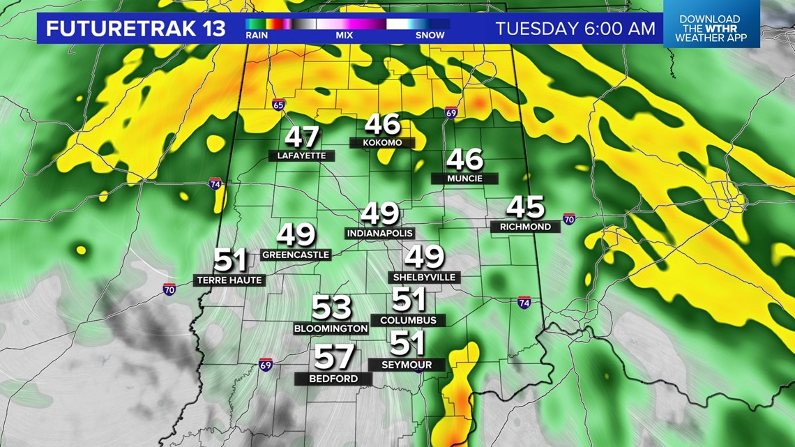
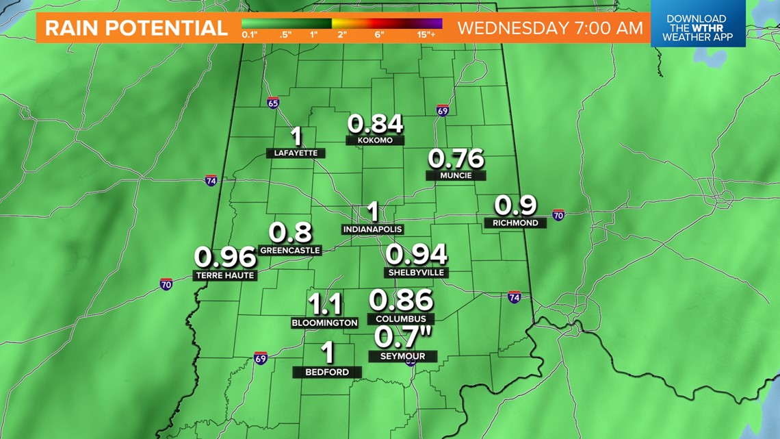
Don't be surprised if rain pounding the roof wakes you overnight in addition to gusty wind and some thunder. This could end up being our heaviest rain in nearly two months with the likelihood of widespread half-inch to locally an inch and half totals by Tuesday evening.
Though the heaviest rain ends for most by 8 a.m. Tuesday, expect wind-whipped showers to continue most of tomorrow with temperatures falling from the 50s to 40s by 4-5 p.m.


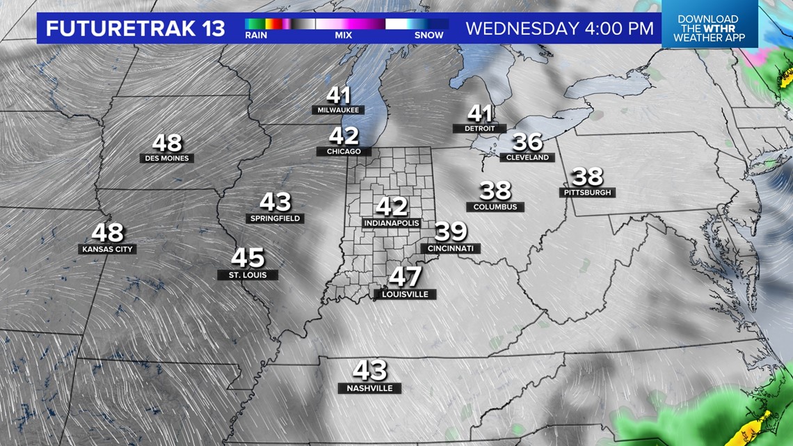

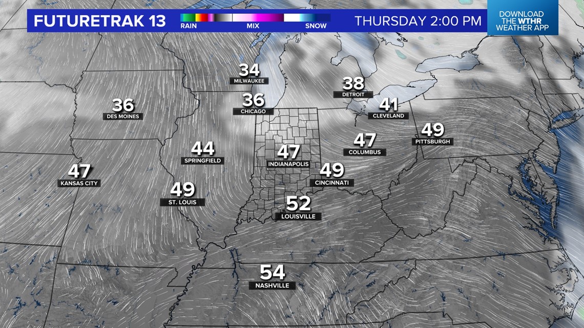
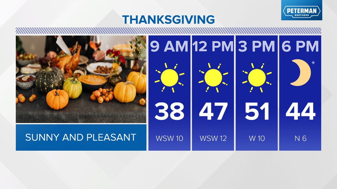
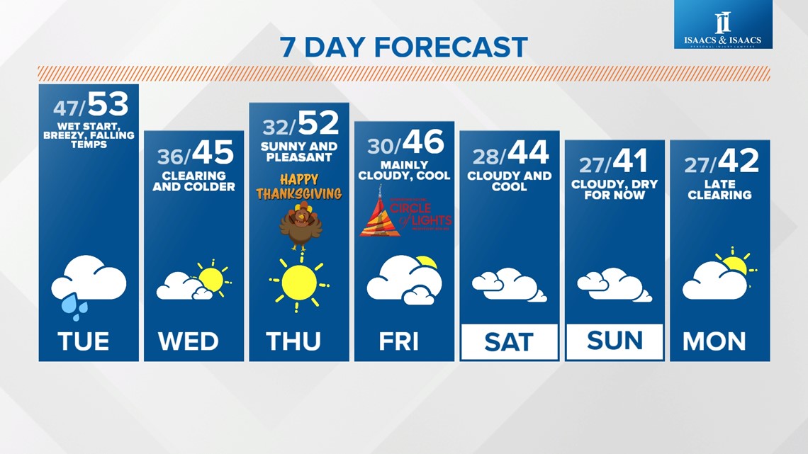
As this storm system departs, we're expecting a clearing sky to develop by later Wednesday afternoon to set-up what's looking like a pleasant Thanksgiving. This is a contrast to the chillier set-up guidance was showing last week for the holiday. Though morning temperatures drop into the 20s/lower 30s, it's looking like highs reach the upper 40s/lower 50s with decent sunshine. We'll see if this holds or additional adjustments will be needed.
Clouds return for Friday and into this weekend. Right now, we're forecasting dry but seasonably chilly conditions for Circle of Lights Friday night.
Our weekend forecast is dry at this time, but we're monitoring the potential of an upper air disturbance moving across the Ohio Valley Sunday which could bring some rain.