Sunday morning got off to a bang with multiple rounds of heavy thunderstorms that were prolific lightning producers. Many areas got over an inch of rain and some locations had over two inches of rain. In addition, severe hail dropped over parts of west-central Indiana and through Boone, Hamilton, northern Marion counties.
A positive byproduct from the stormy start was a relatively quiet,- albeit cloudy, - Sunday during daylight hours. The morning storm complex pushed the firing line for new storm development south and southwest of the WTHR viewing area. Storms have erupted in western Kentucky and Illinois where the atmosphere is conducive for severe weather.
Locally, there remains a "lid" on storm development due to little heating today. This should save us from seeing widespread storms this evening. With that said, a few "hailers" are possible and severe thunderstorm warnings can't be ruled out.

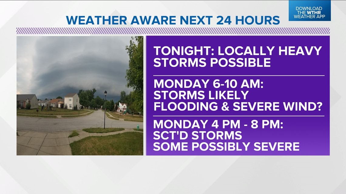
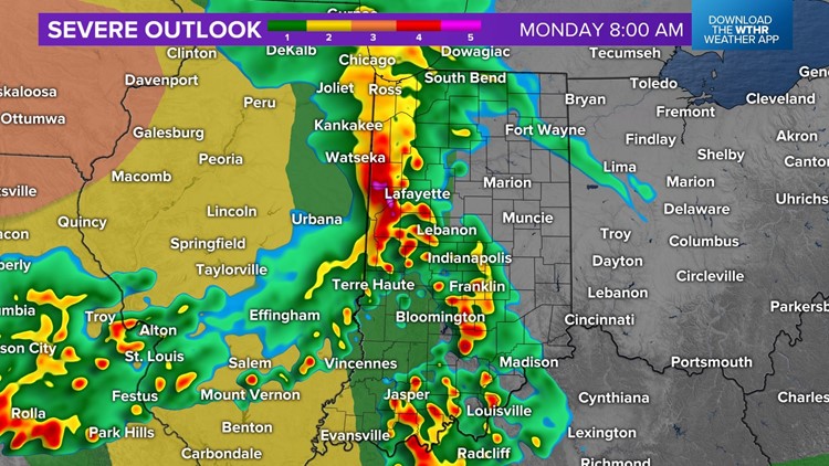
A much more likely scenario is for the storms in Nebraska and Iowa congealing into a severe thunderstorm complex overnight into Monday morning. This complex is expected to track east-southeast and its remnants impacting central Indiana between 6 a.m. - 10 a.m.

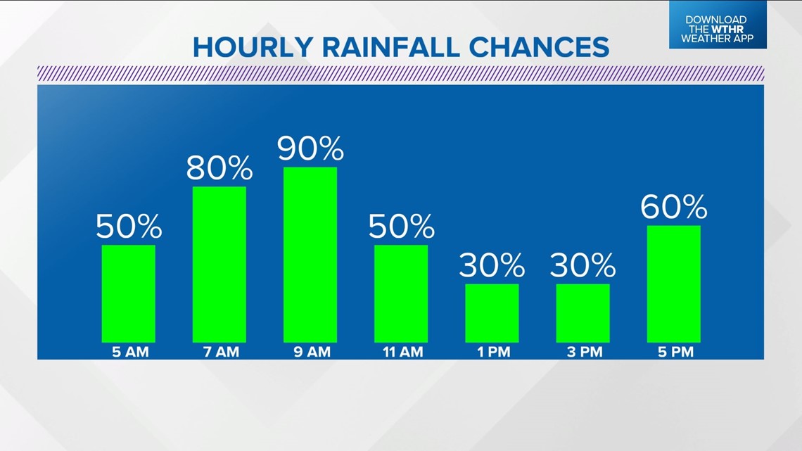


This means plan of a stormy morning commute, school drop-off and bus stop pick-up. Heavy rain and lightning are main threats with areas of flooding, severe gusts, and/or embedded tornadoes secondary.
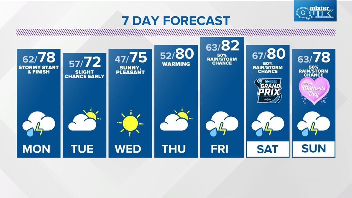
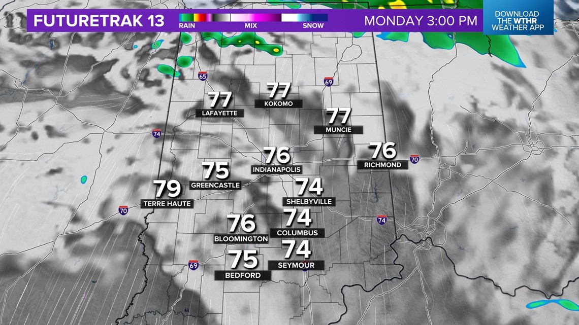
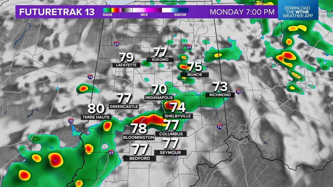
Be Weather Aware in the morning and evening with additional scattered thunderstorms developing Monday afternoon after many dry hours in the midday.
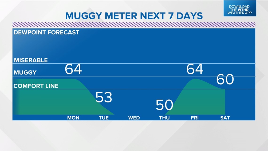
You've likely noticed the Muggy Meter much more uncomfortable and that will linger until a sharp wind shift to the northeast Monday night delivers refreshing air for mid-week. Dewpoints go from the 60s to 30s/40s for a pleasant streak of weather Tuesday into Thursday.

It's short in nature and all model guidance shows another unsettled pattern going into Mother's Day weekend. While it's impossible to say how many storms will be around, we'll be fine-tuning coverage and timing for potential impacts to the Grand Prix Saturday and Mother's Day on Sunday.