INDIANAPOLIS — Central Indiana, and much of the Ohio Valley, is in desperate need of rainfall. Confidence is growing that a decent chunk of our state and region gets some much-needed rain relief with the upcoming pattern change to much cooler temperatures next week.
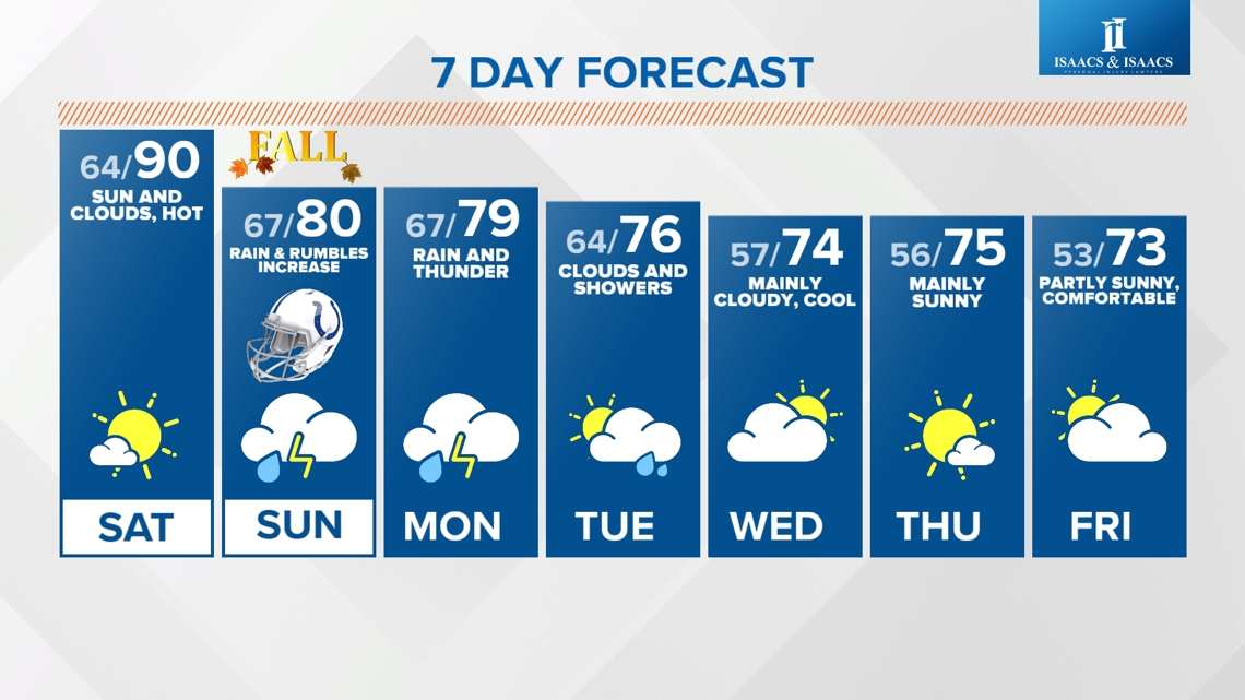
But this afternoon, and Saturday, will be anything but cool. For the seventh straight day, high temperatures soar into the upper 80s and lower 90s. The longest such streak in Indianapolis this late in the season since 2018. After Saturday highs near 90°, it becomes the second-longest streak on record of 87°+ this late behind 14 straight days way back in 1891. This heat streak expires in a big way into next week and the transition proves to be a wet one, beginning with isolated, but possibly severe, storms later this evening.


Impactful Isolated Storms Friday Evening:
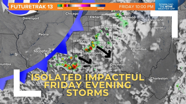
We want you to be Weather Aware if you plan to be outside this evening, especially for areas near/north of I-70 before midnight. The combination of unseasonably hot temperatures, increasing low-level moisture (dewpoints now in the 60s), and an approaching front will trigger storm initiation in northwestern Indiana between 4-6 p.m.

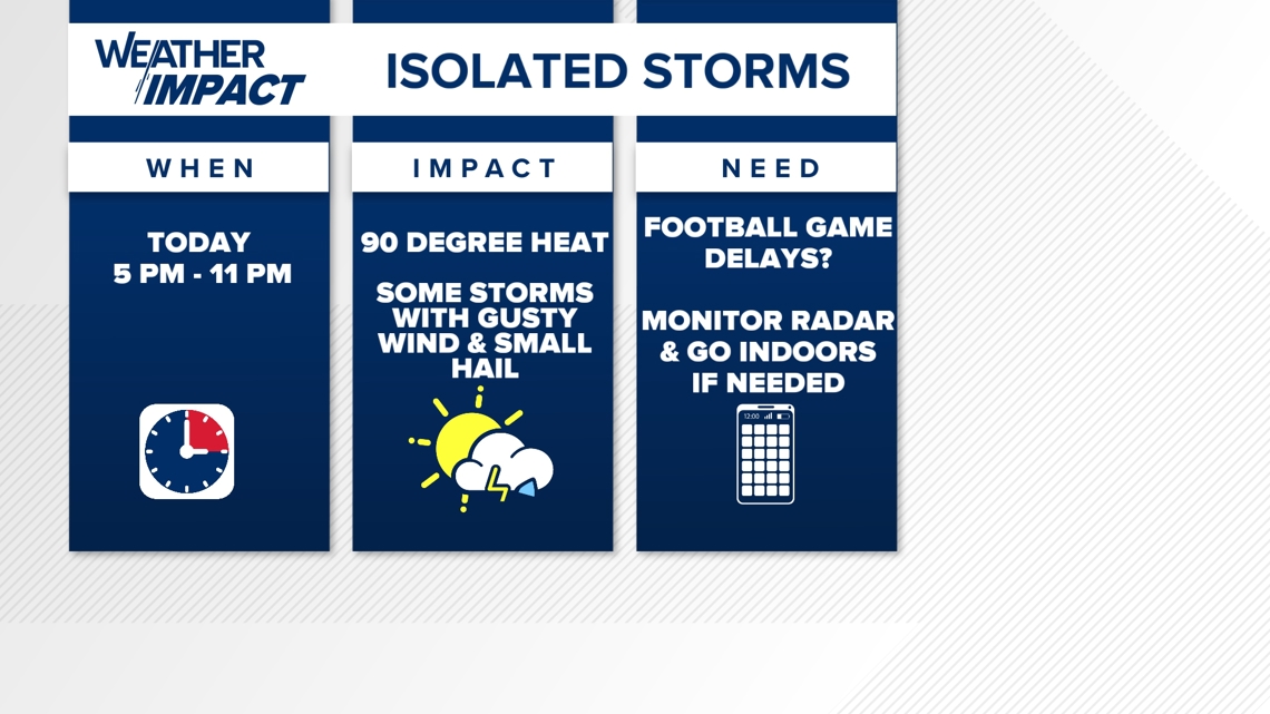

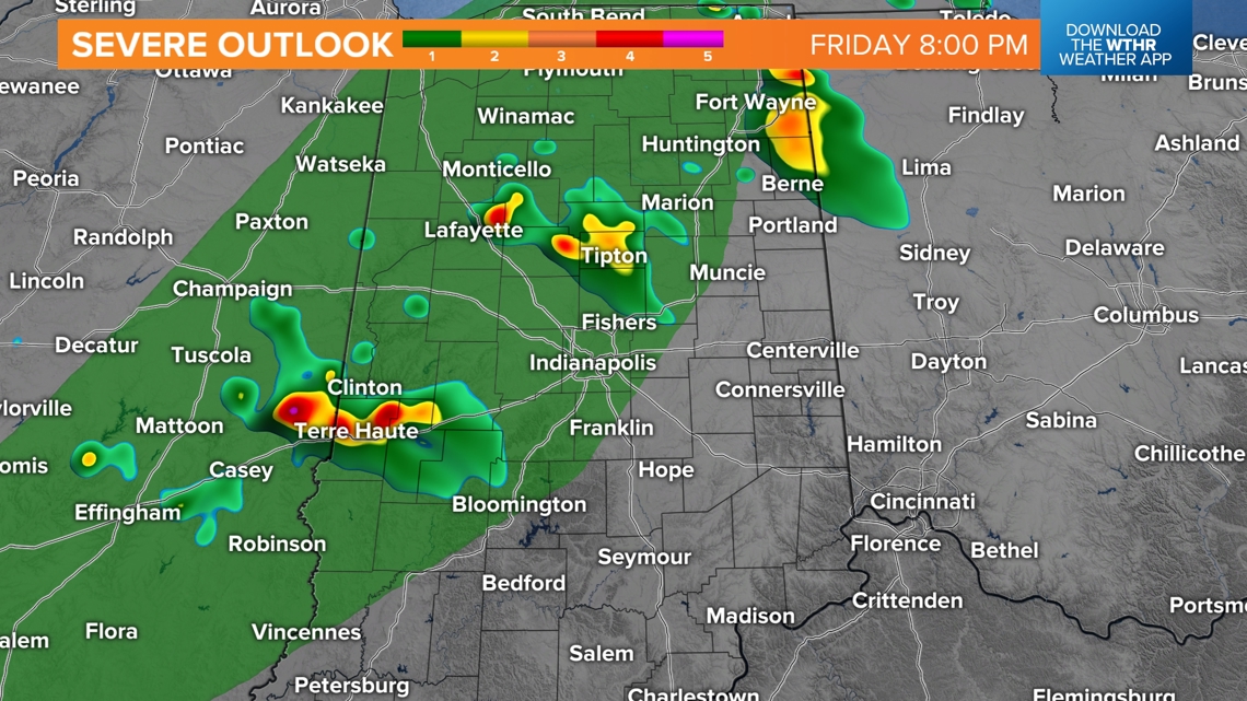
Though storms should remain isolated, they could produce locally severe wind gusts and/or hail as the drift toward the Indy metro area between 9-10 p.m. Delays of some Operation Football games and other outdoor events are possible. Please monitor radar closely and we always recommend our free 13Weather app to alert of approaching thunderstorms and lightning in your area.
Soggy Sunday At Times:
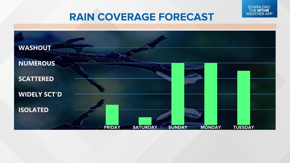
Any storms diminish around midnight and that boundary settles toward the Ohio River during the morning Saturday. That sets the stage for plenty of sunshine tomorrow and one last day of hot highs near 90°, in what will be easily the drier of the two days this weekend and more optimal for outdoor activities.

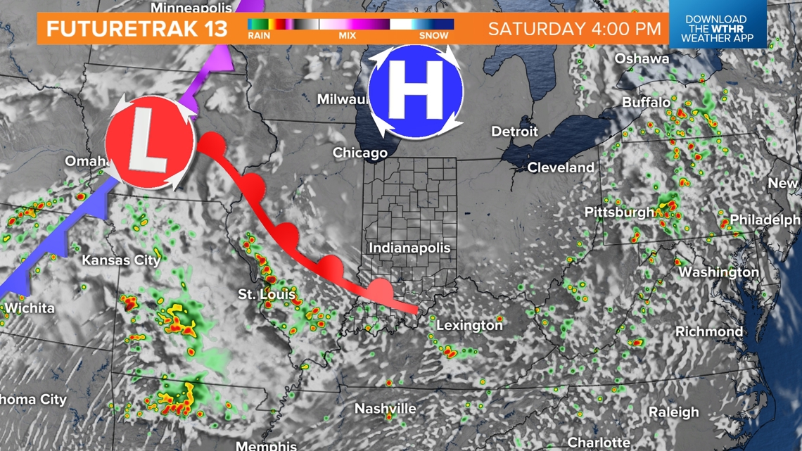

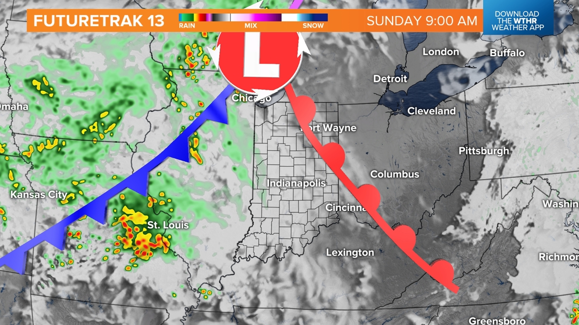

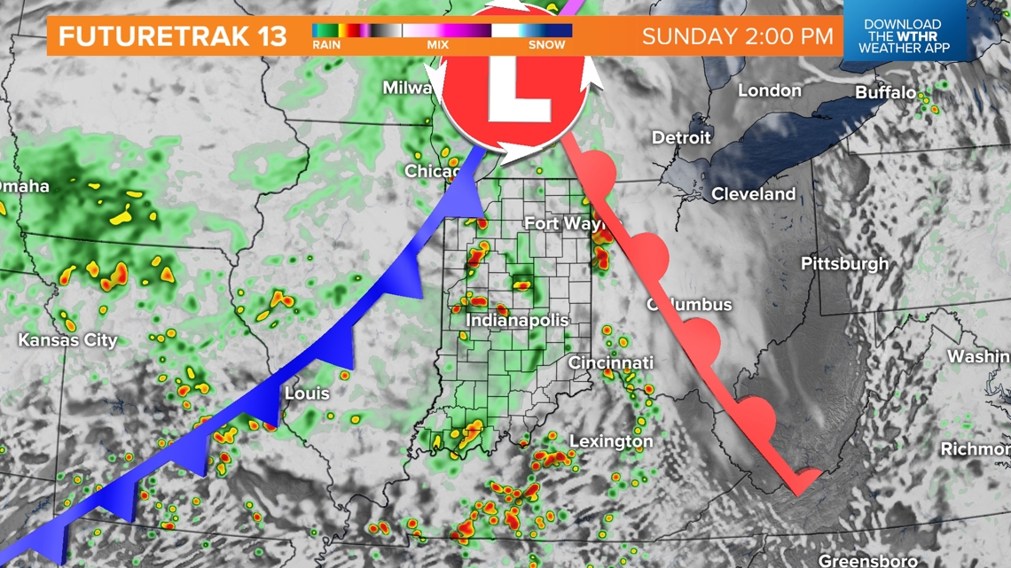
The aforementioned boundary returns as a warm front on Sunday and sets the stage for the busiest 48 hours of radar we will have had since the middle of August. If you plan to tailgate for the Colts on Sunday, you will be on borrowed time for dry weather. It will be cloudy for sure, and eventually rain with rumbles of thunder increase between 9 a.m. and midday. Rain coverage Sunday ranges from scattered to numerous, and there's more of that to come for Monday.
Rain Relief Ahead:
Guidance continues to slowly trend toward much of Indiana being in the path of a sizeable rain footprint with the upcoming pattern transition, with many areas expected to get at least .50" to an inch. Within the main banding, some places could much more (1.50"-2") and some areas could get less. As we get closer, we'll narrow down which parts of the state get the most.

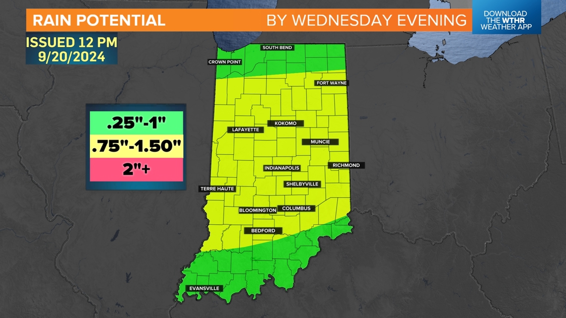

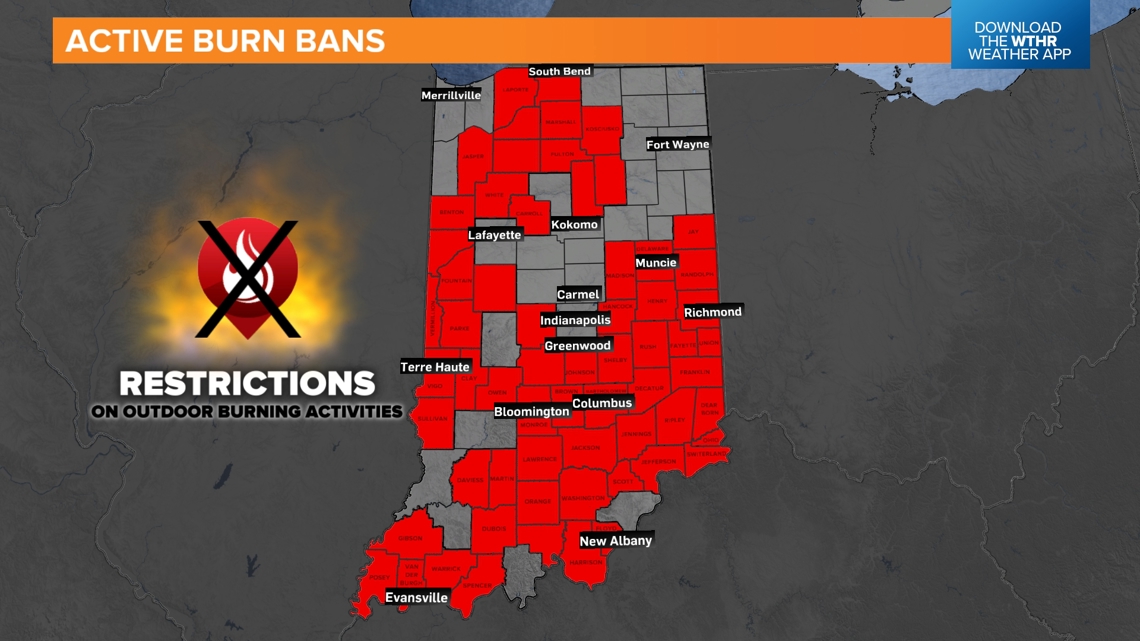
But this is all great news for a state that currently has over 60 counties with burn ban restrictions. While this rain event won't break the drought, it will ease the risk of fire spread by the middle of next week.
After the soaking rain, a well-advertised pattern shift to much cooler temperatures kicks in. While it will be much cooler, temperatures next of highs in the 70s will be near-normal for early autumn but feel even cooler due to the heat streak we're currently experiencing.