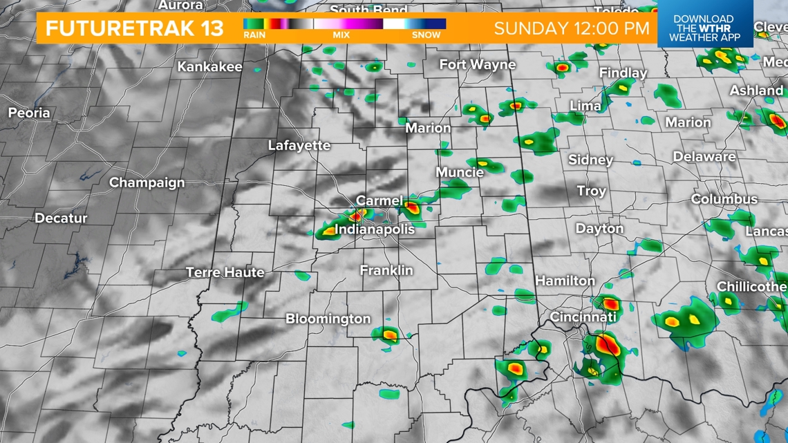
INDIANAPOLIS — A cold front will bring additional isolated showers and thunderstorms through the early afternoon.
![](https://media.tegna-media.com/assets/WTHR/images/f6762f25-8779-42d7-9237-39239389e062/20240623T170356/f6762f25-8779-42d7-9237-39239389e062_16x9.jpg)
![](https://media.tegna-media.com/assets/WTHR/images/f6762f25-8779-42d7-9237-39239389e062/20240623T170356/f6762f25-8779-42d7-9237-39239389e062_1140x641.jpg)
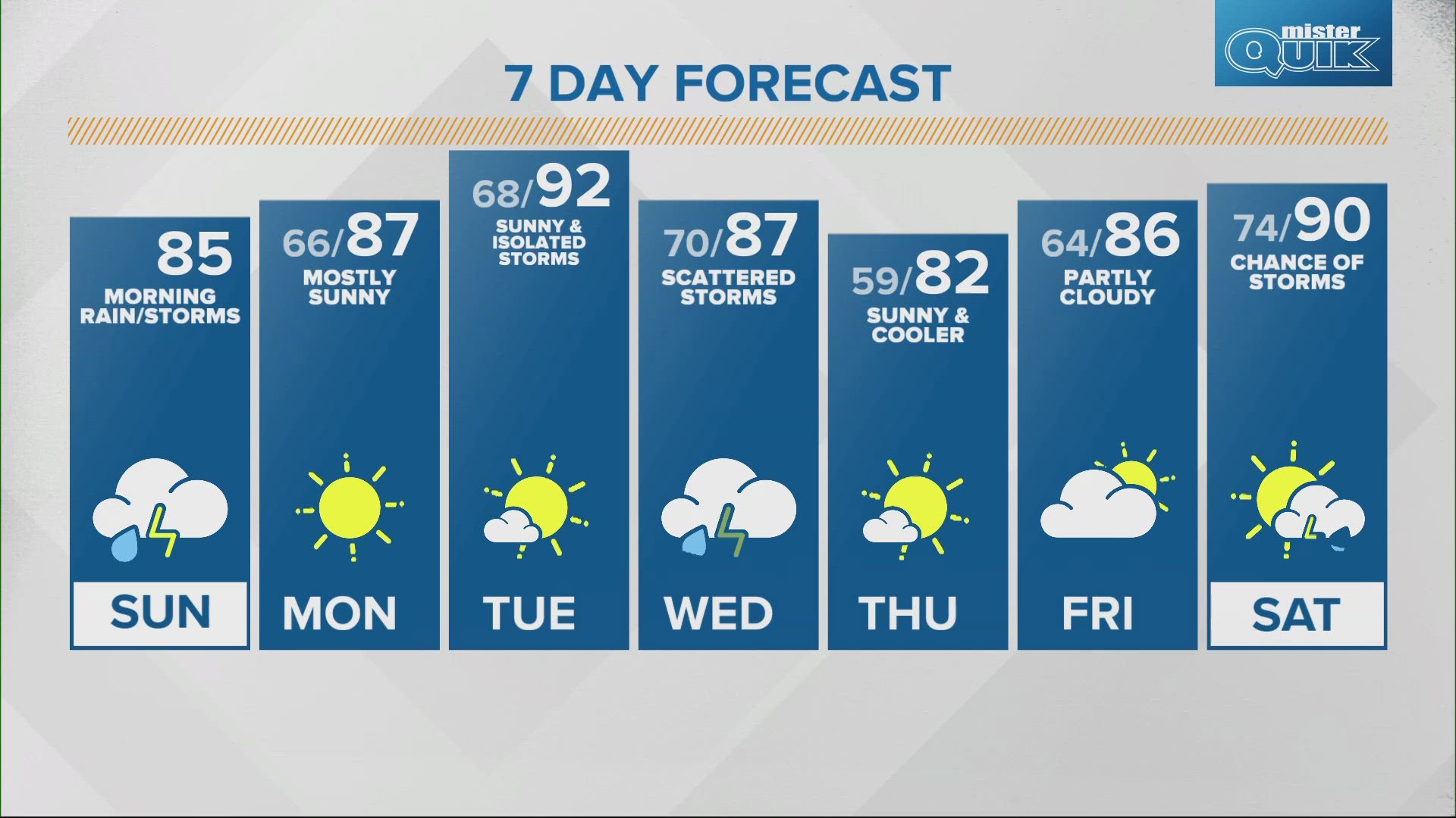
Thanks to the cold front bringing cloud cover and rain, there will be a break from the high heat. Temperatures will warm to the middle 80s, fairly seasonable for this time of year.
![](https://media.tegna-media.com/assets/WTHR/images/dbde963e-0651-4823-b3de-c9e6f221655d/20240623T170417/dbde963e-0651-4823-b3de-c9e6f221655d_16x9.jpg)
![](https://media.tegna-media.com/assets/WTHR/images/dbde963e-0651-4823-b3de-c9e6f221655d/20240623T170417/dbde963e-0651-4823-b3de-c9e6f221655d_1140x641.jpg)
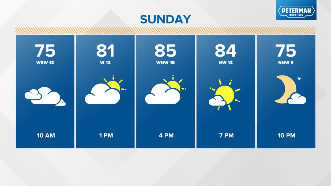
Behind the cold front the humidity will drop and it will become more comfortable by tomorrow.
![](https://media.tegna-media.com/assets/WTHR/images/aac076c0-3bbb-4388-bb7d-aec2fc030545/20240623T170440/aac076c0-3bbb-4388-bb7d-aec2fc030545_16x9.jpg)
![](https://media.tegna-media.com/assets/WTHR/images/aac076c0-3bbb-4388-bb7d-aec2fc030545/20240623T170440/aac076c0-3bbb-4388-bb7d-aec2fc030545_1140x641.jpg)
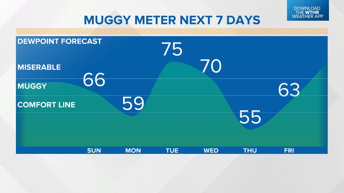
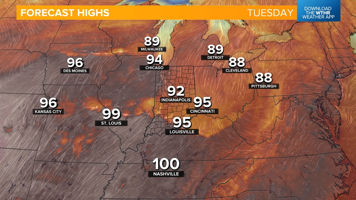
However, the heat and humidity ramps back up Tuesday. Highs are expected to return to the 90s.
![](https://media.tegna-media.com/assets/WTHR/images/a8b86e18-d817-4836-85a8-426a6157ea77/20240623T170502/a8b86e18-d817-4836-85a8-426a6157ea77_16x9.jpg)
![](https://media.tegna-media.com/assets/WTHR/images/a8b86e18-d817-4836-85a8-426a6157ea77/20240623T170502/a8b86e18-d817-4836-85a8-426a6157ea77_1140x641.jpg)