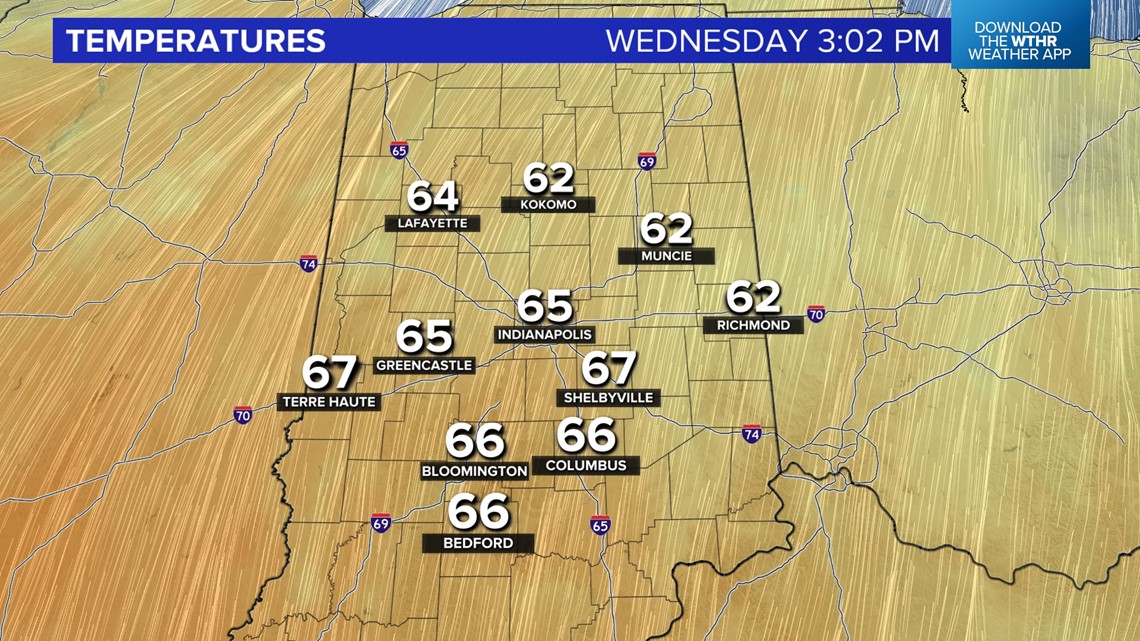
INDIANAPOLIS — Definitely looking and feeling like April today as high temperatures soared into the mid and upper 60s. While the daily record high stayed safe (69°/2018) in Indianapolis, the city did hit 66° which isn't too far from it and over 20° above the daily average high for February 21st.
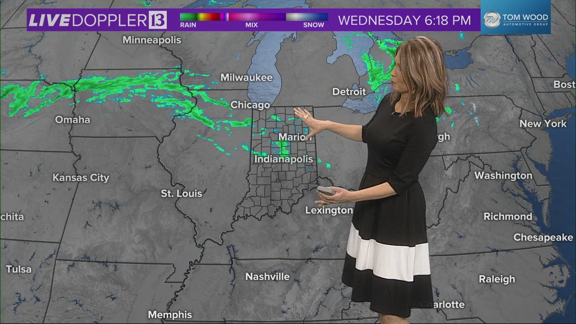
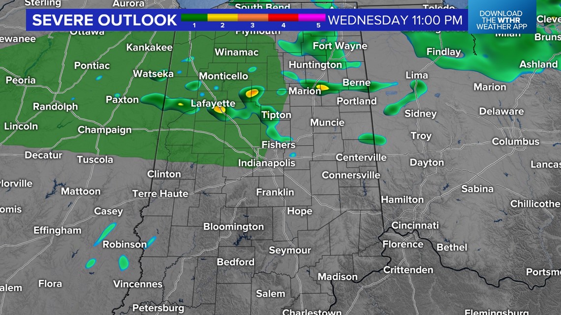
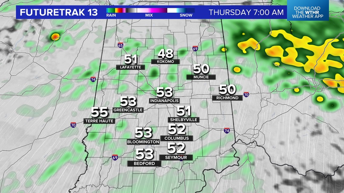
Sunshine slowly gives way to cloud cover later day, but much of it is filled with brightness. Later tonight and before sunrise Thursday, some thunderstorms develop along a warm front.

The stronger cells will be capable of producing hail that could reach severe limits. Don't be surprised if you hear thunder tonight and again on Thursday.
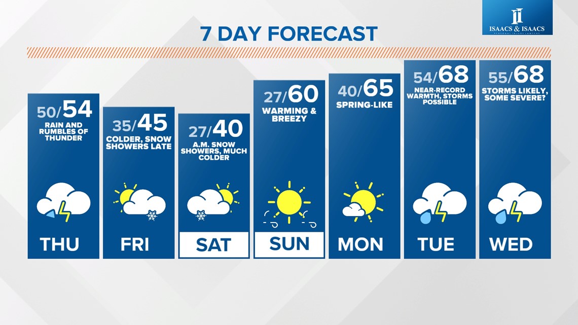
It will be a soggier setup tomorrow, with a front draped over central Indiana, moisture-laden air and a wave of low pressure moving through the area providing widespread rain and pockets of downpours.


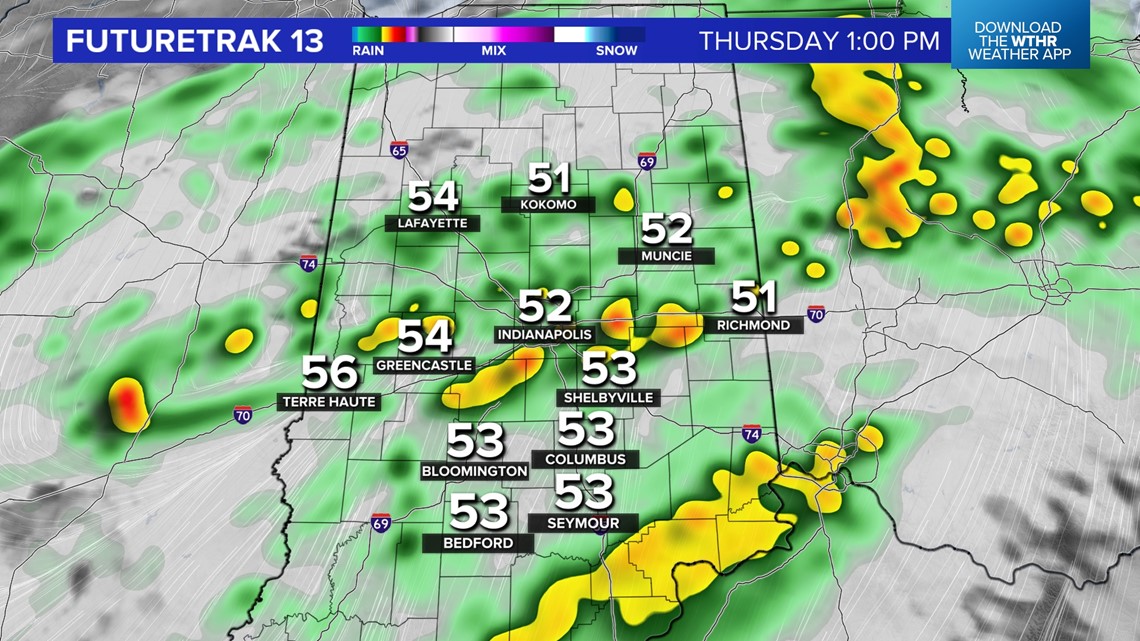

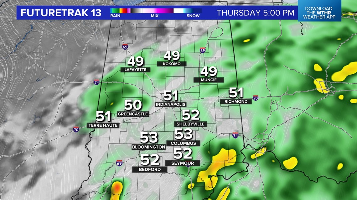
Rain amounts vary from .25" to locally over 1" by Thursday night. Localized flooding remains possible due to saturate ground and what's to come tomorrow. In the wake of the rain, much colder air returns briefly Friday into Saturday. The sharp transition may squeeze-out some snow showers during that time.

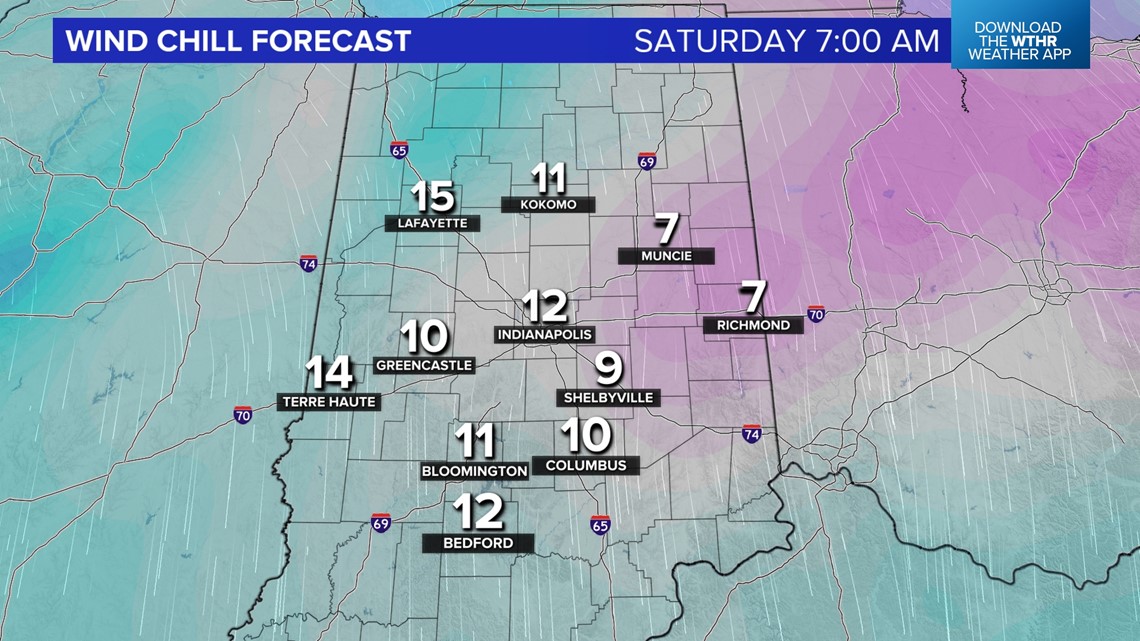
But the chillier, near-normal air, is short lived and warming wind kicks-in quickly Sunday to send highs near 60° by the afternoon.
Even warmer air seems likely next week as highs flirt with 70° Tuesday and Wednesday. That near-record warmth could also help fuel severe thunderstorms in the Ohio Valley during that time next week and will be something we'll update closely in the coming days.