INDIANAPOLIS — We have another seasonably warm day in central Indiana with above-average temperatures in the upper 80s. The Muggy Meter remains relatively comfortable, so when you're in the shade, the air feels pleasant. You've likely noticed the expected high clouds drifting in from the south. These clouds are blowing north from the circulation of Francine. This increased cloud cover continues the remainder of the day, but radar will remain rain-free until much later tonight.
Rainy for some Friday morning; mainly dry for Operation Football
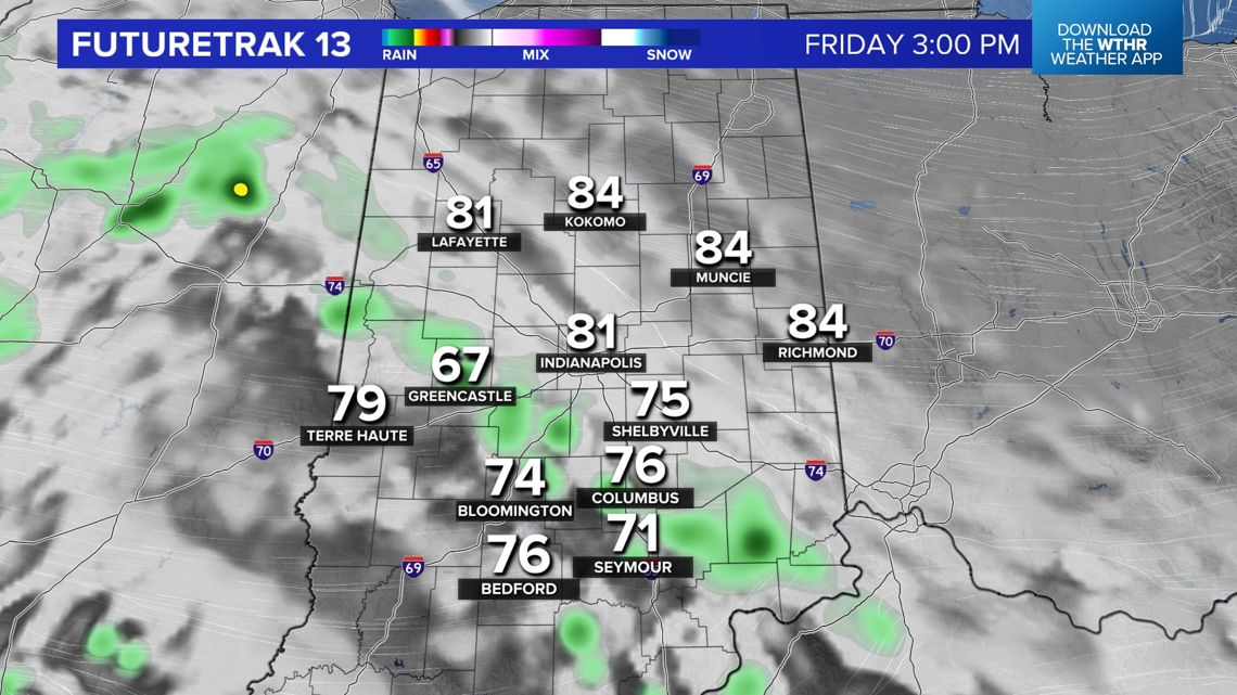
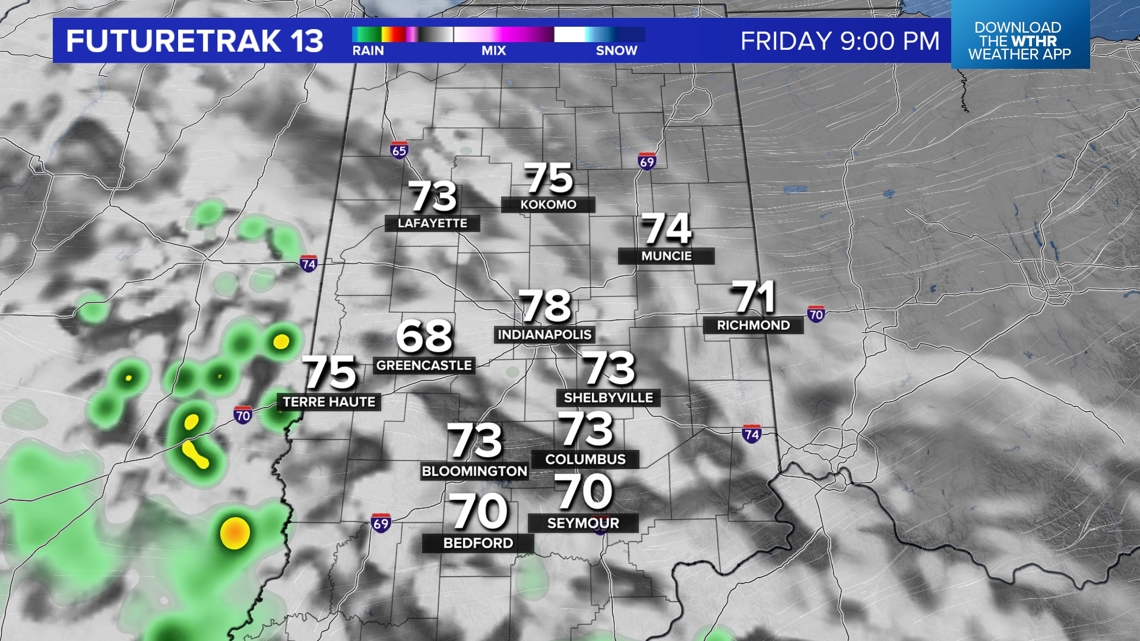
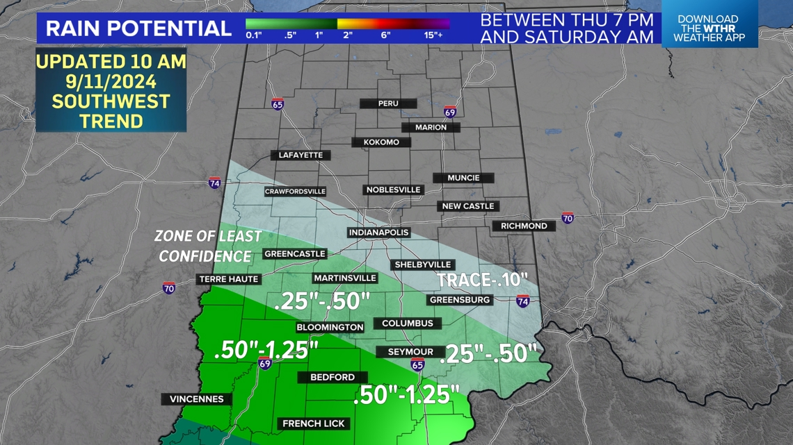
Plan on dry conditions for any outdoor activities this evening and pleasant air gradually getting more humid overnight. Hi-res modeling is advertising a predominant rain band arriving south-to-north in Indiana between 3 a.m. and 6 a.m. tonight/early Friday morning. This likely will be the main band locally, and it mainly hits areas southwest of I-74 the hardest between 5 a.m.-1 p.m. tomorrow.

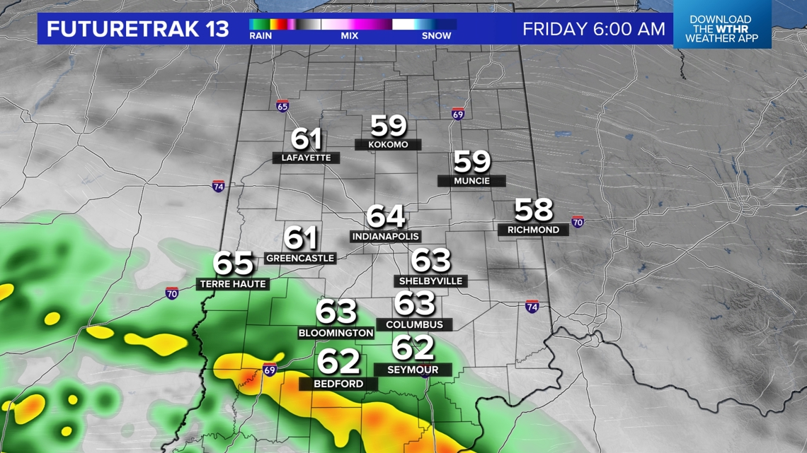

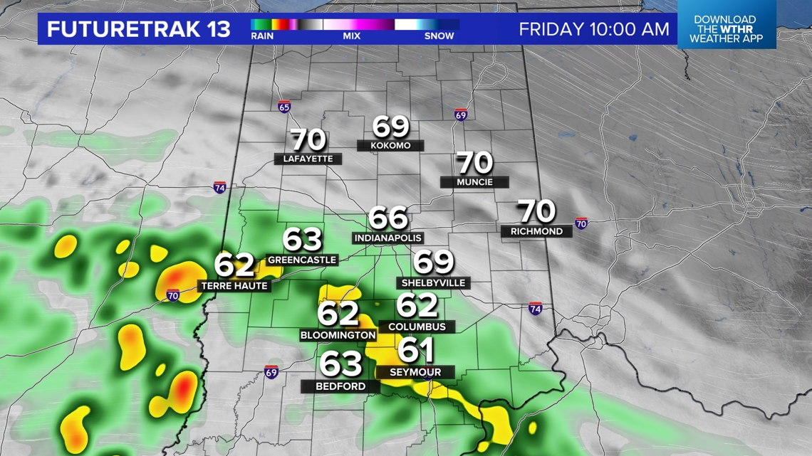


Heaviest rain southwest of I-74
It will weaken as it approaches and goes north of I-74 due to lacking upper lift and encountering drier air. This creates a sharp drop-off in a transition zone along the I-74 corridor from very little rain (north-northeast) to a decent drink of water (.25"-1" south-southwest of I-74). This zone also is the trickiest area for us to forecast due to the sharp gradient in rainfall that will occur.

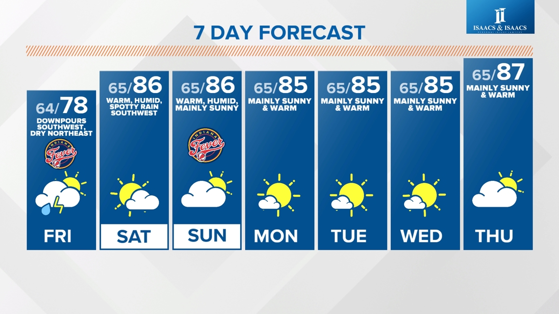
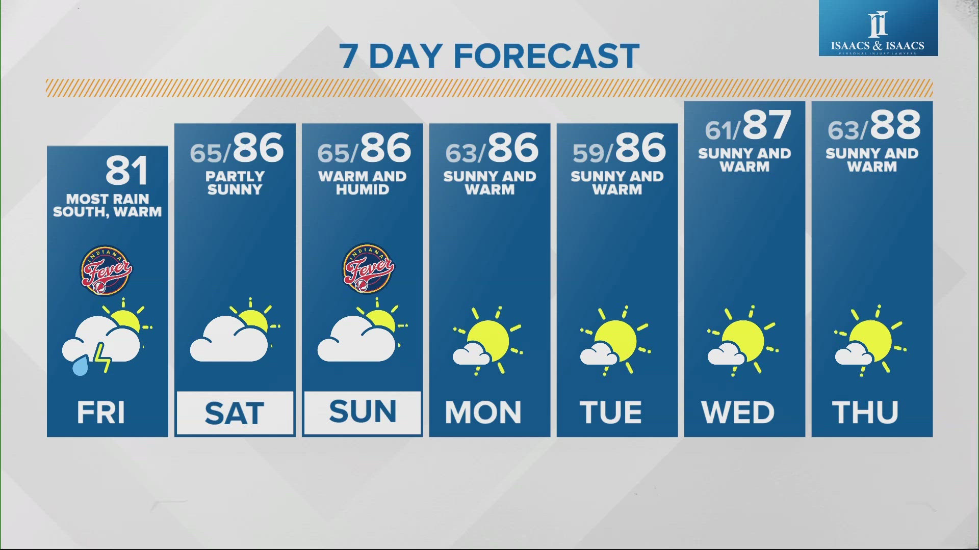
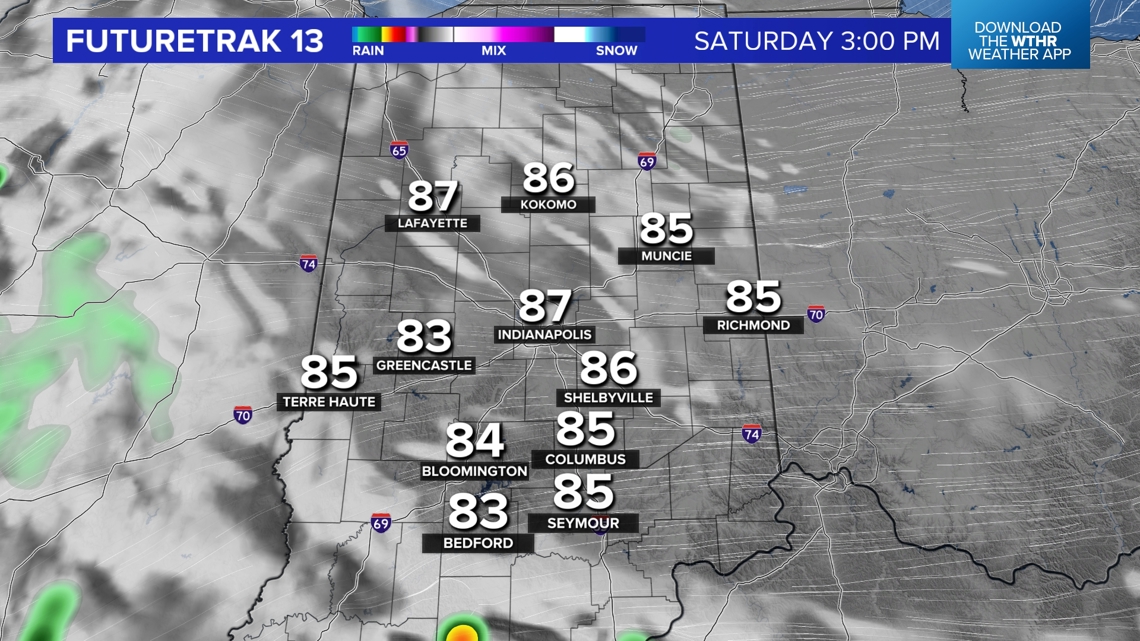
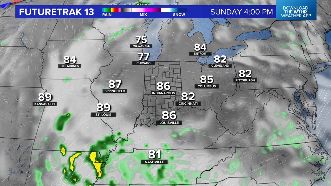
Friday morning will be the greatest coverage of rain we'll likely have on radar for a while as the remnants of Francine drift farther south this weekend — a weekend that's looking unseasonably warm and mainly dry for most areas. Less rain and cloud cover means highs warm quickly both days into the mid/upper 80s. We're forecasting unseasonably warm and mainly sunny days into late next week.
Warm weekend


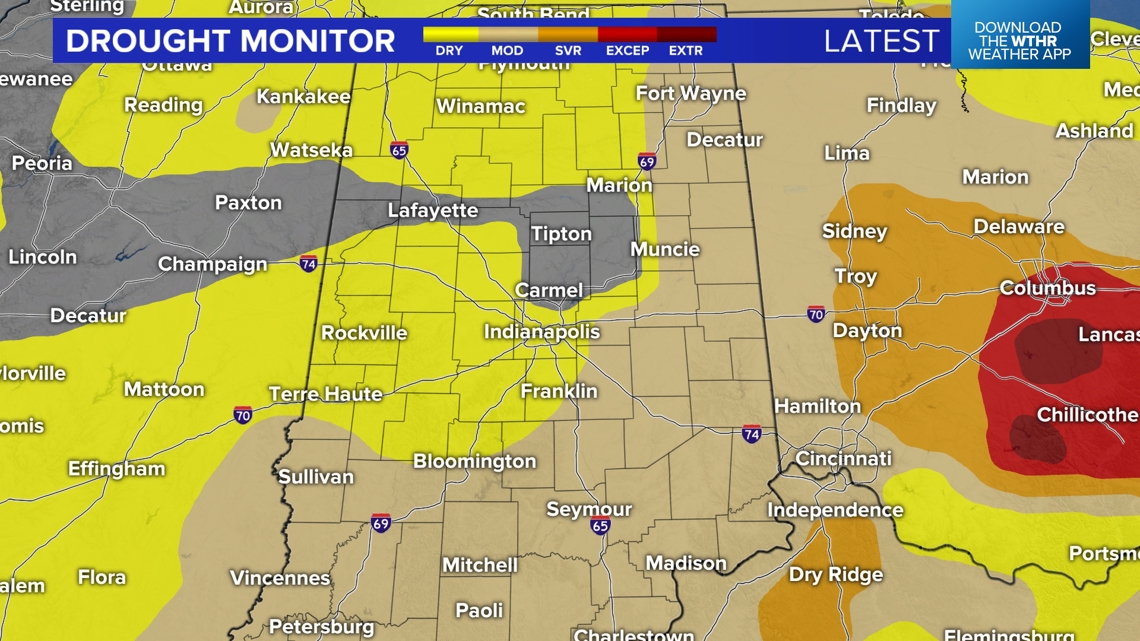
This isn't ideal for a region that continues to dry-out as "flash drought" conditions expand over Indiana and other parts of the Ohio Valley. It was no surprise to see the latest Drought Monitor expand Moderate Drought conditions over Indiana, with many areas a good 2"-3"+ below average at this time.