INDIANAPOLIS — Clouds mostly have more bark than bite today with the exception of some areas of patchy light snow. This has mainly been north of I-70, where there's been slightly more lift to overcome the relatively drier air at the surface.
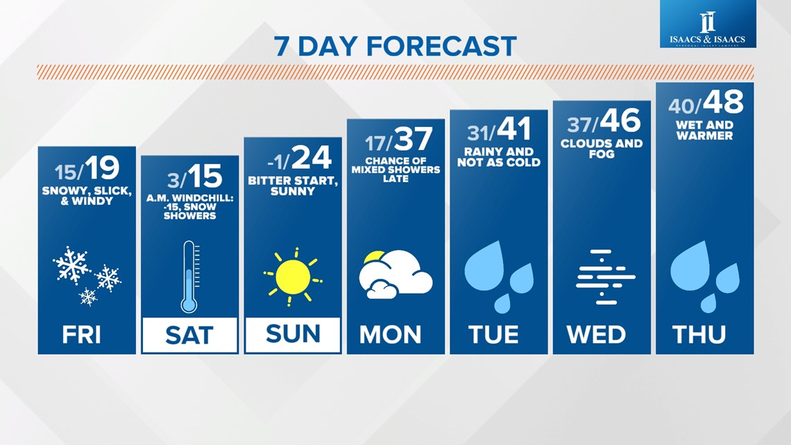
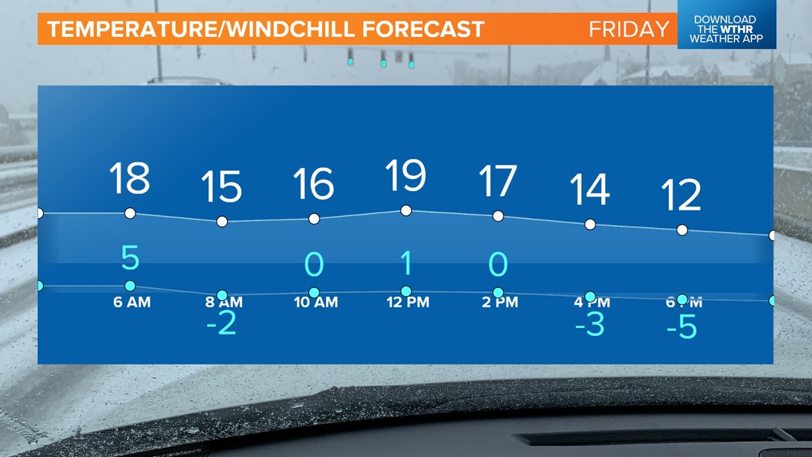
Temperatures are noticeably more "warmer" today and approaching 30°+ this afternoon before the system with more teeth to it arrives overnight. As we've been stressing all week long, commuting Friday into Saturday morning will be much more difficult with widespread snow and bitter cold returning.
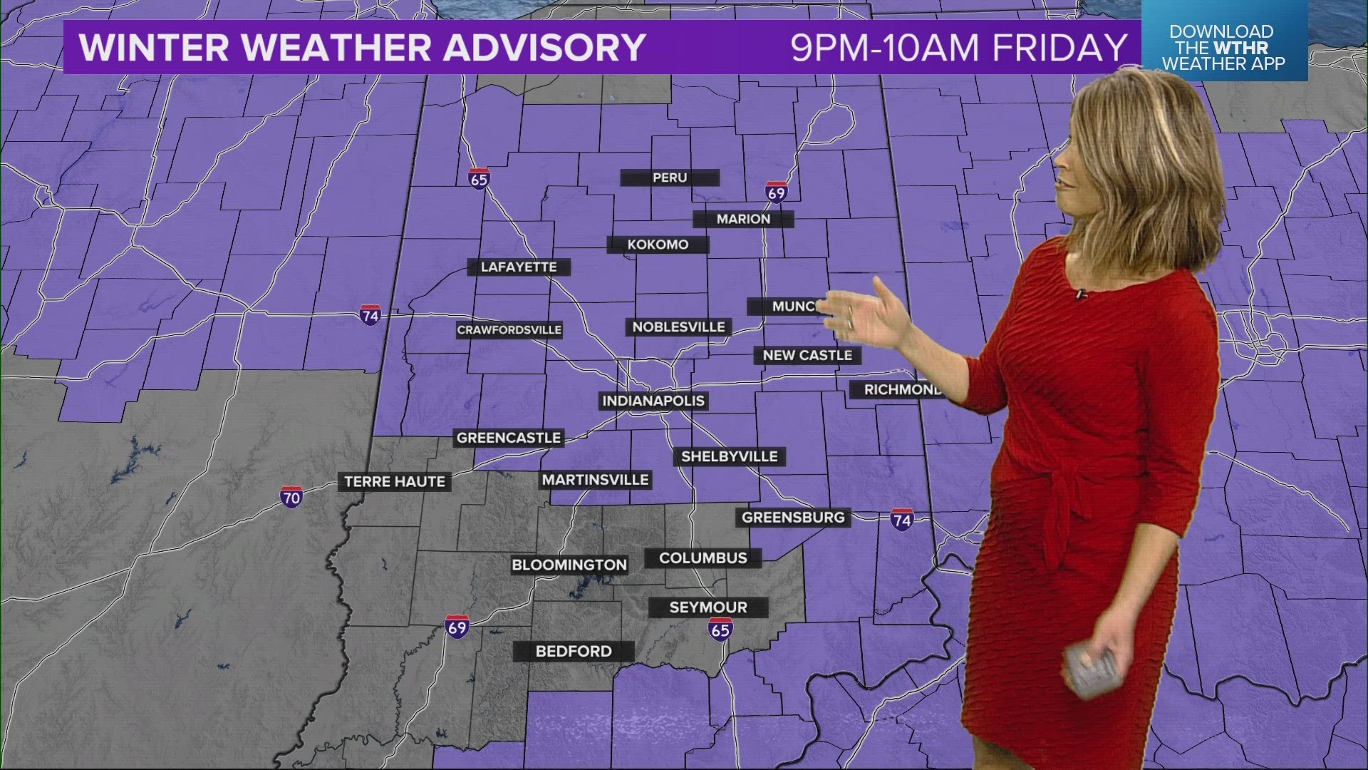
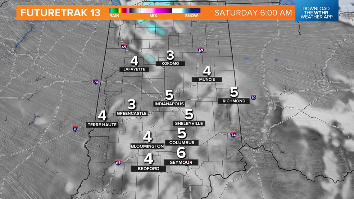
We're expecting snow to spread into north-central Indiana by 9 p.m. and sink south-southeastward by midnight to encompass most of the WTHR viewing area. Snow will be steady between that time and just prior to the Friday morning commute. At the same time, the latest arctic front will be moving through the state and knocks temperatures back into the teens by 9 a.m. Friday.

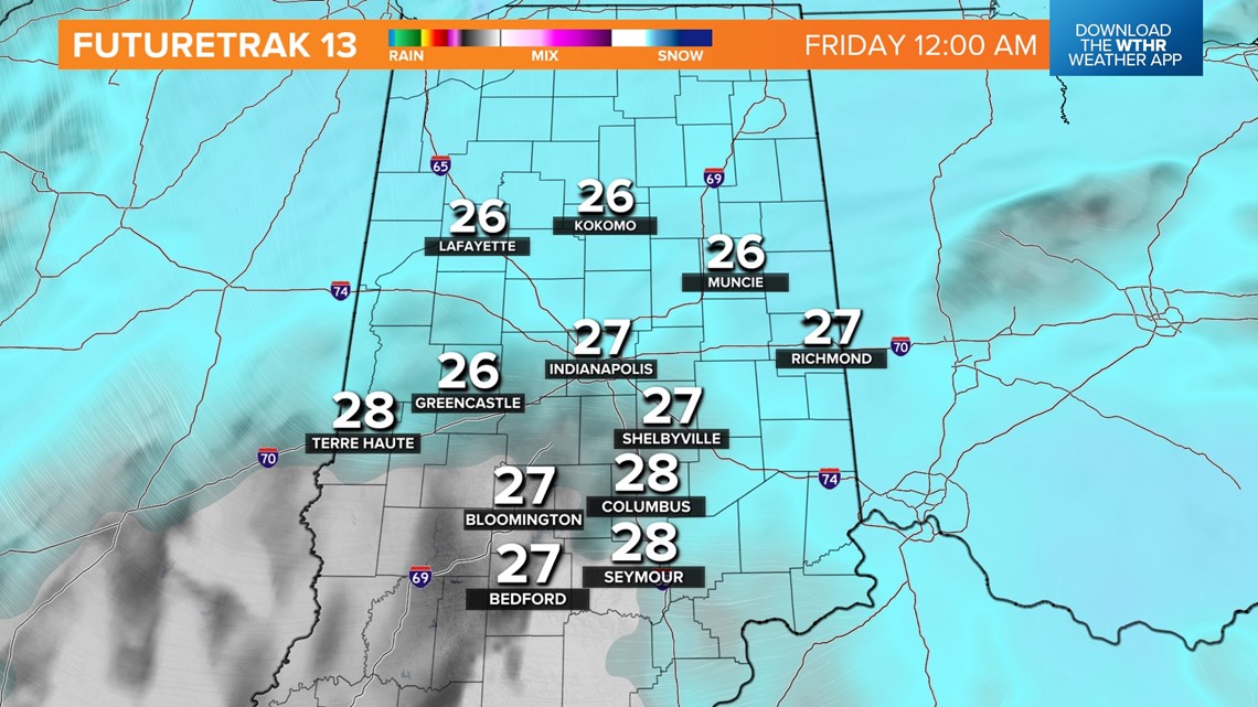

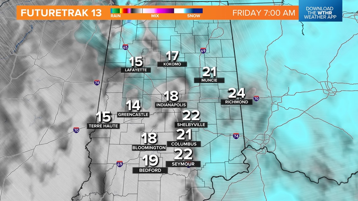


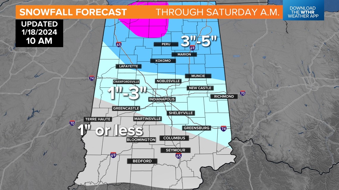
The timing of the snow and that temperature drop doesn't bode well for the Friday morning commute, which we expect to be highly impacted by this setup. Don't focus too much on snow amounts (1"-3" for many, with the highest totals north and lightest south) because even light snow will cause big problems due to the temperature drop.
Plan on slow, slick travel along with likely school delays and/or cancellations Friday due to the aforementioned setup. In the wake of the arctic front will be a steady, stiff northwesterly wind that gusts over 30 mph at times and delivers bursts of lake-effect snow showers into Saturday morning.


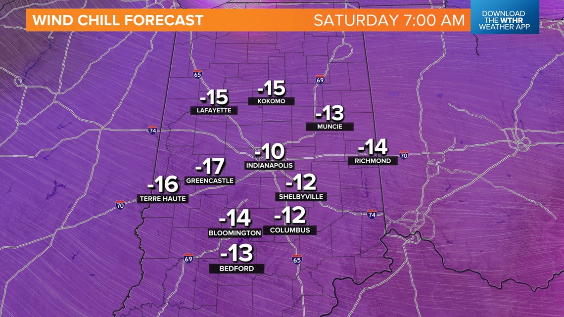
This, combined with single-digit low temperatures Saturday morning, will keep any untreated moisture on roads to remain icy and slick.
Plus, the continue flow off of Lake Michigan keeps intervals of lake effect flurries and snow showers continuing Saturday with sub-zero wind chills and "highs" only in the teens.
Fresh snowpack, a clearing sky and calm wind Saturday night sets the stage for another round of sub-zero low temperatures Sunday morning — likely our coldest morning for awhile.
We're still on target for much warmer air next week, but with it comes rounds of rain beginning Monday night. Follow the forecast for updates.