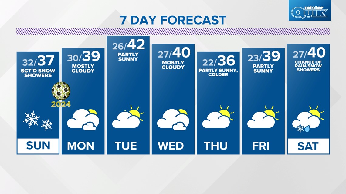
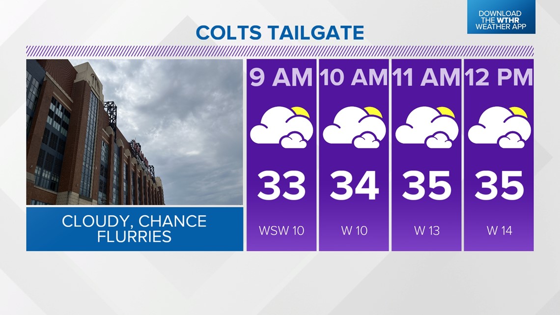
INDIANAPOLIS — A cold front will approach by Sunday morning bringing increased clouds and a little moisture in the morning. This could prompt a few flurries early including for Colts tailgate.

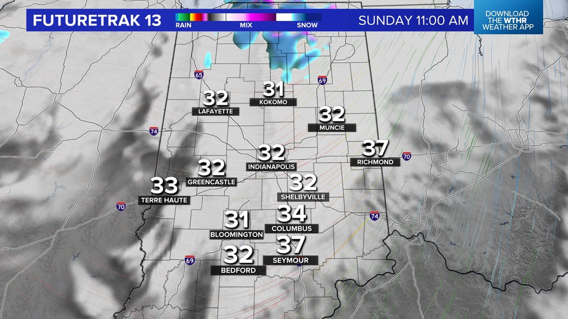

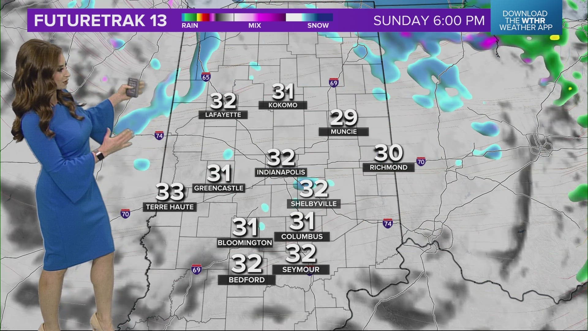
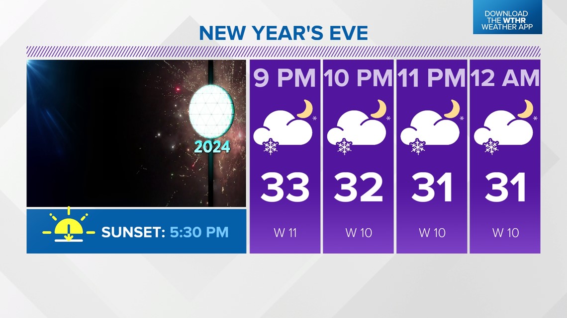
Temperatures recover briefly to the upper-30s around the start of the Colts game before more scattered snow showers develop in the afternoon and continue into the evening. Temperatures will then drop into the low to mid 30s and hold steady.

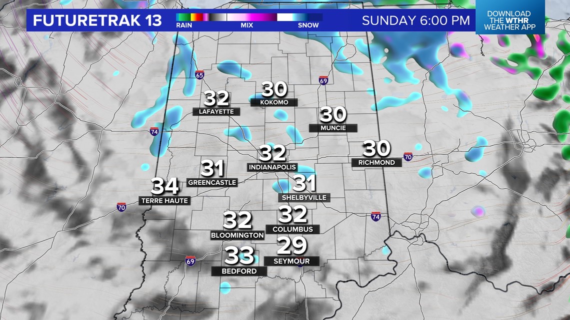
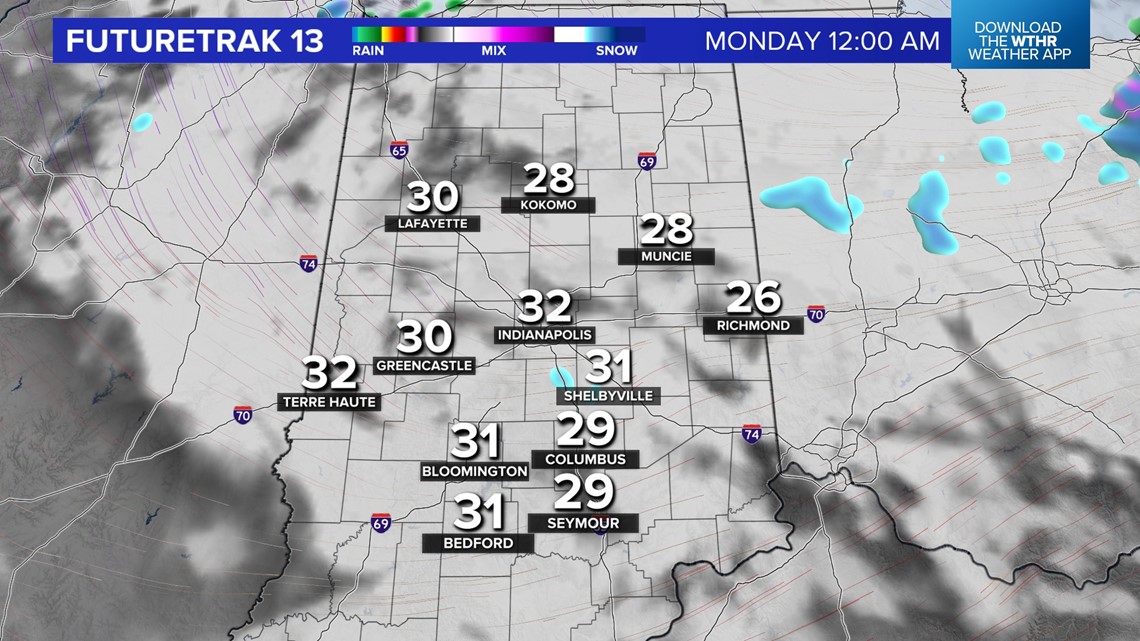
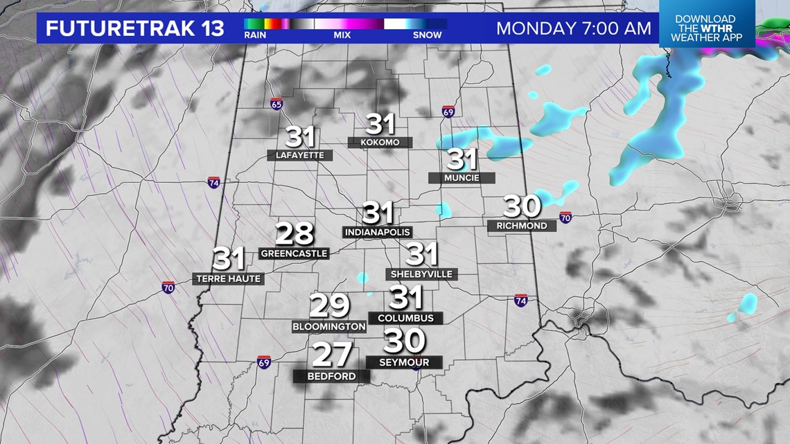
Accumulating snowfall is not expected but brief periods of reduced visibility as well as slick roads are possible. Please travel with caution for any New Year's Eve plans with light snow around. Temperatures drop to near the freezing mark at midnight and another few degrees into the upper 20s for New Year's Day morning.


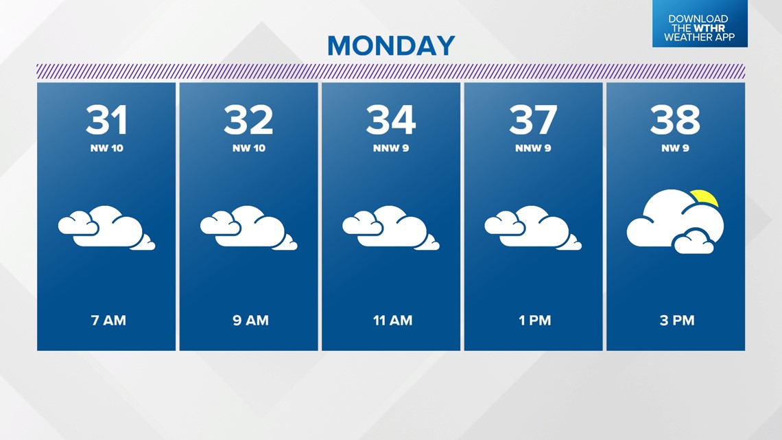
A few lingering flurries are possible with otherwise mostly cloudy skies and highs in the upper-30s on New Year's Day.


High pressure will then take control of the forecast helping to clear skies and allowing temperatures to return to the low 40s for Tuesday and Wednesday. While slightly cooler air returns for Thursday and Friday with highs back in the 30s, the forecast looks to stay mainly dry.
With no weather systems of significance through the next week, Indianapolis is on track to break a record for the latest 0.1"+ (measurable) snowfall for the season. The record currently is January 4, 1941 for the 1940-1941 snow season.