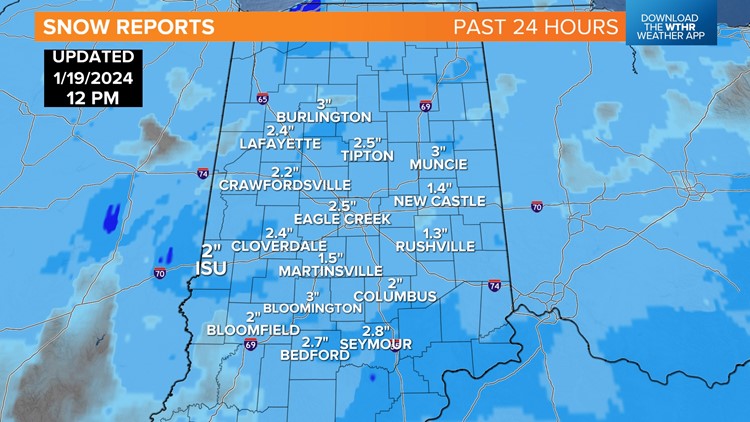
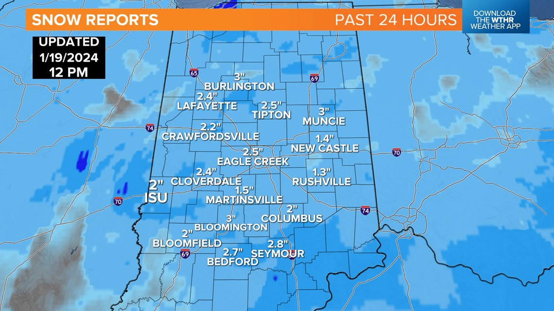
INDIANAPOLIS — The well-advertised bitter cold and snow has returned. It resulted in a broad 1"-3" accumulation in central Indiana. That's mostly what was expected, with the exception of many areas in southern Indiana getting a couple inches more than our 1" or less forecast. But timing and impacts to the morning commute certainly meet our expectations.


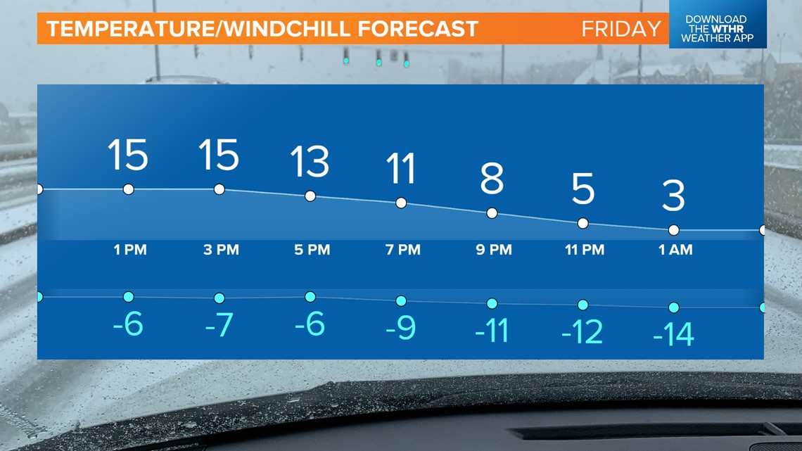
At this hour, main roads seem to have responded to treatment and are holding up "nicely," considering temperatures remain in the mid-to-low teens — this despite continued light snow and stiff wind gusts over 30 mph. That wind is producing sub-zero windchills already and the coldest are yet to come.
That wind flow coming off of Lake Michigan is also responsible for an impressive lake effect snow-band that's causing squall conditions in northwest Indiana and southwest lower Michigan. Travel is not recommended along I-94 in LaPorte, which has easily the worst travel conditions in the state, if not the entire U.S.
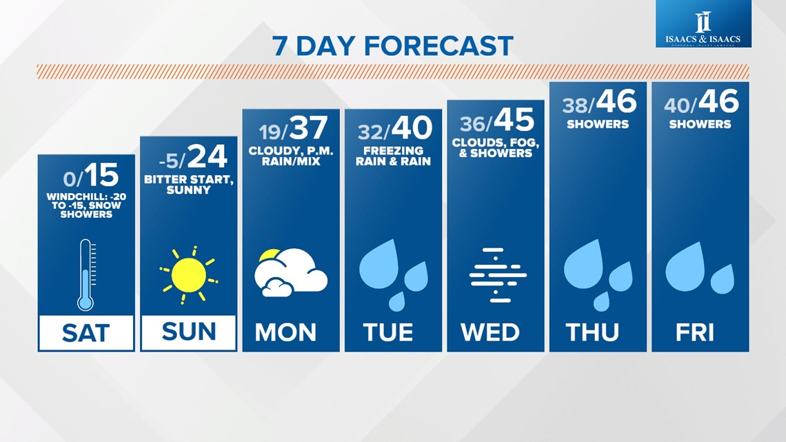
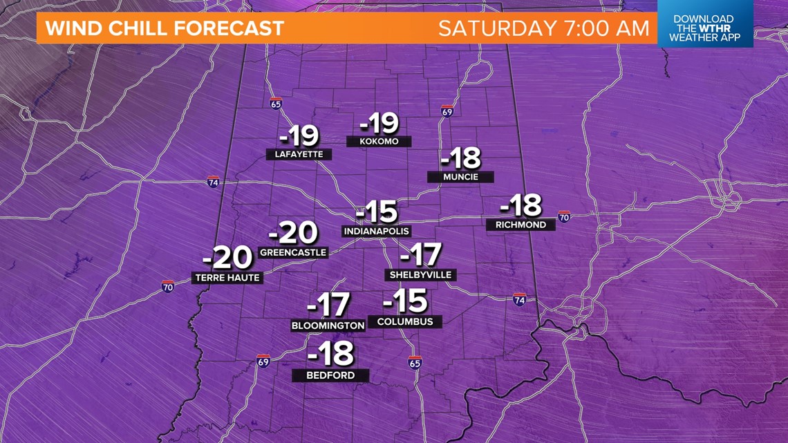
We'll continue to see residual lake effect drift southward into central Indiana this evening and into Saturday morning, but with much colder temperatures tonight in the single digits. Windchills tonight bottom out in the -25 to -15 range and set the stage for a Saturday stinger.


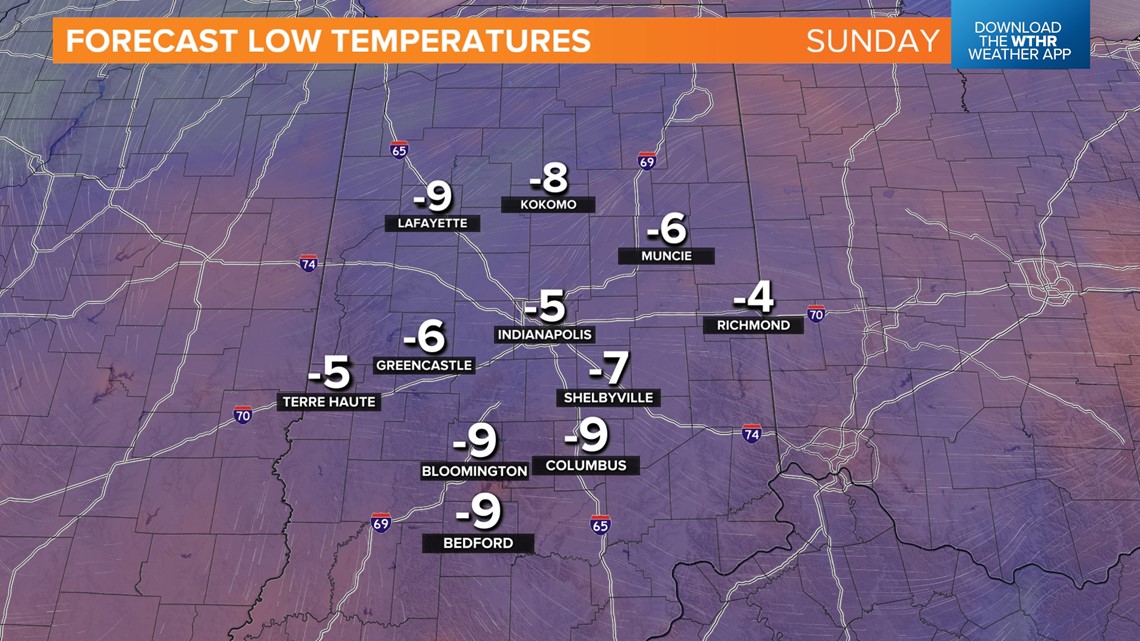
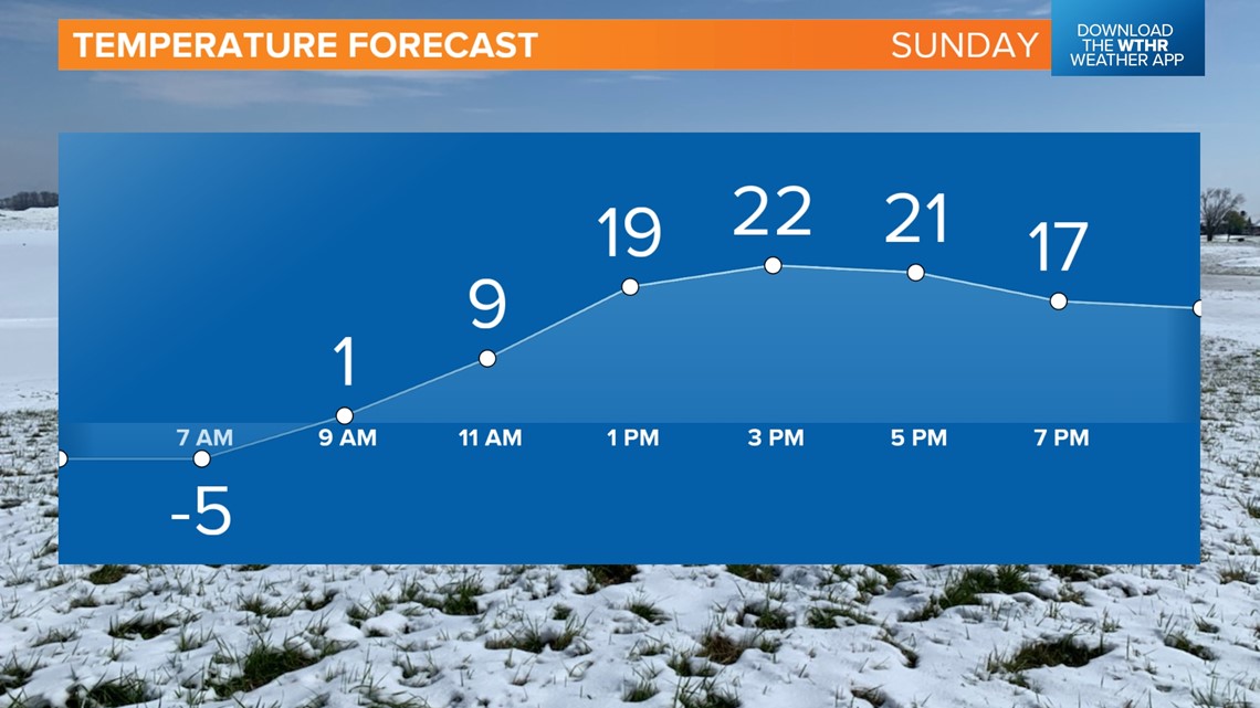
As we've discussed all week, Sunday morning conditions favor our coldest morning of this batch of arctic air. And that's fresh snow, calm wind and a clear sky around the center of high pressure nearby. This delivers low temperatures well below zero in what's likely our coldest lows for a while.

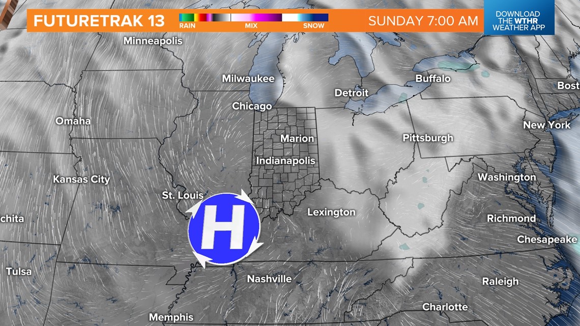


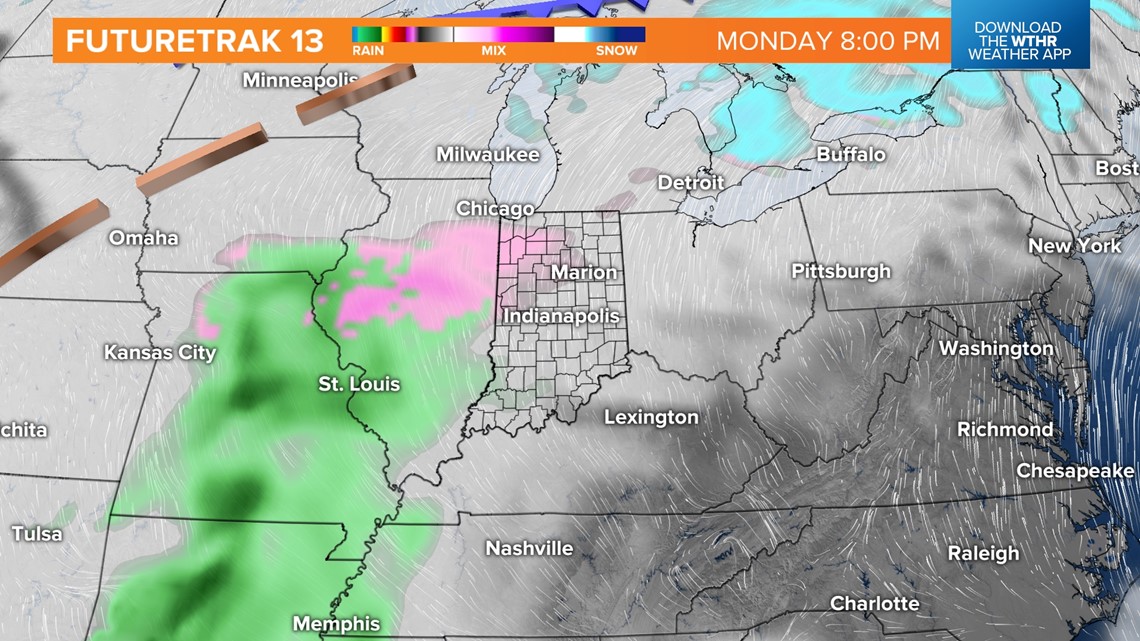
Once that high drifts to the east, a "warming" wind emerges into next week, but it comes with increasing moisture. The first round of precipitation arrives Monday night. In what would normally be a cold rain may actually freeze on contact of cold surfaces (untreated sidewalks/streets), and Tuesday morning could be icy before enough warming occurs.
Then it's cloudy, damp, foggy at times Tuesday into late week with highs in the 40s.