INDIANAPOLIS — Today marks the beginning of a more active weather pattern for central Indiana, at least for the next 48 hours. You've likely noticed the advertised stiff breezes today that continue to gust over 30 mph. While the wind remains gusty, the direction of the wind shifts to the northwest this afternoon after the passage of the latest cold front.

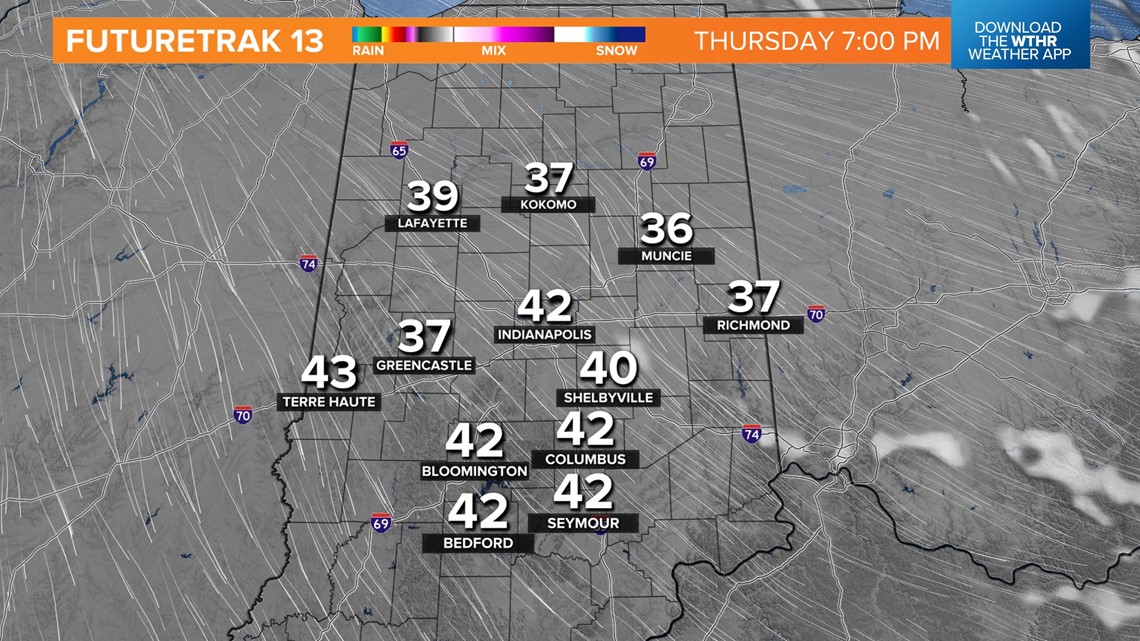


That front is moisture-starved near the surface, hence little rainfall today. But there's ample mid-level moisture for generous cloud cover until clearing takes place from west-to-east this evening.
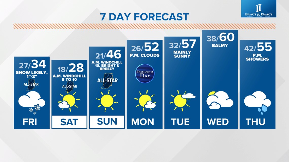
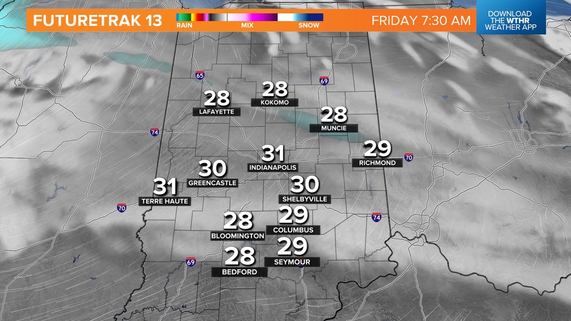
The clearing comes with chillier air too. After peaking near 50° again today, temperatures drop into upper-30s near sunset and sets the stage for much colder temperatures Friday into Sunday morning.
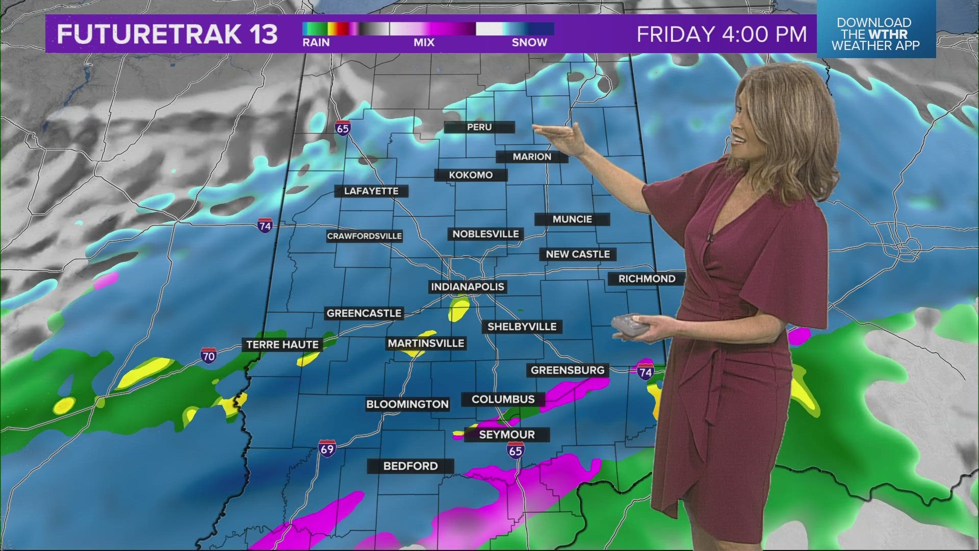
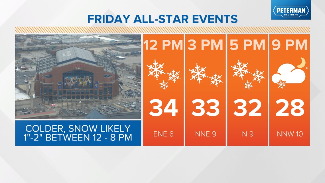
While there will be some changes to the Friday forecast the next 24 hours, we're still placing a broad 1"-2" snowfall over central Indiana. The majority of that occurs from noon to 8 p.m. Friday. That means snow rates may be moderate at times.

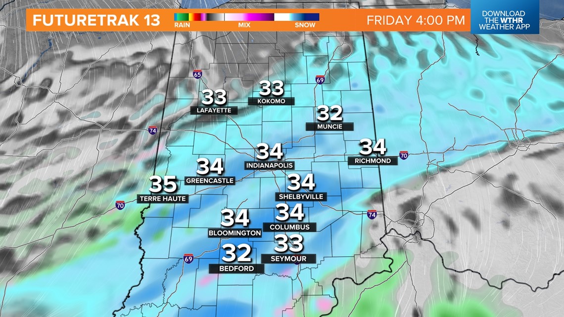

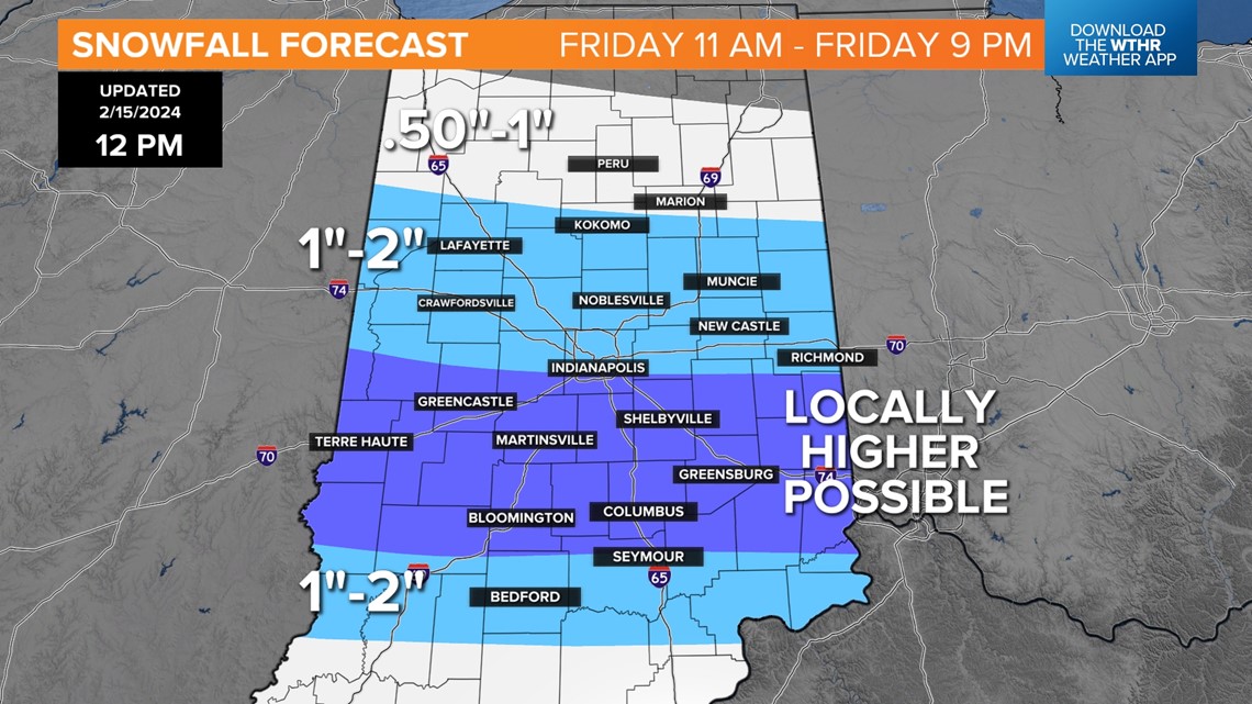

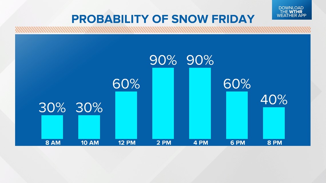

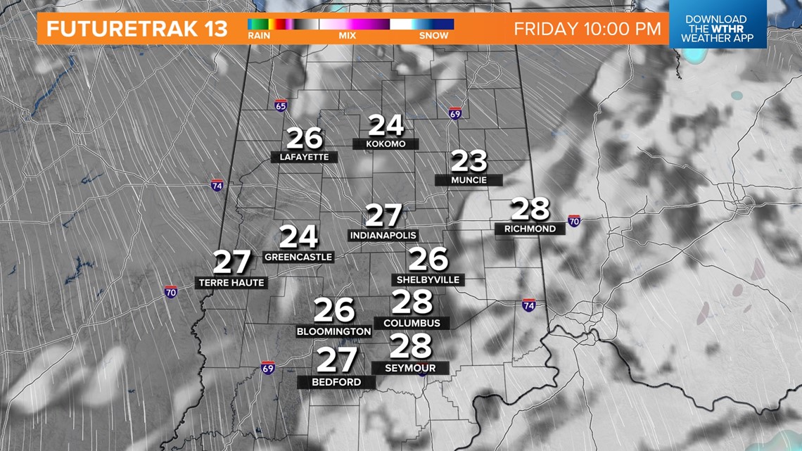
There's also some potential of a narrower, heavier band of snow to develop. Its exact location is highly uncertain at this time. We'll narrow-down specifics the next 24 hours, but please know that some road impacts are possible during peak snow rates Friday afternoon.

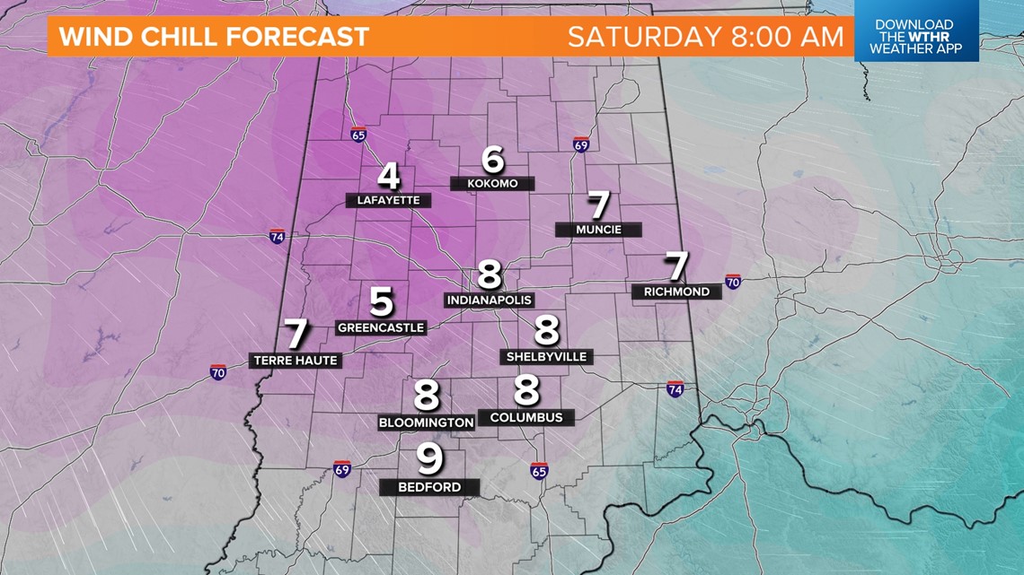

Snow should quickly depart Friday night and the focus becomes a stinging start Saturday morning with single digit windchills. While this normally would be shrugged off to typical winter weather, it's been anything but typical in what's been the warmest first two weeks of February on record in Indianapolis.
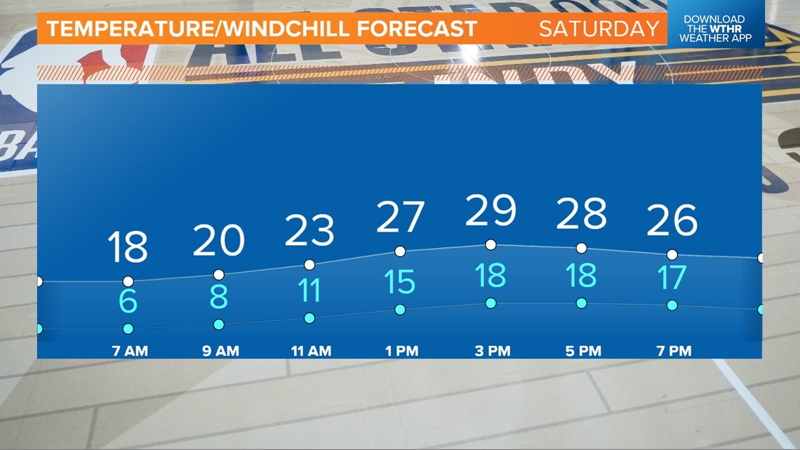
It's a quick jab of cold, but it will be our coldest air since Jan. 19-20. Highs on Saturday struggle to return to the upper-20s despite sunshine. The weekend finishes sunny and breezy on Sunday with highs back in the 40s.
Another balmy stretch of days ahead next week with peak high temperatures near 60° next Wednesday.