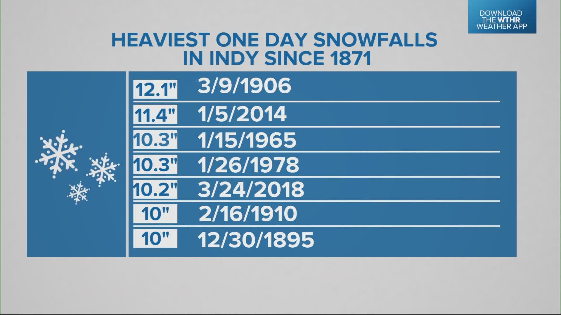
INDIANAPOLIS — So far, this winter storm has played out as expected, producing the heaviest snowfall Wednesday north-northwest of Indianapolis. Purdue is reporting nearly 9" of snow and many areas along and west of US 31 and north of I-70 took a decent hit.
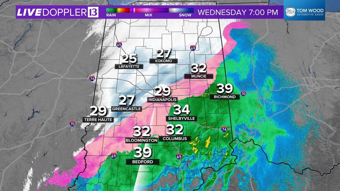
Temperatures continue to drop this evening and the transition from rain to sleet to snow has made untreated surfaces very slick. This will continue for the rest of tonight, though precipitation is expected to ease between now and midnight. Travel with caution overnight and get ready for round two on Thursday.


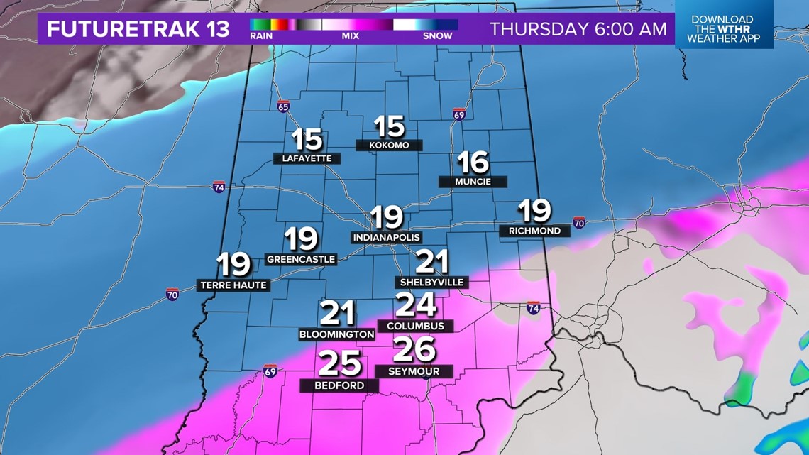
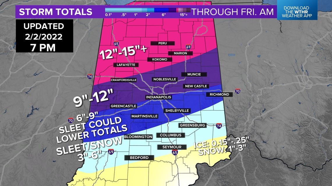
Please remember when you see this snow/ice accumulation, these are two-day totals. The brunt of accumulation for Indianapolis and the I-70 corridor occurs between 4 a.m. and 5 p.m. Thursday. Depending on your location, you're not going to wake up with 8"+ on the ground.


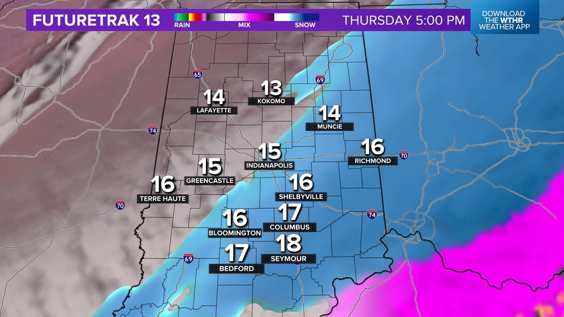
Travel is not recommended Thursday due to heavy snow and near-whiteout conditions at times, blowing and drifting from 30+ mph gusts and a fluffier snow, and dangerous to impassable roads.
Snow ends from west to east between 5 p.m. and 9 p.m., but the clean-up in many areas will take much longer.

