For good reason there's been plenty of attention paid to the winter storm potential this weekend. But please don't ignore the fact the freezing drizzle cuases slick spots tonight, Wednesday... and a quick-moving system brings wider spread snow/freezing rain Thursday.

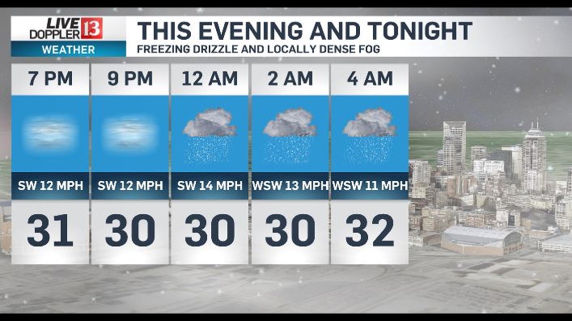
Temperatures remain below freezing this evening... so any drizzle or locally dense fog freezes on contact to untreated surfaces. It's a good idea to check conditions before leaving with some roads being rather icy at times the next 24 hours.

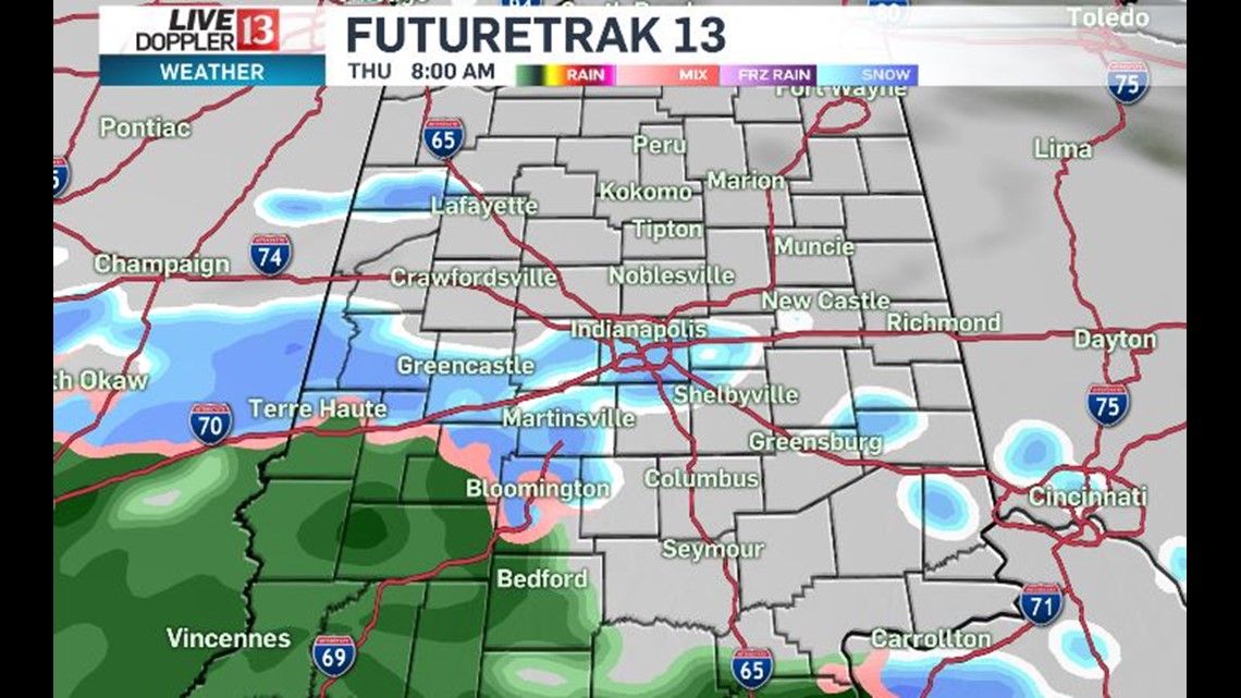

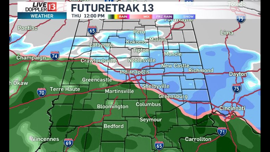
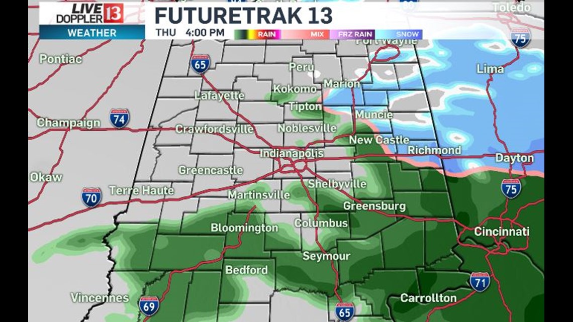
Thursday morning may also be messy as precipitation rates pick-up and overspread Central Indiana during the commute that day.

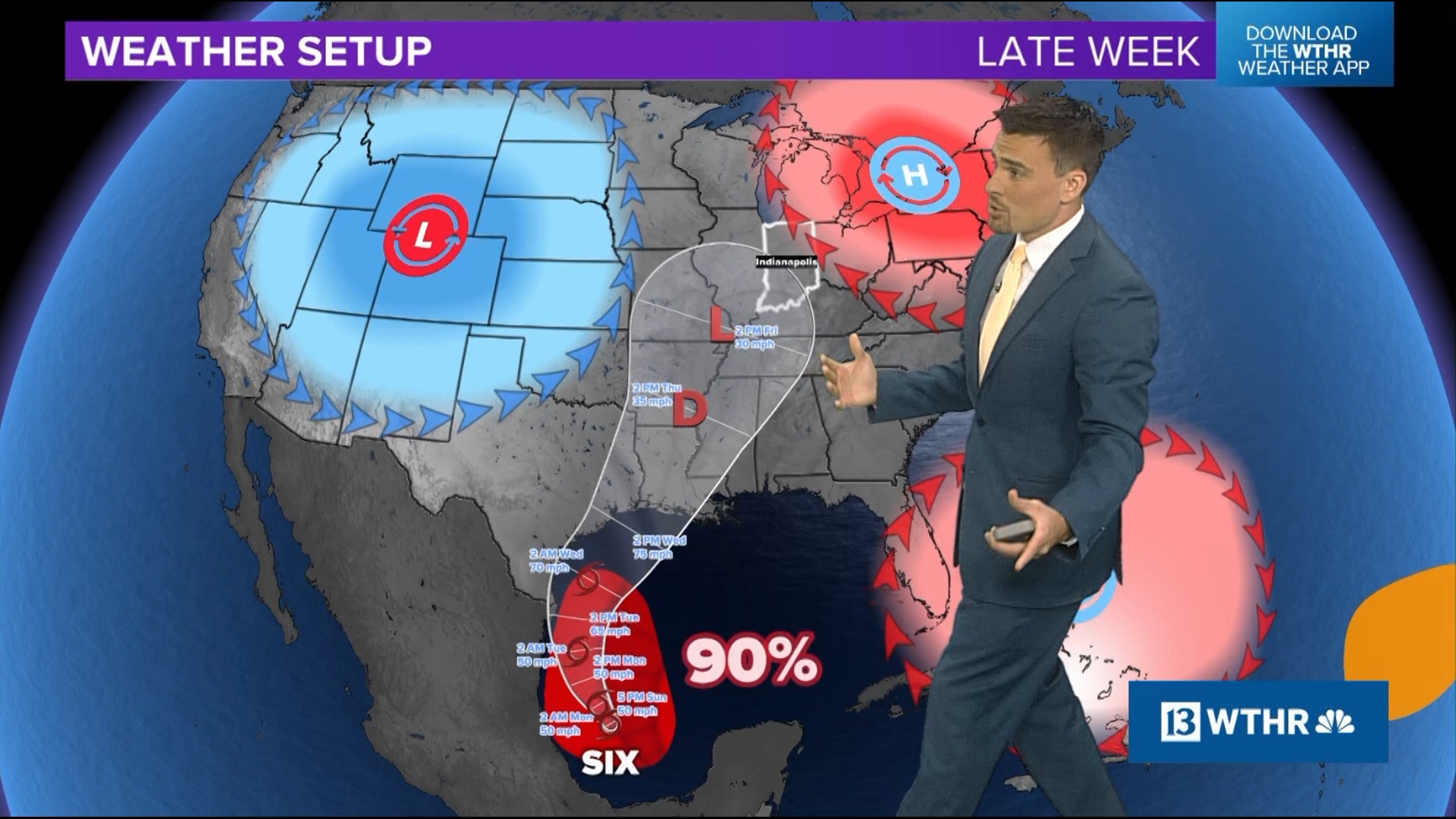
Friday remains a cloudy, seasonably cold day before a likely winter storm impacts the Great Lakes and Ohio Valley.

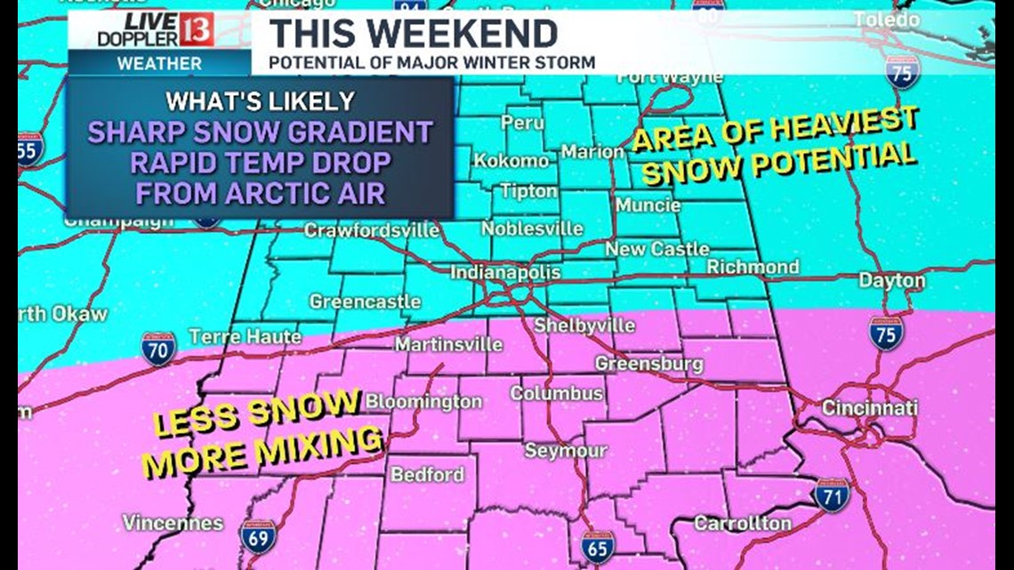
Right now it appears that a swath of widespread heavy snow gets dropped by this system... though exactly where and how much remain uncertain. There also will be a sharp cut-off from a lot of snow to much less over a short distance (county wide in some instances).

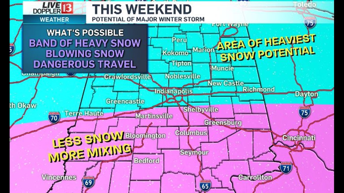
Blowing snow from strong wind seems likely and with temperatures dropping quickly from the 20s to single digits Saturday night... there will be a flash freeze. This means that even areas of less snow/sleet/freezing rain will get icy too.


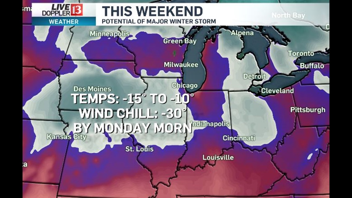
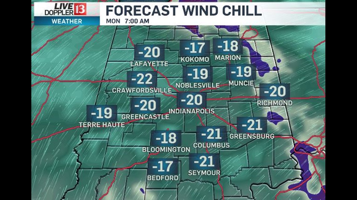
We're expecting roads to be very slick Sunday with "high" temperatures only around 10 degrees. Areas that get fresh, deep snow can expect low temperatures of at least -10 Monday monring with dangerous wind chills of -30 to -20.

If trends with this system continue you can expect Winter Storm Watches to be issued... that likely become Winter Warnings for some by the weekend.