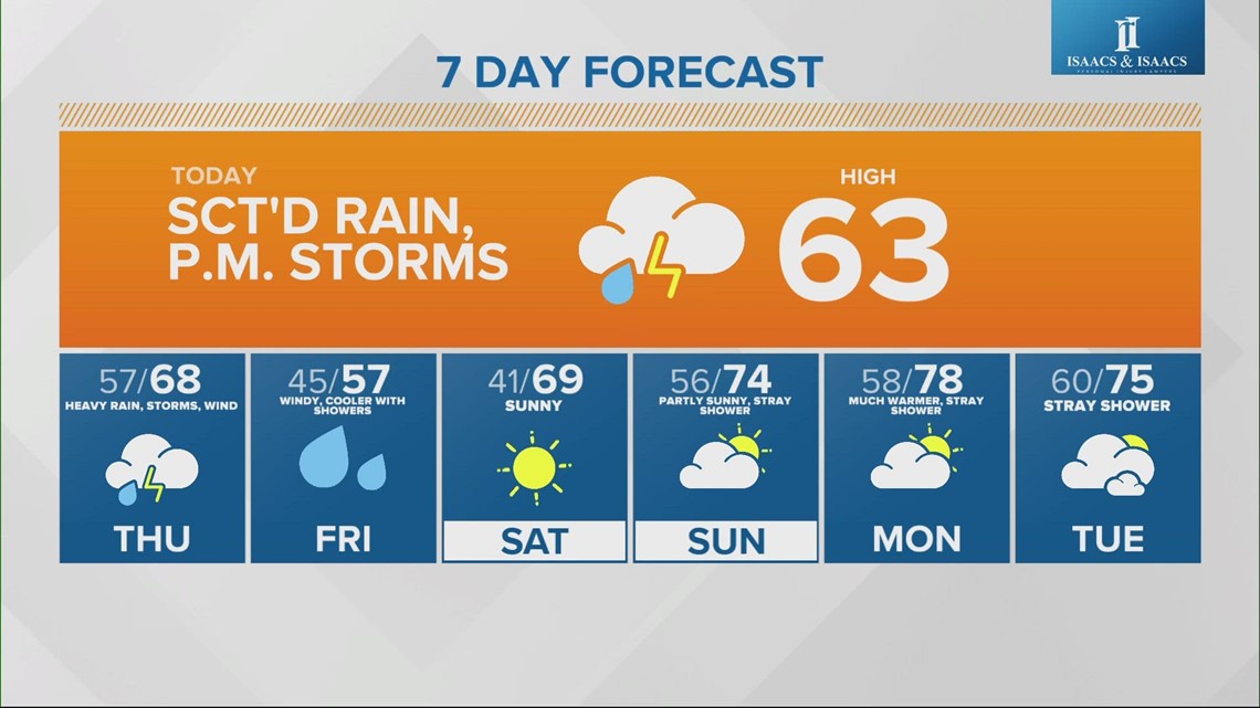
INDIANAPOLIS — A strong area of low pressure developing south of Indiana today will bring increasingly wet weather through Friday.
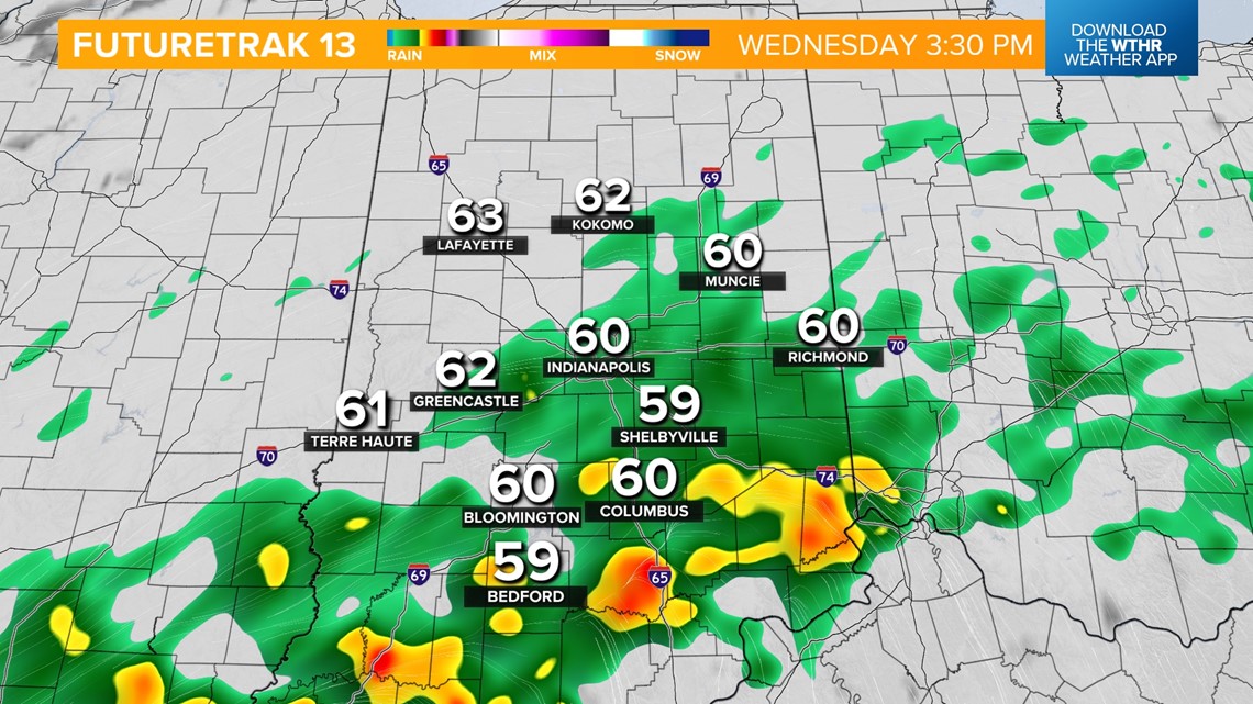
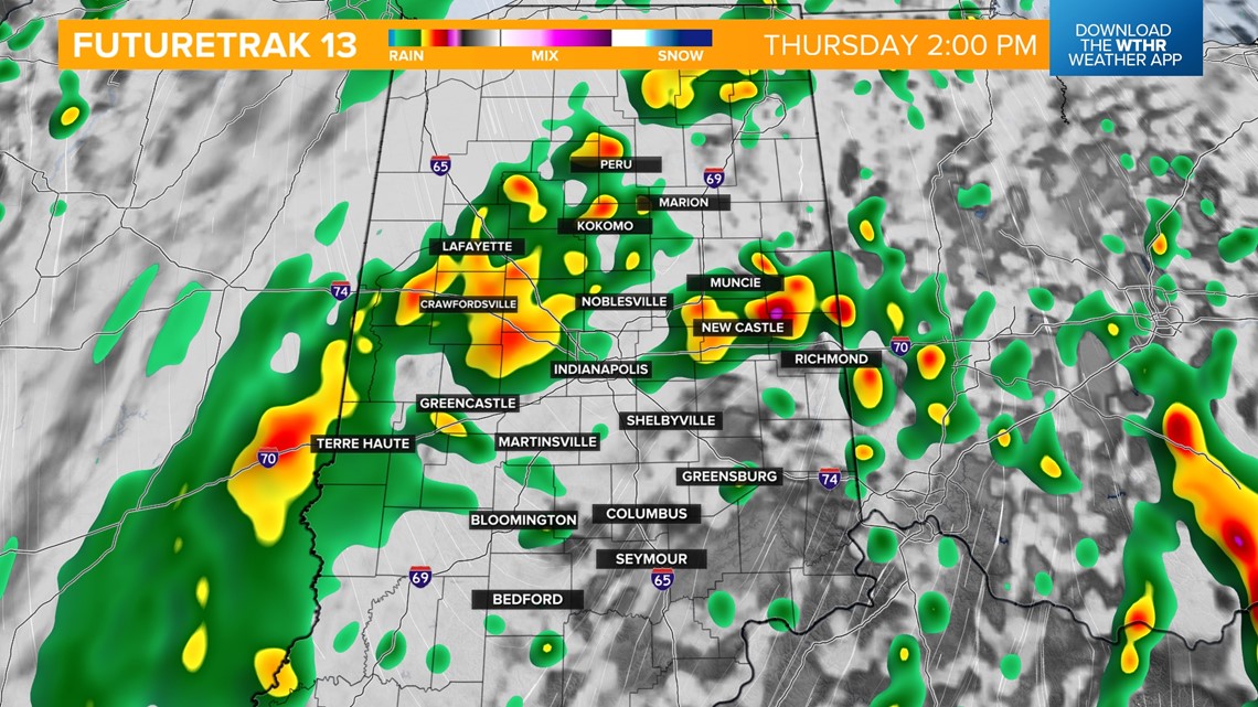
LATER THIS AFTERNOON: Widespread rain develops all throughout central Indiana around 2 p.m. as temperatures hold steady in the low 60s.

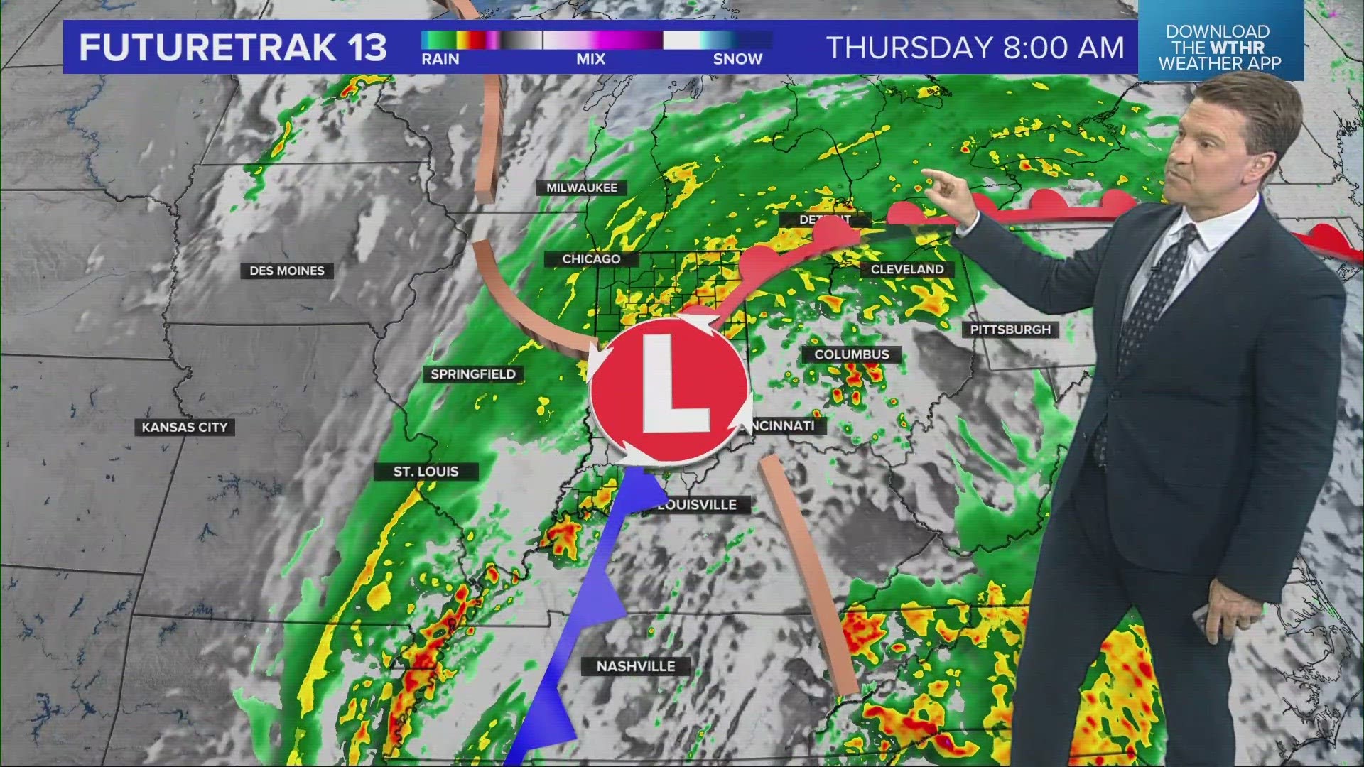
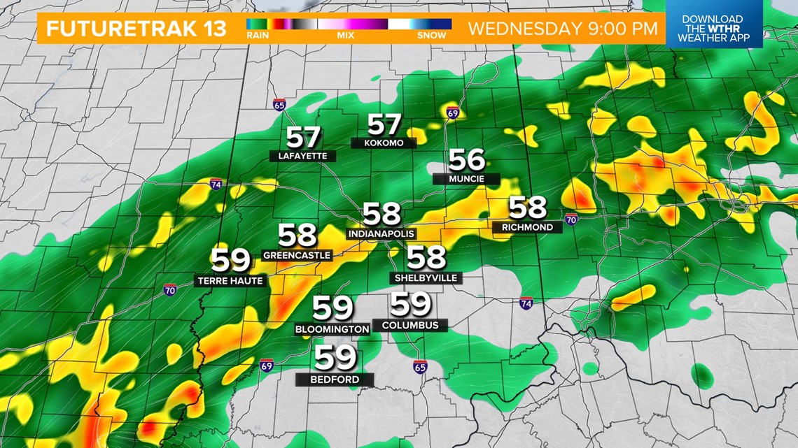
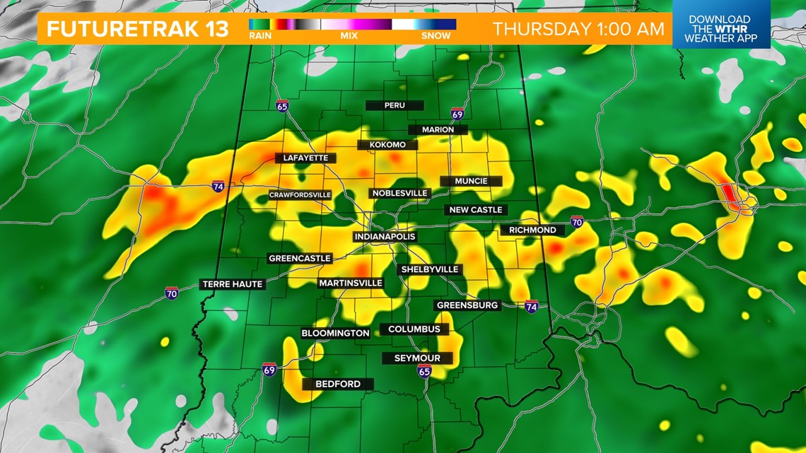
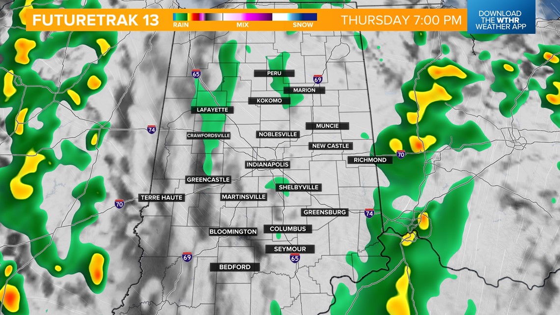
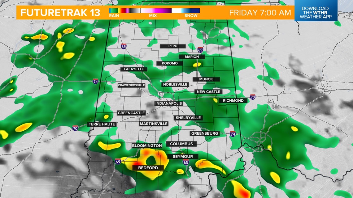
HEAVIEST RAIN THREAT: Rain will continue to increase in coverage area and intensity this evening through daybreak Thursday as an area of low pressure tracks through the state. There is a chance of a few embedded thunderstorms, but heavy rain will be the primary concern.


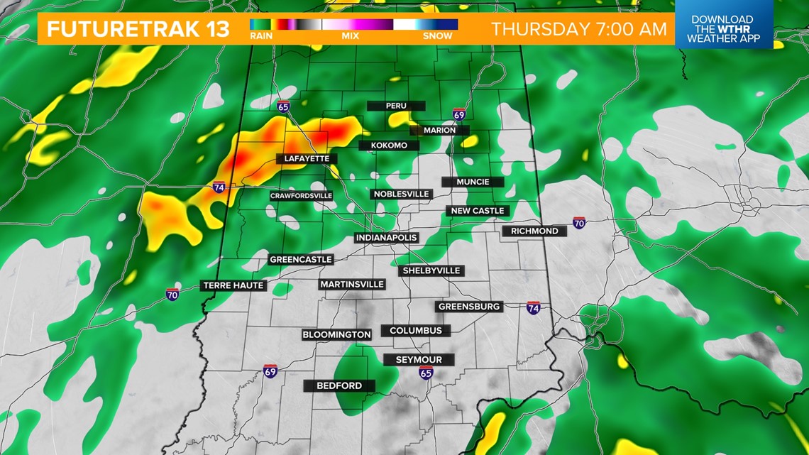
THURSDAY MORNING: There will be a slight lull in steady rain during the morning. Temperatures recover to the upper 60s while we sit in the "warm sector" of this weather system. Expect very windy conditions with 40+ mph wind gusts possible.

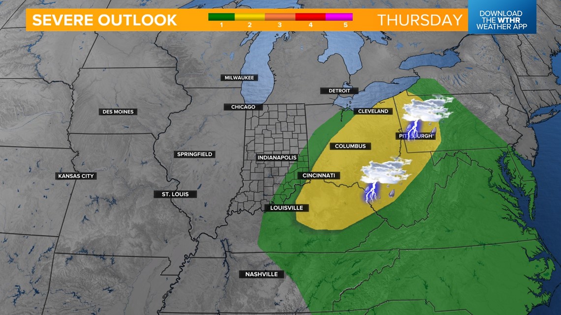
THURSDAY SEVERE THREAT: The Storm Prediction Center has placed the southeastern tier of Indiana under a level 1 of 5 threat for Thursday afternoon for the potential of isolated strong storms as the cold front moves through. Damaging wind gusts are the primary threat. The severe threat quickly dwindles in the late afternoon/evening.


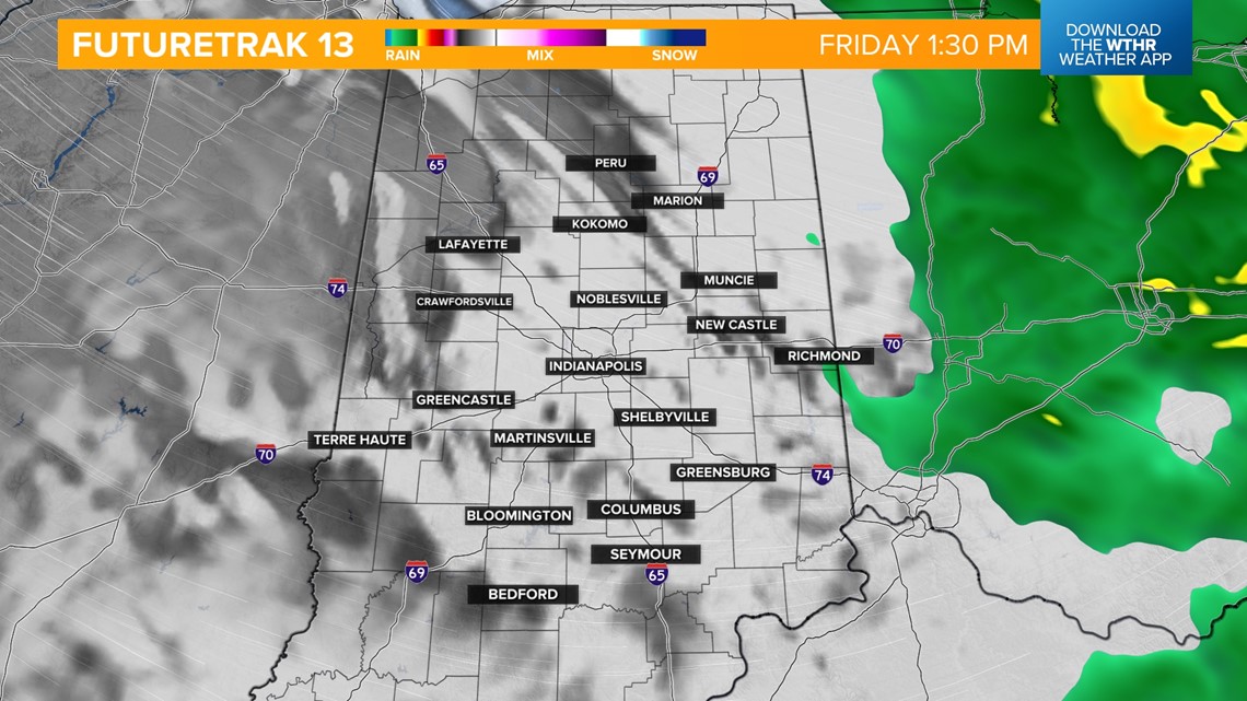
FRIDAY: Rain sticks around through early Friday afternoon on the back side of this weather system. Cooler air returns with steady temps in the 50s and 40 mph wind gusts possible.


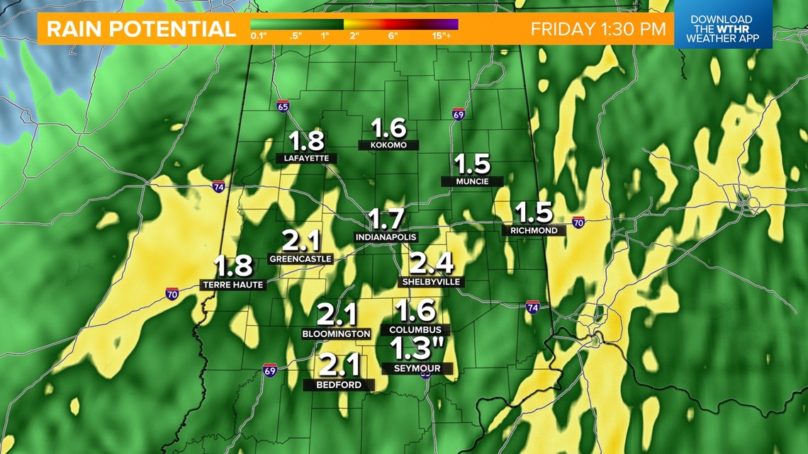
RAINFALL POTENTIAL THROUGH FRIDAY: All weather models agree everyone sees around 1.5 to 2.5 inches of rainfall throughout Friday. This could lead to lowland flooding along local waterways, rivers, creeks and tributaries.

EXTENDED OUTLOOK: Huge improvements for the weekend. It will be a dry and sunny Saturday with highs near 70. Not as wash out Sunday, but stray showers possible with temperatures in the mid-70s. We'll push 80 on Monday with above-average highs through mid-week next week in the 70s.