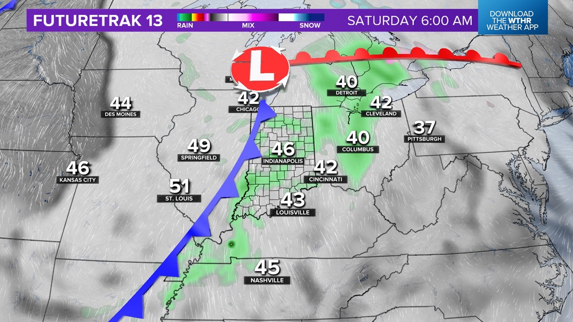
INDIANAPOLIS — A wet evening in progress over central Indiana will make for wet roads if you're traveling tonight or grabbing some last-minute Christmas gifts.
Rain rates vary from light to locally moderate, but overall rainfall totals won't be excessive despite it raining steadily overnight into early Saturday morning.
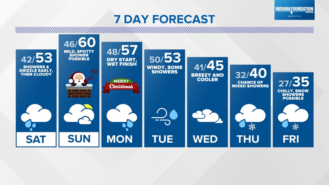
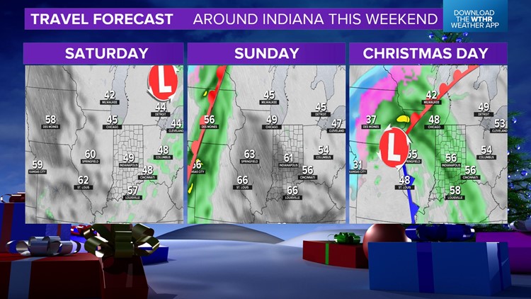
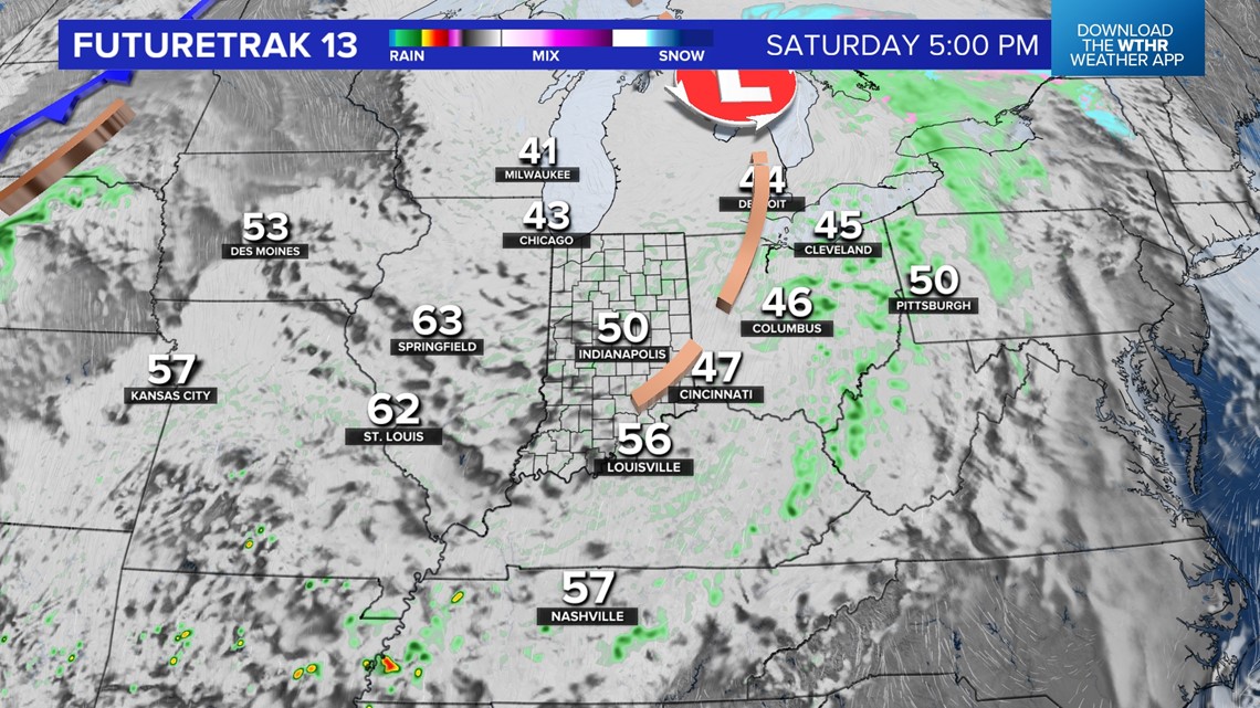
The weekend begins with drizzle and showers, but clouds have more bark than bite to finish Saturday afternoon as precipitation thins out. Even with lingering clouds, temperatures reach the lower 50s for the fourth straight day on Saturday afternoon - but the warmest is yet to come.


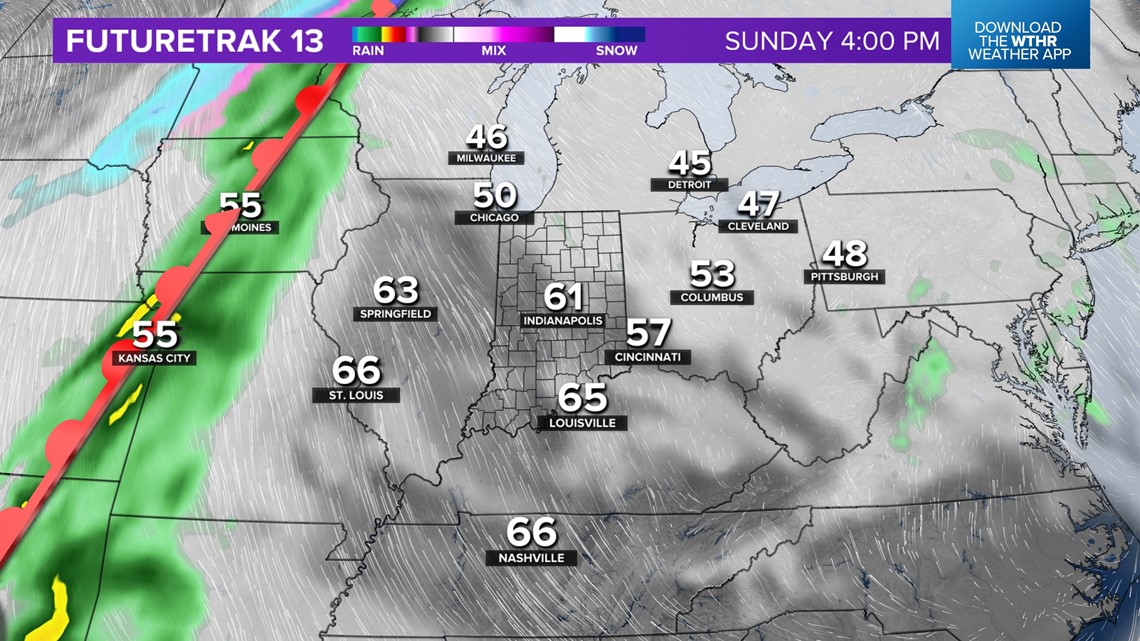
Spotty showers are possible Sunday morning but otherwise we're only expecting very slim chances of rain for Christmas Eve. In fact, you could argue Sunday afternoon may be weather perfection for late-December if you enjoy a mixed sky and balmy highs in the lower 60s.
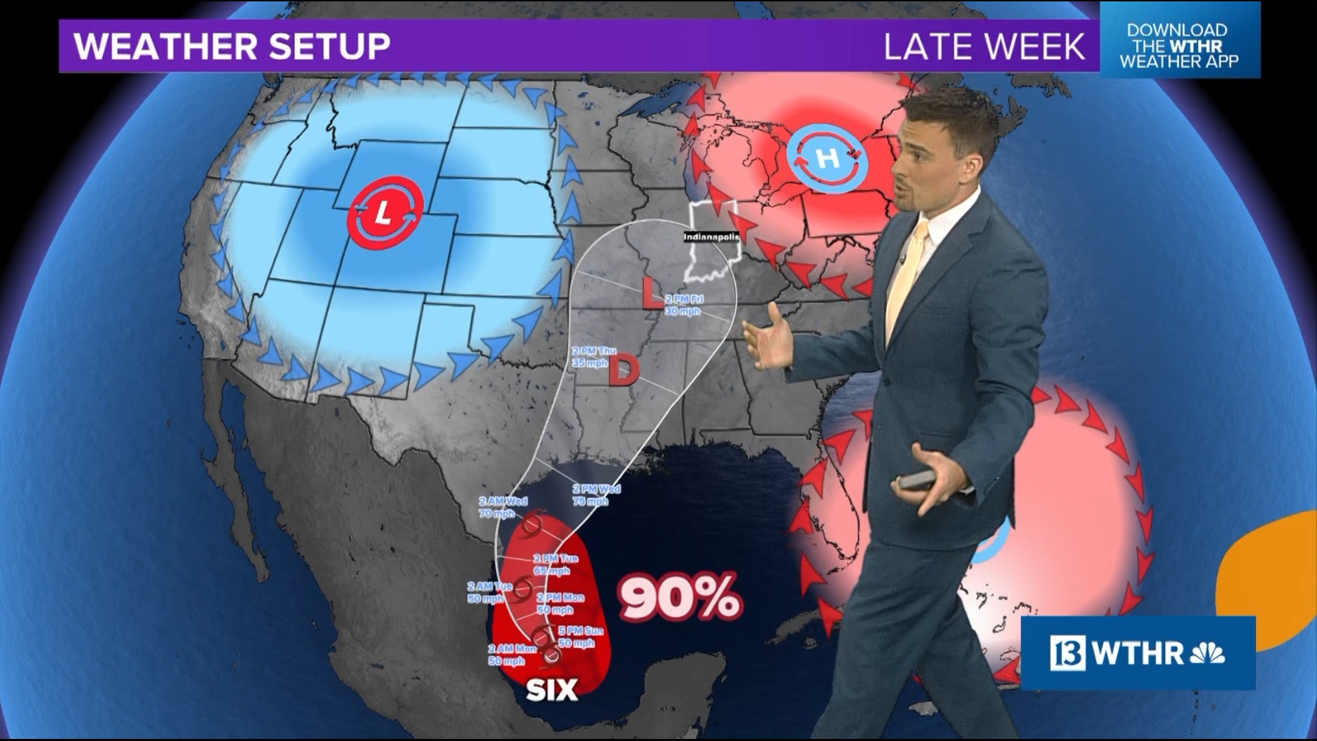
Traveling around the Ohio Valley/Great Lakes on Christmas Eve will be quiet with the closest rain showing up in Iowa along a slow-moving cold front. Some wind-whipped snow on the backside of that front will cause slow travel on Christmas Day from Kansas to Minnesota/Wisconsin.


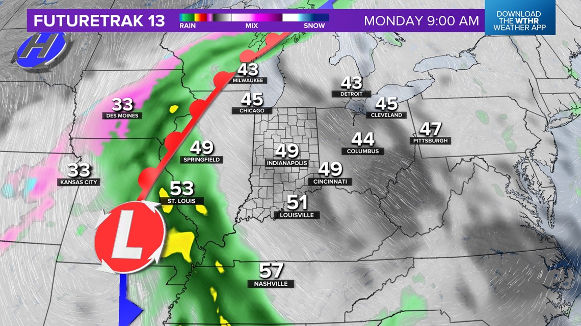

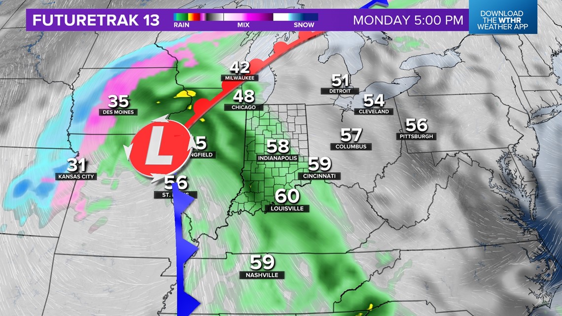
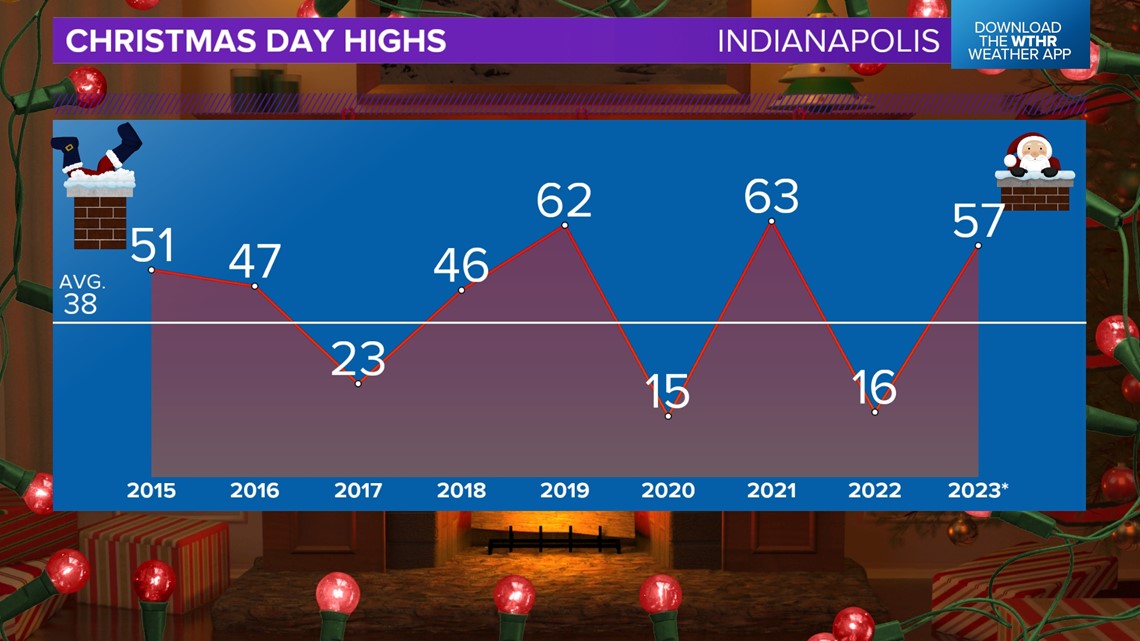
Central Indiana will be in the warm sector of that storm system, resulting in a mild Christmas afternoon with highs in the upper 50s/lower 60s. We've adjusted the arrival time of rain next Monday to midday/afternoon. That means there should be dry hours in the morning for kids to get out and enjoy any new toys.

An axis of wind-whipped overspreads the viewing area Christmas afternoon and lingers Monday night. The main rain shield lifts north on Tuesday, but we'll remain in the 50s before the cold front finally clears the state later Tuesday into Wednesday.
Long-range guidance is showing a much colder set up later next week into New Year's weekend. We'll update accordingly, but some winter cold may finally show up to finish 2023.