Indianapolis "enjoyed" it's eighth 90° day of the year on Friday afternoon thanks to sunshine and dewpoints drying-out into the lower 60s. Indy averages 20 days in the 90s per year.
Mainly quiet this evening and early Saturday with the exception of a spotty shower possible in north-central Indiana before midnight tonight.
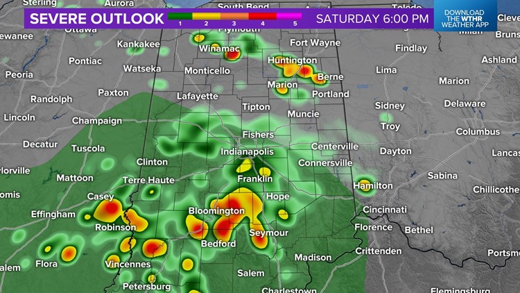
We do want you to know that based on latest radar/satellite imagery, combined with hi-resolution modeling, we've had to make significant forecast changes to Saturday afternoon/evening. This is due to a mesoscale-convective vortex (MCV) that's currently prompting a Severe Thunderstorm Watch to our west in Missouri.

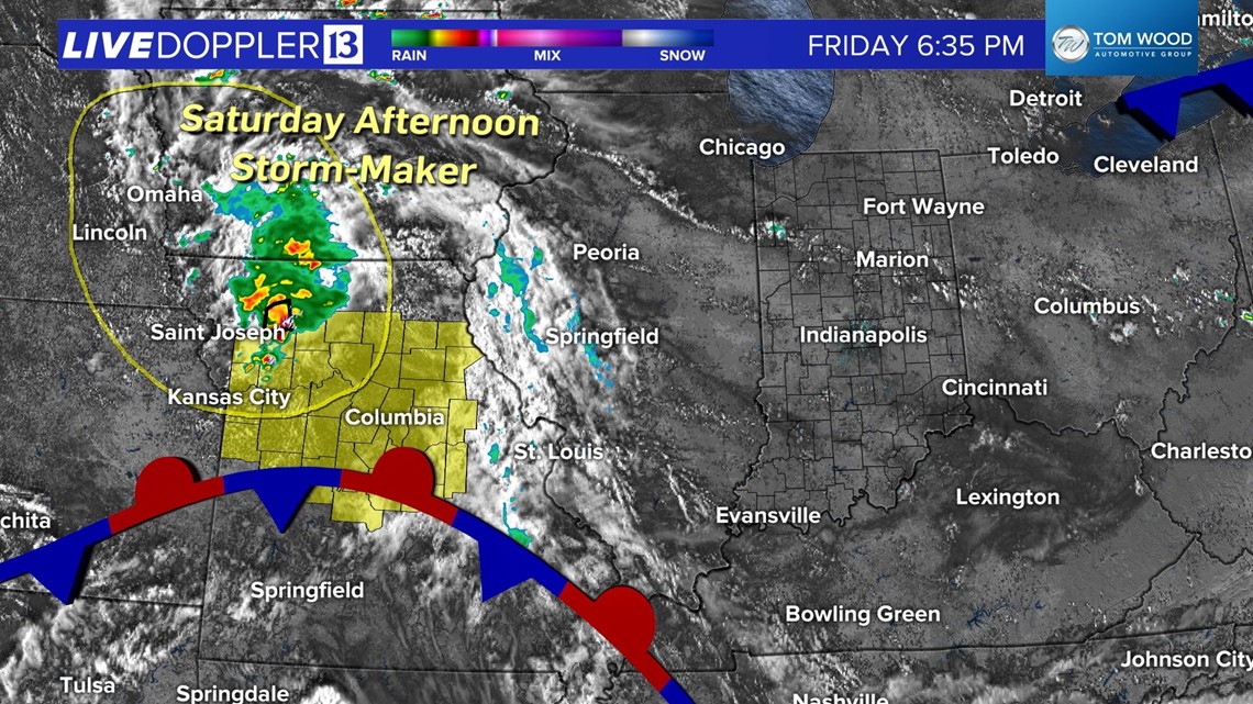

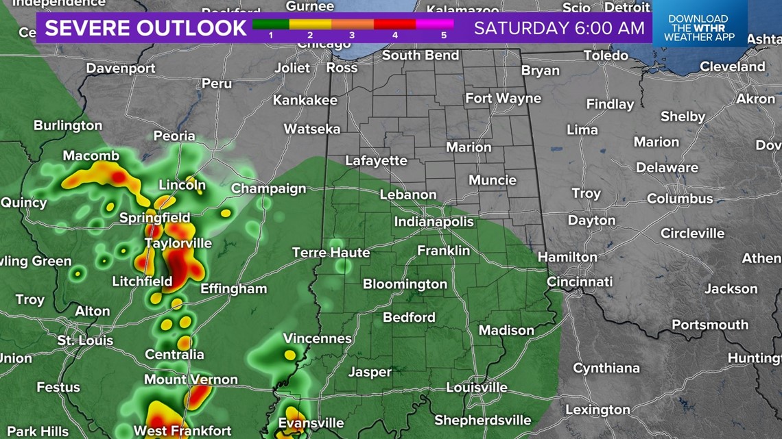

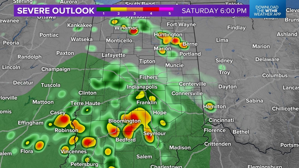
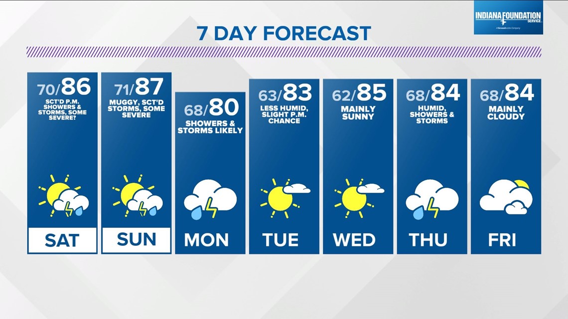
This feature was timed to be slower-arriving in days leading up to the weekend...which is why we had a dry Saturday forecast. But based on latest analysis we're now expecting scattered to possibly numerous downpours/thunderstorms emerging mainly between 1 p.m. - 8 p.m, though it should be noted that activity is possible outside of that timeframe.

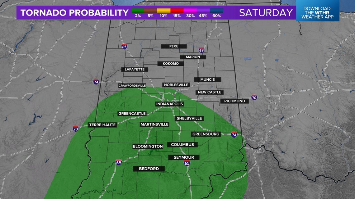

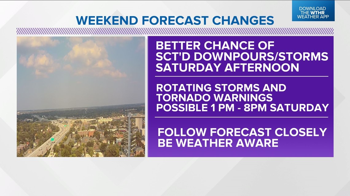
MCVs can also be sources of rotating thunderstorms/tornadoes depending on their location during peak-heating/instability hours. That location Saturday afternoon looks to be over central Indiana and as a result it's possible there could be Tornado Warnings due to spinning storms. Have multiple ways to get any Watches/Warnings that may be issued and follow our forecast closely for updates.
At minimum there will be more rain/storm coverage Saturday afternoon then previous forecasts leading up to the weekend. At worst we may get some Tornado Warnings between 1 p.m. - 8 p.m. in areas that heat and destabilize the most. Be Weather Aware.

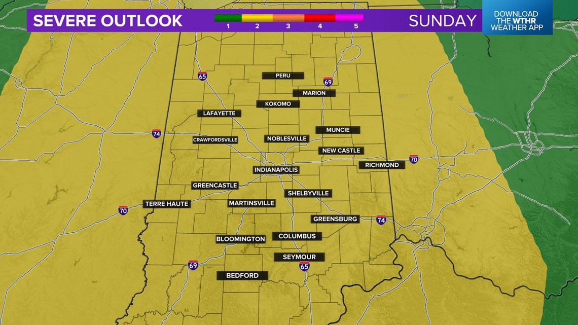

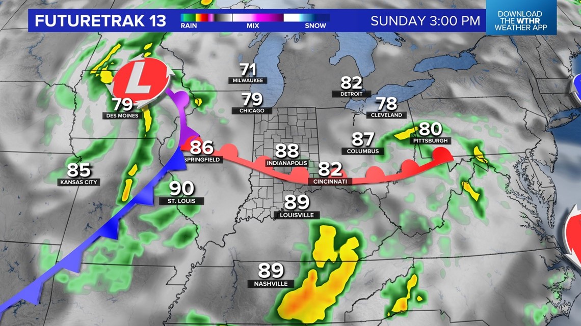

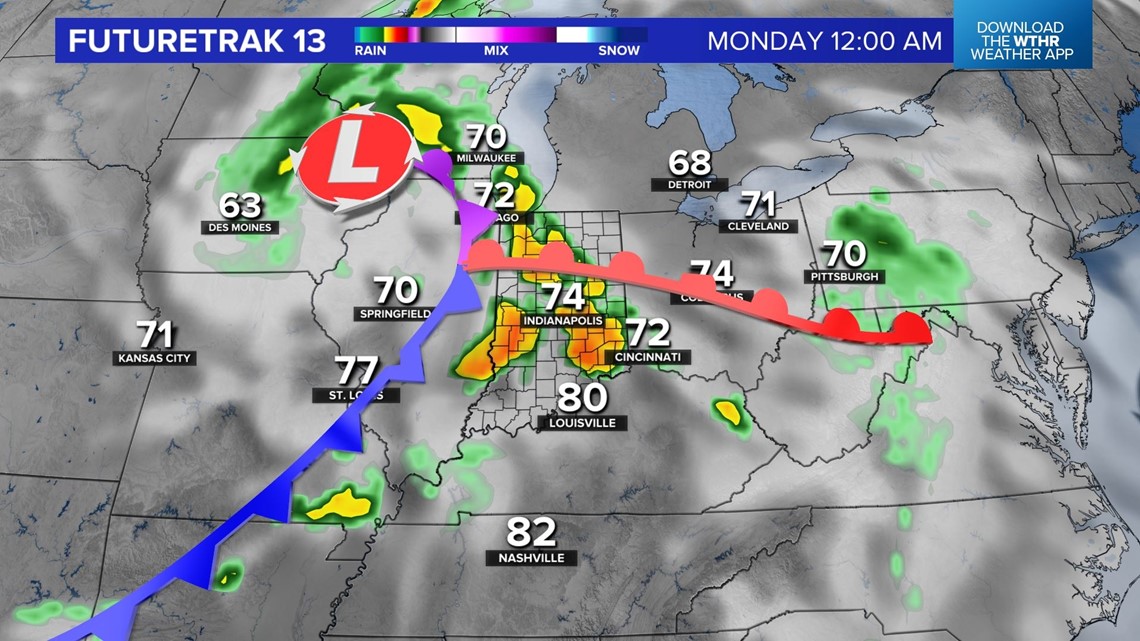
Severe weather will be more localized Saturday versus what looks like a more widespread threat Sunday afternoon into early Monday morning. Overall modeled wind-fields remain seasonably robust during the second-half of the weekend and could feed organized severe wind gusts along a line of storms on a cold front. Specific timing for the Sunday event remains uncertain. But you should be Weather Aware this weekend and monitor radar for outdoor impacts.
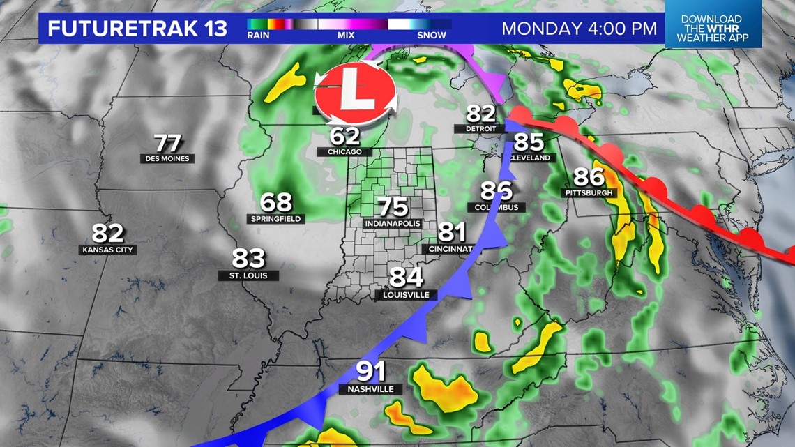
Central Indiana will be on the backside of the cold front Monday with cooler highs in the 70s in addition to numerous showers and thunderstorms. Stay tuned for updates.