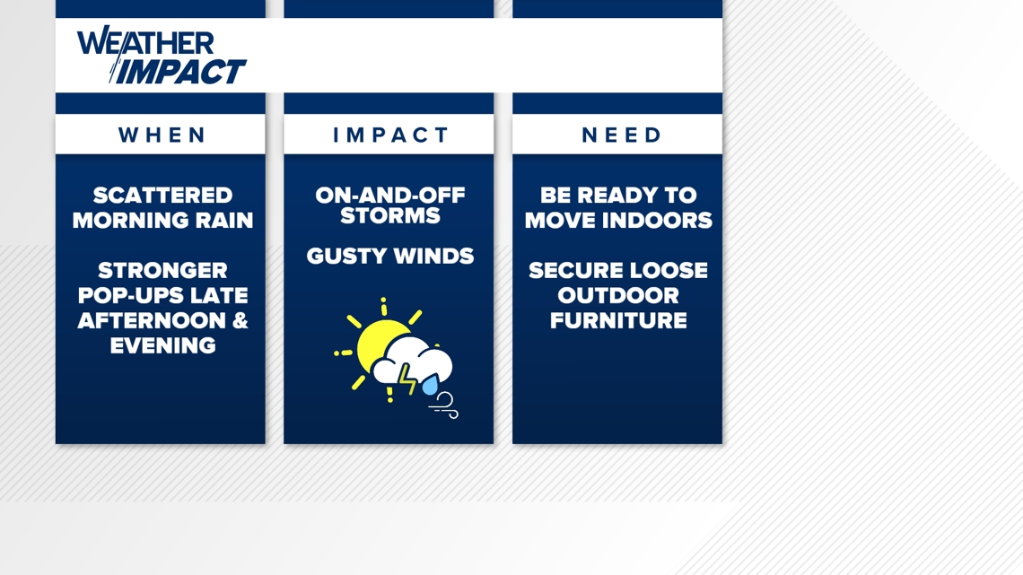
INDIANA, USA — Get ready for more on-and-off storm chances across Indiana. However, this next round could be a lot stronger. A level 1 severe threat is in place across much of Indiana for Monday evening. An isolated shower or storm will be possible all day, but watch for some severe storms with wind between 6 p.m. and midnight.
Tap HERE to track rain and storms with our interactive radar.
Sunday was soupy with hit-or-miss rain across the Hoosier state. An additional shower or rumble of thunder is possible overnight into early Monday morning, especially south of Indianapolis.
Weather setup
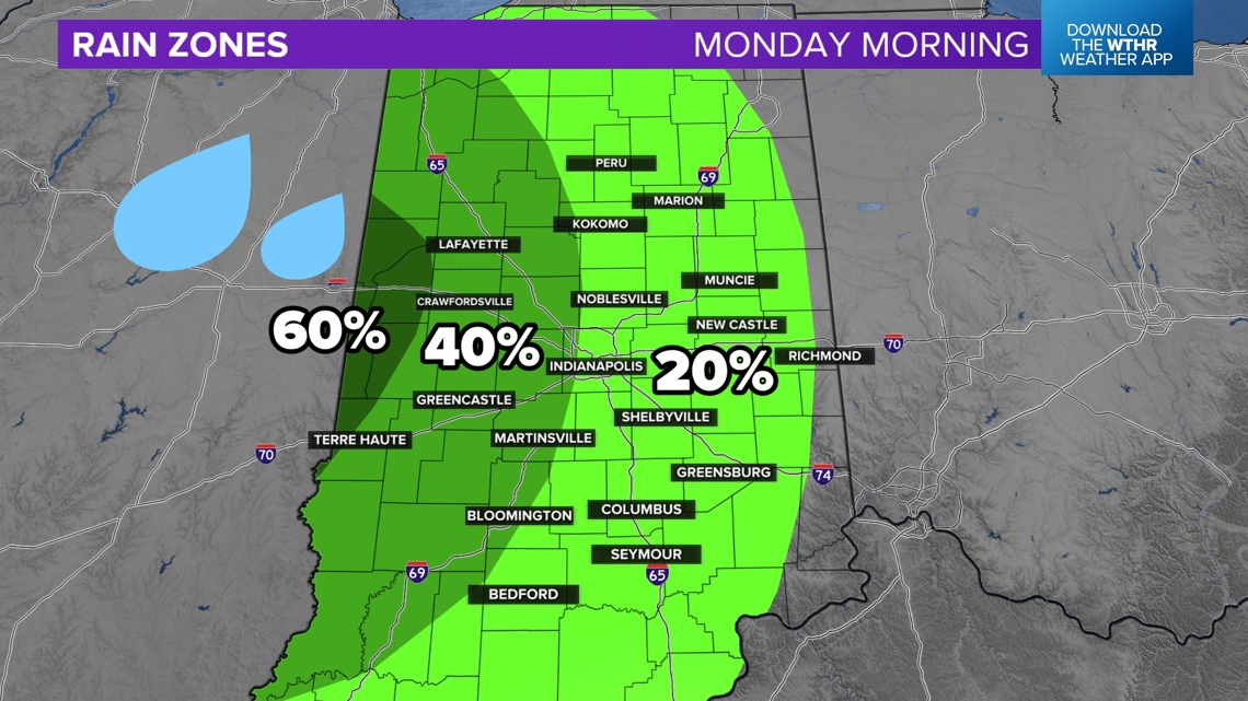
Morning: Monday is messy. Here is why: A cluster of storms is pushing across Iowa and may arrive in western Indiana by Monday morning, weakening over time. Highest rain chances will be west of Indianapolis after sunrise.
Afternoon: After this complex dissipates, expect small boundaries between towns that got rain and towns that did not. These boundaries can help spark their own pop-up showers and storms throughout the day. Coverage should be isolated with sunshine in between.
Evening: After an already unsettled day, the jet stream will enhance overhead and help pop more storms. These are likely to be the strongest storms of the day.
Overall, Monday's rain forecast will be complicated. Every Indiana town will have a different timeline and experience the day differently. Some of us get dumped on, while others get slim pickings.
Now that we have that disclaimer covered, let's get into some specific details we are expecting for tomorrow.
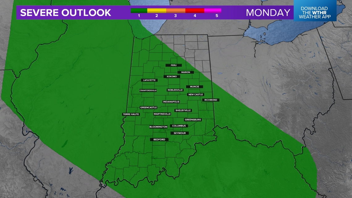
Severe threat
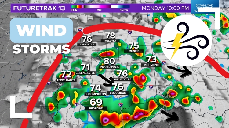
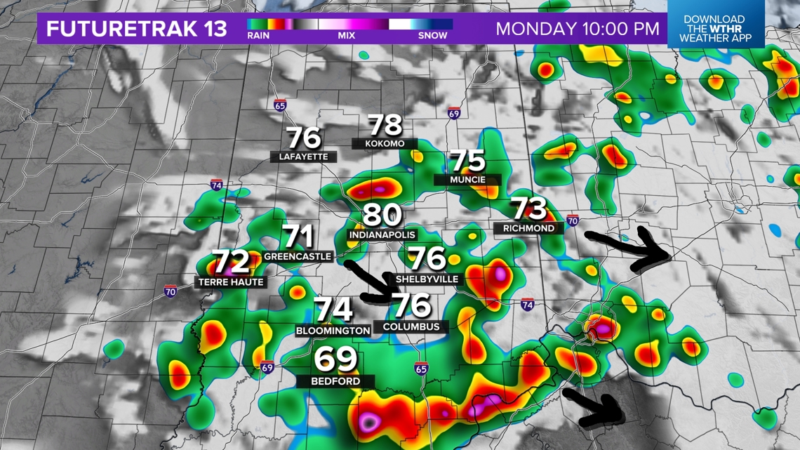
A very low-end severe threat is in place across most of Indiana, a level 1 out of 5. This may be upgraded due to a wind threat. Winds could top 60 mph in some storms, especially Monday evening.

After a soupy day with warm, humid air and isolated downpours, we are expecting a higher concentration of showers and storms later Monday evening, generally after 5 p.m. The highest wind threat is likely to be south of Indianapolis.

Rain zones
Monday morning: The highest rain chances will be west of Indianapolis, but technically, most Hoosiers have a chance at some rain in the morning, while others get some patchy fog and sunshine.

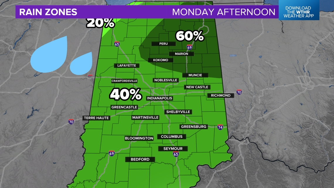
Monday afternoon: Almost everyone has a 40% chance for a pop-up shower or storm. That's a 60% chance you also stay dry. Some of us will get a good downpour, while others stay warm and partly cloudy.
There may be a slightly higher rain chance in northeast Indiana, where not much has happened yet the past couple of days.

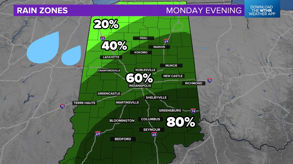
Monday evening: Storm chances greatly increase. While still not at 100%, expect some scattered showers and storms. Some very gusty winds are also possible, especially south of Indianapolis. Watch for some rain and some severe weather. Tornado chances are very low, but not zero.
If storms start running into one another, we could develop a long wind storm that dives south. The leading edge will have gusty winds and a possibility of a spin-up tornado.

Weather may impact your day
Leave the umbrella, and be ready to do indoors. There will still be several quiet, muggy hours on Monday. At times, storms will be possible.