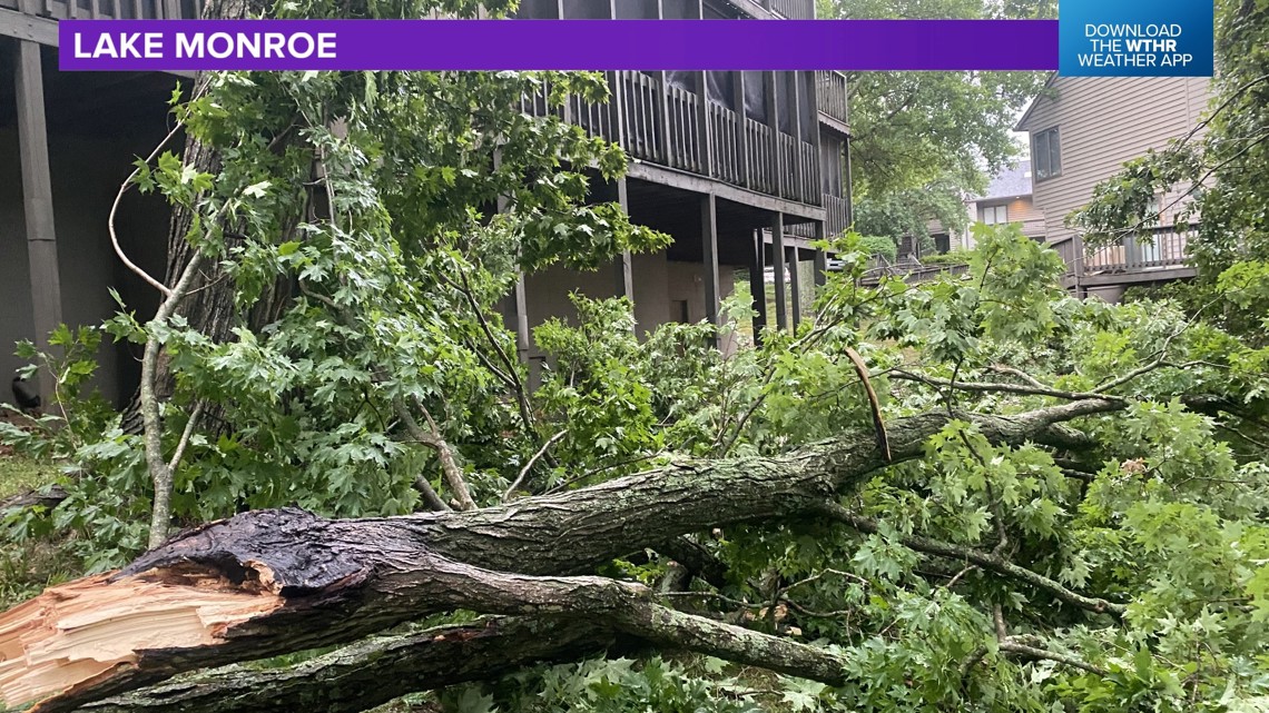
INDIANAPOLIS — Severe storms moved through parts of central Indiana between 3 p.m. and 5 p.m. Tuesday. Monroe County was hard hit with winds near 80 mph. Here is a picture of some of the damage near Lake Monroe:

There were more than 40,000 without power due to the storms with trees and powerlines down.

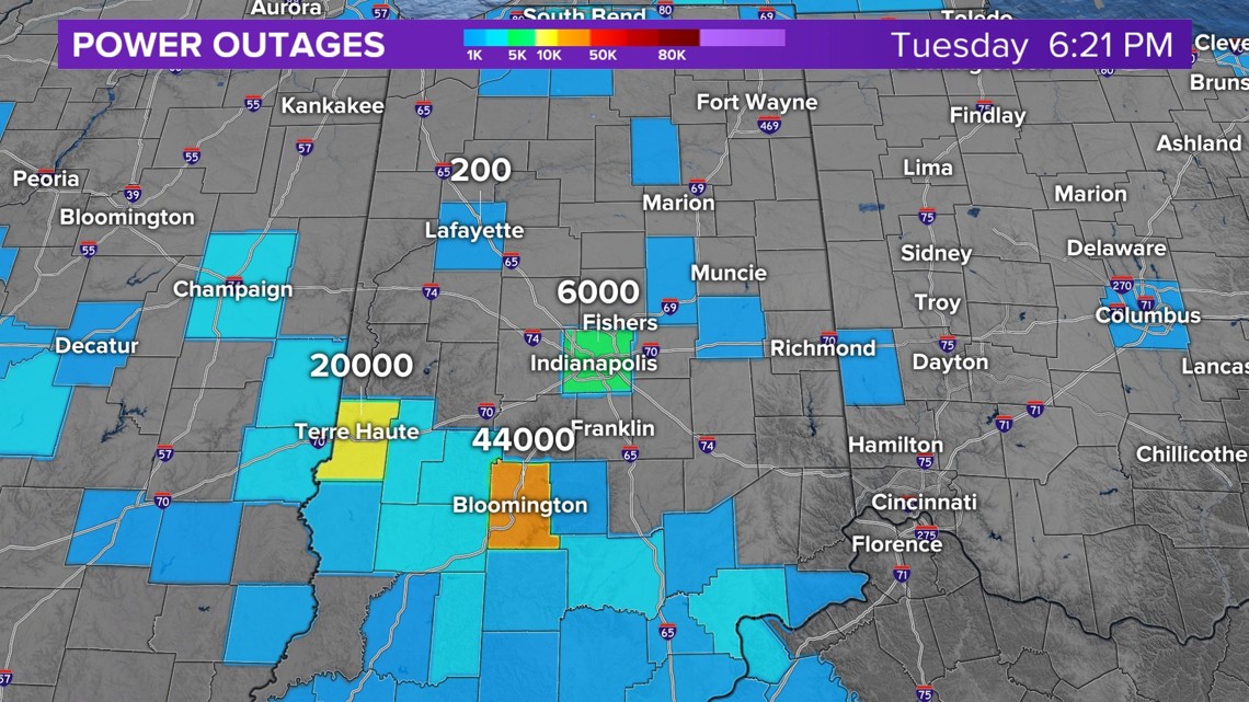
An interesting weather phenomenon developed behind the line of storms called mesoscale high winds. These winds were 40-50 mph and caused some power outages in Marion County.
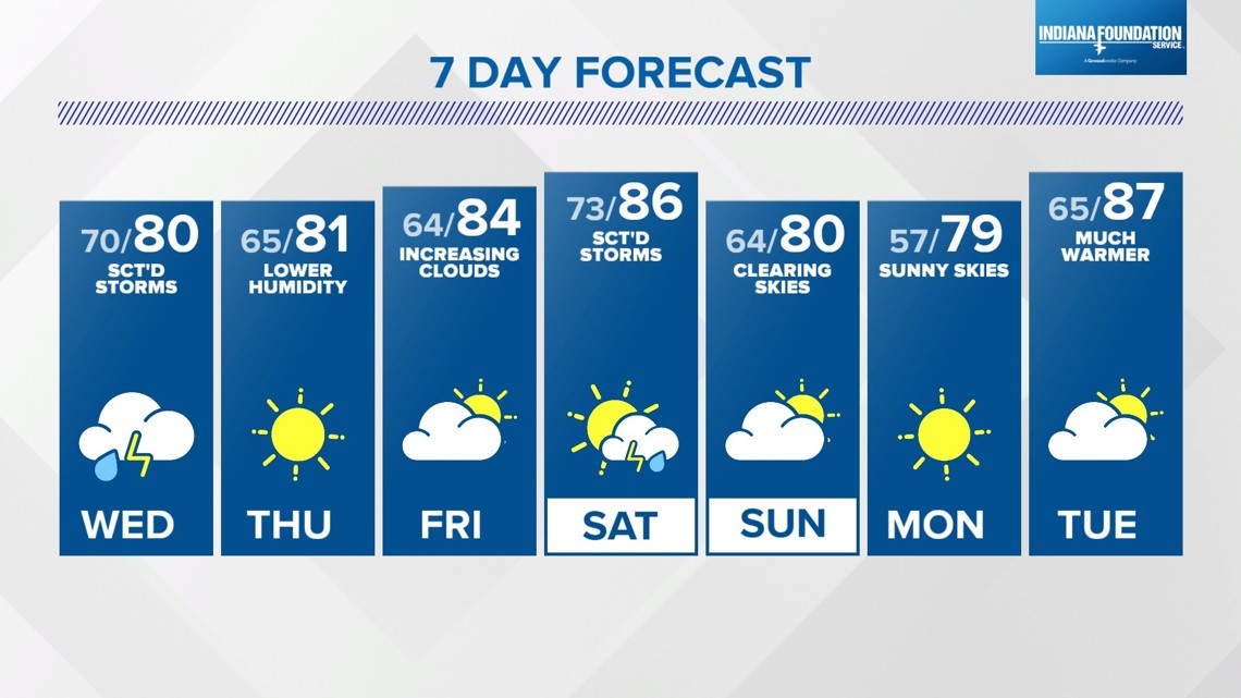
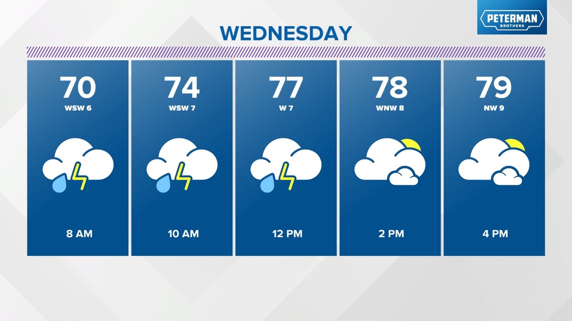
The weather pattern will be quiet for a few hours this evening. Another round of storms is possible after midnight and early Wednesday morning. The rain and storms may slow down the morning drive. Scattered storm chances stay in the forecast through Wednesday afternoon and evening.

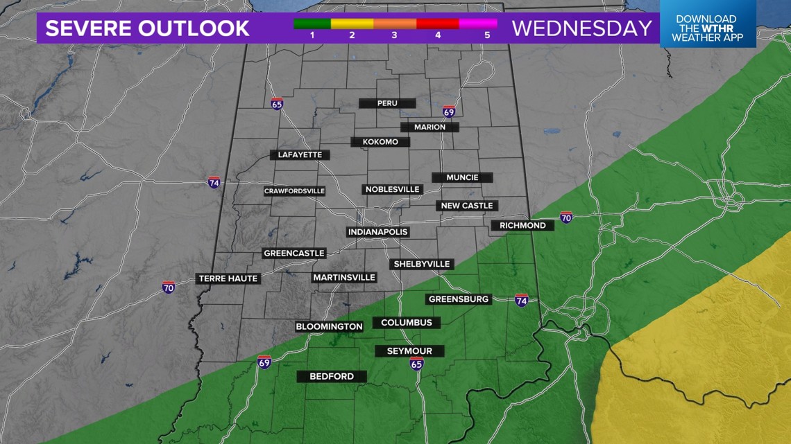
The threat of severe weather is southeast on Wednesday.

Sunshine and lower humidity return on Thursday, with forecast highs near 80 degrees.
The weather pattern warms back up on Friday with highs in the middle 80s. We start the weekend with a bump in the muggy meter and highs in the middle and upper 80s on Saturday. A few storms are possible on Saturday, too.
The weekend will end with another drop in the muggy meter on Sunday. Forecast highs are near 80 with clearing skies Sunday afternoon.