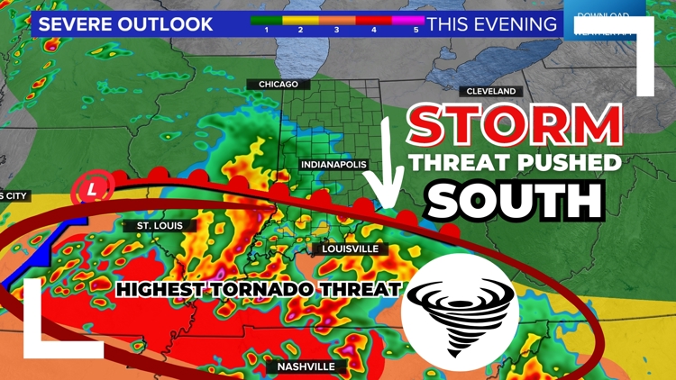
INDIANA, USA — UPDATE: The Storm Prediction Center has slightly shifted the severe zones to the south as a warm front struggles to return north. Still expect scattered severe storms, especially south of Indianapolis later this evening, mainly after 6 p.m.
(Note: We have a map of tornado touchdowns from yesterday, May 7 at the bottom.)
Tap HERE to track the storms coming in.
After plenty of morning sun, clouds are slowly increasing across Indiana ahead of more storm chances for this evening, some of them turning severe. The strongest storms are likely to be south of Indianapolis, including cities like Bloomington, Columbus, Evansville, Jeffersonville, New Albany, Seymour and Vincennes.
We have your complete guide to the storm chances this evening from timing to coverage, hail risks, wind risks and tornado risks.
GENERALY SUMMARY: Scattered showers and storms are possible this evening, but the main threat looks to be in far southern Indiana, for areas within 50 miles of the Ohio River.
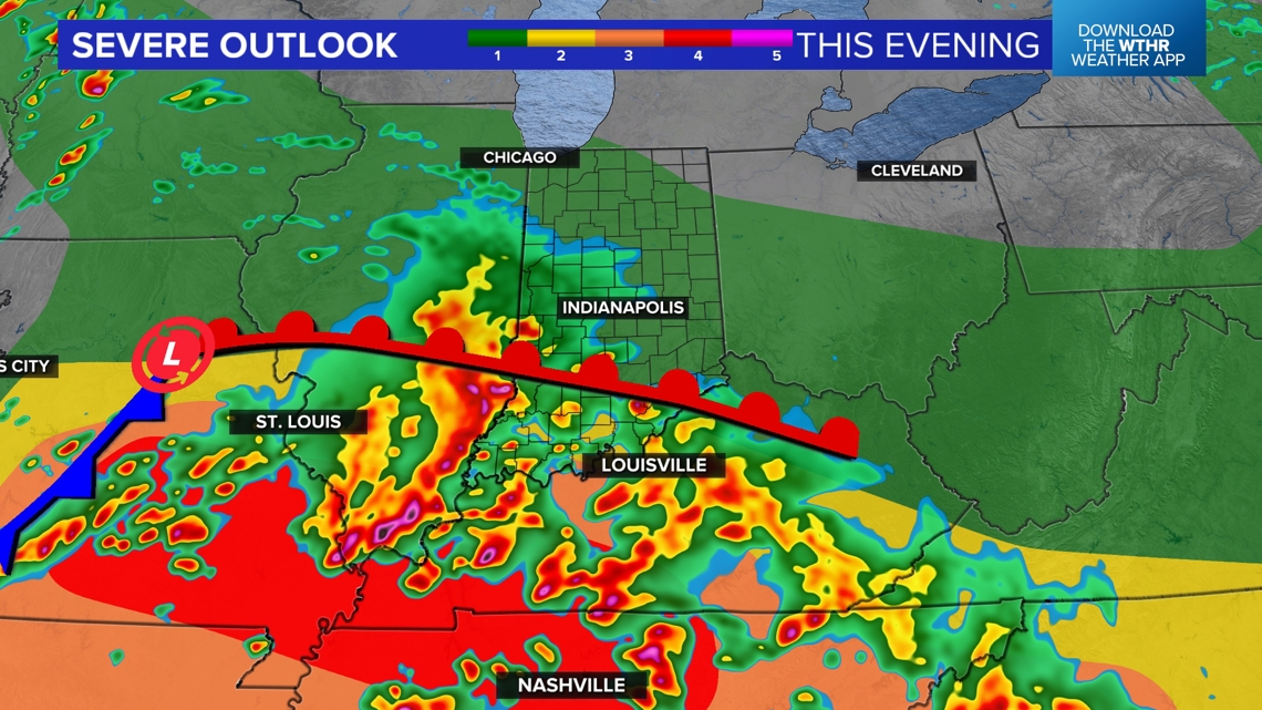
Latest check on the severe zones
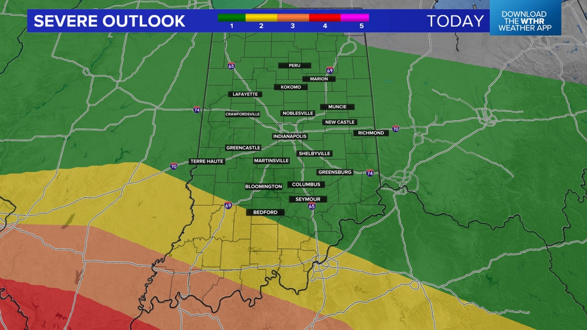
The latest afternoon update from the SPC is that the severe zones have been pushed farther south. A level 1 still remains for much of the state, with higher 2-3 risks in southern Indiana.

After Tuesday's storms, the atmosphere is trying to recover. We have built up enough heat, but the humidity is not nearly as high as it was yesterday. Enough to foster some storms, but not enough to carry the worst cells into central Indiana, comparted to Kentucky, Missouri and Tennessee.
The warm front will probably only reach south-central Indiana. However, we will have to watch the warm front for some enhanced rotation. Areas too far north of the front will have a much smaller chance for severe weather.

When to expect the storms?
A stray shower is possible after 4 p.m., but scattered rain and storm chances should pick up closer to 5-7 p.m. Then, expect storms to last on-and-off through 10-11 p.m.

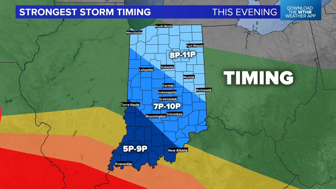
The farther north and west you go, the later you may wait.
The atmosphere still has a shortwave in the upper levels and warm temperatures, so a storm could fire up at any time, but most of the chances will remain in the evening hours.
After the storm chances, there may be some scattered showers overnight.
How many storms will there be?
We have storm chances, but that doesn't mean everyone gets a lot of rain and thunder. In fact, we will likely have fewer storms over Indiana as a whole tonight compared to yesterday. The farther south you go, the greater the chance that you will get hit by a storm. You may not get hit by the strongest part of the cell, but the chance is higher.

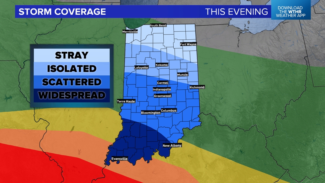
Areas north of Indiana will be very hit-or-miss. Not everyone will get a storm, or even rain for that matter. Generally around Indianapolis, the storms will be scattered, still not everyone getting one.
What is my risk for hail?
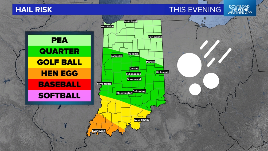
Many cells may drop some small hail, but the larger hailstones will likely be in southern and southwestern Indiana. There, we may see 1-2" sized ice chunks in the stronger storms.
Still, up to quarter-sized hail can dent vehicles and damage property/crops.

What is my risk for gusty winds?
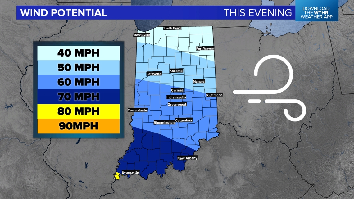
The strongest wind potential will likely be south of the warm front, so areas south of Indianapolis will have the highest gusty wind chance. Extreme southwestern Indiana could see wind gusts near or above 70 mph.

What is my risk for a tornado?
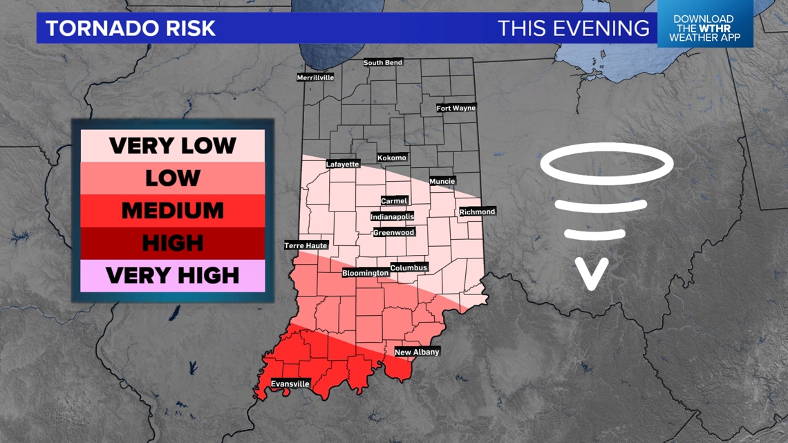
Most of the tornado chances will be south of the Ohio River, however with the warm front in place, bringing enhanced rotation to the atmosphere, watch for some tornadoes, especially in southern Indiana. The chance is NOT zero for Indianapolis, but it is lower.

The rest of the week looks a quieter and cooler! No more severe weather for the rest of the week and weekend.
-13News Meteorologist Matt Standridge
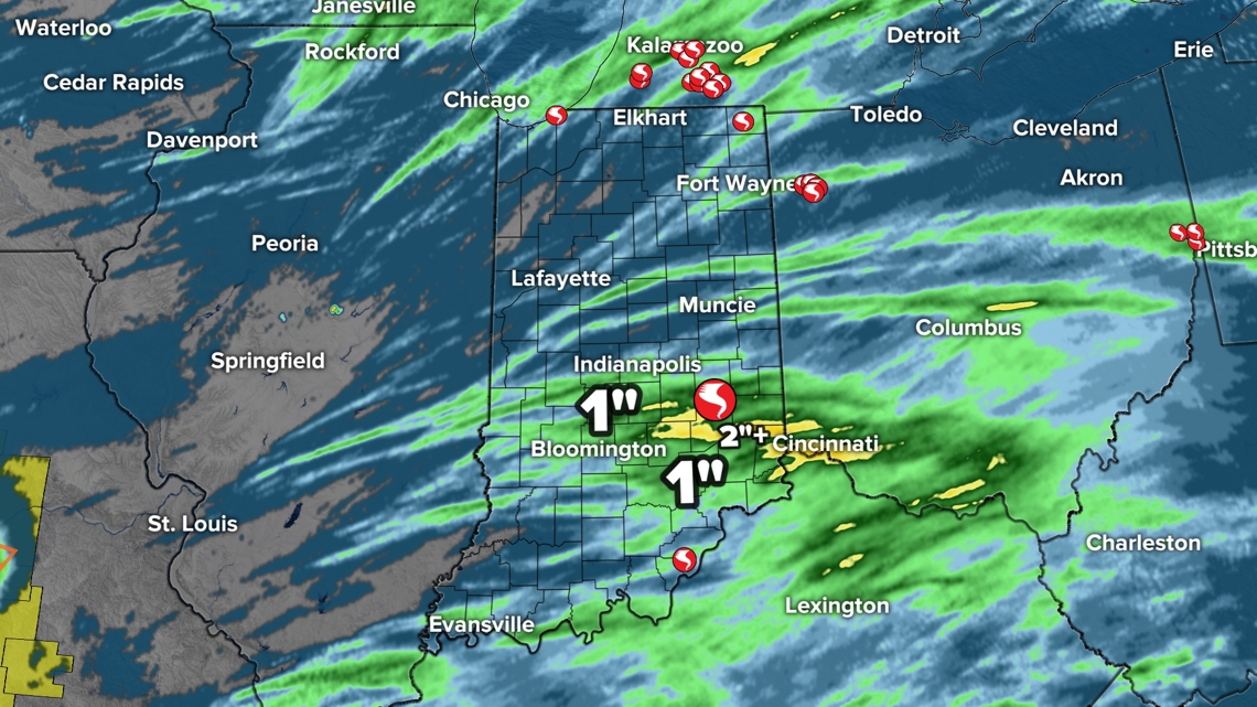
Tornado reports so far from May 7th (may be updated with more), plus estimated rainfall.

