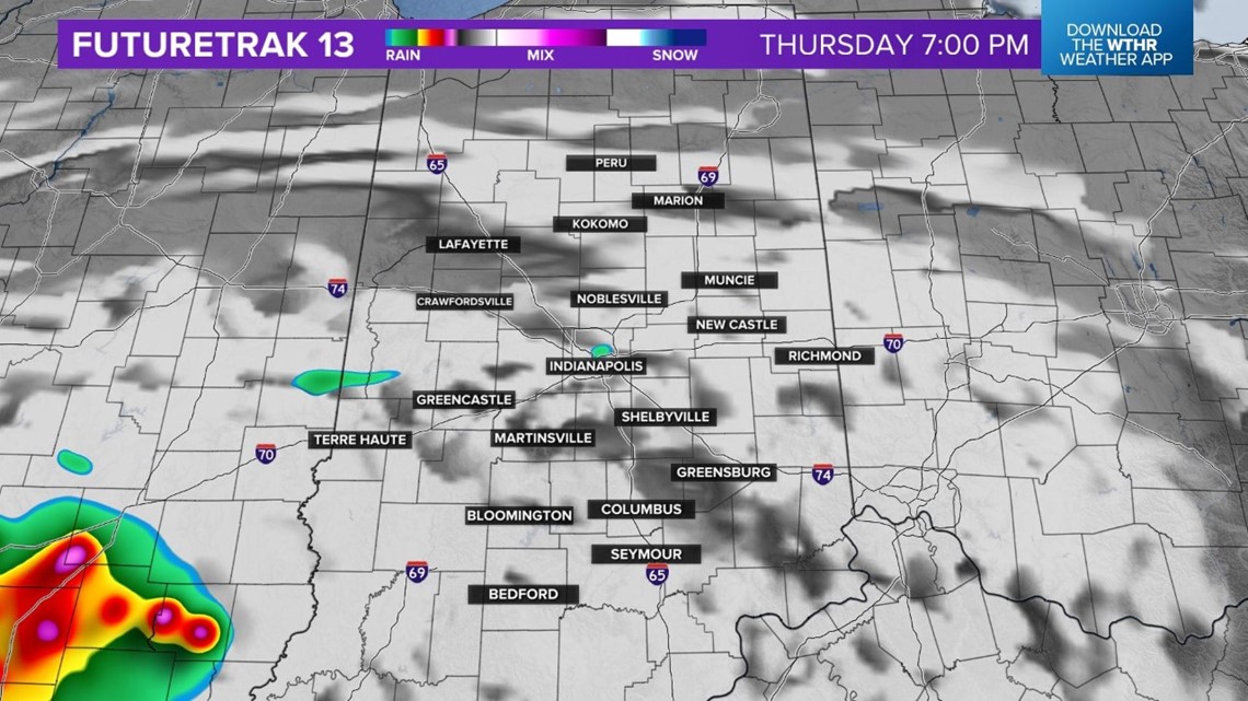
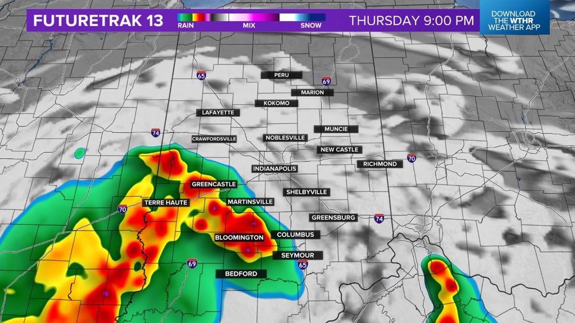
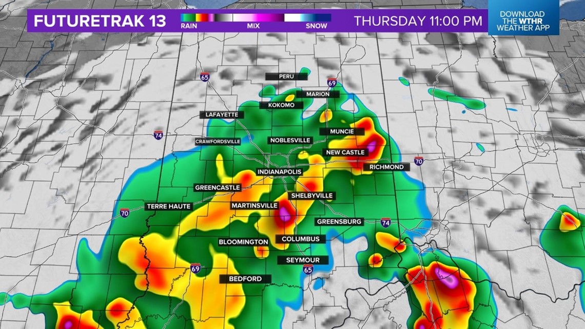
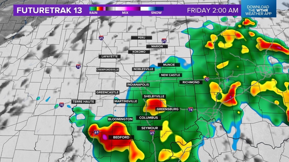
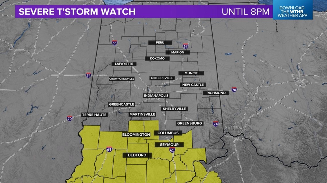
INDIANAPOLIS — There is the threat for severe storms across the southern half of the state this evening and overnight. A severe thunderstorm watch is in effect for Bloomington, Nashville, Bedford, Seymour and North Vernon until 8 p.m. Here is the outline for the watch area:
![](https://media.tegna-media.com/assets/WTHR/images/b61d78a5-4add-493a-8bd1-21f0b77767f6/b61d78a5-4add-493a-8bd1-21f0b77767f6_16x9.jpg)
![](https://media.tegna-media.com/assets/WTHR/images/b61d78a5-4add-493a-8bd1-21f0b77767f6/b61d78a5-4add-493a-8bd1-21f0b77767f6_1140x641.jpg)
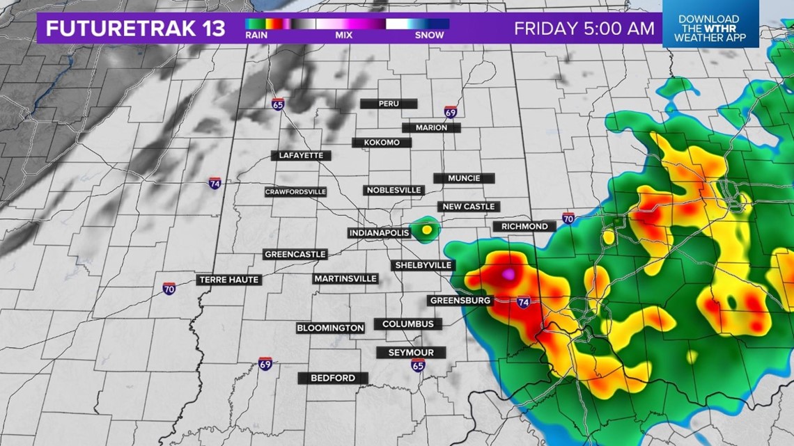
We are expecting several waves of storms through early Friday morning.
Here is the timeline with Futuretrak 13:
![](https://media.tegna-media.com/assets/WTHR/images/f3ec0481-eb4d-41fd-baad-c4c6a2f76759/f3ec0481-eb4d-41fd-baad-c4c6a2f76759_16x9.jpg)
![](https://media.tegna-media.com/assets/WTHR/images/f3ec0481-eb4d-41fd-baad-c4c6a2f76759/f3ec0481-eb4d-41fd-baad-c4c6a2f76759_1140x641.jpg)
![](https://media.tegna-media.com/assets/WTHR/images/c556c668-e446-4e9c-87b8-248bebcbfdab/c556c668-e446-4e9c-87b8-248bebcbfdab_16x9.jpg)
![](https://media.tegna-media.com/assets/WTHR/images/c556c668-e446-4e9c-87b8-248bebcbfdab/c556c668-e446-4e9c-87b8-248bebcbfdab_1140x641.jpg)
![](https://media.tegna-media.com/assets/WTHR/images/bb4c5efb-1ad4-48f8-ae80-68334bbf6b4b/bb4c5efb-1ad4-48f8-ae80-68334bbf6b4b_16x9.jpg)
![](https://media.tegna-media.com/assets/WTHR/images/bb4c5efb-1ad4-48f8-ae80-68334bbf6b4b/bb4c5efb-1ad4-48f8-ae80-68334bbf6b4b_1140x641.jpg)
![](https://media.tegna-media.com/assets/WTHR/images/daf561bd-3fb7-45df-ab67-c1a232b0e31e/daf561bd-3fb7-45df-ab67-c1a232b0e31e_16x9.jpg)
![](https://media.tegna-media.com/assets/WTHR/images/daf561bd-3fb7-45df-ab67-c1a232b0e31e/daf561bd-3fb7-45df-ab67-c1a232b0e31e_1140x641.jpg)
![](https://media.tegna-media.com/assets/WTHR/images/f8c966ed-2745-41b0-bed8-8cb8b5c9b9f8/f8c966ed-2745-41b0-bed8-8cb8b5c9b9f8_16x9.jpg)
![](https://media.tegna-media.com/assets/WTHR/images/f8c966ed-2745-41b0-bed8-8cb8b5c9b9f8/f8c966ed-2745-41b0-bed8-8cb8b5c9b9f8_1140x641.jpg)