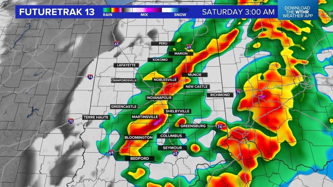
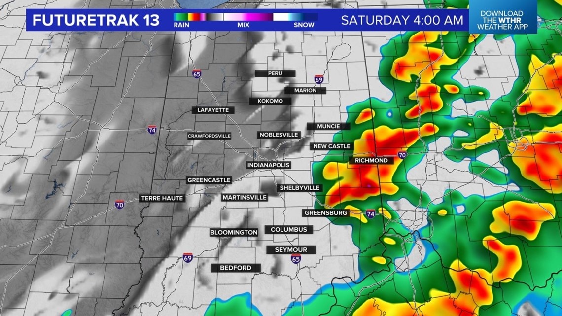
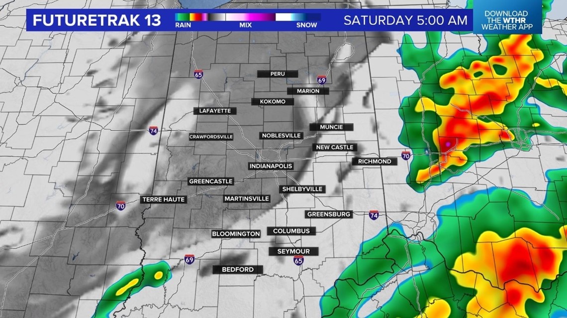
INDIANAPOLIS — The threat for strong/severe thunderstorms will continue for the eastern half of the state over the next couple of hours. The line of storms will be into Ohio by about 5am.


The strongest storms developed to our southwest and south. Unfortunately there are reports of damage from Arkansas to Illinois to Missouri, Kentucky and Tennessee. This is a story we will continue to follow.
The big local story on Saturday will be the temperature tumble. Temperatures will stay in the 60s through early Saturday morning and then drop into the 30s by Saturday afternoon.
The weekend will end with sunshine and highs in the middle and upper 40s on Sunday. Looking ahead to next week we are tracking a mild weather pattern with highs near 50 on Monday and in the middle 50s on Tuesday. 60 degree warmth is back for Wednesday and Thursday, along with a few showers especially on Thursday.


