INDIANAPOLIS — Monday night main takeaways:
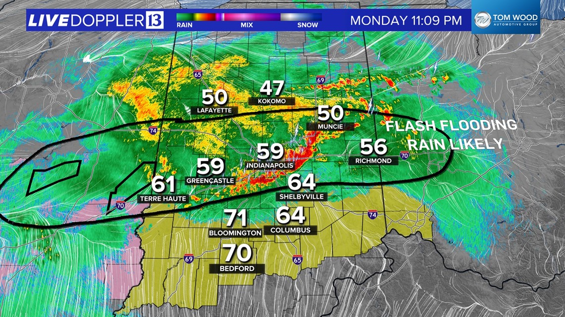
Heavy swath of storms in progress along the I-70 corridor with intense rain rates (1"-2"+ per hour) leading to some flooding.
Severe risk (outside of flooding) minimized farther north of I-74 by cooler air.
Tornado potential may increase south of I-70 the remainder of the night as low-level wind increases and a mesolow approaches from the west.
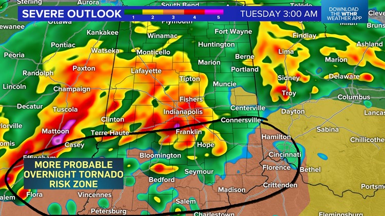
Severe risks elevated for Tuesday during the 12-7 pm timeframe including potential of tornado outbreak along and especially east of I-65.
The expected stormy night is underway with widespread rain and heavy storms just dumping torrential rain along the I-70/74 corridors. This was within a zone we were most concerned about for flooding and where some Flash Flood Warnings are in effect.
Most areas within this zone get 1"-3" and some 4"+ totals are likely before sunrise Tuesday morning.
At the time of posting, a Severe Thunderstorm Watch remains in effect for central/southern Indiana until 3 a.m., but we believe the focal point for any stronger gusts and embedded rotation shifts south of I-70 after midnight and lingers into early Tuesday morning.


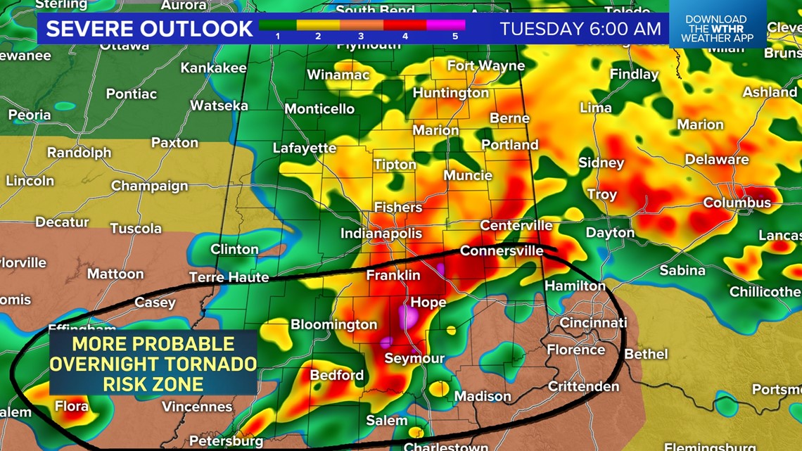
Please stay Weather Aware south of Indy. Lindsey Monroe and Chuck Lofton will continue to monitor for any areas of interest on radar leading into 13 Sunrise that begins at 4 a.m.
The heavy storm complex lingers early Tuesday morning before departing south and east. How quickly that occurs and how quickly its residual cloud clover dissipates plays a major role in how volatile the atmosphere becomes later in the day.
Monday night hi-res modeling suites remains bullish on a window of opportunity for supercells to develop along an approaching cold front within a destabilizing warm sector over central/eastern Indiana Tuesday afternoon.

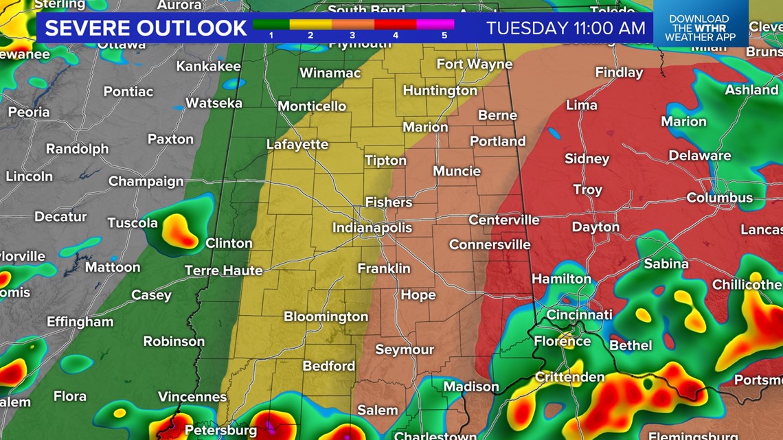

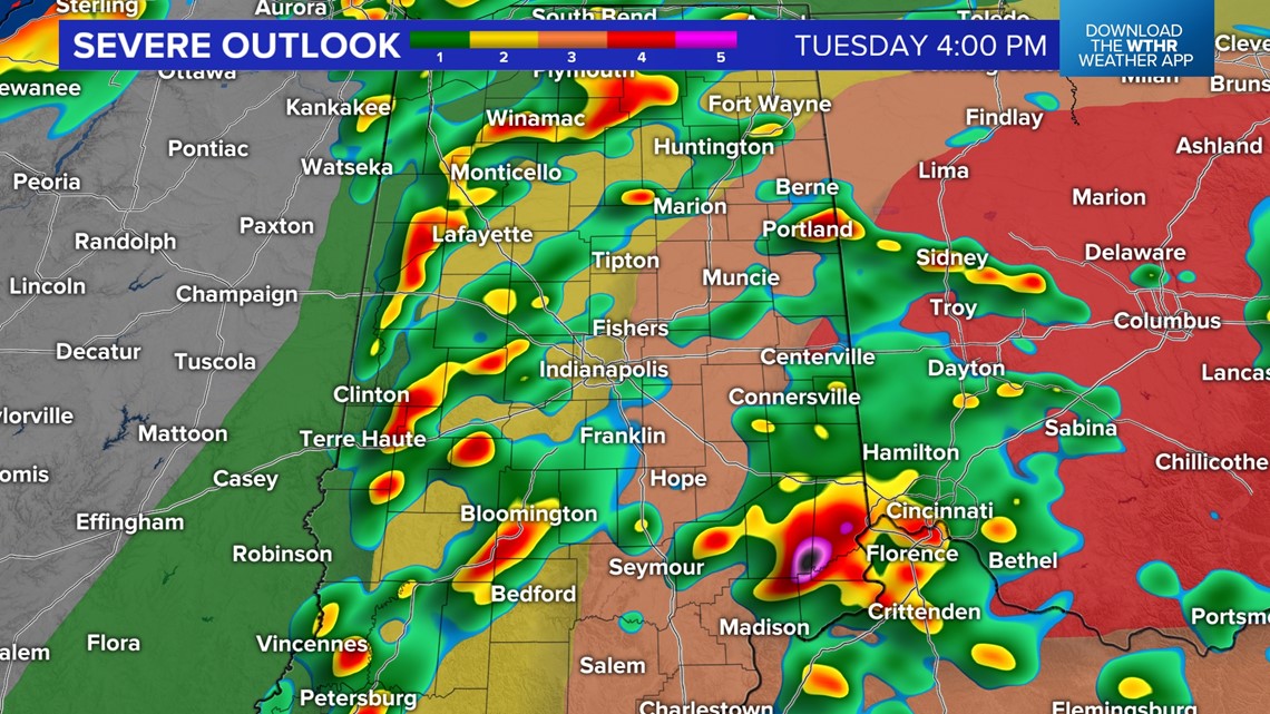

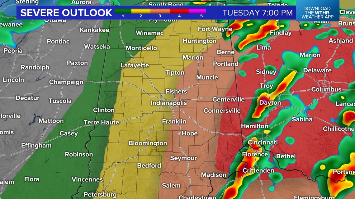
We continue to highlight the hours from noon to 7 p.m. Tuesday for the possibility of tornadic supercells that could also have significant hail (baseball-sized or larger) and destructive wind (75+ mph gusts).
We'll update in the morning with latest severe weather outlooks that right has been significantly increased for areas along and especially east of I-65, with a Level 4 out of 5 risk for eastern Indiana.
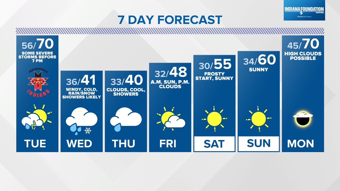
Stay vigilant, be Weather Aware, and follow our forecast for updates. The threat of severe weather quickly ends with the passage of a cold front Tuesday evening. That front delivers much colder air Wednesday and Thursday along with wind-whipped rain/snow showers.