It's been awhile, but for the first time in over three weeks, organized rain moved over central Indiana.
Mainly light rainfall with pockets of downpours around the Indy metro area are contrasted by steadier and heavier rainfall over southwestern Indiana that produced some flooding. This complex is weakening, and rain overall continues to diminish this afternoon.
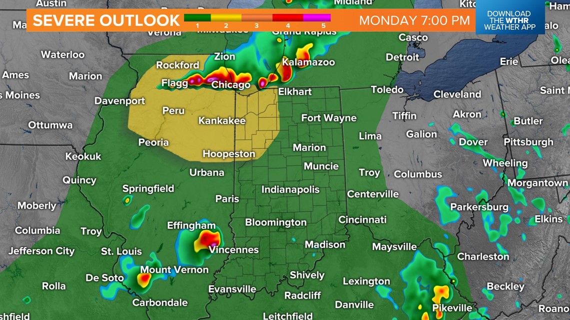
Remnant cloud cover limits severe weather most of the day, but we'll be monitoring northwestern Indiana later for storm development within a corridor of sun and increasing instability. Storms that develop around Chicagoland could become severe and track south into the WTHR viewing area overnight. These storms could be severe, and you should be Weather Aware if you're around Lafayette/Delphi/Monticello/Logansport.


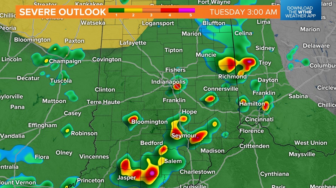
The remnants of storms upstream could reach Indy after midnight, and this is all a part of a more active pattern this week.
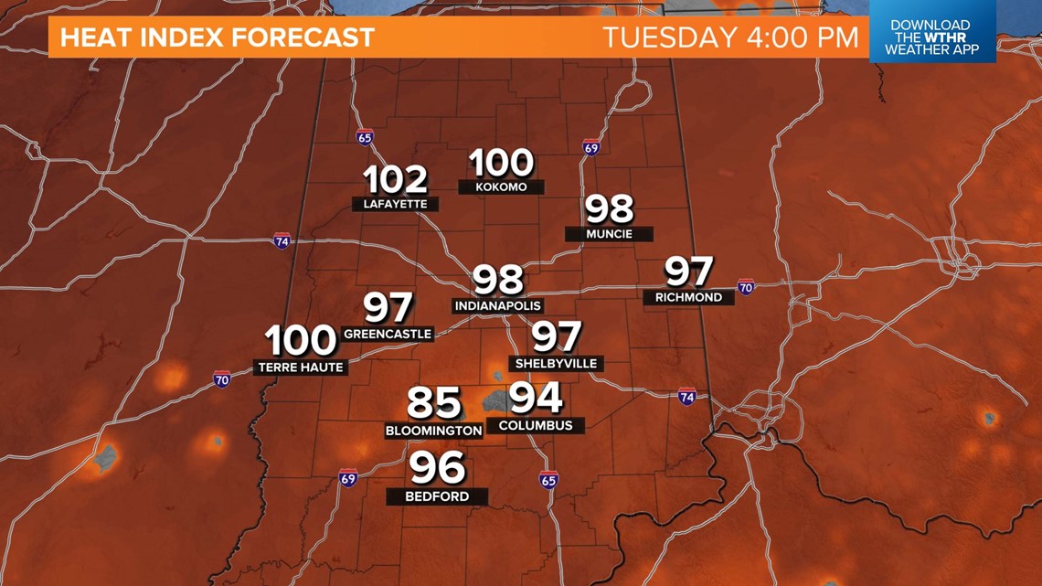
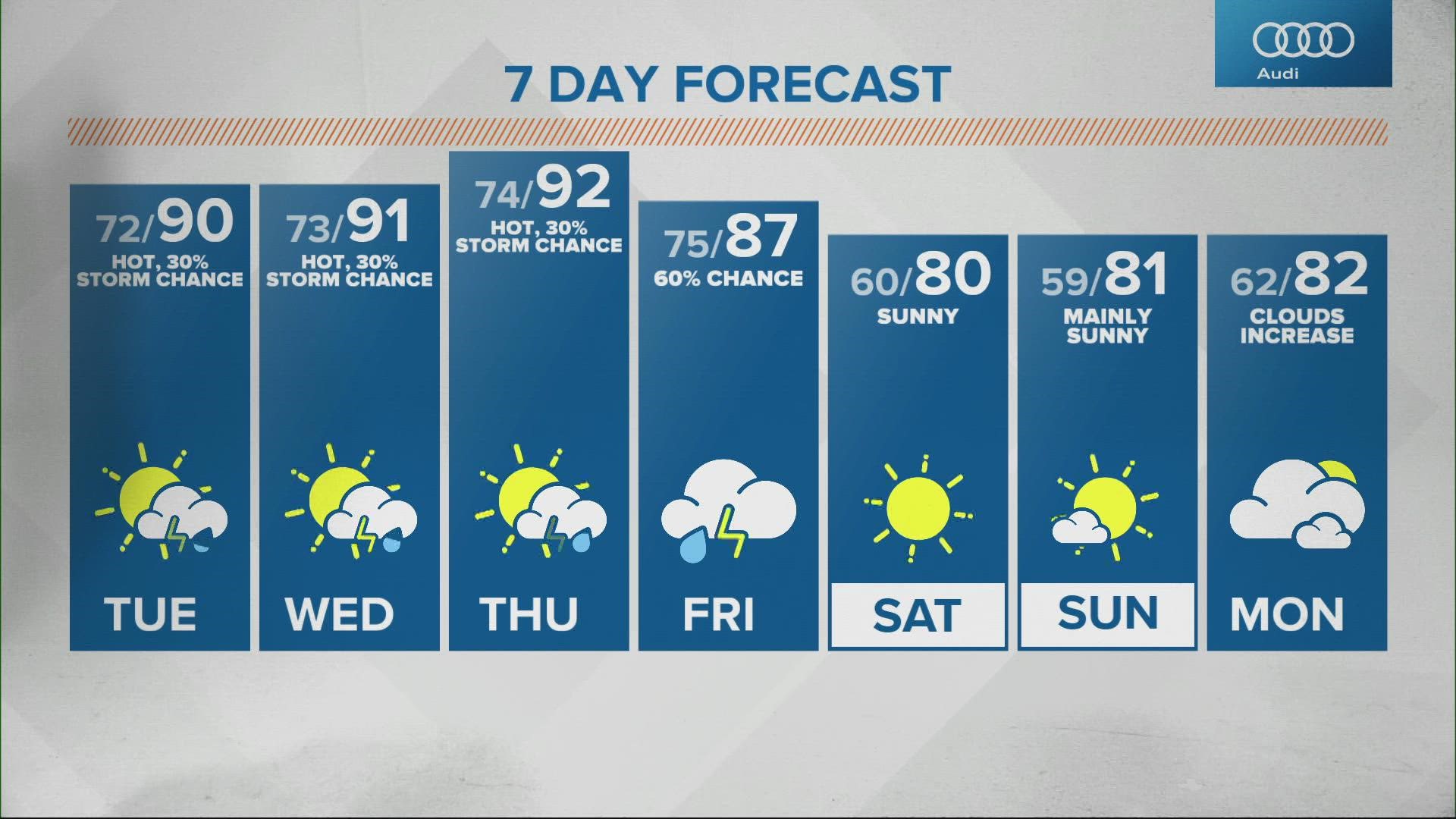
Much of Tuesday will be hot and humid. Highs will be near 90°, and heat indices will reach the upper 90s to near 100°. This sets the stage for another potential storm complex impacting central Indiana Tuesday night into Wednesday. If this scenario plays out, severe wind gusts and heavy rain would be possible.
Thursday remains hot, Friday remains humid and potentially stormy, and the early call for this weekend remains rather pleasant.


