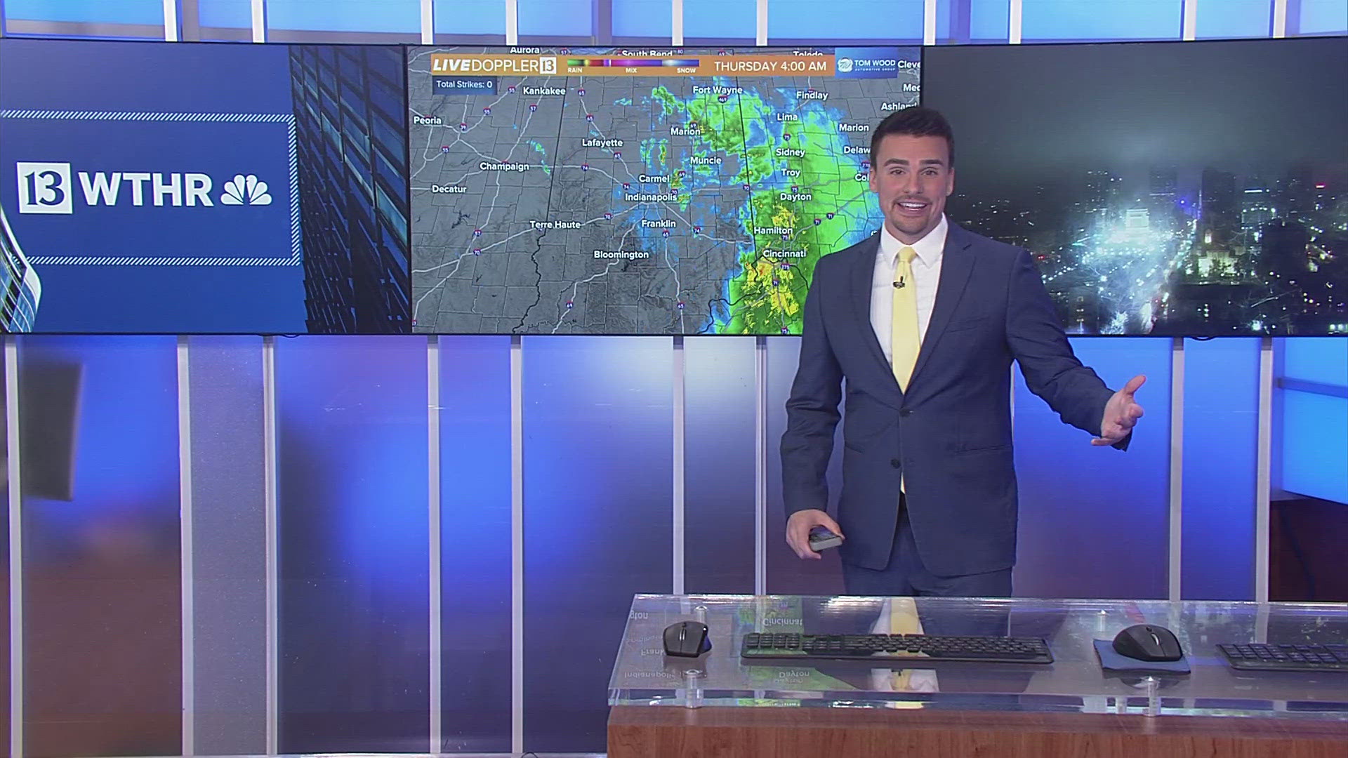
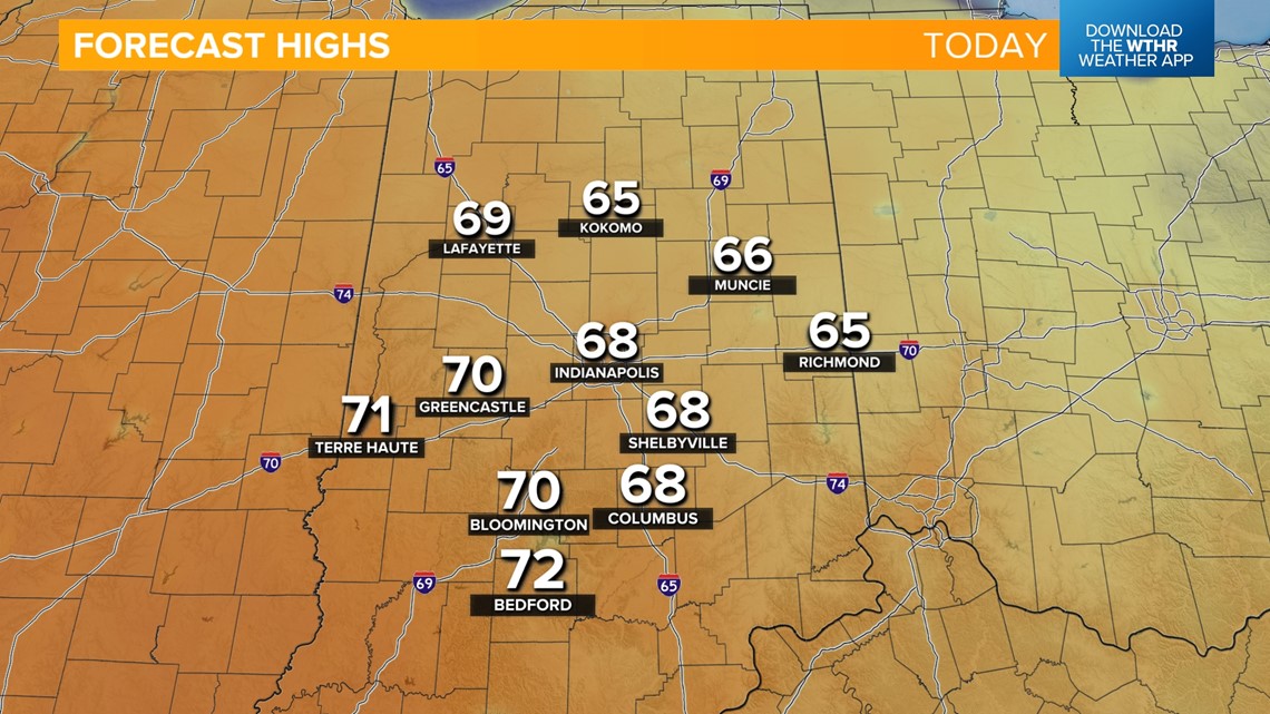
INDIANAPOLIS — We're headed into record-tying warmth territory today with highs in the upper 60s, near 70 southwest. The record high temperature for Indianapolis on Feb. 26 stands at 68 from 1917, 1944 and 1998. Staying mainly sunny and breezy.

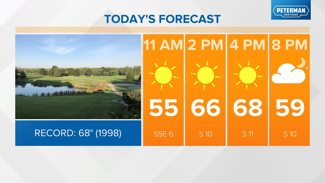

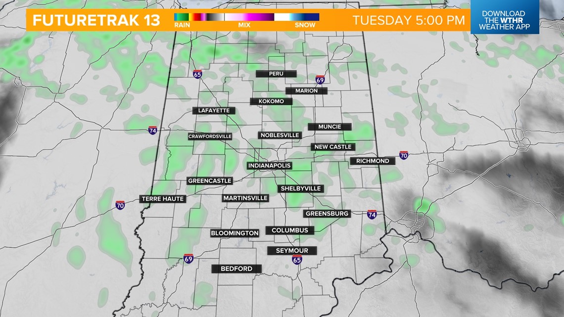
Clouds will build in during the evening hours with a few spotty rain showers developing overnight. Scattered rain showers with a chance of isolated storms continue through the day on Tuesday. We'll still be on the warm side of our next weather system so temperatures will once again rebound into the upper 60s, near 70.
We do look to stay shy of the record for Feb. 27 as it stands at 73 from 1996. It'll also be a very windy day with 35+ mph gusts from the south.

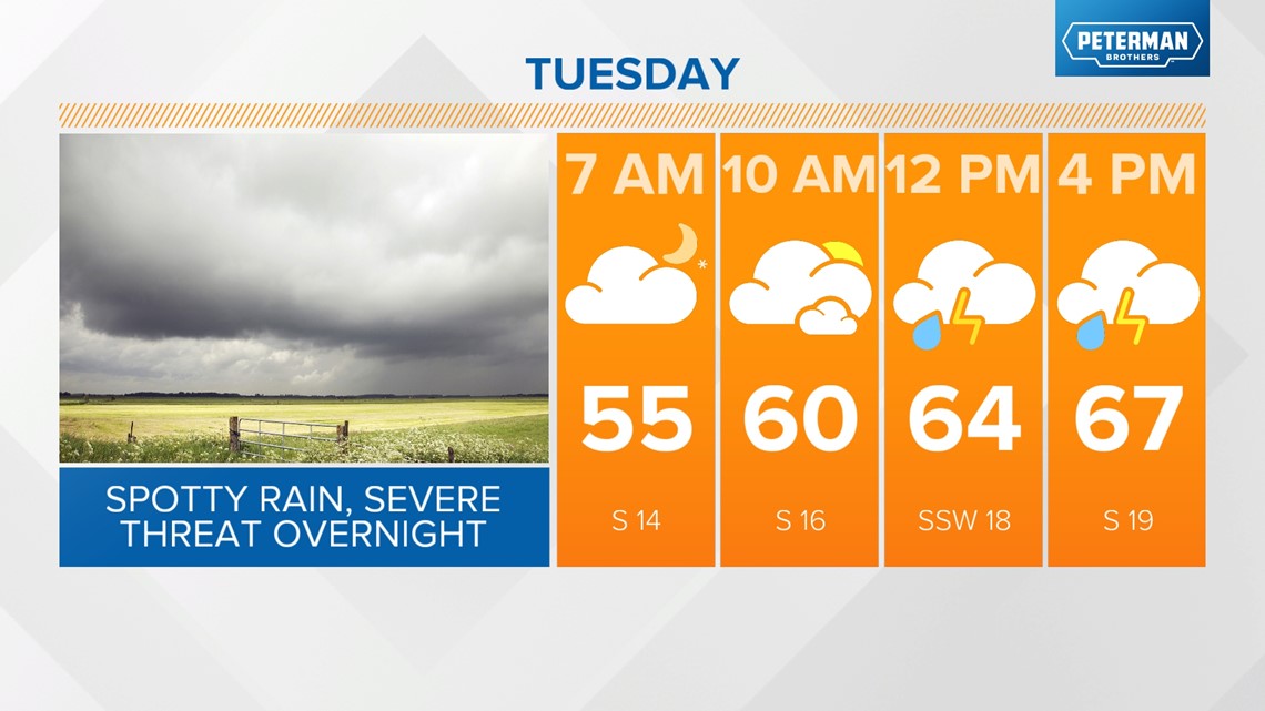

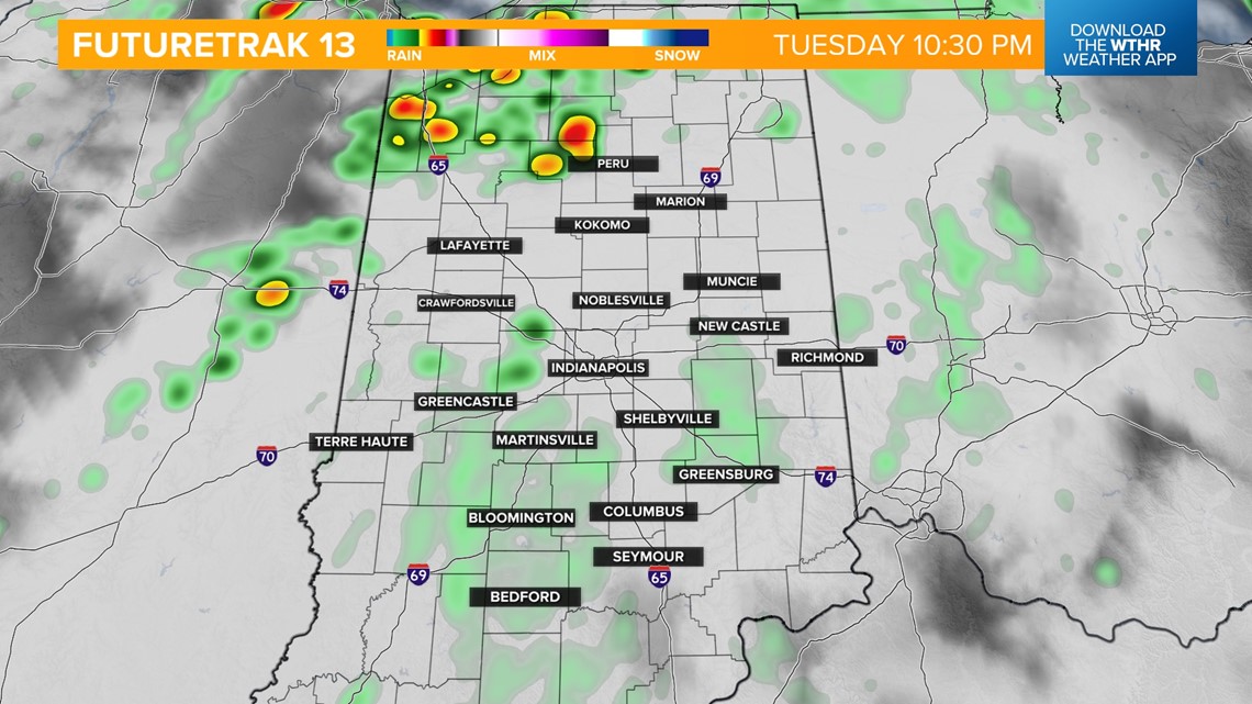
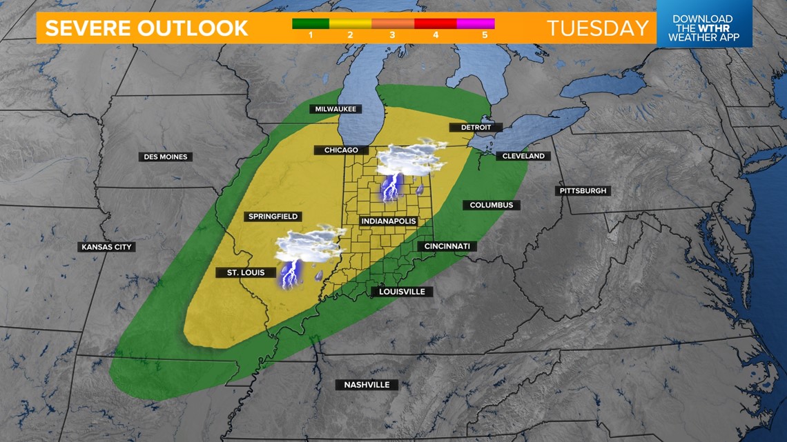
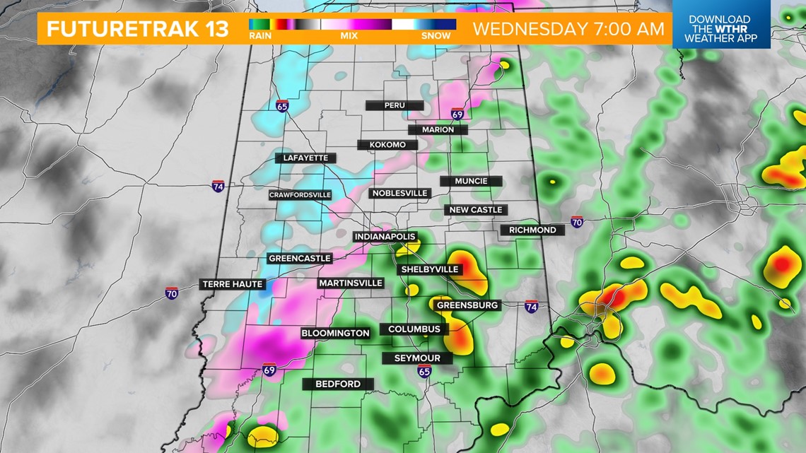
The risk of strong to severe storms ramps up after sunset Tuesday as a cold front approaches. The Storm Prediction Center has placed a good portion of Indiana in a level two of five for the risk of scattered strong storms. The primary time frame is after 9 p.m. Tuesday through 5 a.m. Wednesday.
All modes of severe weather will be possible including damaging wind gusts, large hail (mainly north) and rotating storms within the main line.



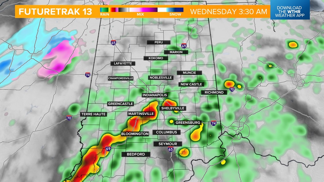
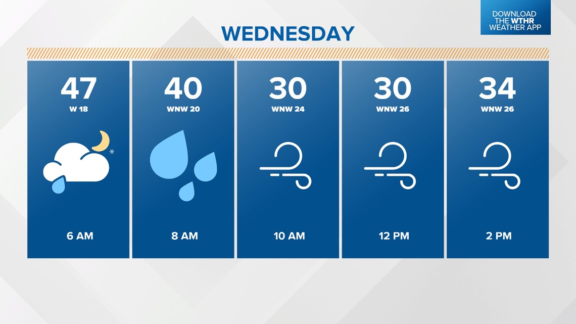
Temperatures will drop from the 60s overnight into the 50s/40s by Wednesday morning as the storm threat comes to an end. We'll eventually drop into the 30s by Wednesday afternoon with a few stray snow showers possible with any remnant moisture.


Sunshine returns for the remainder of the work week and into next weekend. We'll still be under a cooler air mass Thursday and Friday with highs in the low to mid 40s.
We're looking at a nice warming trend for the weekend with highs in the 60s.


