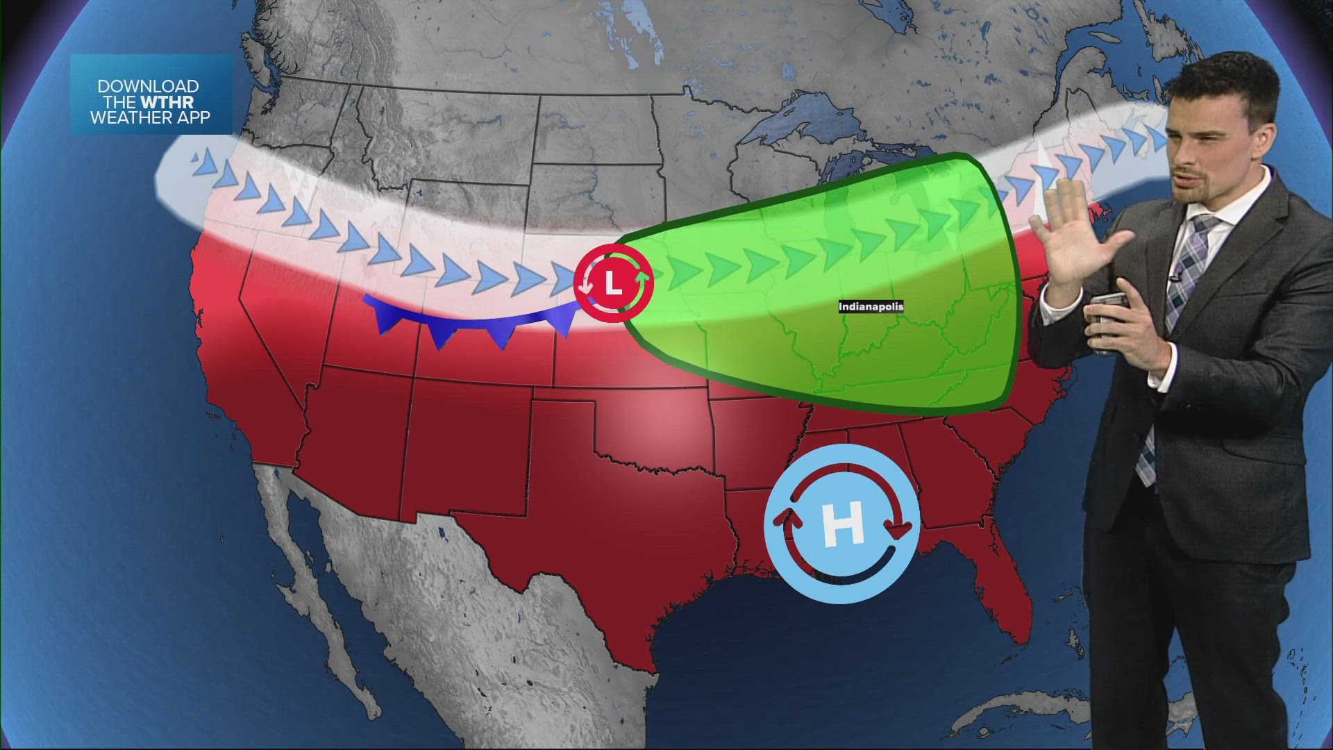
INDIANAPOLIS — Today will be another near-record-setting warm day as central Indiana sits on the warm side of our next weather system.
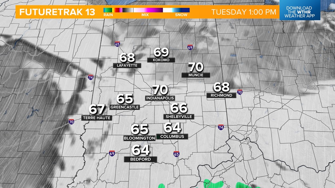
Temperatures will once again rebound into the low 70s, very close to the Feb. 27 standing record of 73 from 1996. We'll see more clouds today compared to yesterday with the chance of isolated storms in the afternoon.
It'll also be a very windy day with 35+ mph gusts from the south.

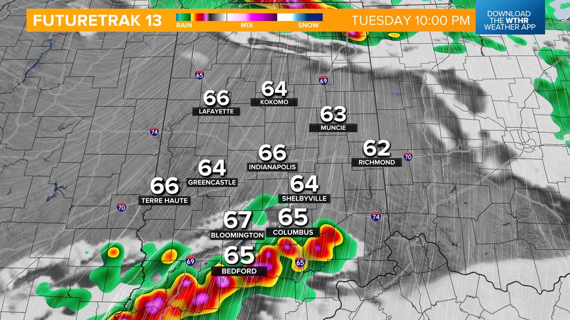
The risk of strong to severe storms ramps up after sunset as a cold front approaches. The Storm Prediction Center has placed all of Indiana in a level 2 of 5 for the risk of scattered strong storms. All modes of severe weather will be possible, including damaging wind gusts, large hail and rotating storms within the main line.

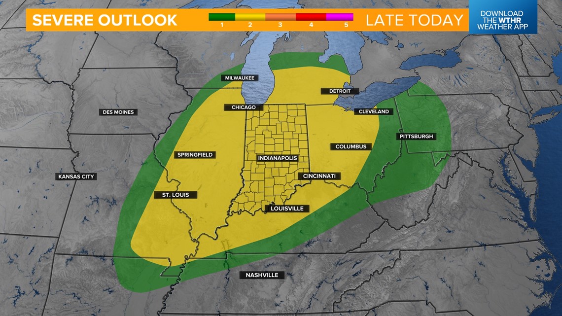

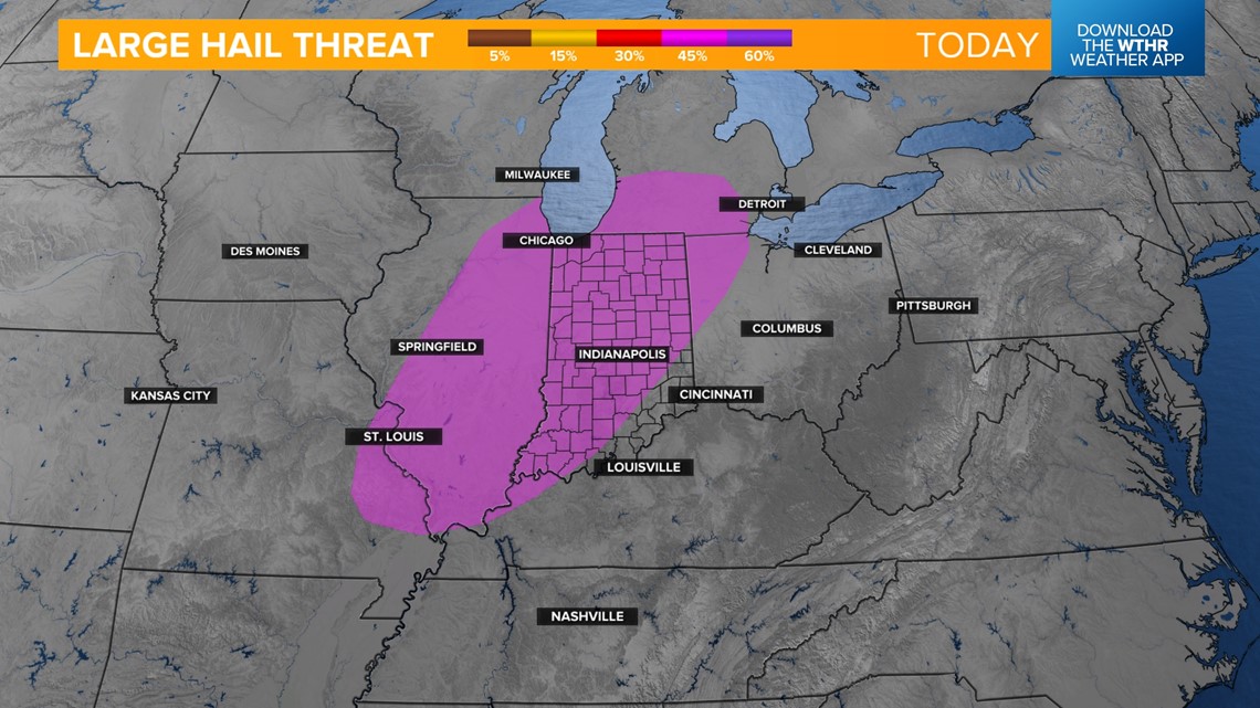

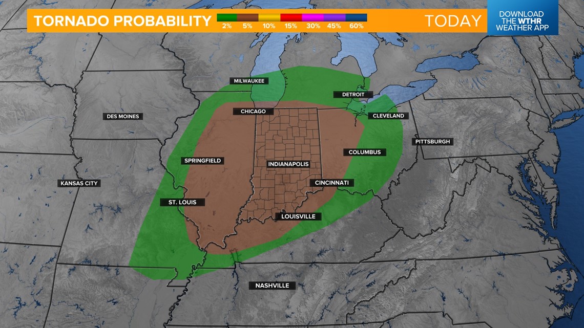
The primary time frame is after 9 p.m. through 5 a.m. Wednesday.


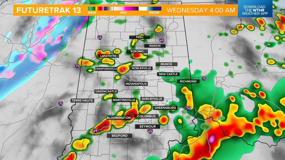

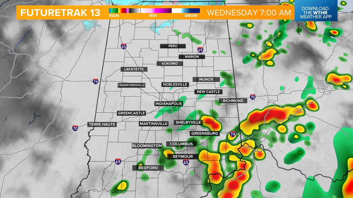
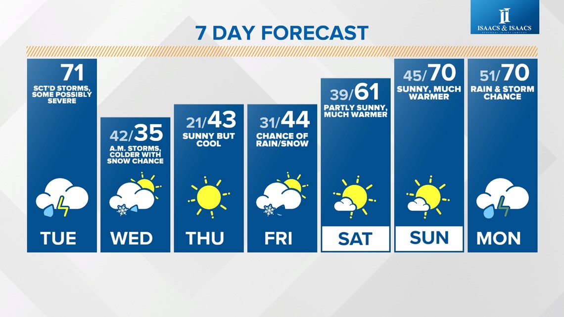
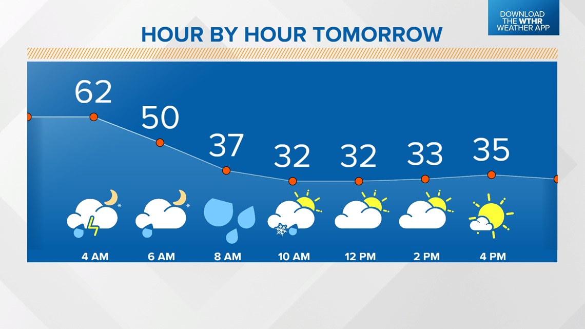
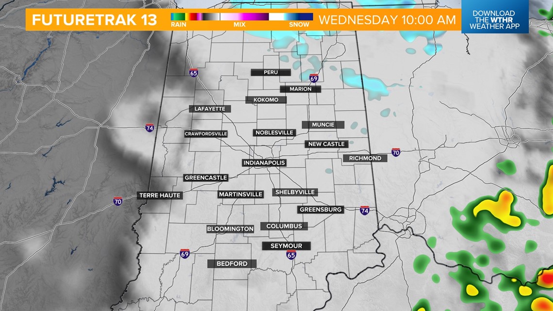
Temperatures will rapidly drop along the cold front as we go from the 60s into the 50s/40s by daybreak as the storm threat comes to an end. We'll eventually drop into the 30s by Wednesday afternoon with a few stray snow showers possible before midday with any remnant moisture.


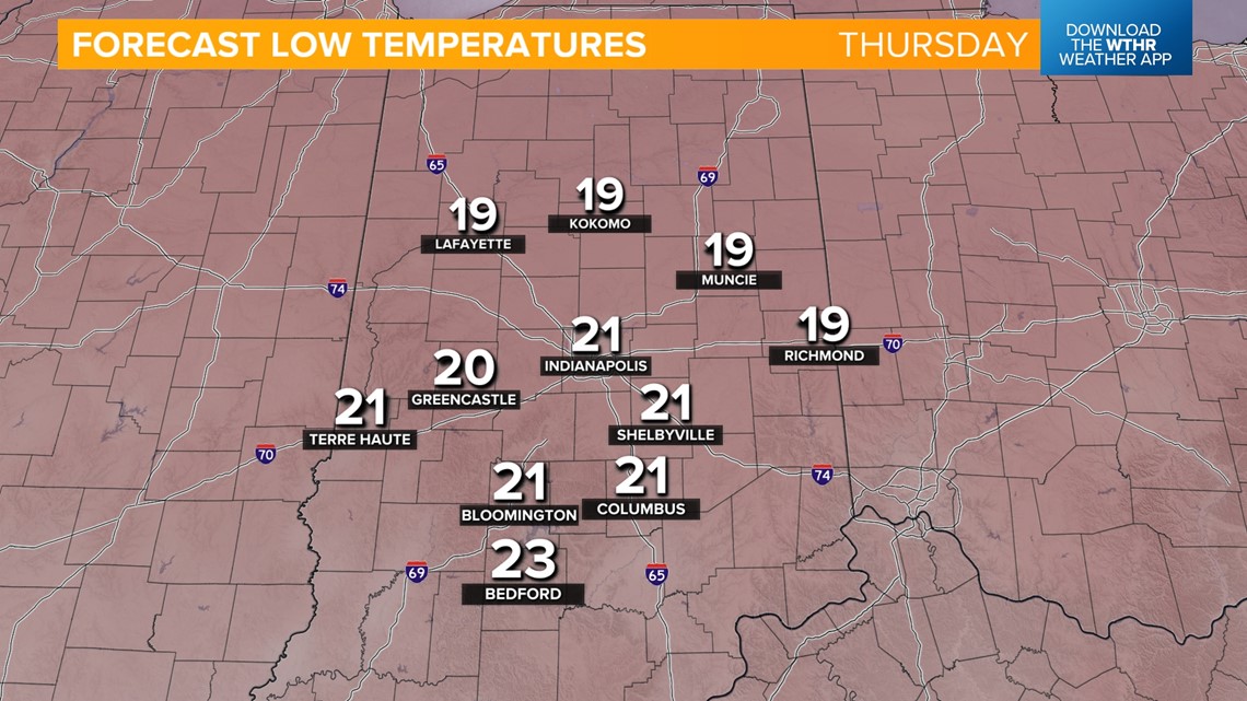
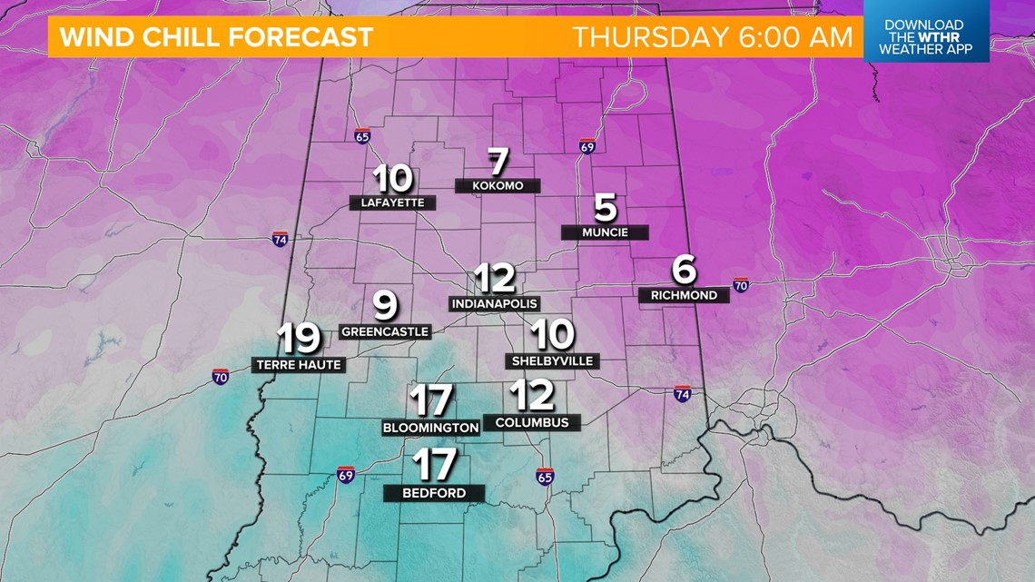
The coldest air behind this system will be Thursday morning with lows in the low 20s and wind chill values in the teens; some outlying spots may briefly fall into the single digits. Sunshine returns Thursday afternoon as temperatures recover to the low 40s.


We will still be under a cooler air mass Friday with highs in the low-to-mid-40s. A quick-hitting system will bring the potential of a stray mixed shower early.
We're looking at a nice warming trend for the weekend with highs in the low 60s Saturday and back near 70 Sunday.