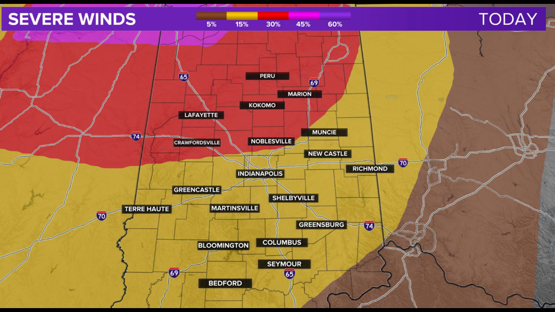
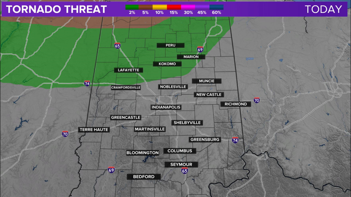
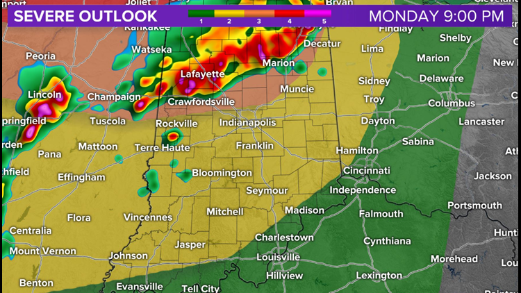
INDIANAPOLIS — A complex of storms, with a history of destructive 80 to 100+ mph wind gusts continues to head toward central Indiana.
After beginning in South Dakota some 12 hours ago, it's near Chicago now, moving east at nearly 65 mph and has been going for over 600 miles now.

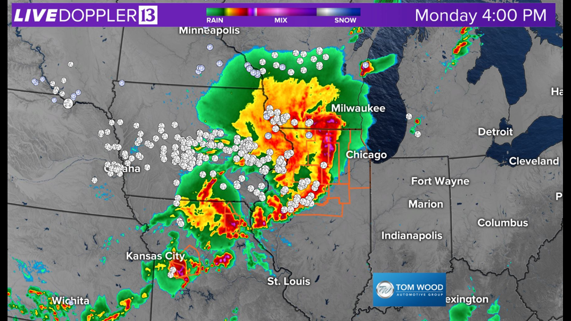


Unfortunately, the air mass ahead of the derecho is extremely moist and unstable. This means it will likely sustain, if not strengthen on approach to Indiana. It should reach NW Indiana around 5 p.m. and the Indy metro area around 7-8 p.m. (give or take).


A Severe Thunderstorm Watch is in effect for east-central Illinois until 11 p.m. EDT and it's likely this gets extended over time to encompass most of the WTHR viewing area.


