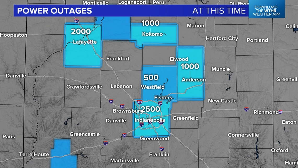
INDIANAPOLIS — Thousands remain without power at this hour in central Indiana due to the wind storm that blew through the state in just a few hours last night.
Marion County and Tippecanoe County have the greatest concentration of outages at this time. Those it's not remotely as hot as yesterday, the air remain rather humid and uncomfortable. Hopefully power gets restored asap for those in need of it.

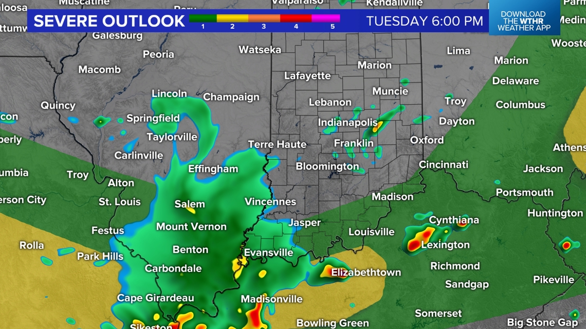
Severe threat south of central Indiana Tuesday
Heat indices in the lower/mid 90s are much lower than the 100 degrees to 110+ degrees range from 24 hours ago as the greater storm energy and hot dome have been displaced south in the wake of the early morning storm complex.
This eliminates severe storm potential in central Indiana and places higher probabilities of that near and especially south of the Ohio River.
That does not mean we'll be completely storm-free the next 24 hours, but outside of locally heavy rain/lightning/gusty wind the storms on radar locally should remain below severe limits.
But you'll want to still monitor radar if you have outdoor plans. Tuesday we can say there will be many rain-free hours and likely won't see anything pop locally until near/after sunset.


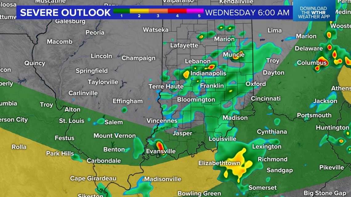
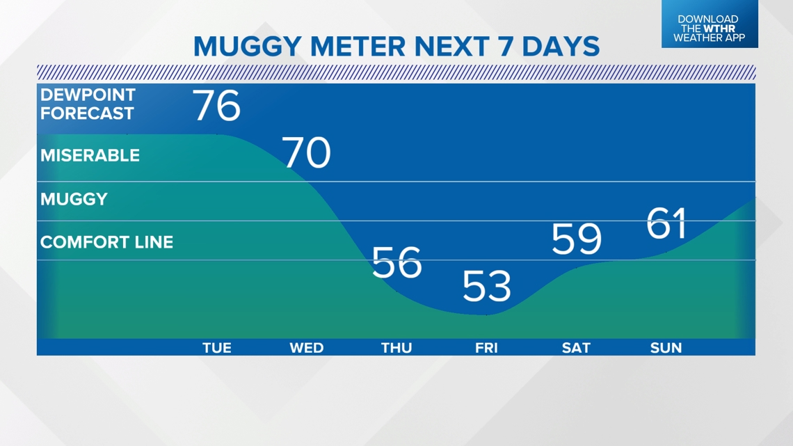
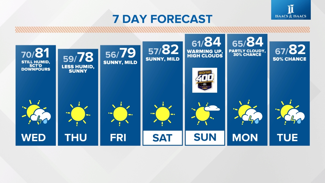
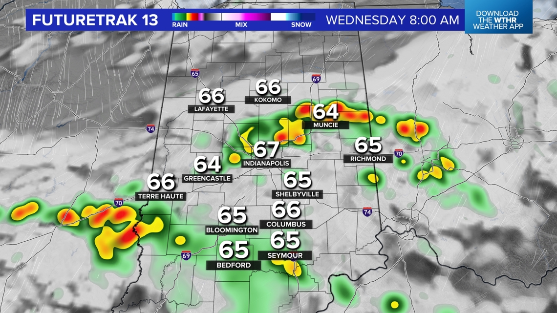
Still humid Wednesday and dodging downpours
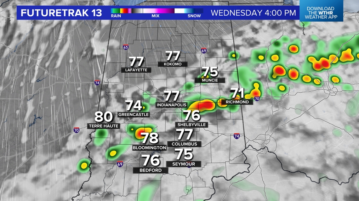
What does develop over the next day will be scattered. Humid air lingers into Wednesday and teams up with an approaching frontal system to trigger the scattered downpours/thunderstorms tomorrow before 6 p.m.
Later Wednesday evening, after the passage of the front, the wind of change begins to blow from the north and delivers a refreshing air mass change just in time for Brickyard 400 weekend.


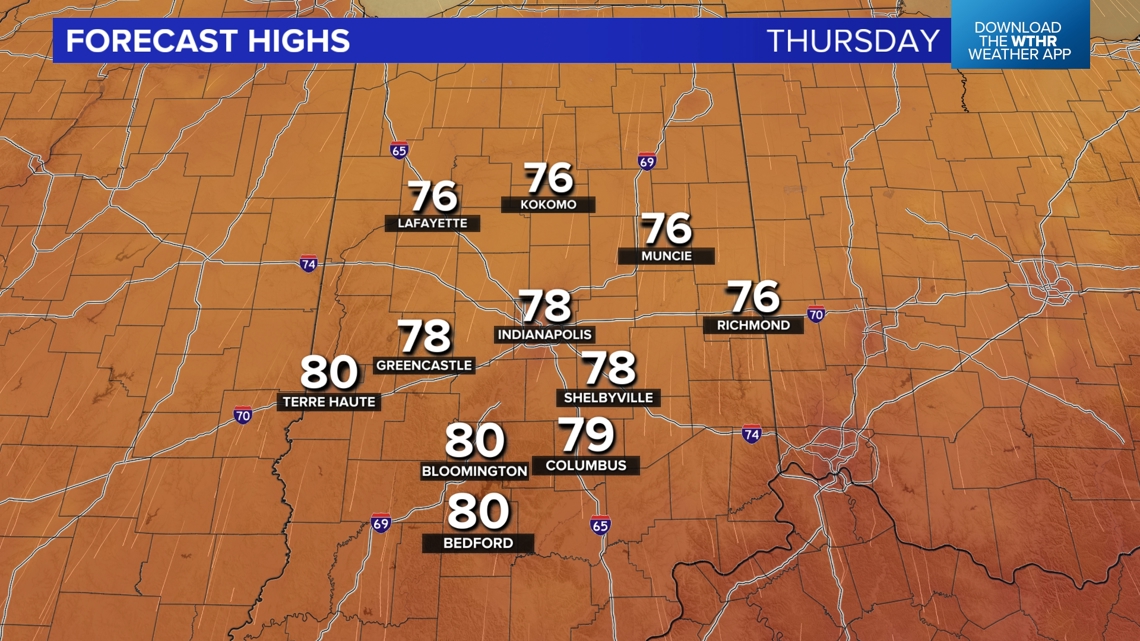
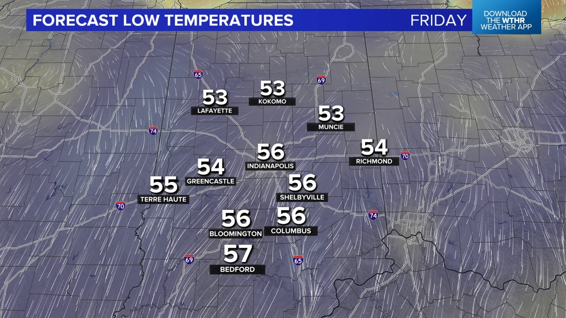
Wonderful weather Thursday into the weekend
The Muggy Meter goes comfortable heading into Thursday morning as temperatures/dewpoints drop well into the 50s. It stays comfortable until next week, setting the stage for several nights in the 50s, mainly sunny days, and mild highs in the 70s to near 80 degrees Thursday through Saturday. It's just what the doctor ordered after the miserably streak of days we've endured.
We'll be able to give the A/Cs a well-deserved break and enjoy some refreshing breezes. The next chance of rain/thunderstorms after Wednesday won't arrive until Monday through Tuesday of next week.