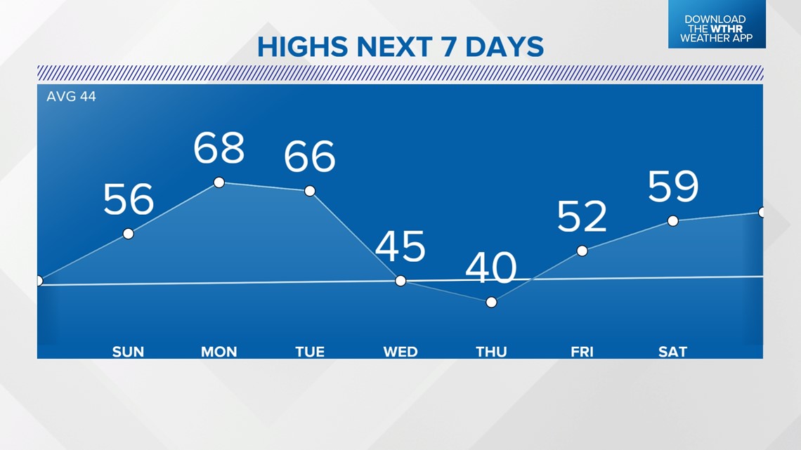
INDIANAPOLIS — February has been filled with cold/snowy days and record warmth. The end of the month will continue to feel like a roller coaster, switching between winter and spring.
After a seasonably cold Saturday with snow during the morning, Sunday will run about 10 to 15 degrees above the average high.

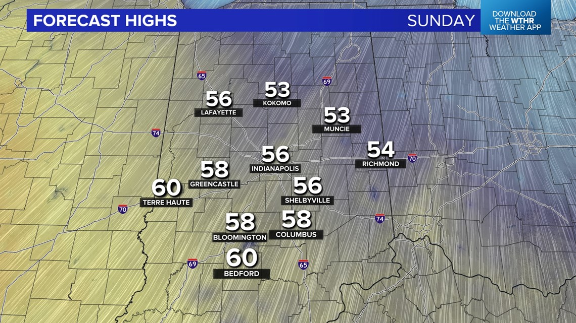
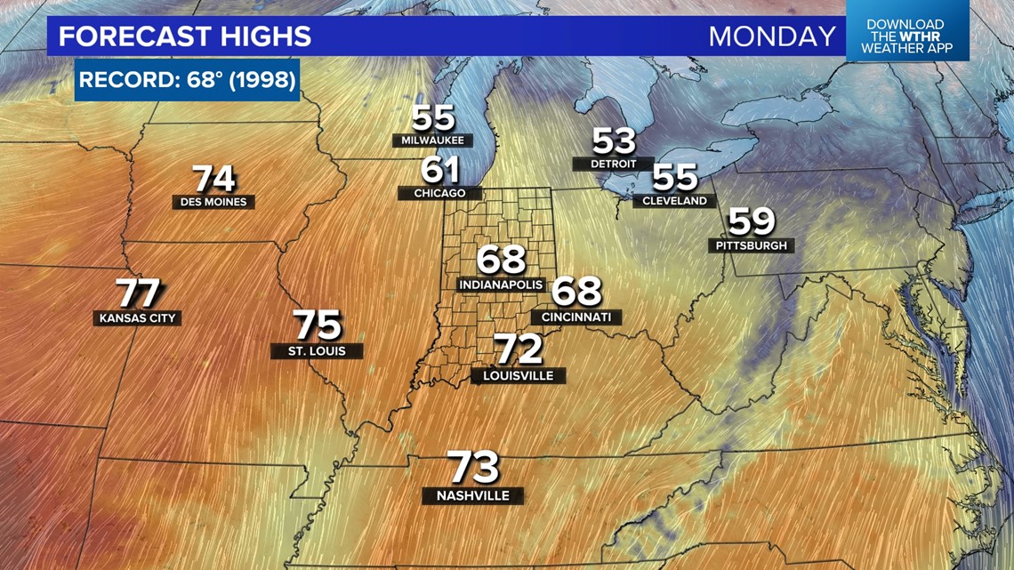
A stronger southerly breeze will continue to draw in warmer air over the next few days. Highs will be near/matching the daily record high of 68° (1998).

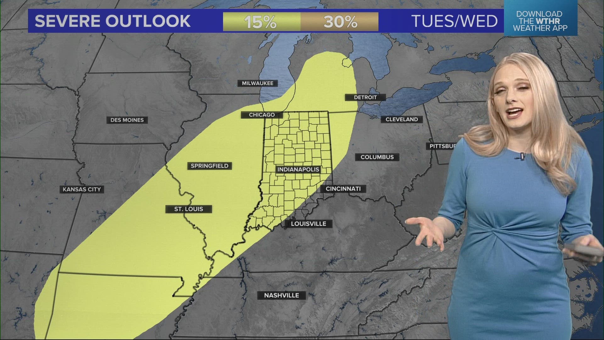
There will be a chance for thunderstorms, potentially severe, Tuesday through early Wednesday.

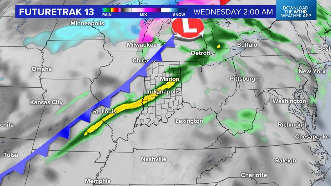

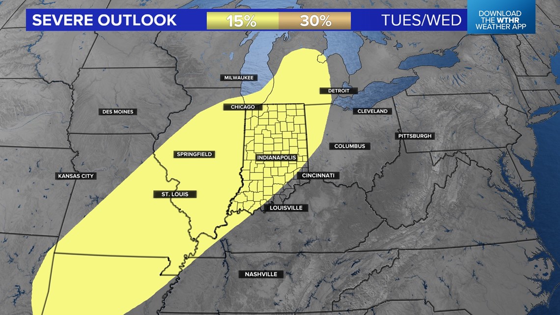
The chance for rain/storms continues into Wednesday morning. Behind the cold front, much colder air will cause temperatures to fall throughout the day. As temperatures drop, rain could switch to a wintry mix.

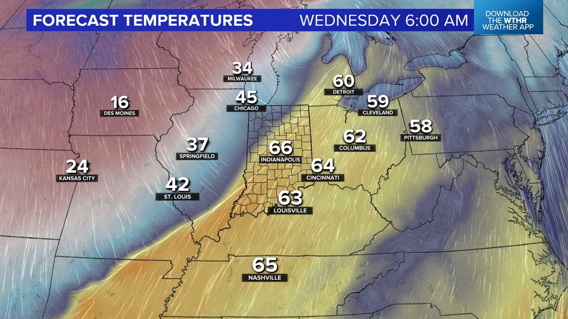

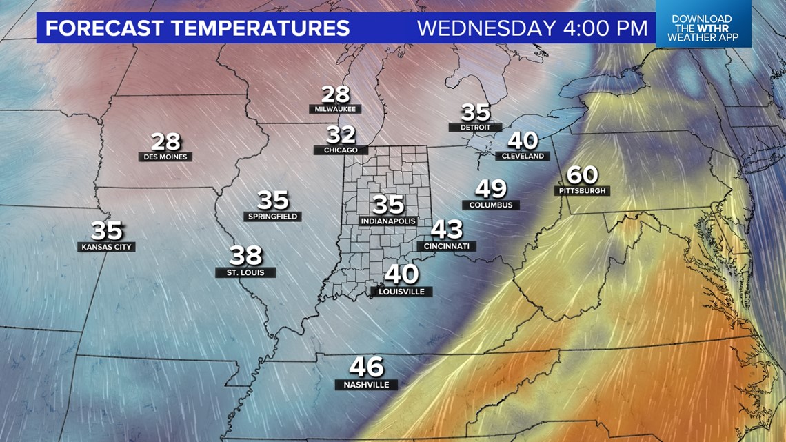
The cold spell will be brief, and spring-like temperatures are expected to return by next weekend.

