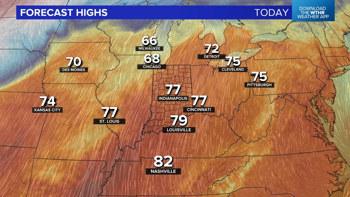
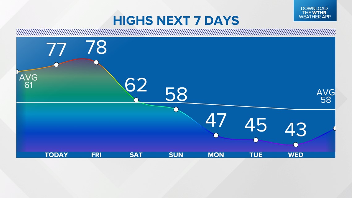
INDIANAPOLIS — Temperatures are well in the 70s this afternoon for the third straight day in central Indiana as an unseasonably balmy airmass continues to claim real estate from the central plains to the east coast.
A few showers possible before sunset, but we're not expecting much rain coverage this evening, so please take advantage of this before our weather becomes more unsettled during the next 24 hours.

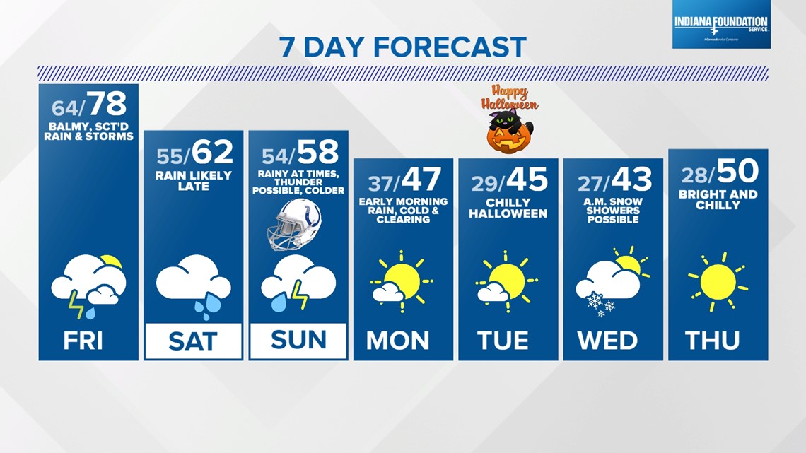
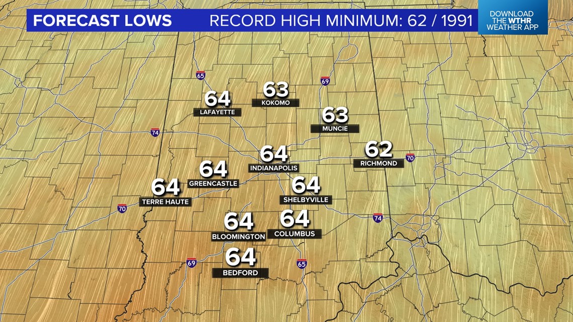
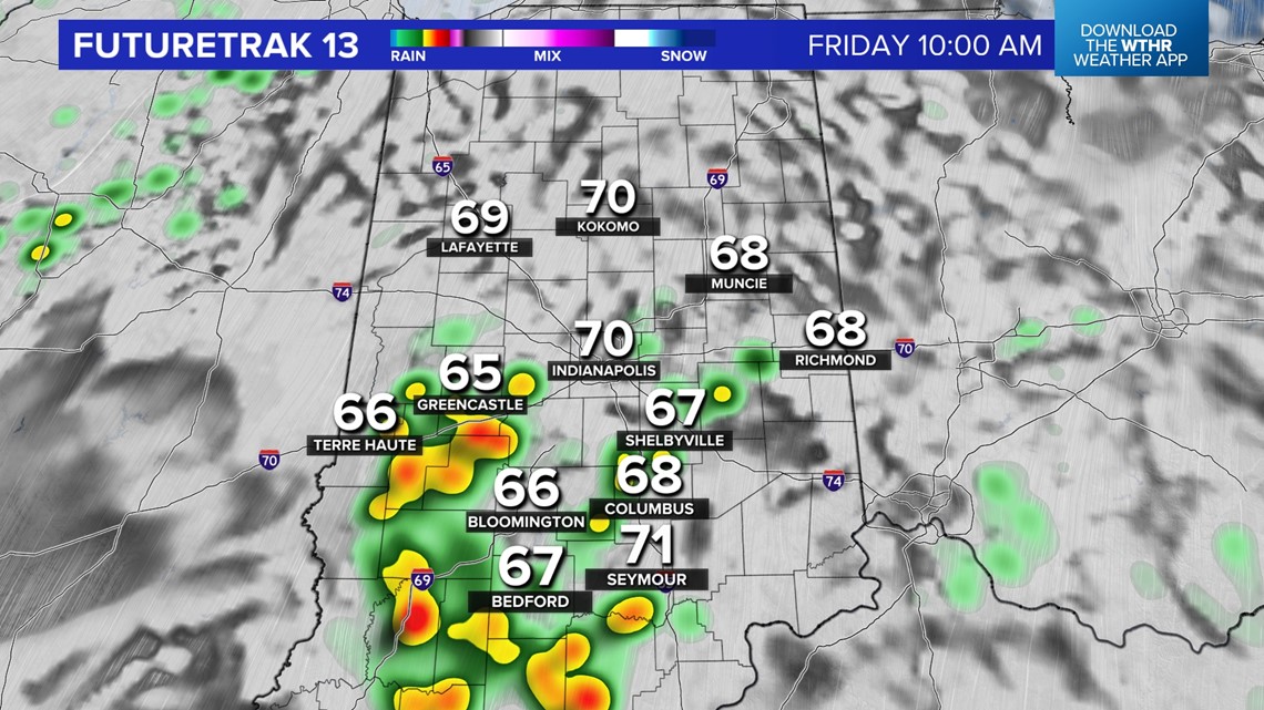
Noticeably more humid air arriving overnight into Friday as dewpoints creep into the 60s. The climbing Muggy Meter, combined with a broken to overcast layer of clouds, keeps low temperatures elevated tonight and we're forecasting lows in the mid-60s. To put that into perspective, temperatures Friday morning will be warmer than the average high for late-October and the 64° forecast low in Indianapolis would break the daily high minimum record of 62° set in 1991. Bottom-line, it will be unusually balmy Friday for this time of year.

In addition, the increasing low-level moisture ups the ante for heavier showers and scattered thunderstorms arrive tomorrow. It will be fair game from sunup to sundown for thunderstorms to impact your area, but at this time it appears coverage will be of the scattered variety.


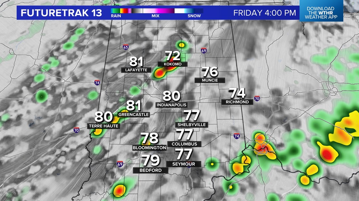

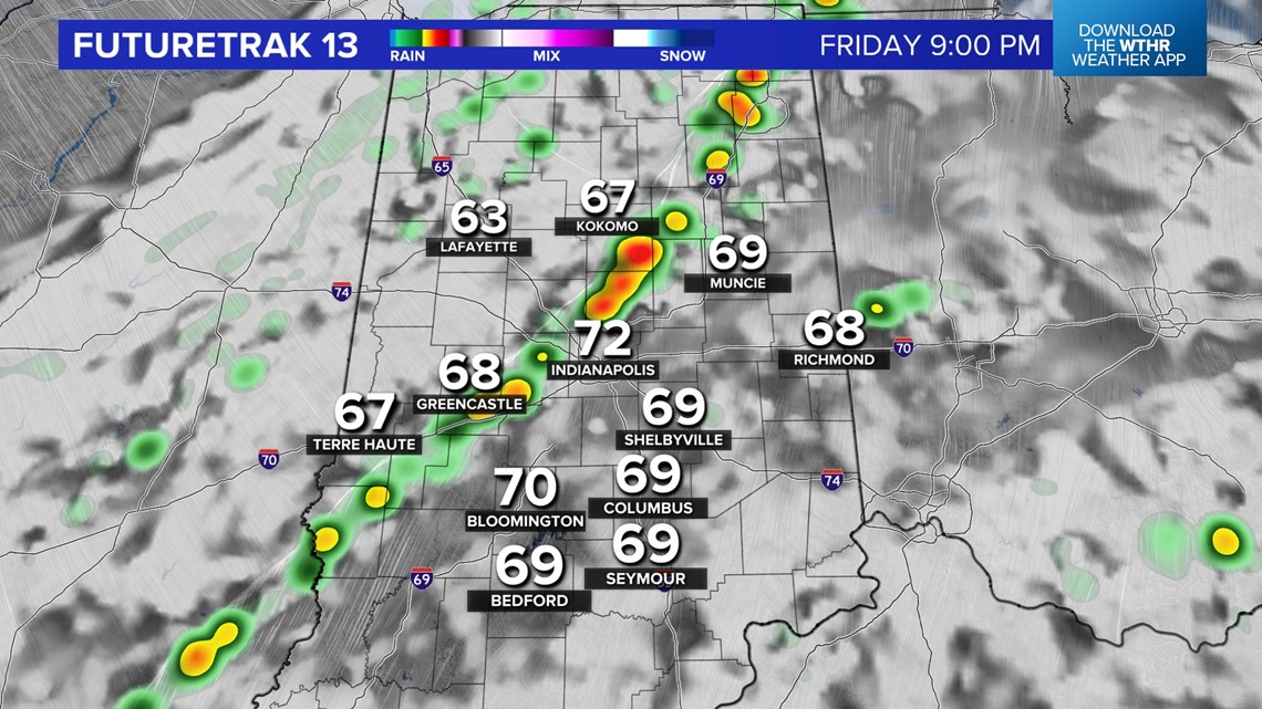
Check radar frequently if you have outdoor plans Friday and/or are heading to Operation Football games Friday night.
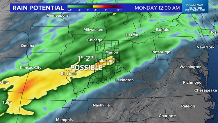
Latest guidance continues to hint of some dry hours around to open up the weekend, but we're definitely going to be on borrowed time for dry weather. There's an expectation of a building rain axis developing along the Arctic front Saturday afternoon into Sunday morning with heavy rain falling at times into early Monday morning.

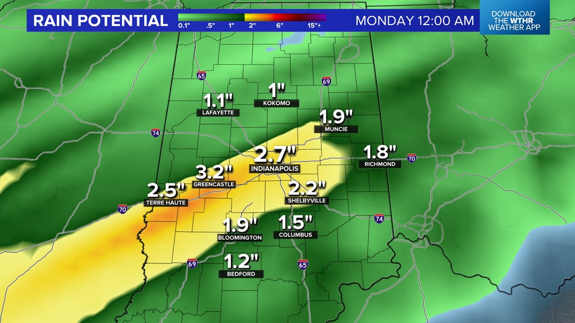


It's to be determined where the heaviest rain swath occurs, but within it, we're expecting 1"-2"+ rainfall before the cold air intrusion shuts down the rain by midday Monday.
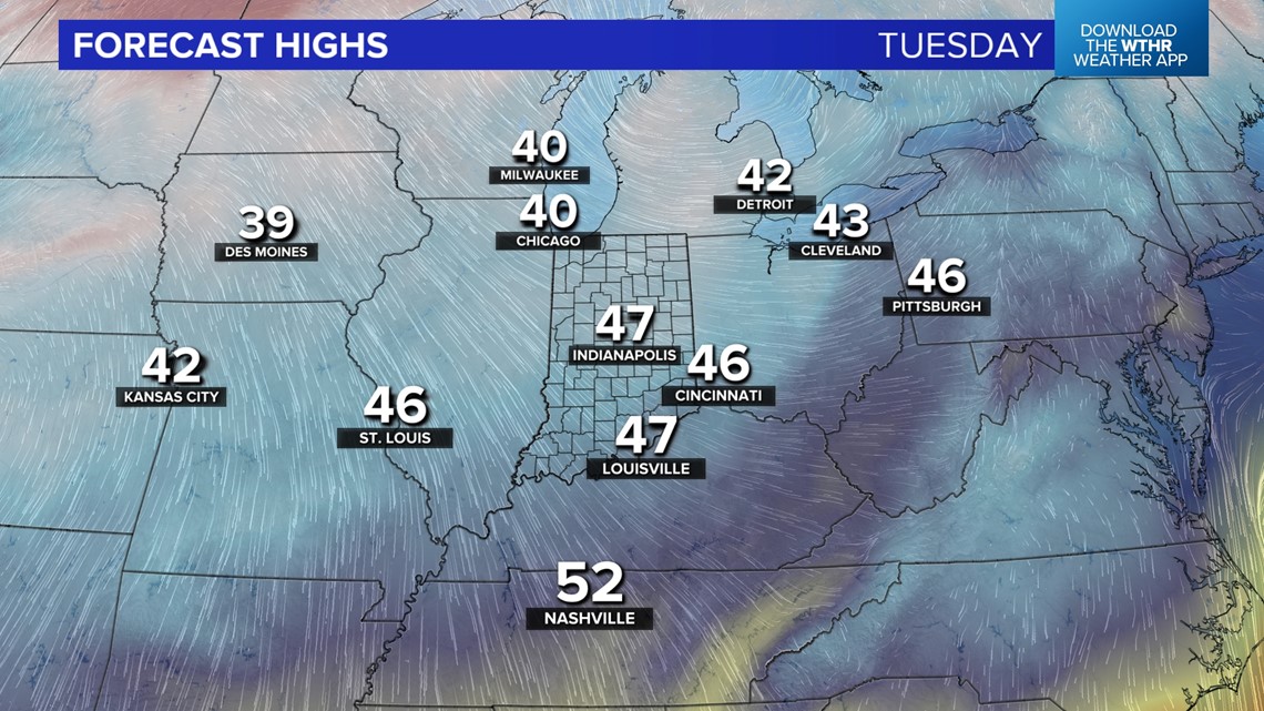
That's when the focus shifts to sharply colder air for much of next week with highs in the 40s, lows in the 20s, windchills in the teens at times, and possibly the first flakes of the season whipping around Tuesday night into Wednesday morning.
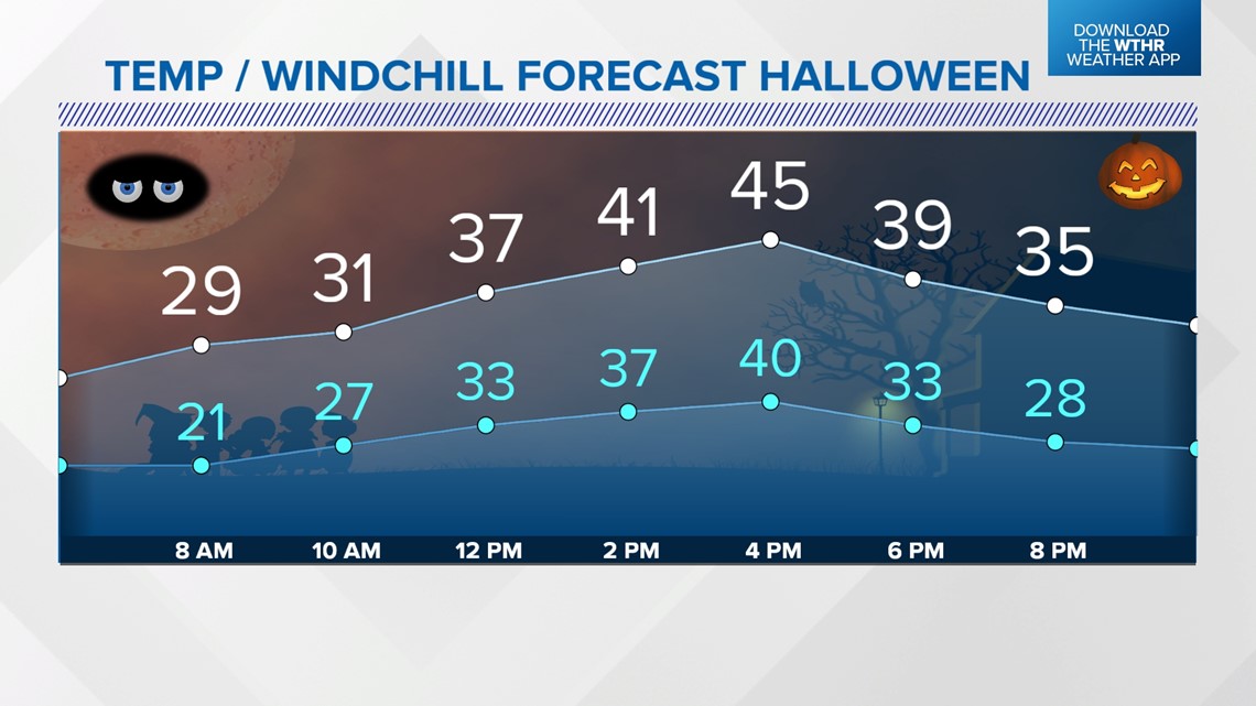
Time to dust off the heavier winter coats with what's ahead next week... and that includes one of our colder Halloween days on record.