INDIANAPOLIS — Central Indiana got some much-needed dry time today which allowed for many laps at Indy 500 practice at the track.
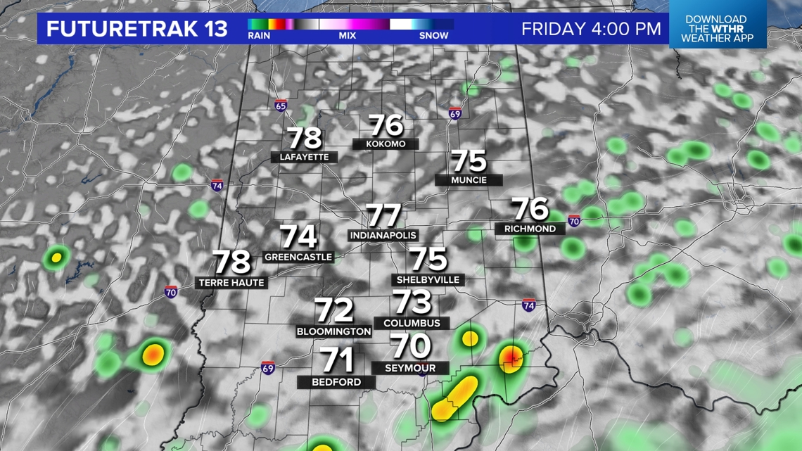
We're monitoring an area of rain on radar in western Indiana. It's heading toward Indy, but it's also weakening as it approaches due to limited lift. Around it are scattered heavier pockets of rain and thunder.
The leftovers of this feature could reach by 6 p.m. and there will be scattered downpours/thunderstorms on radar for the remainder of the day. Increasing low-level moisture overnight into Friday morning pools along a weakening boundary resulting in areas of drizzle and fog to start tomorrow.

This Evening:
Scattered Showers, downpours and thunder.
Overnight: Drizzle with areas of fog
Friday Morning: Damp start, Locally dense fog, cloudy
Friday Afternoon: Mixed sky, scattered rain and thunder
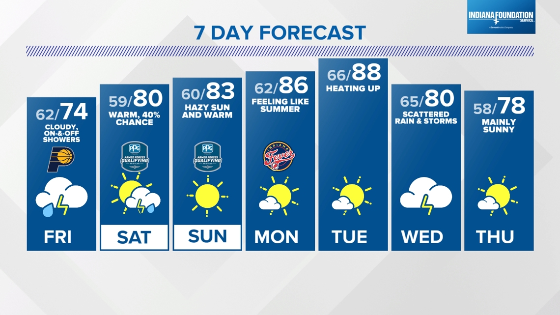
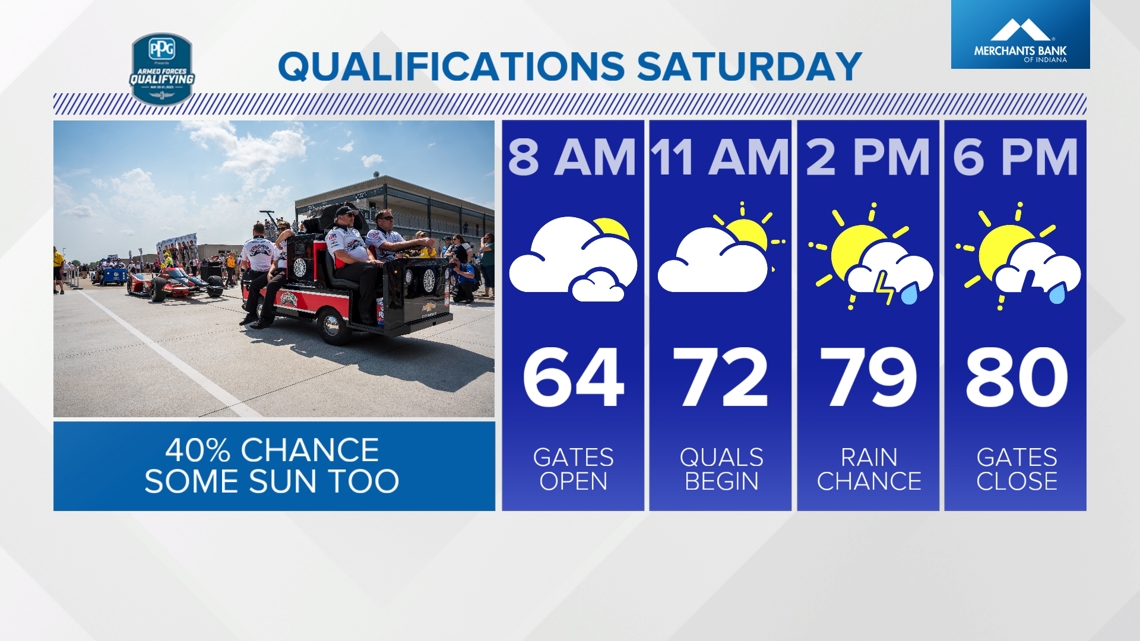
Saturday: Mainly to partly sunny, 40% chance of showers/thunder

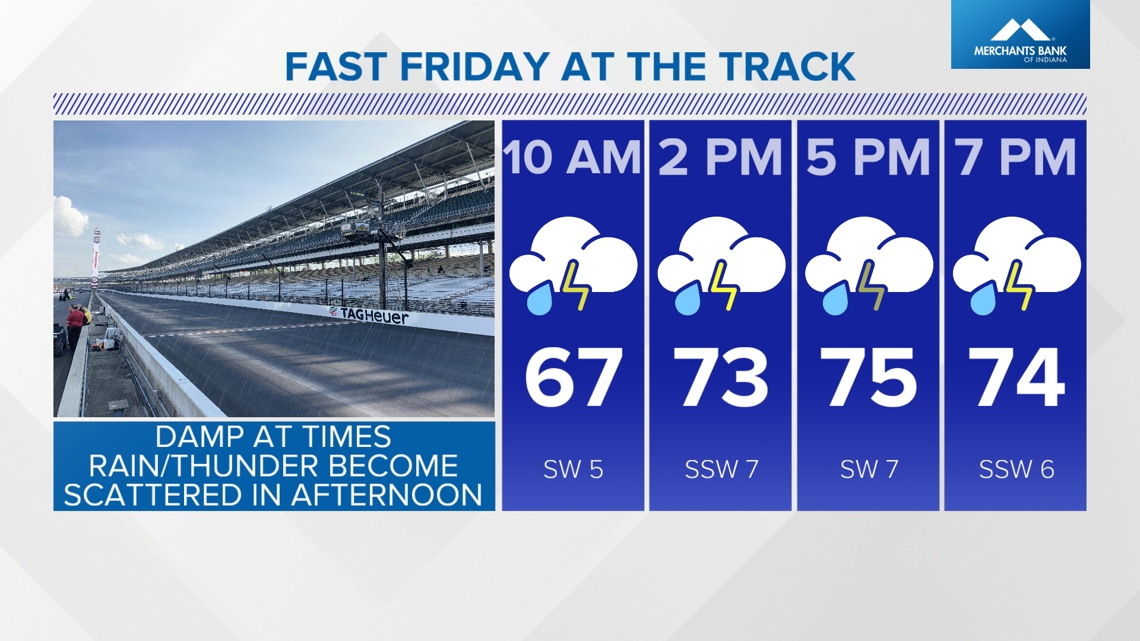

So, a damp in the morning will require patience if you're heading out to Fast Friday, but we do expect a mixed sky to gradually develop with scattered showers and storms in the afternoon. Hopefully there will be a enough time to dry the track and get laps before qualifying this weekend.
No significant forecast changes to the weekend. Plenty of dry hours expected Saturday but with a 40-50% chance of showers/thunderstorms popping with daytime heating.


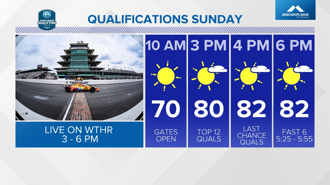
The upper level feature that brings a chance of rain on Saturday will depart for a sunny, unseasonably warm finish on Sunday with highs well in the 80s. Unseasonably warm highs ahead next week as it will look and feel like summer into Tuesday.