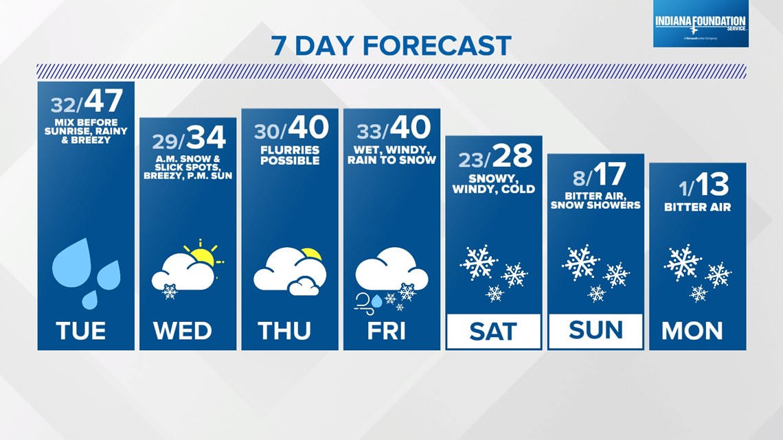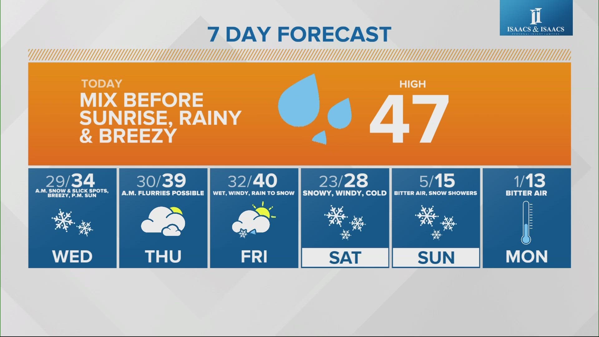
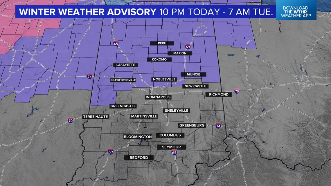
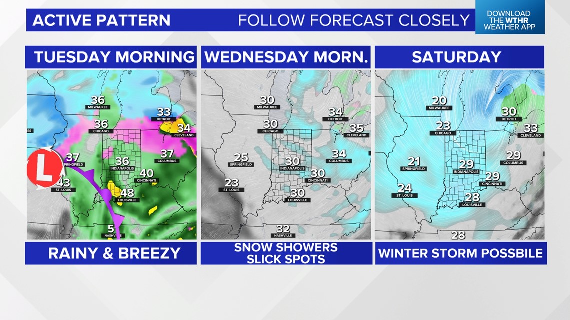
INDIANAPOLIS — It is a day of change for all of us as rain, snow and a wintry mix are now in Indiana. Early this morning, bursts of heavy snow moved through the northern third of Indiana, while much of the state saw either rain or a wintry mix that could cause tricky driving.
Twenty central Indiana school districts have announced two-hour delays Tuesday. Click here for the full list.

Later, look for a very windy day with rain, gusts to 45 mph and a high of 47.
Tonight, the winds remain strong out of the east, and snow will move in during the overnight hours into Wednesday morning. Look for a potential for slick roads during tomorrow's morning rush hour. The high will only top out at 34, and we could see a few showers in the afternoon.

The wild weather continues with morning snow and slick spots Thursday morning. Friday will be more tame with a few flurries but a high of 40 degrees.
The long-range outlook is not as encouraging with snow showers and rapidly cooling temperatures. The high Monday — after a low of 1 — may only top out at 13 degrees!