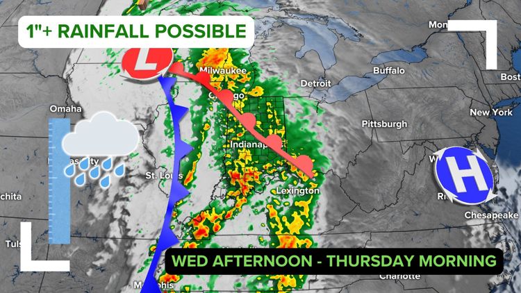
INDIANAPOLIS — Another round of rain is likely after 3 p.m. Wednesday, with a few showers lingering through Thursday afternoon.
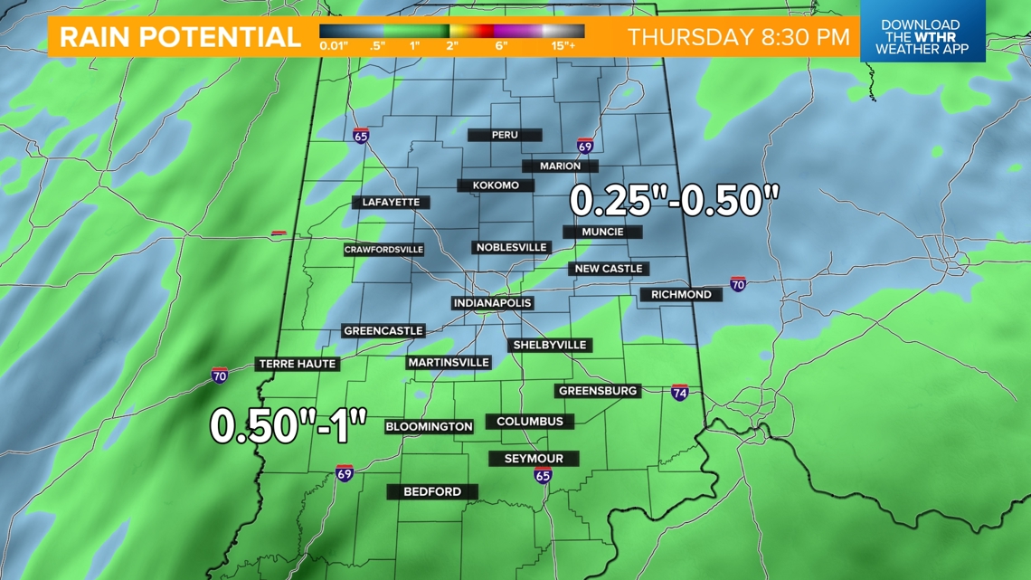
Some spots in Indiana may see upwards of an inch of rainfall with this system.
Dry and cool today
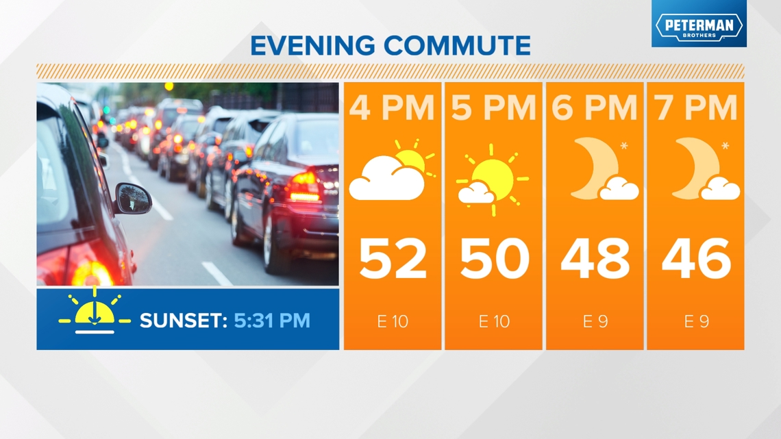
We've got a lot of dry time today before our next weather system brings rain Wednesday. It will be cooler today with highs only in the low 50s this afternoon and lows tonight falling back into the 30s. Outlying areas will likely see patchy frost.

Latest rain timeline
- Mostly clear and cool to start the day.
- Clouds increase in the morning.
- Temperatures top out in the upper 50s/low 60s around noon-2 p.m. ahead of rain moving in.
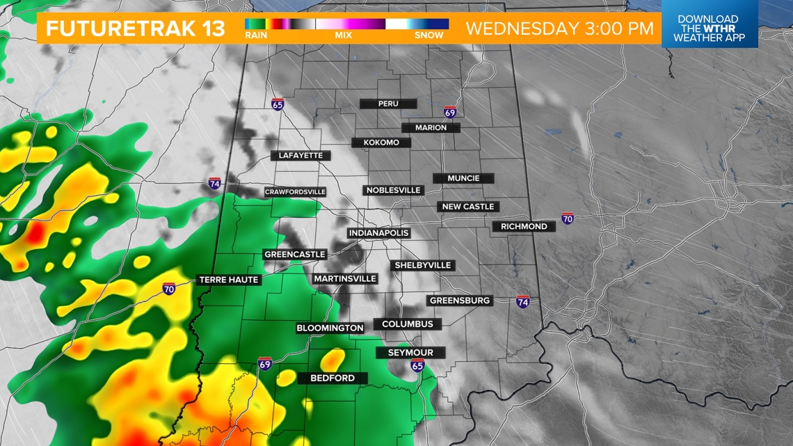
- Rain moves in from SW to E after 2 p.m. Wednesday.

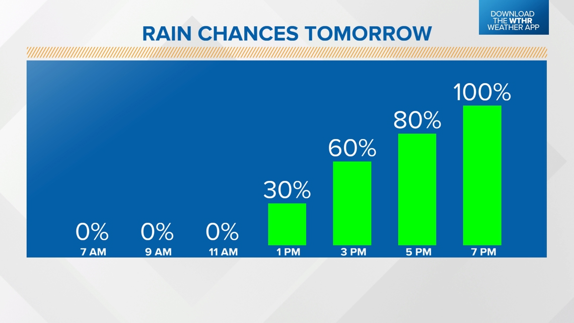

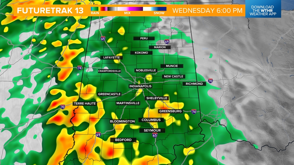
- Rain becomes widespread by the late afternoon and will continue through the evening with heavier downpours possible.
- Storms are not expected.


Thursday
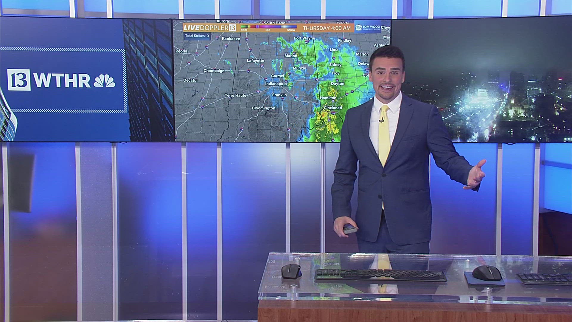
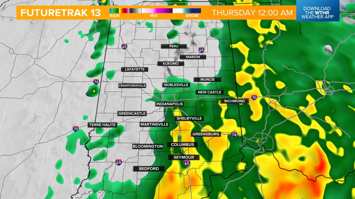
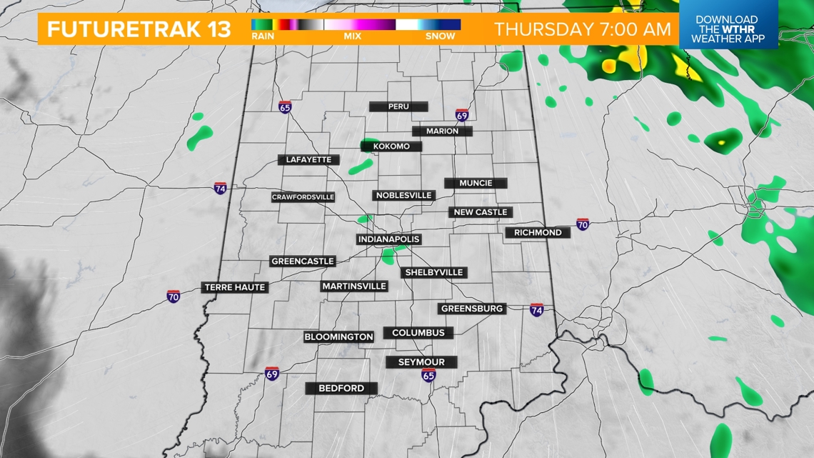
- Heaviest rain ends just after midnight with scattered showers through daybreak Thursday.
- A few showers will be possible through Thursday afternoon, especially in eastern Indiana.
- Staying cloudy, breezy and cool with steady temperatures in the low 50s.

Rainfall potential
- The heaviest rain looks to fall south of central Indiana, bringing the potential of one inch.
- Slightly lower amounts but still decent rainfall of 0.25-0.5 inches farther north and east.
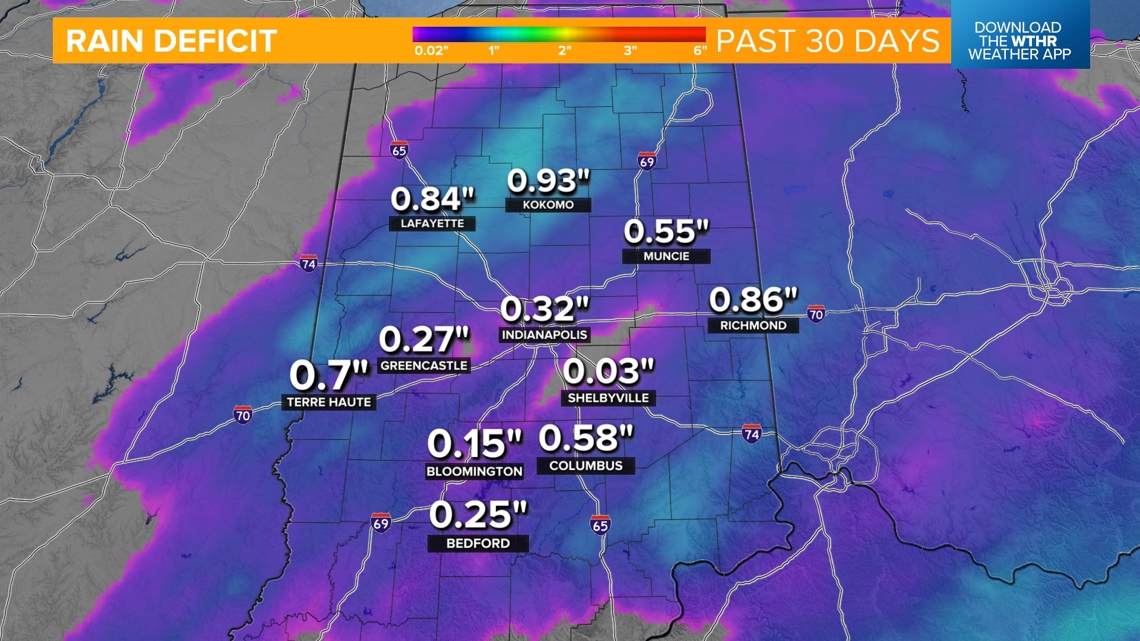
- 30-day rainfall deficits are within range of making up with this rain event and could alleviate drought conditions, especially across the southern half of the state


Extended forecast
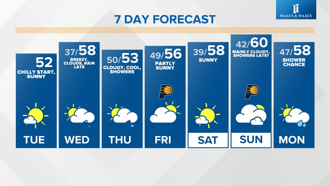
We'll get a break from the rain with some sunshine Friday and Saturday, with near-normal high temperatures in the mid to upper 50s. Another system will approach central Indiana on Sunday and could bring a few showers. A more potent system with slightly better rain chances will be possible Tuesday.

