INDIANAPOLIS — Hot and dry weather will come to an end by Friday as the remnants of Francine arrive in central Indiana.

But first, increased risk of fire danger today and tomorrow
A combination of abnormally dry/drought conditions, low humidity levels (15-20%) and higher temperatures will hit the area. We'll see an elevated fire danger and risk of rapidly spreading fires during this hotter streak. The National Weather Service recommends postponing outdoor burning at this time until we can get some rain.
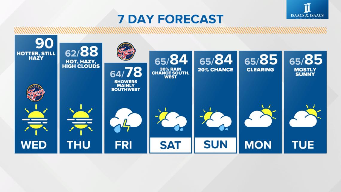
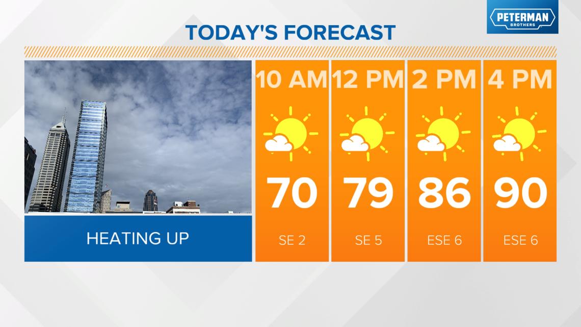
- Sunny, near 90 degrees this afternoon
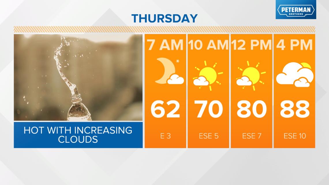
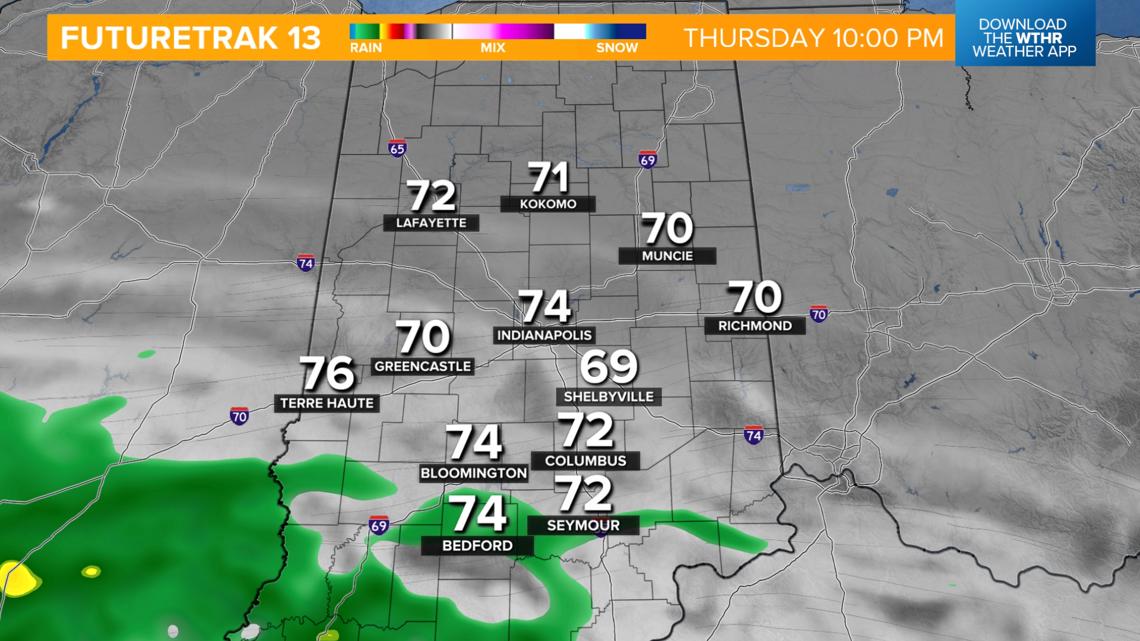
- Still hot in the upper 80s Thursday but with increasing clouds


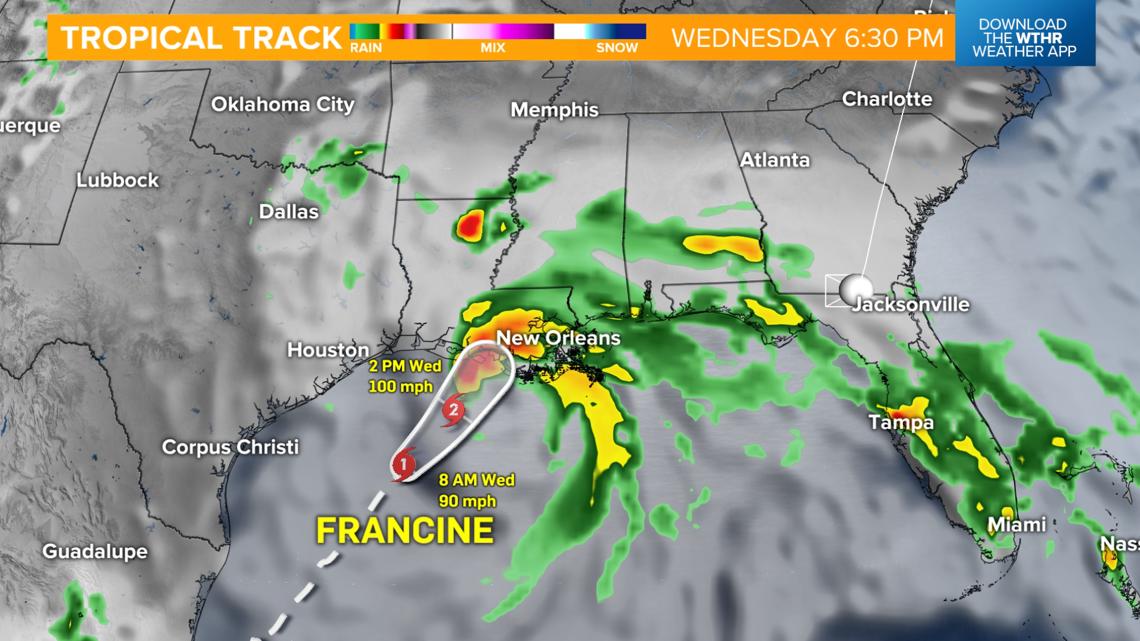
What's the latest on Hurricane Francine and its impact on Indiana?
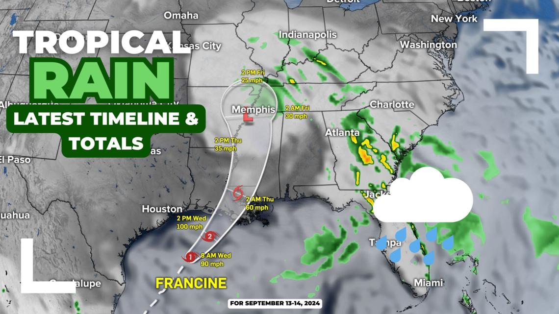
Hurricane Francine is currently a Category 1 storm with 90 mph sustained winds off the Louisiana coast. The storm is forecast to make landfall as a category 2 storm later today with 100 mph winds and a peak storm surge of 5-10 ft. between Vermilion Bay and Port Fourchon, Louisiana.

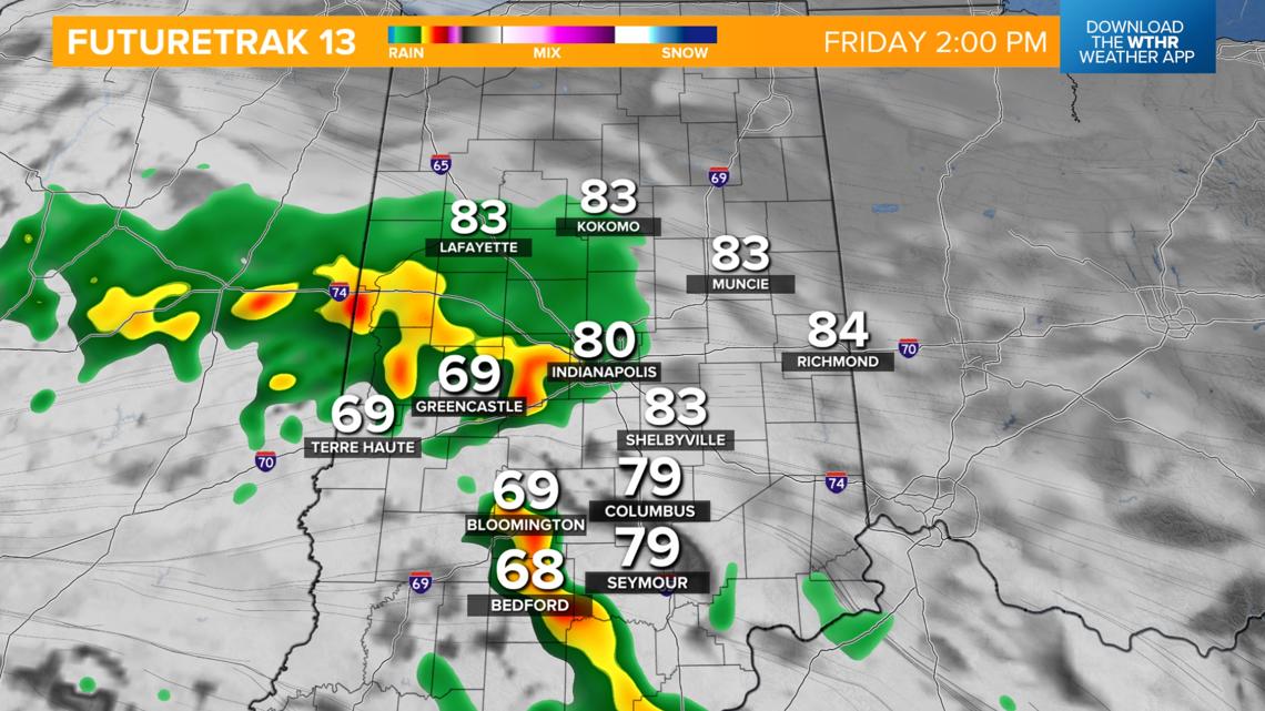
Latest rain timeline and potential totals in Indiana
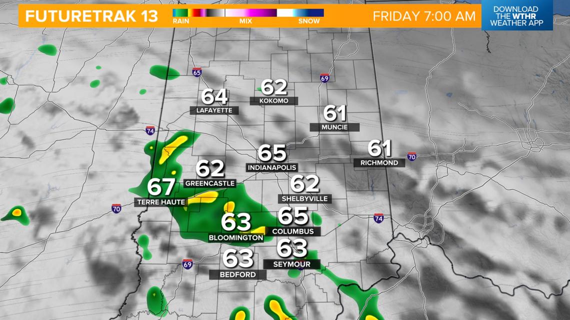
This system will continue to weaken as it tracks northeast through the mid-South on Thursday and eventually stalls just south of Indiana late Thursday night. This will first bring rain into southern Indiana late Thursday evening.

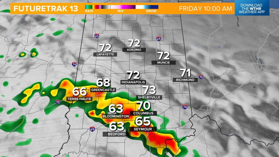
Rain coverage area will become more widespread across the southwestern tier of the state by Friday morning. Given the tropical nature of this rainfall, it will be likely that heavier bands develop through Friday afternoon, which will bring the higher rainfall potential south of the Interstate 74 corridor. The more northeast you live in central Indiana, the better chance you have of missing out of much of the rain from this system.


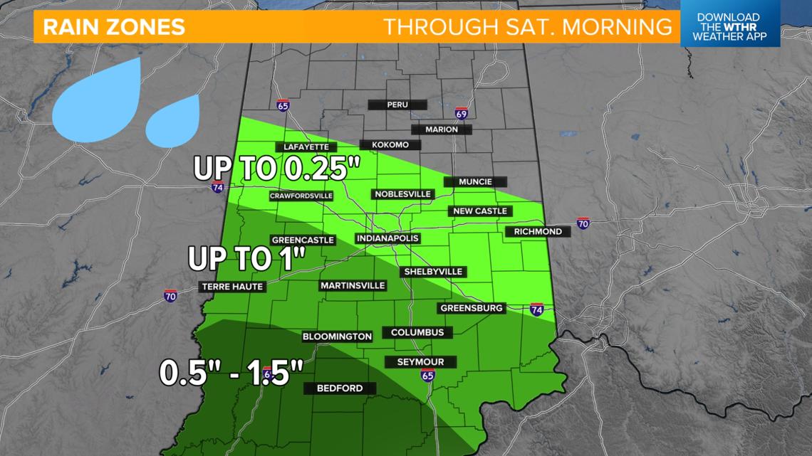
A bulk of the rainfall will come to an end by Friday evening, but a few showers will linger on Saturday, mainly in western and southern parts of the state.

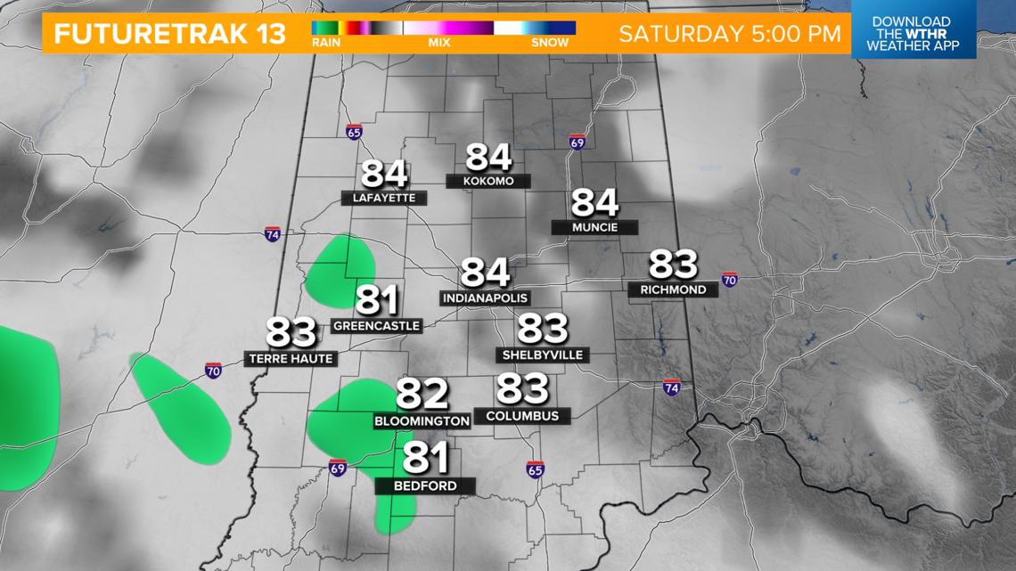
Highs will be cooled due to rain and clouds on Friday to the upper 70s. Areas that stay mainly dry this weekend will likely be back in the 80s with areas farther south staying in the rain-cooled area in the 70s. The pattern dries out early next week with slightly above average temperatures in the mid 80s.