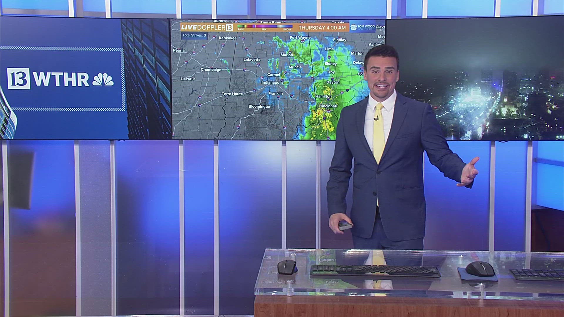
INDIANAPOLIS — At this hour, we're monitoring an axis of downpours and thunderstorms moving across central Indiana. It stretches from near Gary to just west of the Indy metro area. In advance of this axis, additional hit-and-miss downpours have developed. Everything on radar today moves east-northeast.
While these aren't severe at the moment, additional thunderstorms that occur later this evening and overnight could be. There's an elevated probability of storms in Illinois/western Indiana later today to rotate and/or produce funnels, so we won't be surprised if some Tornado Warnings are issued in those areas before sunset.

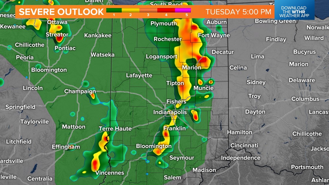

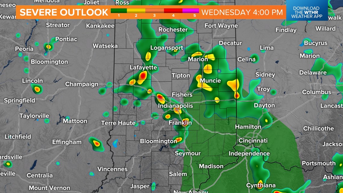
Scattered storms that develop westward this evening are expected to congeal into a larger storm cluster overnight into Wednesday morning, producing a much-needed wet start tomorrow.
As the day progresses, rain will scatter out, but the focal point for funnels/severe gusts shifts to central/eastern Indiana, with higher confidence of those occurring closer to the Ohio state line.

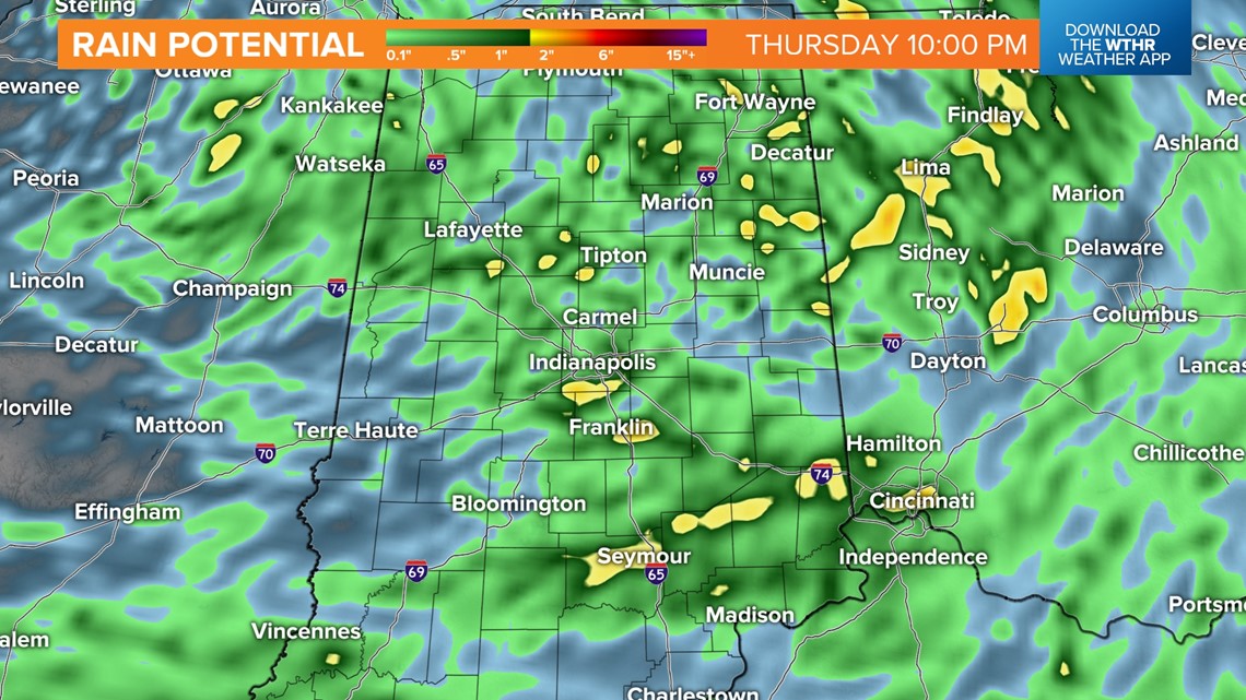
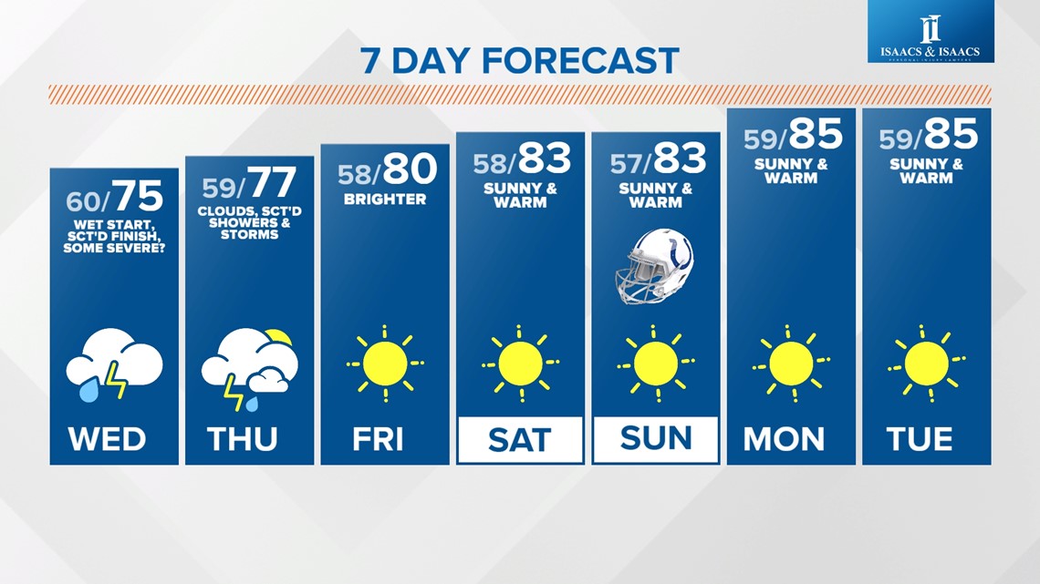
Locally, heavy rain amounts over 1 inch are possible in heavier cells/storms during the next 36 hours. In fact, the modeled rainfall footprint during this time is the largest we've had in quite some time and will be the largest for quite some time, with warm and dry conditions returning after Thursday. Hopefully, it verifies, and many places get at least some rain, with "abnormally dry" to "moderate" drought conditions widespread since mid-August.
The other big weather story going forward is what will be an unseasonably warm start to October. We're forecasting mid-80s this weekend into next week, which will be a good 10-15 degrees above average.

