

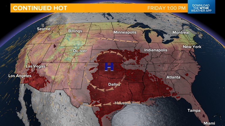
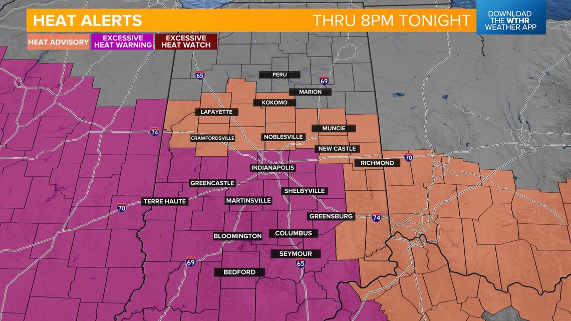
INDIANAPOLIS — The hot air mass the past week will still be in play today. An Excessive Heat Warning remains in effect for areas along and south of the I-70 corridor and a Heat Advisory is in effect for areas north of I-70 and east central Indiana.

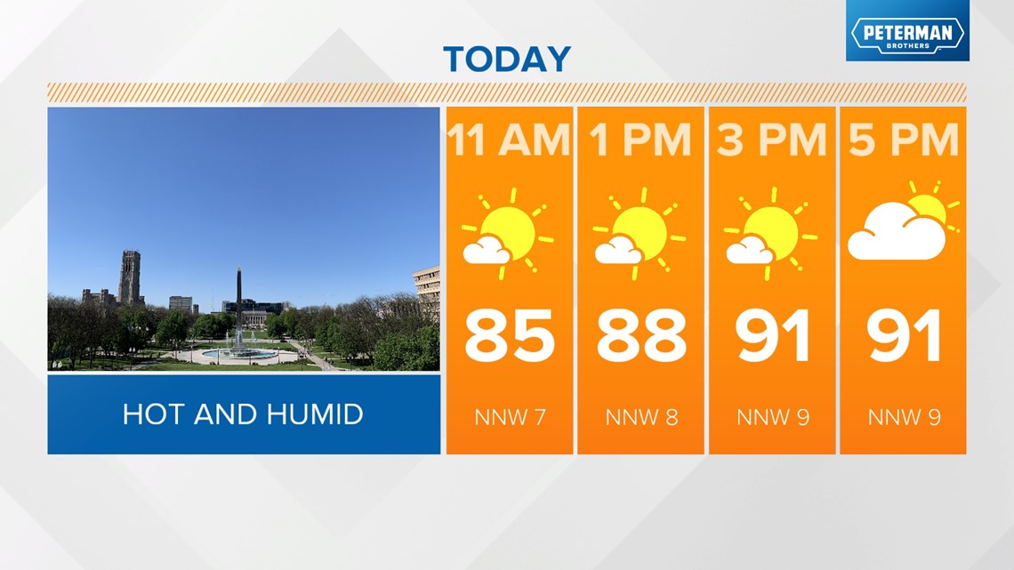
The air temperature will climb into the low 90s.

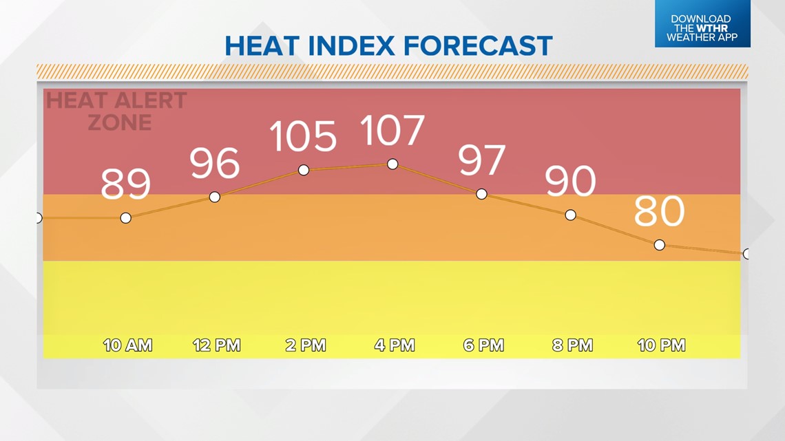
Heat indices will make it feel like 100 to 110°.

A boundary will arrive later this evening, potentially triggering a few showers and thunderstorms.

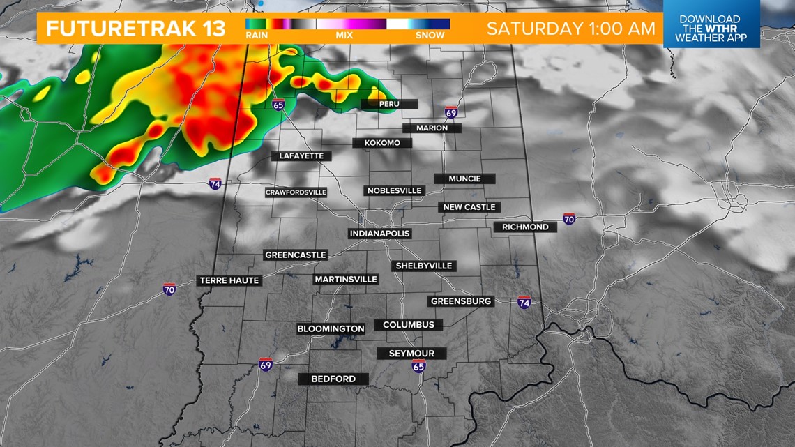

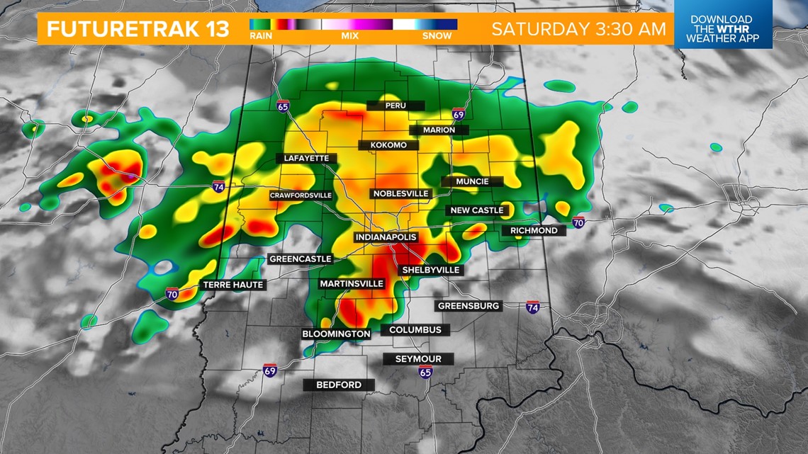

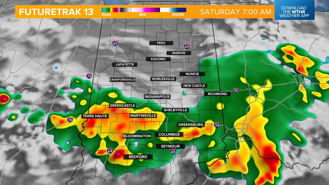

Areas south of I-70 could see an isolated severe thunderstorm. Damaging winds will be the main threat.

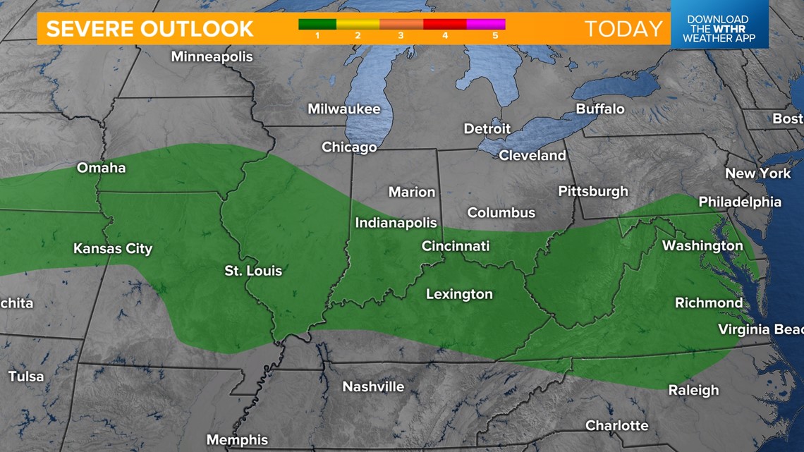
Rain potential will be from 0.10” to 0.25”. Temperatures overnight will only fall into the low 70s.
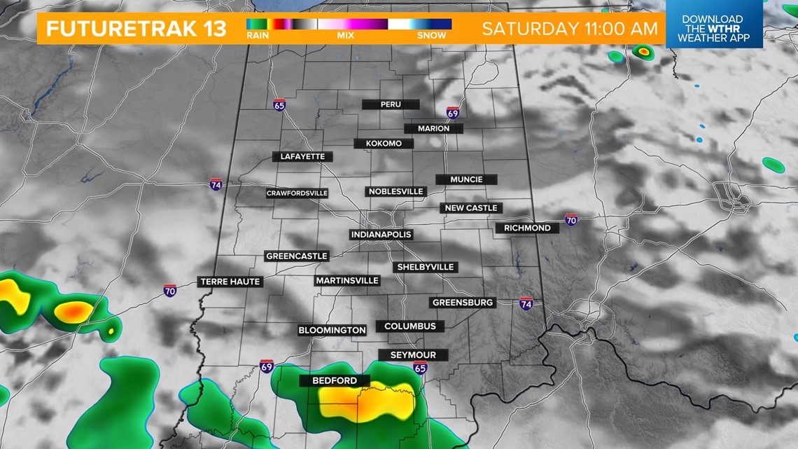
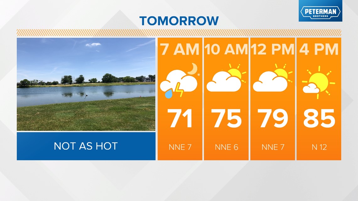
Dewpoints will start to dry out on Saturday. It will be mostly sunny, with winds out of the north-northeast. Afternoon highs will climb into the mid-to-upper 80s.

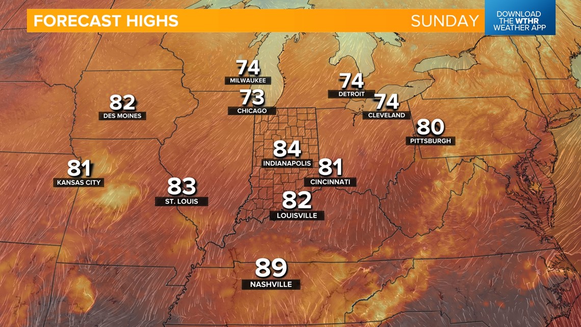
Sunday will be pleasant and cooler. Temperatures will start off in the low 60s with highs in the low 80s.

A cooler trend continues next week, with afternoon highs in the 70s and morning lows falling into the 50s by mid-week.
