It's hard to imagine with temperatures near 60° this evening, but northwestern Indiana is less than 12 hours from heavy snow to start out their Wednesday morning.
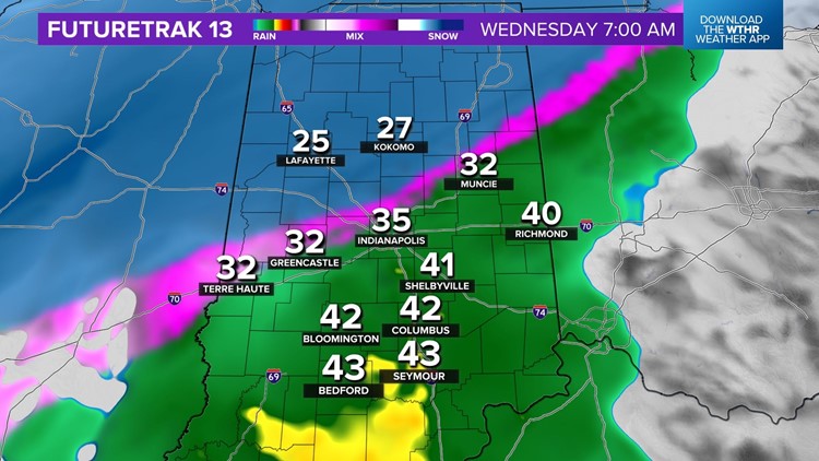
It's very important to note for the Indy metro area, and points south of I-70, that you're going to wake up to wet roads and a cold rain and that may very well linger into the afternoon.
We also want people that live in cities like Lafayette, Delphi, Attica, Kokomo, Peru, and Marion that you're going to wake up to snow falling moderately to heavily. Those heavy snow rates will last several hours on Wednesday afternoon.


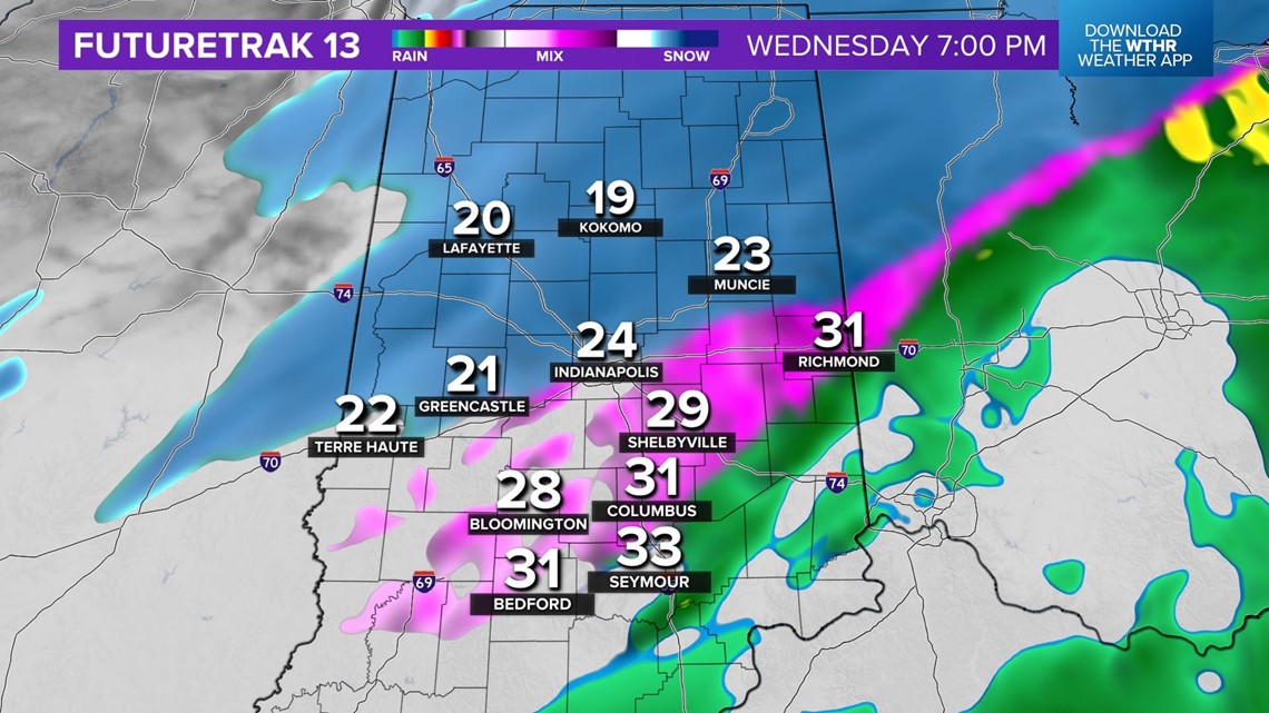
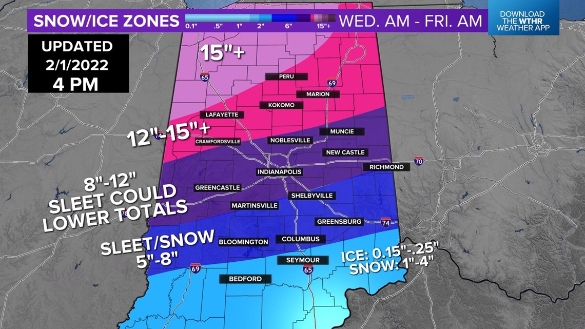
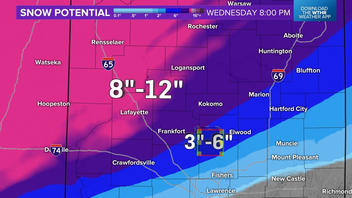
By this time Wednesday evening, we're expecting 8" to 12" locally of snowfall from Kokomo, Frankfort, and Logansport, with 3"-6" over northern Hamilton County to Hartford City.

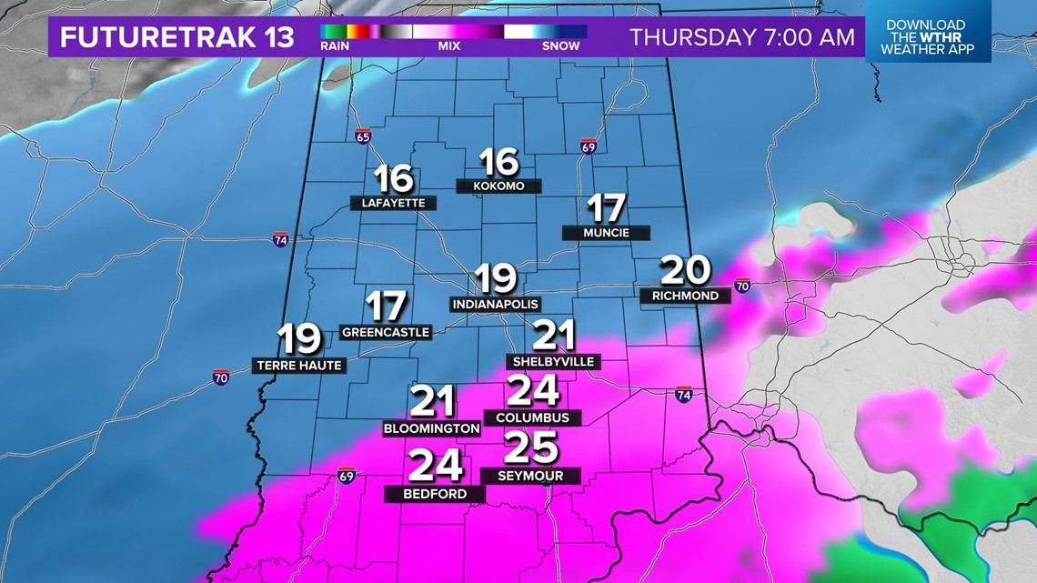
For areas along and south of the I-70 corridor, the brunt of this storm and bulk of accumulation occurs from early Thursday to early Thursday evening. That's when Indianapolis will have its heaviest snow rates, wind gusts to near 35 mph creating whiteout conditions at times, and blowing/drifting becomes a big problem, especially in rural areas.
Unless there's a prolonged period of sleet, Indianapolis could reach the 10"+ snowfall mark for the first time in a day since March 24, 2018. Either way, traveling Thursday and even Friday isn't recommended.