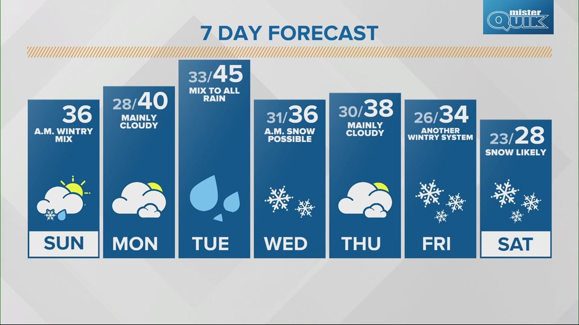
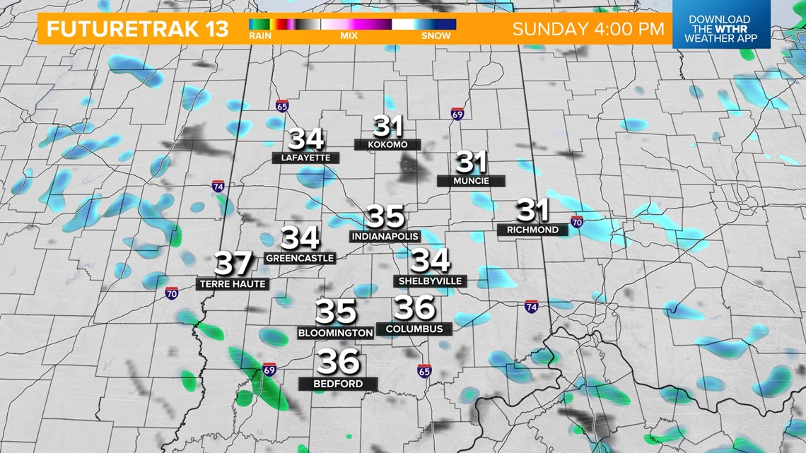
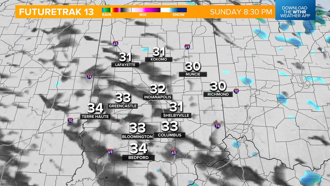
INDIANAPOLIS — A weak wave moving through central Indiana will keep a chance of isolated snow/mixed showers around through the early afternoon. Temperatures will hold steady in the low to mid 30s today. We'll see a gradual clearing this evening as temperatures drop into the upper 20s overnight.


Monday looks to be a quiet day early on with mainly cloudy skies and highs near 40 in the afternoon.

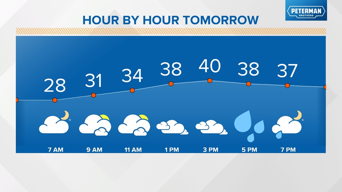
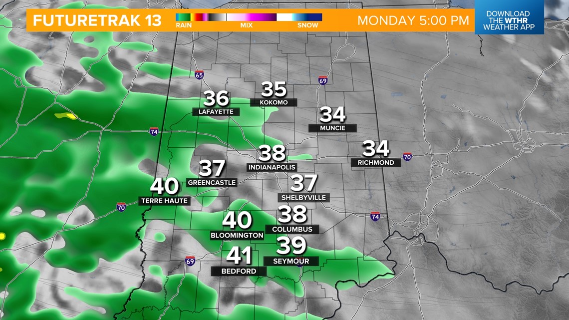
Our next potent storm system will bring rain mainly after 5 p.m. Monday. Rain becomes heavy overnight for most of central and southern Indiana where temperatures hold steady in the mid to upper 30s. Where temps are a few degrees colder in northern Indiana, a snow/rain combination is likely.


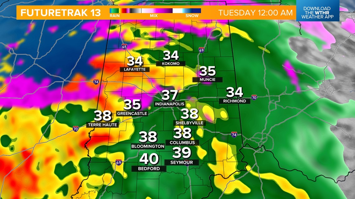
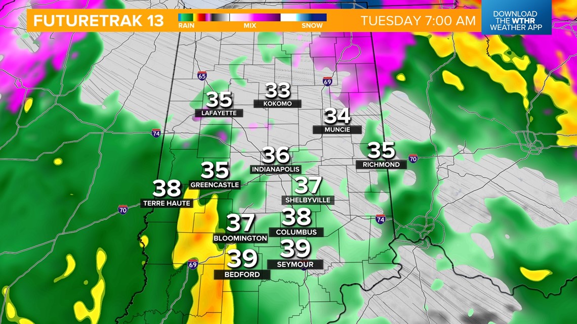
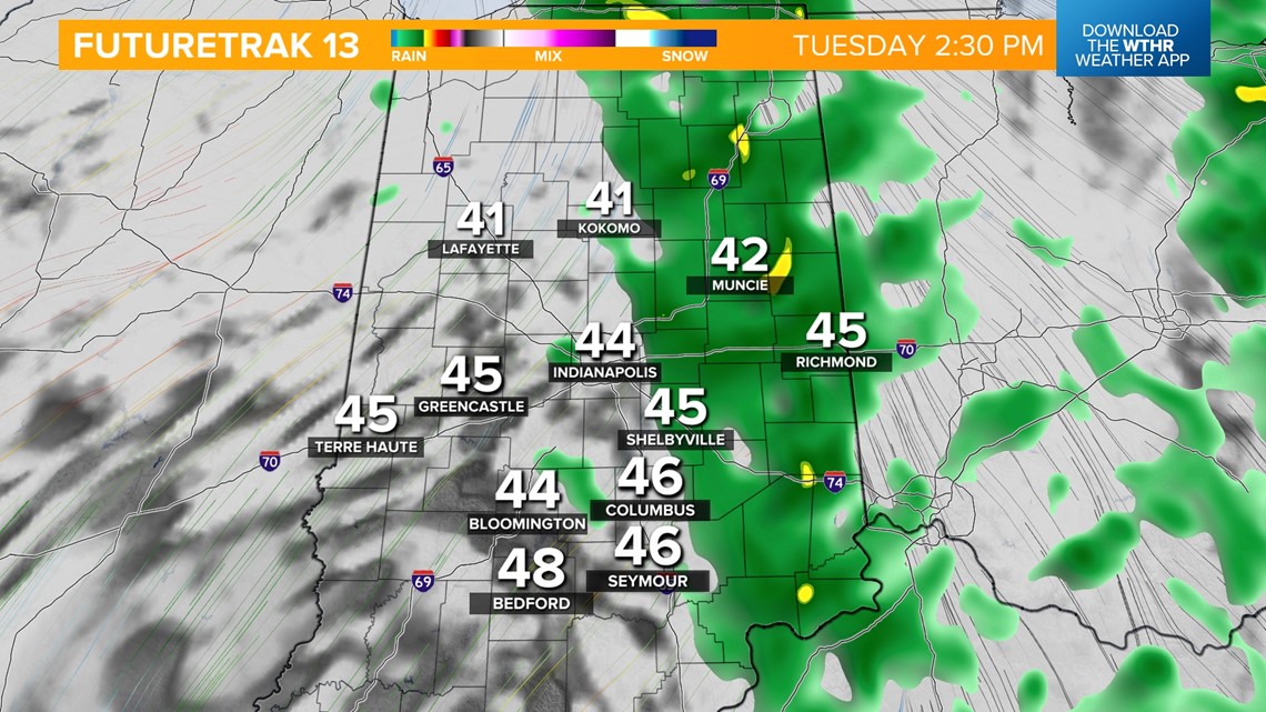
By Tuesday morning, the state will be in the "warm sector" of this storm system changing our precipitation type into all rain. Rain will become heavy rain at times through Tuesday afternoon and evening as temperatures warm into the mid 40s.


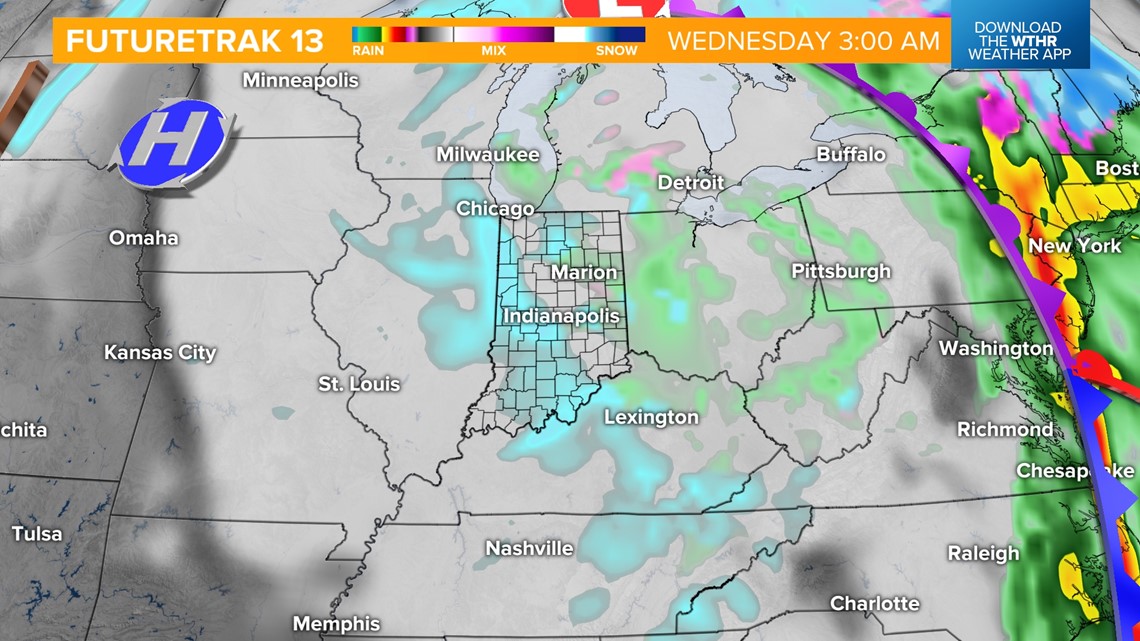
The core of the storm system will lift northeast in the pre-dawn hours Wednesday allowing for colder air to wrap around the backside of this system and remnant moisture will transition into mainly snow. Wind gusts will increase to 30+ mph as well Wednesday as temperatures hold steady in the mid 30s. Minor snow accumulations are possible before snow exits in the afternoon.

The pattern remains active with another wintry system set to bring a rain/snow combination Friday into Saturday. Snow accumulations look possible with this system, especially on Saturday. Also worth monitoring is a potential arctic blast expected to return next weekend behind this system. Much colder than average temperatures look likely. We'll continue to monitor these changes in the forecast.