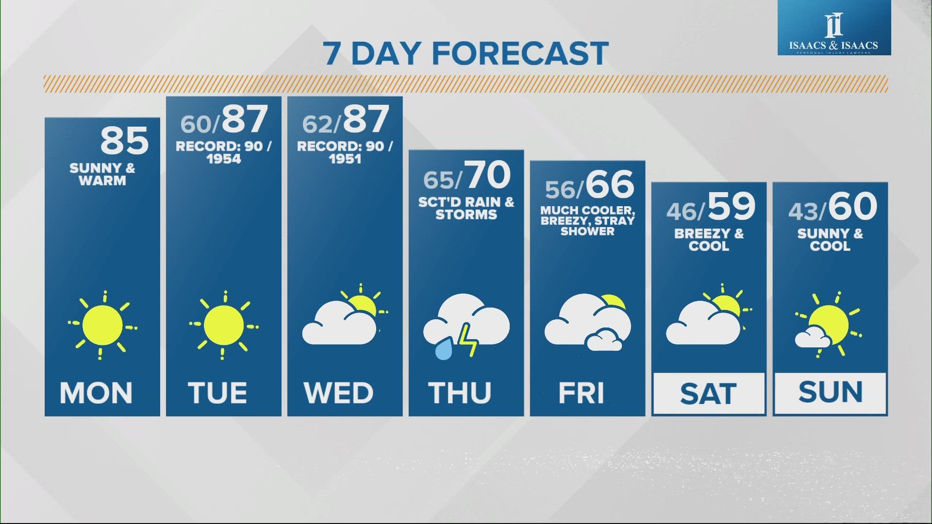
INDIANAPOLIS — This first week of October will bring a wild ride of temperatures, ranging from near-record warmth to start and the potential of the first frost of the season arriving by the weekend.

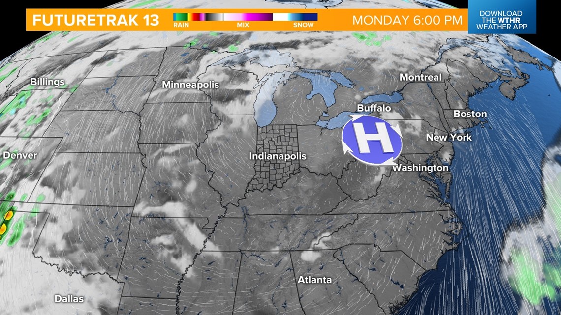
For today, there are no major changes to our unseasonably warm weather pattern. A dominant area of high pressure is still parked over the Great Lakes region, bringing plenty of sunshine and unseasonably warm high temperatures in the mid-80s.


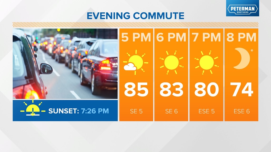
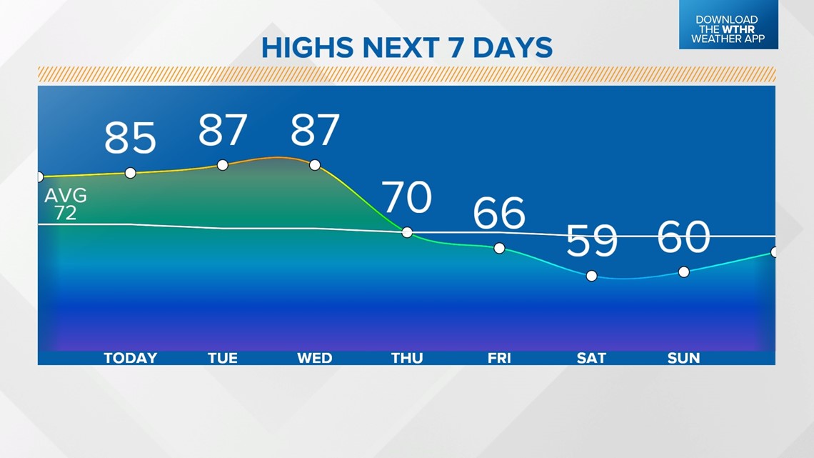
This pattern will persist through midweek, with mostly sunny skies, highs in the upper 80s and overnight low temperatures in the low 60s.

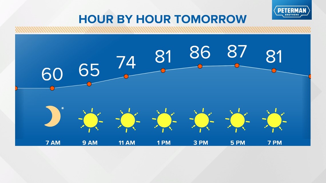
Clouds will increase during the day on Wednesday, but temperatures remain in near-record warm territory with highs in the upper 80s.

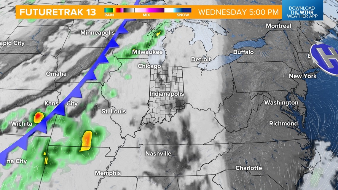
A cold front is set to arrive early Thursday, bringing scattered rain showers and possibly some rumbles of thunder. This will bring much-needed rain, with many spots in central Indiana seeing 0.5-1" of rainfall out of this system.

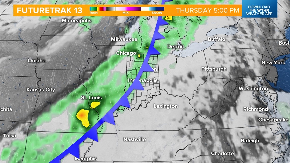
Behind the front on Friday, we'll see lingering clouds and perhaps a stray shower still. The biggest change will be the major cooling trend. Highs on Friday will only be in the mid-60s, with even cooler air settling in for the weekend.

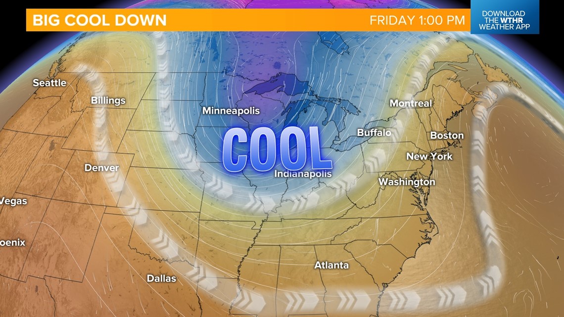
Overnight low temperatures both Saturday and Sunday mornings could prompt the first frost of the season, with outlying locations dropping into the 30s and into the low to mid-40s around the Indy metro. On average, Indianapolis sees the first frost of the fall season — 36° or lower — on Oct. 17.

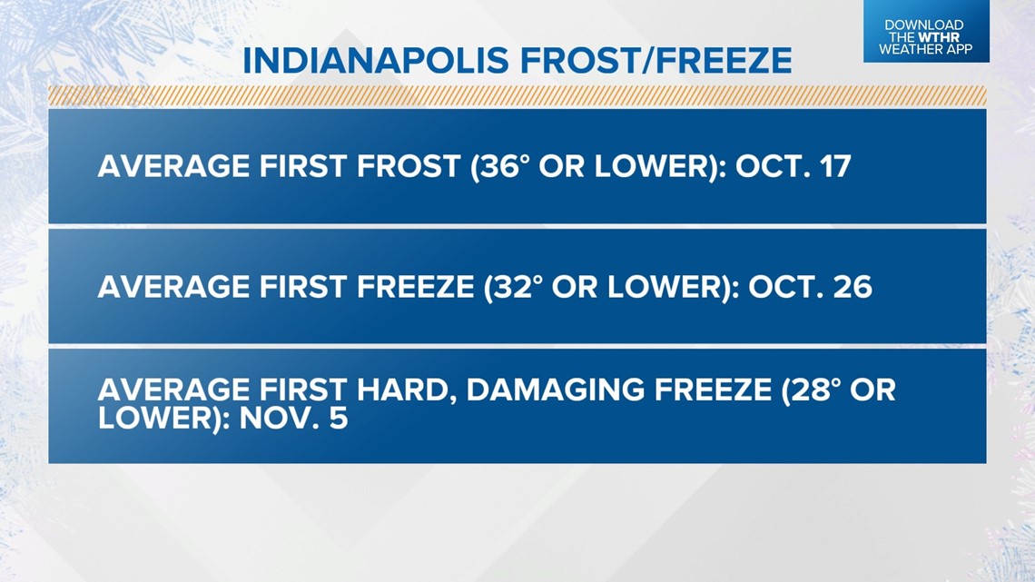
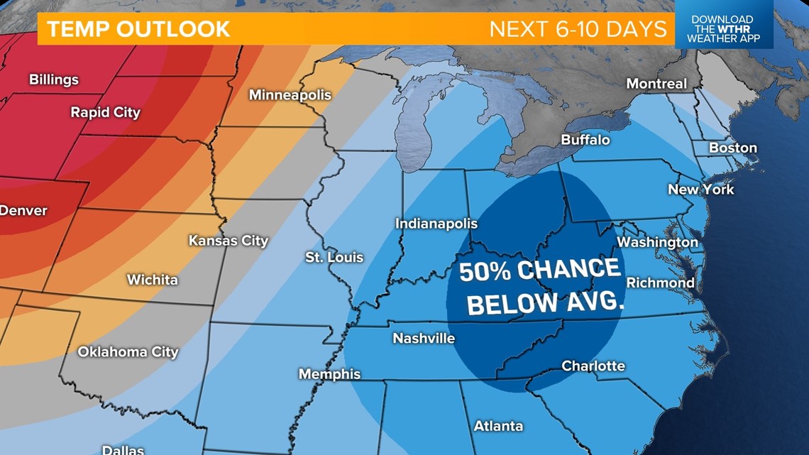
Daytime highs Saturday will be hindered to the upper 50s and still only near 60 degrees Sunday. Unseasonably cool temperatures look to hang out in the near-term, with the Climate Prediction Center forecasting a 50% chance of below-average temperatures through Oct. 11.

