
INDIANAPOLIS — A Dense Fog Advisory is in effect for eastern parts of central Indiana including Wayne-Fayette-Union-Franklin counties through 10 a.m. Areas of dense fog will begin to mix out in the mid-morning as temperatures start to warm-up.

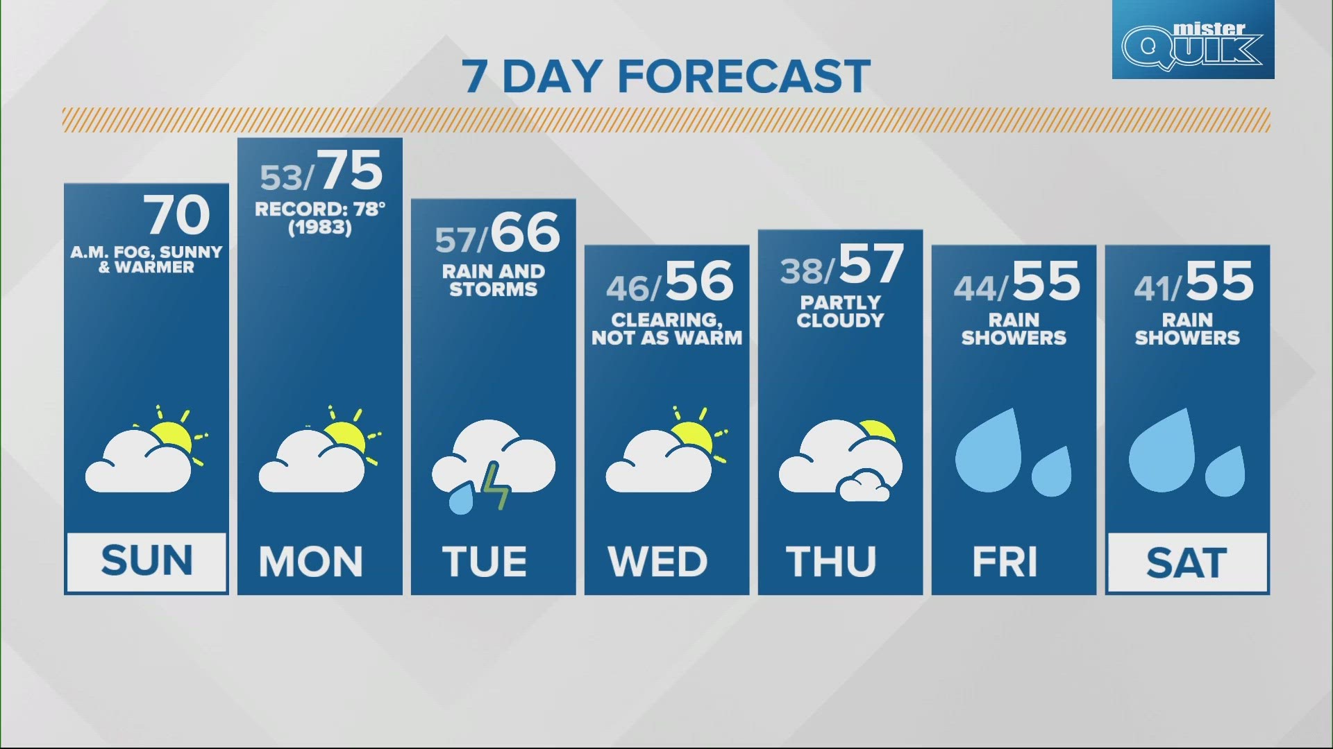
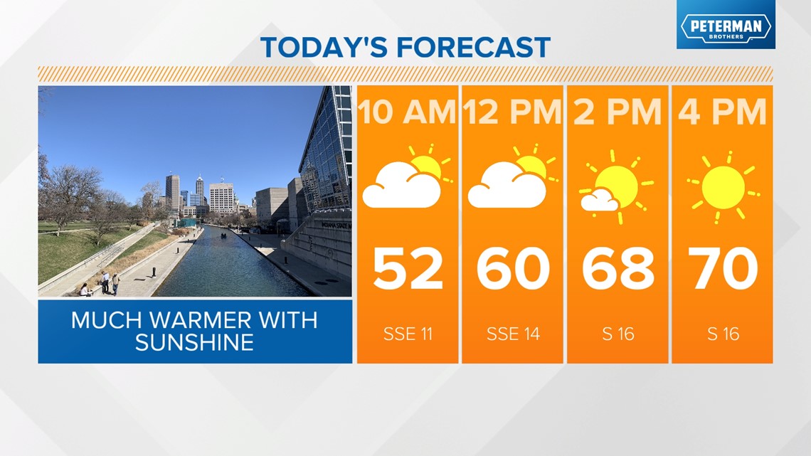
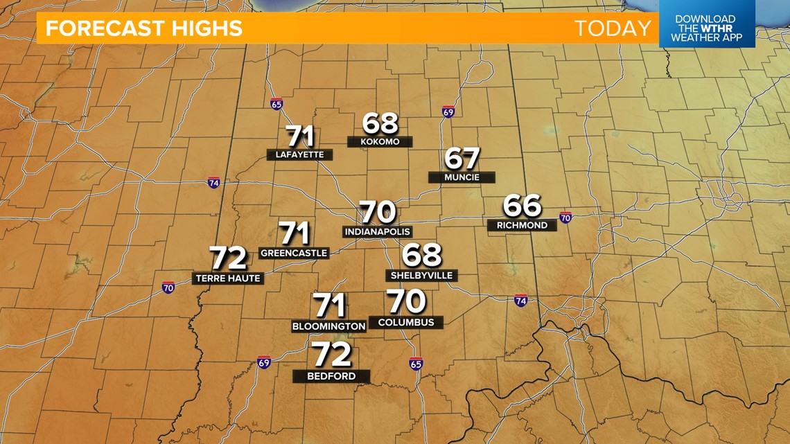
An unseasonably warm and breezy day is on tap for central Indiana as winds shift from the south and will be gusty up to 25 mph at times. This breeze will help usher in a milder air mass. As skies become mostly sunny this afternoon, look for highs nearly 20 degrees above average near 70.


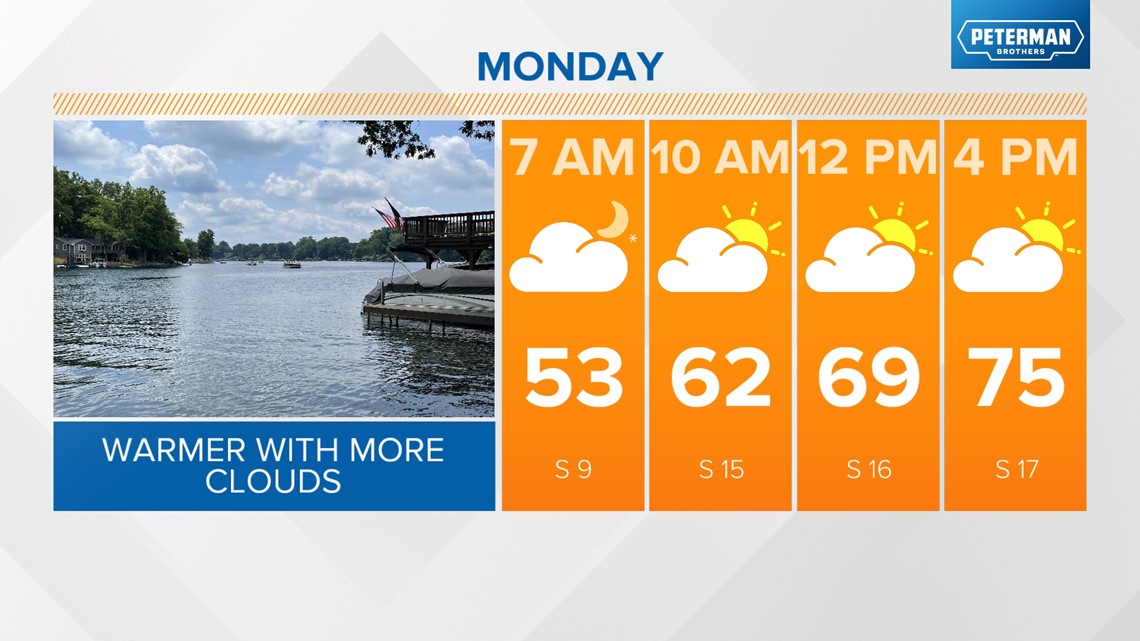
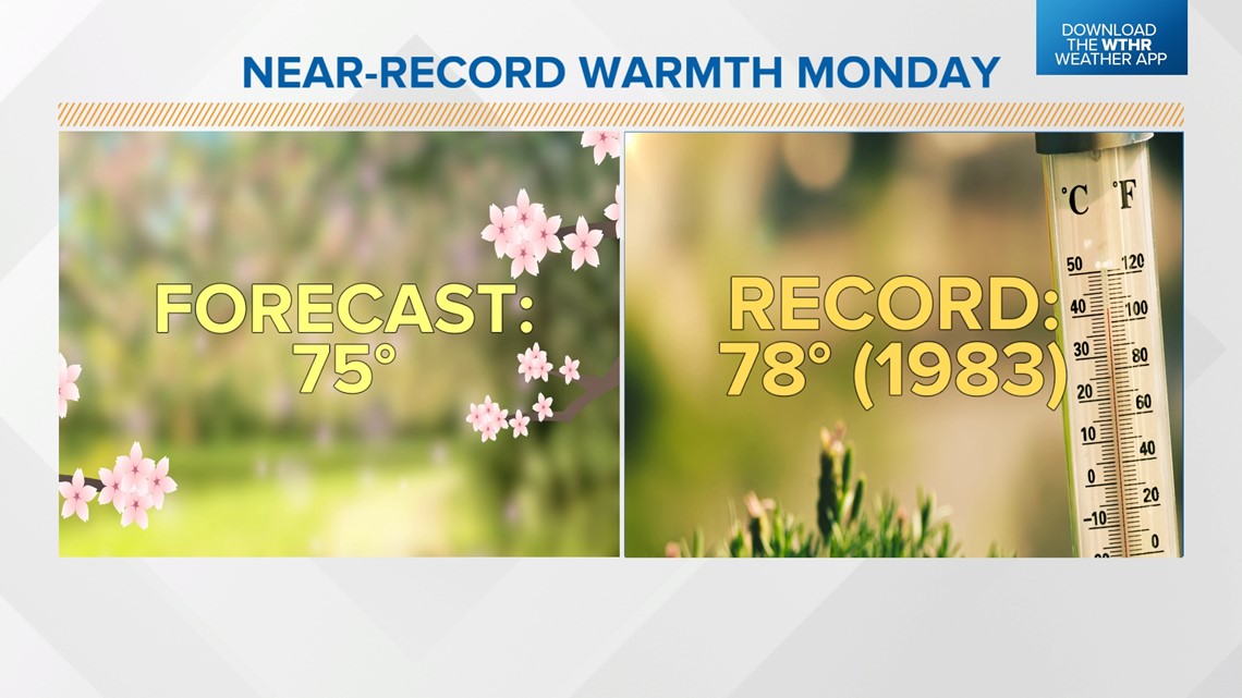
We'll be on the warm side of our next weather system on Monday so temperatures will still be well above average in the mid 70s. The standing record for Indianapolis on Mar. 4 is 78 degrees set back in 1983. Clouds will increase Monday with rain chances moving in overnight as a cold front approaches.


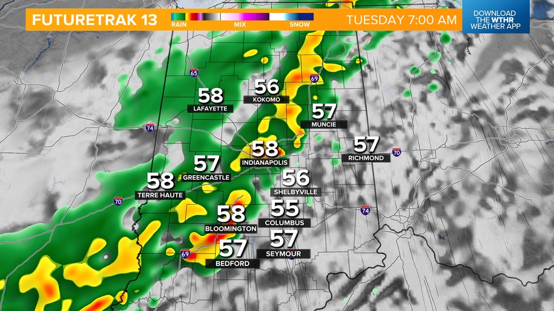
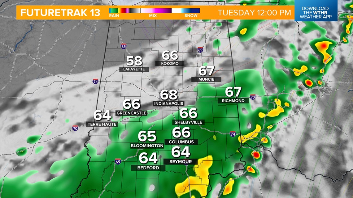
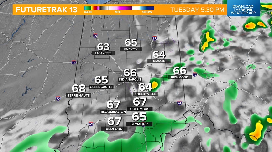
Showers and a few thunderstorms will be most likely overnight Monday into Tuesday morning as the cold front moves through. Severe storms are not expected. Scattered rain chances continue through Tuesday afternoon, but temperatures remain above average in the mid 60s.


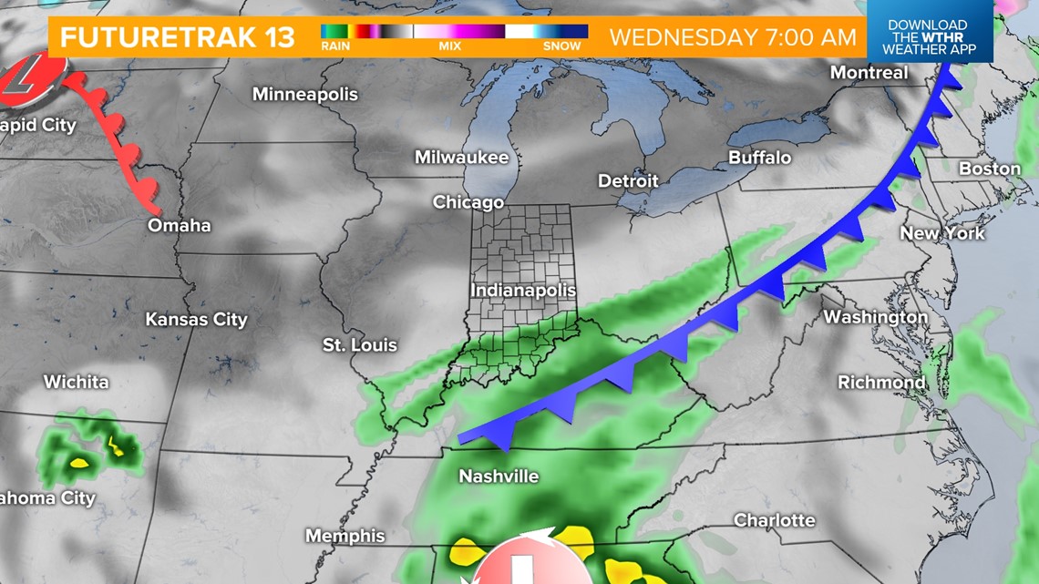
This boundary will stall to our southeast Tuesday night into Wednesday morning. Showers will be possible across the southern half of the state during this time frame. High pressure will then take over helping to clear skies out by Wednesday afternoon.

High temperatures will fall back into the 50s starting on Wednesday and continue through the rest of the work week. We'll also stay dry until our next weather system brings rain chances Friday into the start of next weekend. Temperatures are trending downward behind this system with highs dropping back into the upper 40s by next Sunday.

