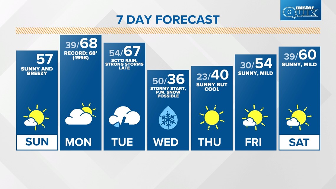
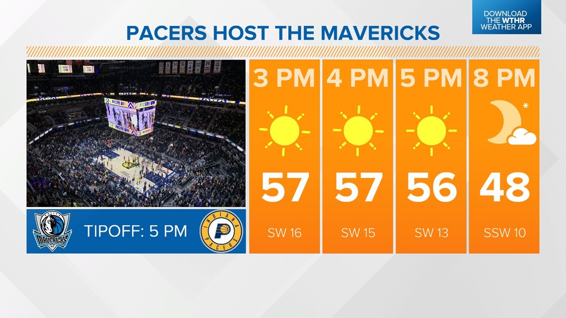
INDIANAPOLIS — Gusty southwesterly winds, combined with sunny skies today, will bring a major warming trend. Temperatures will jump about 20° compared to Saturday, with highs in the upper 50s. Grab the sunglasses if you're headed downtown to cheer on the Pacers for a 5 p.m. tipoff against the Mavericks.

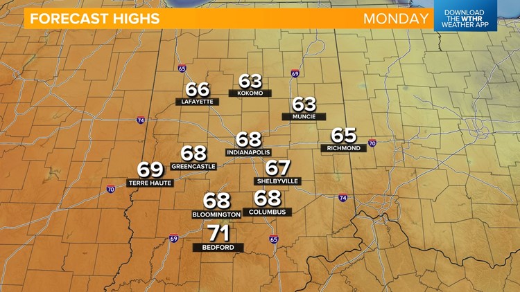
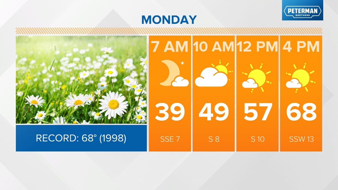
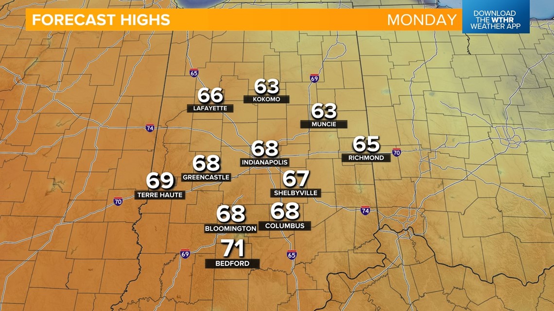
We're headed to record-tying warmth, with highs in the upper 60s tomorrow afternoon. The record-high temperature for Indianapolis on Feb. 26 stands at 68 from 1998. We'll stay dry and mainly sunny.


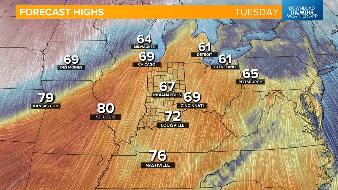
We'll see a few spotty rain showers on Tuesday as we sit in the "warm sector" of our next weather system, keeping temperatures in the mid to upper 60s. We do look to stay shy of the record for Feb. 27 as it stands at 73 from 1996.

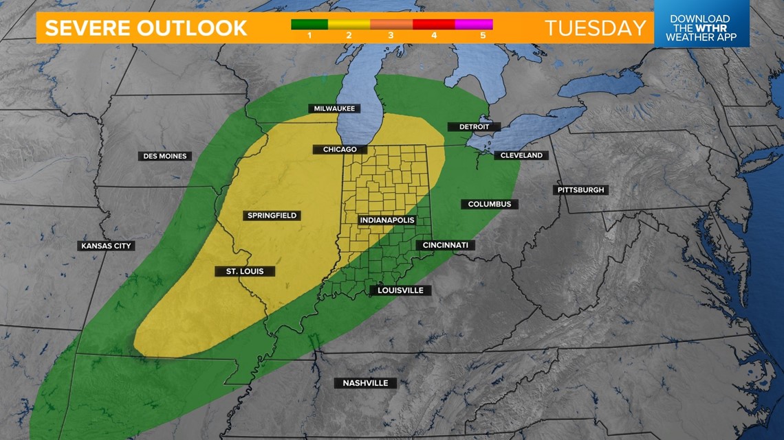
The Storm Prediction Center has placed a good portion of Indiana in a Level 2 of 5 for the risk of scattered strong storms. This comes as the cold front approaches late Tuesday night into Wednesday morning. The primary threat is damaging wind gusts, which could lead to isolated power outages and wind damage.


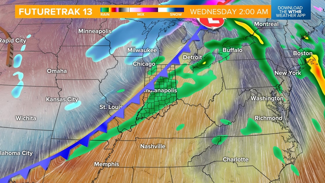
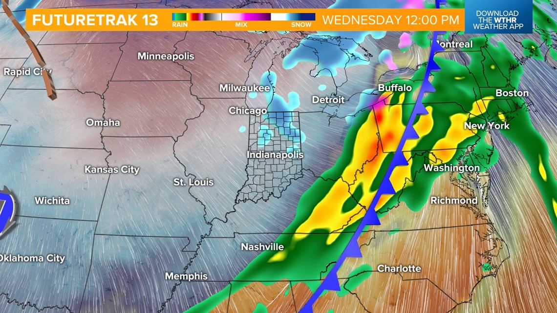
Temperatures will drop from the 60s overnight into the 50s/40s by Wednesday morning as the storm threat comes to an end. We'll eventually drop into the 30s by Wednesday afternoon, with a few stray snow showers possible.

Sunshine returns for the remainder of the work week and into next weekend. We'll still be under a cooler air mass Thursday, with highs near 40. We're looking at a nice warming trend starting Friday though, with highs in the 50s and into the 60s next weekend.