INDIANAPOLIS — Multiple rounds of strong storms are possible starting after midnight tonight and lasting until a cold front moves through Wednesday morning.
TODAY:
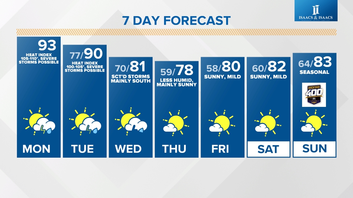
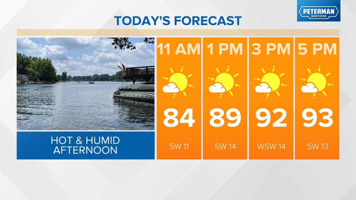
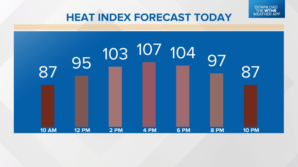
Morning rain has ended as heat and humidity return. Today will likely be the hottest/most humid day in this heat streak with highs in the low to mid 90s and heat indices up to 105-110 degrees.


When is severe weather expected next?
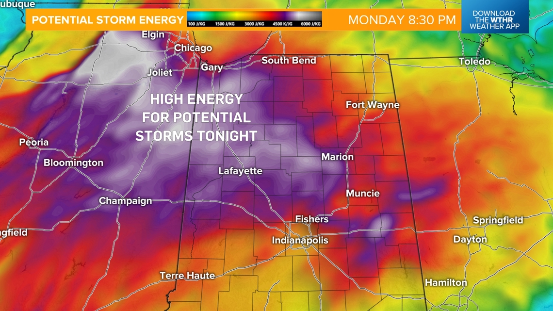
Another storm complex will develop across the Midwest this afternoon and track closer to Indiana after sunset. The atmosphere will have ample time to recover today, which will help fuel storm development, especially across the northern half of the state.

What is the timing and what are the primary threats with this severe weather?
THREATS: The Storm Prediction Center has placed the northwest tier of the state under a level 3 of 5 for the risk of widespread damaging wind gusts along a line of storms. The rest of north and central Indiana is under a level 2 of 5. The potential is there for isolated power outages and downed trees.
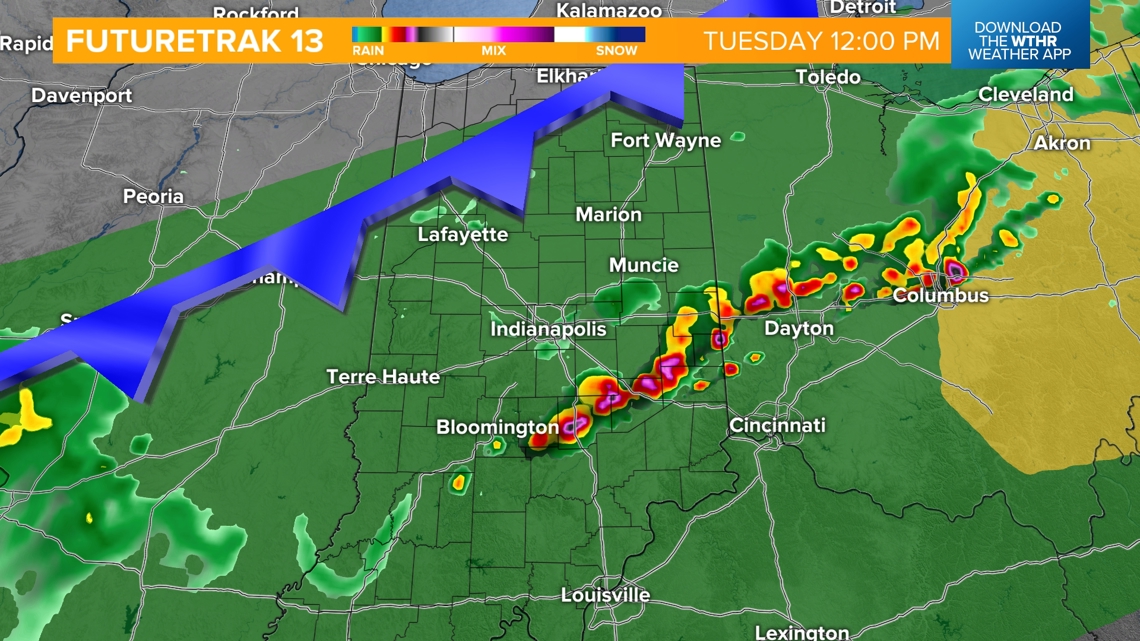
TIMING:
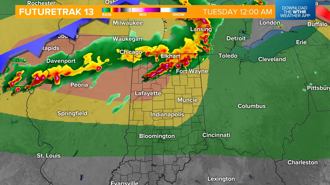
Tuesday 12 a.m. (mainly north initially) - 7 a.m.


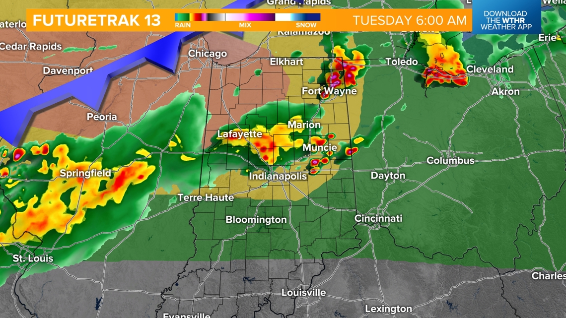
This system will likely dissipate by the morning rush hour on Tuesday, allowing temperatures to recover to near 90 in the early afternoon.
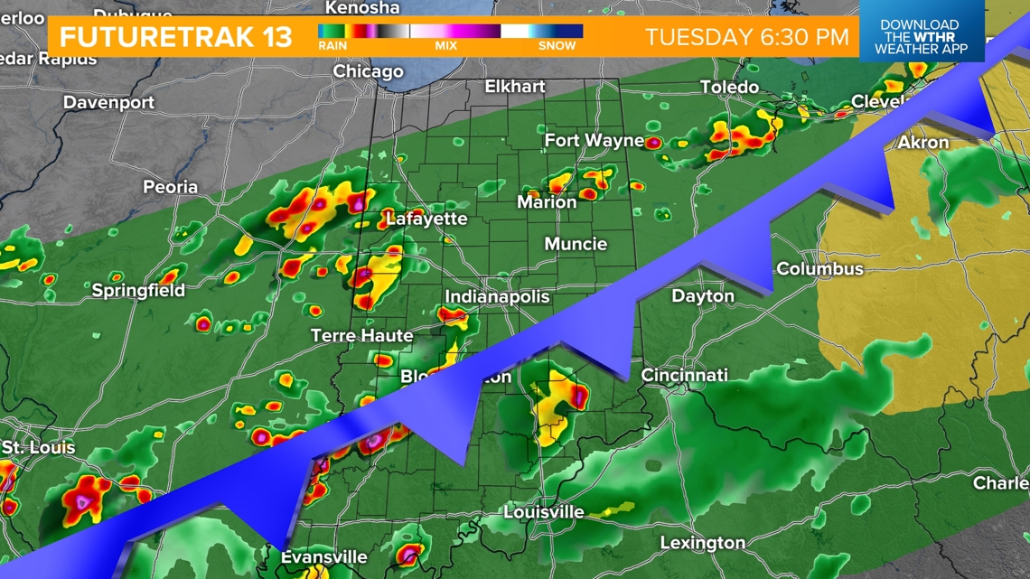
We're then watching an incoming cold front which will prompt more organized rain and storms starting Tuesday afternoon. Widespread severe weather is not expected, but a few strong storms will be possible starting Tuesday afternoon into the evening with damaging wind gusts and heavy rainfall leading to localized flooding.


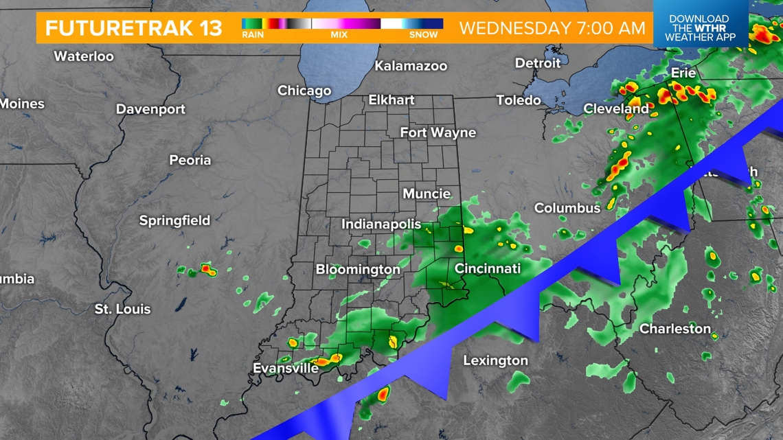
Scattered storms continue Tuesday night into Wednesday morning as the cold front continues to move though. Outside of a lingering storm across the southern half of the state Wednesday, most of central Indiana will be dry.

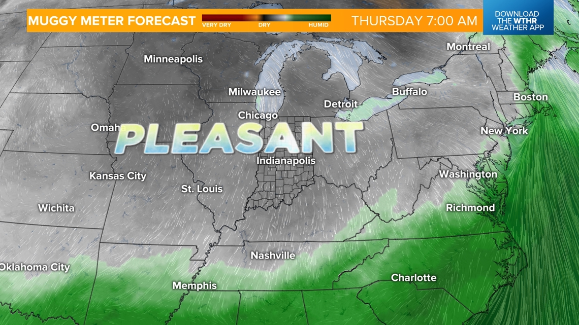
Feelin' good again
A more refreshing air mass takes over for Wednesday afternoon through the end of the work week. Overnight low temperatures drop into the upper 50s even for Thursday and Friday mornings. The pattern looks quiet and sunny through the weekend for the Brickyard events at the Indianapolis Motor Speedway.