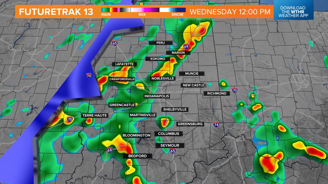
INDIANAPOLIS — As expected, locally heavy storms continue to develop around central Indiana within warm and humid air. Primary threats with storms today will be heavy rain and lightning with gusty wind (50+ mph) and small hail (pea-sized) being secondary impacts.
Storms will continue to pulse up and down the remainder of the day, and not every area gets hit. We're still expecting the greatest coverage of rain and thunderstorms to occur Wednesday between sunrise and 6 p.m. with the approach of a slow-moving system.


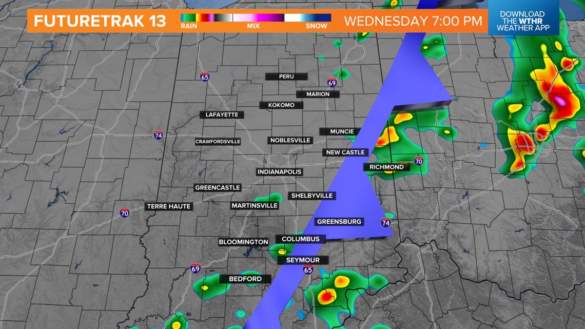
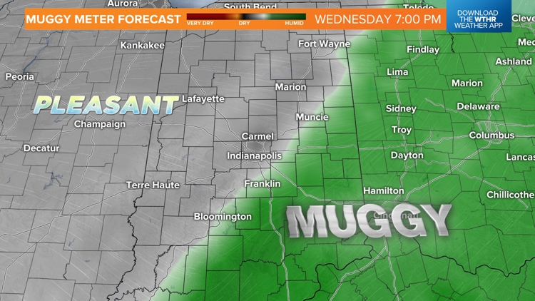
The Muggy Meter will be miserably humid overnight and much of tomorrow as near/above 70° dewpoint air pools along that front. That fuels heavy rain rates and localized flooding within heavier cells. Coverage of rain and thunderstorms diminishes between 5 p.m.-7 p.m. as drier air filters in behind the frontal passage.


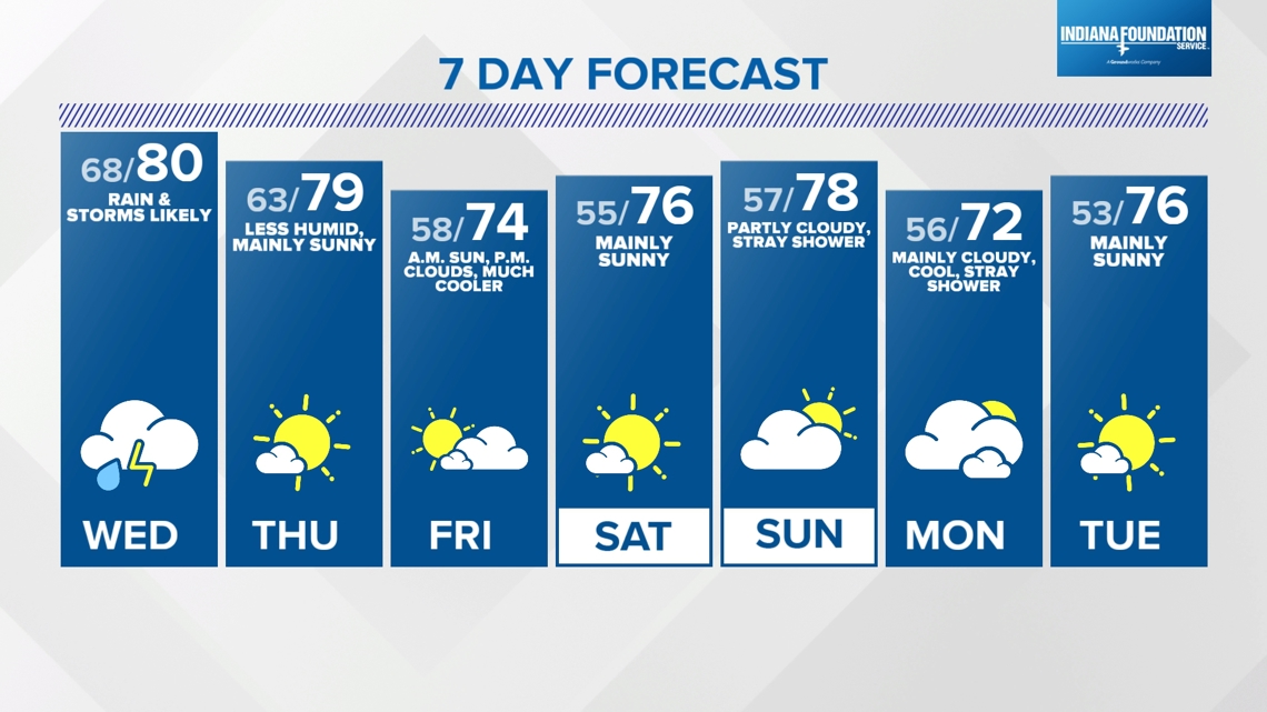
Noticeably less humid air arrives as early as midnight Thursday and certainly by sunrise that day. A steady diet of northwesterly wind keeps the air pleasant into and beyond this weekend. It comes with intervals of low cloud cover that at times may be mainly cloudy, especially Friday afternoon and again Sunday into Monday. But little rain development is expected, with the exception of some sprinkles or a light passing shower.