
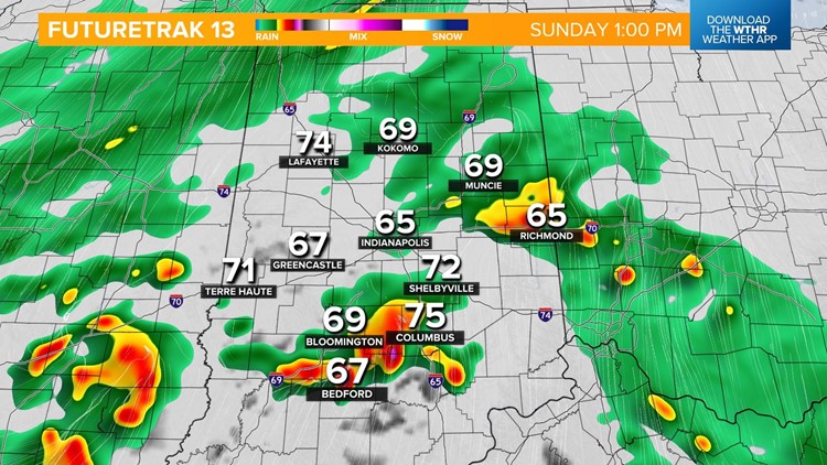
INDIANAPOLIS — Much-needed rainfall is moving into Indiana along an area of low pressure set to track right through the state this afternoon.
Scattered showers and isolated storms will become more widespread by mid-morning and likely during the afternoon hours.
Temperatures will remain rain-cooled and steady in the upper 60s, low 70s for afternoon highs.


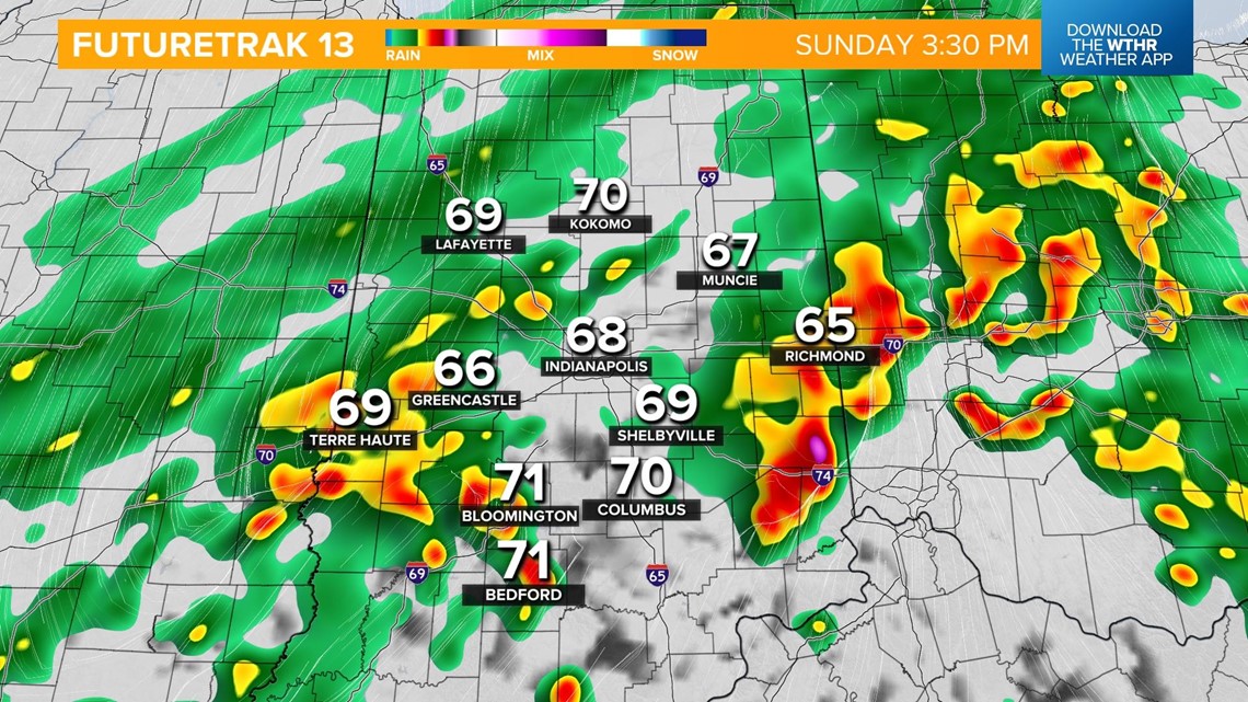

Where conditions are slightly more conducive of storm activity in southern Indiana, an isolated strong to severe storm can't be ruled out in the late afternoon.
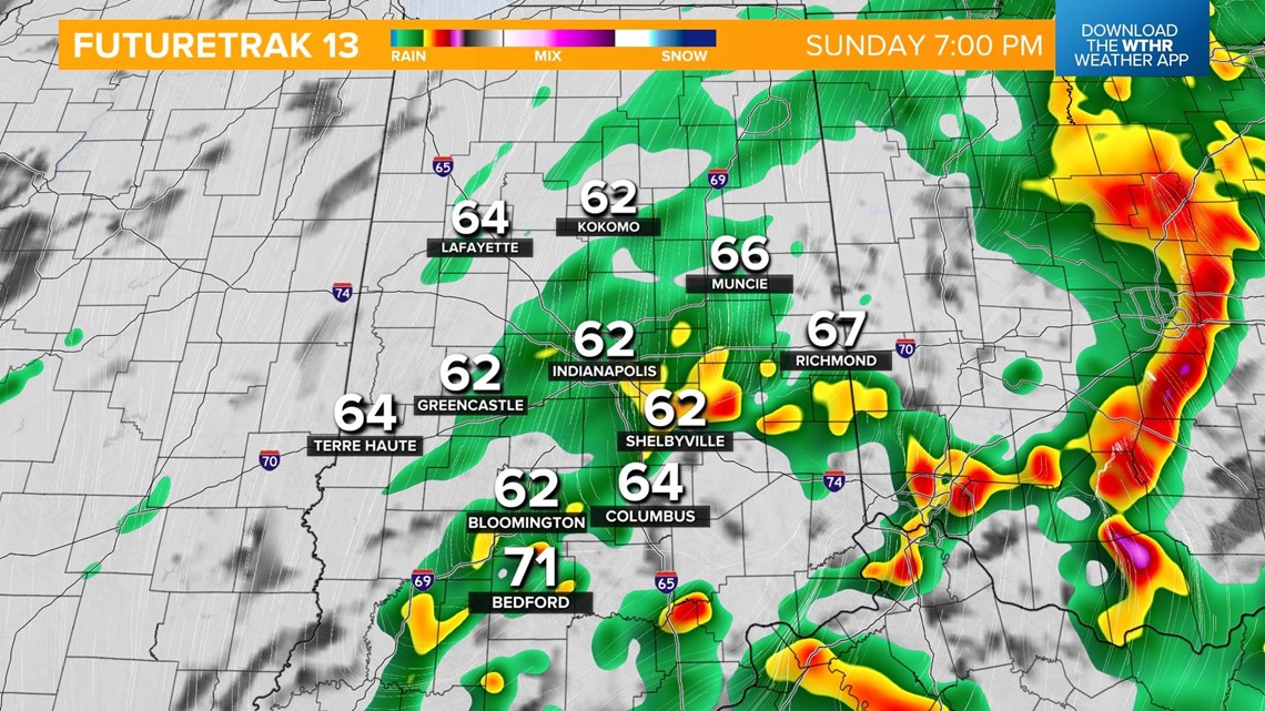
This system will pull east in the evening and steadier rain will exit the state after 6 p.m.
Most areas have the potential to see 0.5 - 1" of rainfall with higher totals within thunderstorms and heavier pockets of rain.
Skies will slowly clear overnight but winds strengthen on the backside of this system with northerly gusts up to 30 mph possible at times. Temperatures fall into the low 50s with outlying locations especially north seeing lows dipping into the upper 40s.
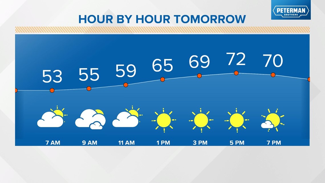
Behind the front, temperatures cool with highs back in the low 70s on Monday under a mostly sunny sky.

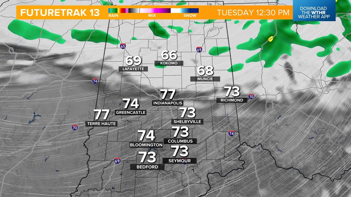
Temperatures will gradually warm back up throughout the week with highs in the upper 70s Tuesday. There will be a weak wave that pushes south during the day Tuesday bringing stray shower chances to the northern tier of the state first then spotty showers in central Indiana Tuesday evening.

Wednesday looks to be a dry, sunny day with highs in the upper 70s ahead of a warming trend back into the 80s for the latter part of the week. A more unsettled pattern will bring stray rain chances back into the forecast for Thursday and Friday.
