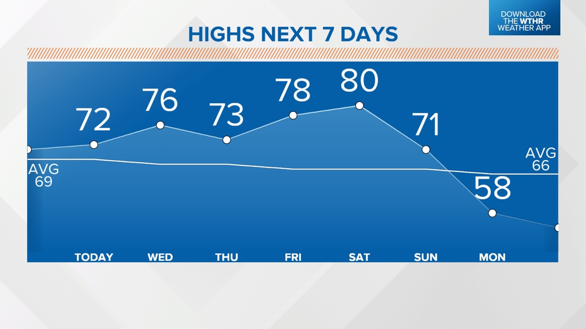
INDIANAPOLIS — You can certainly feel the changing of the seasons in central Indiana as some areas dropped into the 30s and even isolated areas of light frost this morning. This dry airmass and abundant sunshine quickly pushed temperatures into the 60s and 70s this afternoon and afternoon will gradually get warmer in the coming days.
Another crisp night in the 40s to be followed by highs in the mid-70s Wednesday. The same northerly flow controlling our weather will also keep Hurricane Milton from going much farther than the Georgia/Florida line. Don't forget our Milton weather blog is updated several times a time a day with the latest intensity and track. Sadly, that storm will be the worst hurricane for some on the west-central coast of Florida.
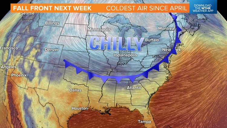
Locally, our weather will remain quiet and rather sunny until Sunday. The passage of a stronger cold front may have some clouds but will certainly have stiff breezes on Sunday. Then a cold wind emerges Sunday night and delivers our coldest air since the middle of April.


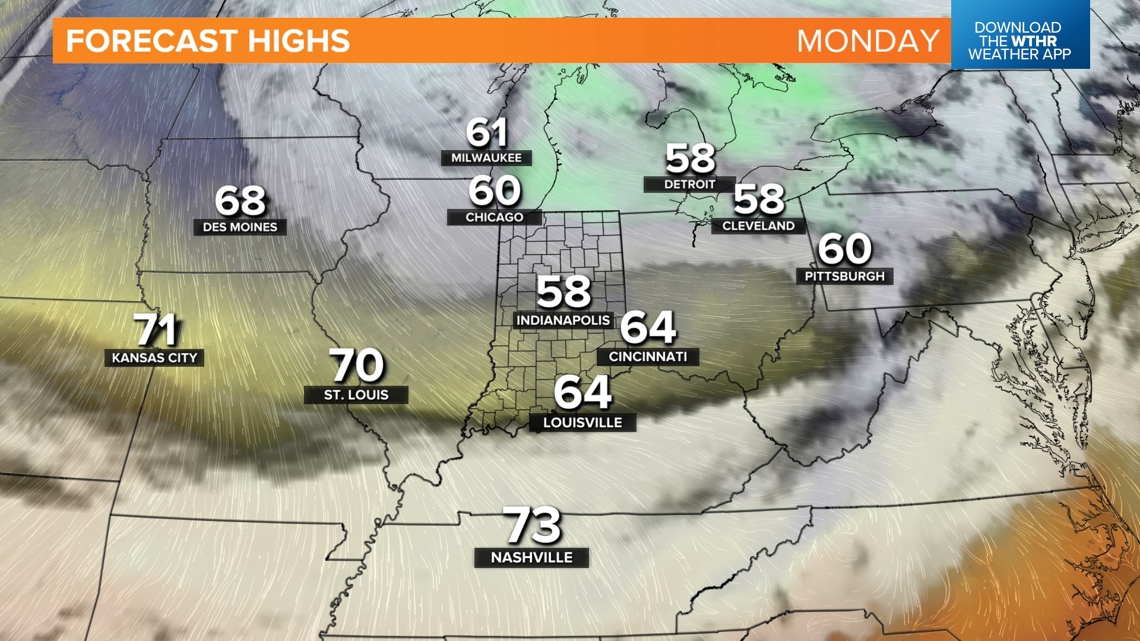
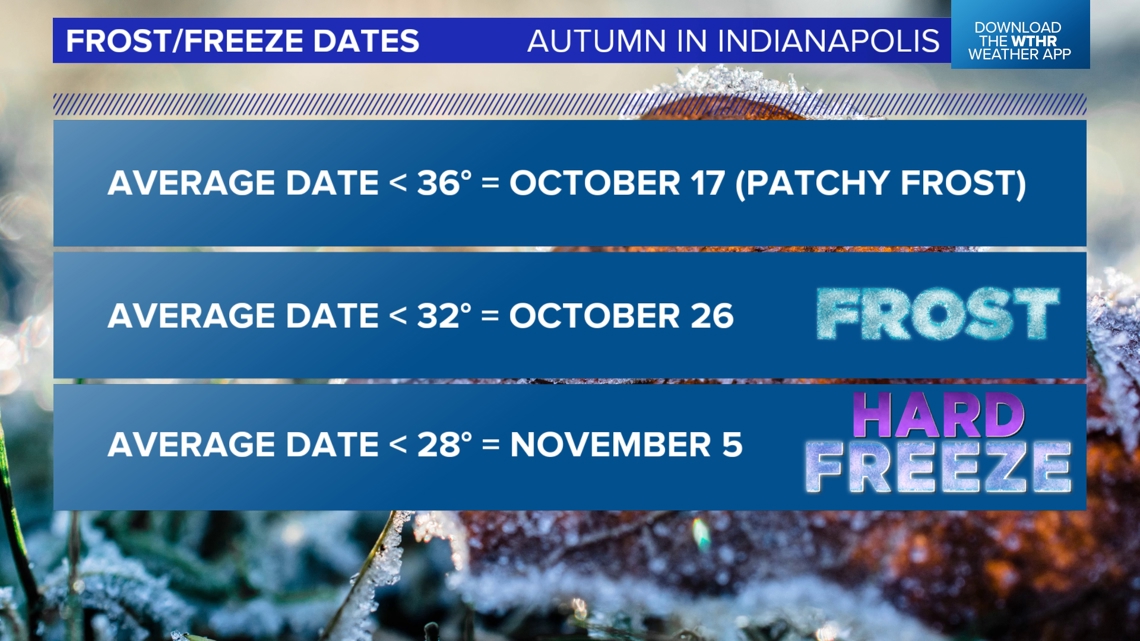
We're forecasting highs in the 50s for several days next and widespread lows in the 30s for multiple mornings. Cloud cover and wind may protect from getting a frost Monday/Tuesday mornings—but a calming wind and clear sky next Wednesday may lead to widespread frost in Indiana which coincide with the average date for the first frost in autumn.
So you may want to dig out your best crockpot recipes, some extra layers and get the fire pits ready for some chillier air next week.
A reminder that the NWS has updated how the issued cold weather alerts. Meteorologist Matt Standridge explains here.