

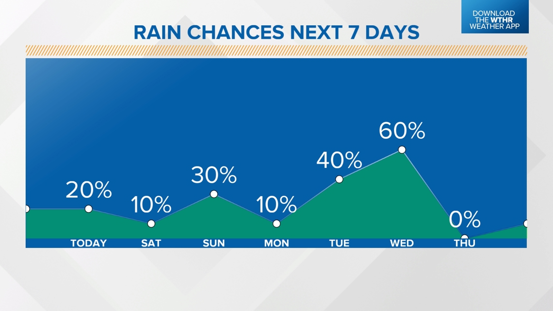
INDIANA, USA — Mid-July is turning hotter and muggier for Indiana. High pressure is building toward the west. The position of the jet stream will keep lots of warmth locked in for the Hoosier state, but it may also bring on-and-off rain chances almost every day until Thursday, July 18.
Tap HERE to track pop-up showers and storms with our interactive radar.
Jet stream pattern analysis
During the summer, we are closely watching the position and angle of the jet stream. High pressure is intensifying heat in the western and central United States. Around the edge, there are ridge riders, or pop-up storms that stay closer to the jet stream flow.

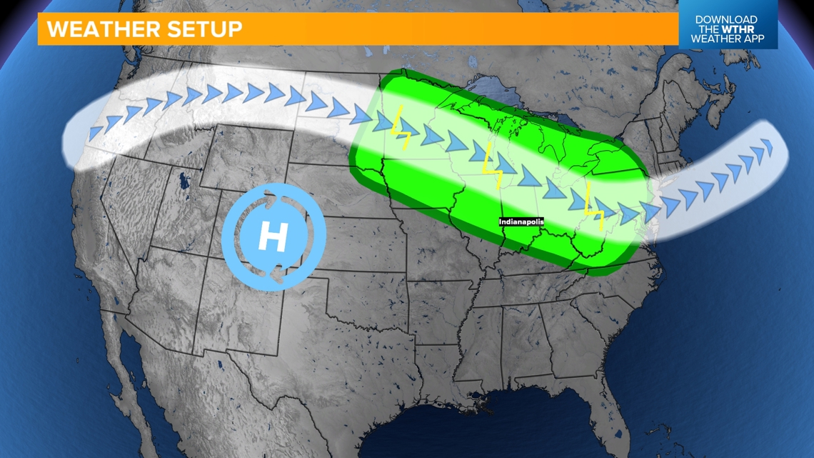
The northwest flowing part of the jet stream tends to be more active. We highlighted this in the green area. This northwest flow zone helps the updrafts on pop-up showers and storms become more efficient.
Indiana will be included in this zone for a few days.
How the storms will likely evolve
Closer to the jet stream, scattered storms will fire up in the afternoons. They will eventually push south to feed into warmer, more humid air. Indiana will see storms in the northern sky and some will be able to push south. Most times the storms will be isolated in nature. Generally look up and stay weather aware.

Severe threats will be on the lower side. The storms will likely be stronger in Michigan, Wisconsin and northern Illinois. As they push south toward Indiana, eventually they should weaken. Most storms in Indiana will just have heavy downpours, some lightning and some gusty winds at times.
-13News Meteorologist Matt Standridge
