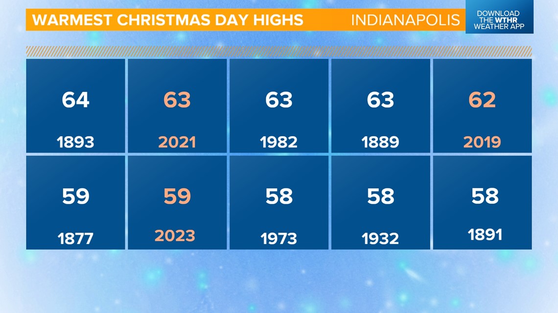
INDIANAPOLIS — Indianapolis officially hit 59 degrees on Christmas Day, which ties for the fourth warmest Christmas on record, and we also saw 0.20 inches of rainfall.

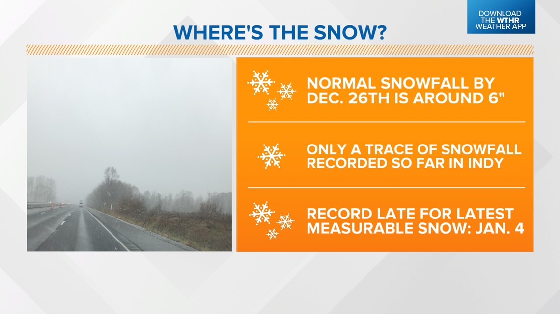
By this point in the season, central Indiana typically sees around 6 inches of snow, according to the National Weather Service. The Indianapolis metro has only recorded a trace amount of snowfall so far.
We're nearing a record for the latest measurable snowfall, which is currently Jan. 4, 1941!

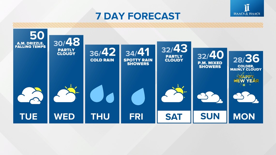
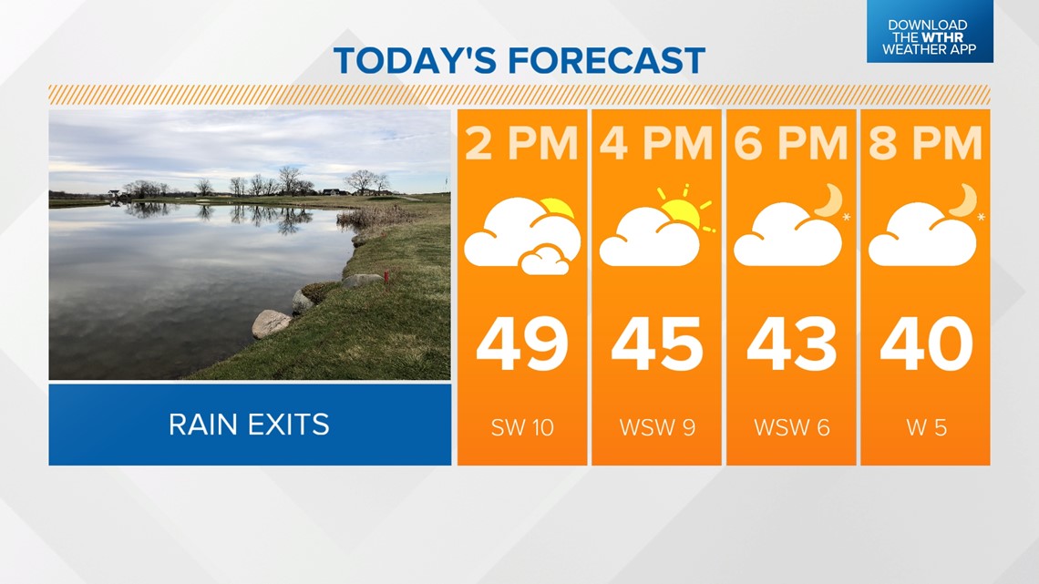
For the rest of today, a cold front will continue slowly moving through the state. Indy achieved what will be the "high" temperature for the day around midnight at 54 degrees as temps hold steady near 50 through the afternoon. Skies will gradually clear from west to east this afternoon.

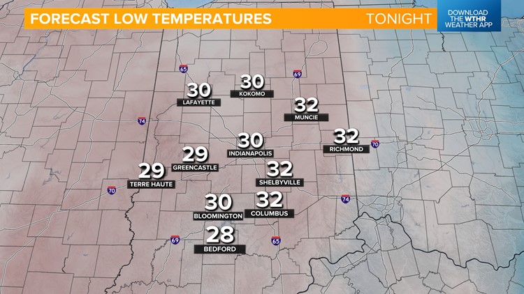
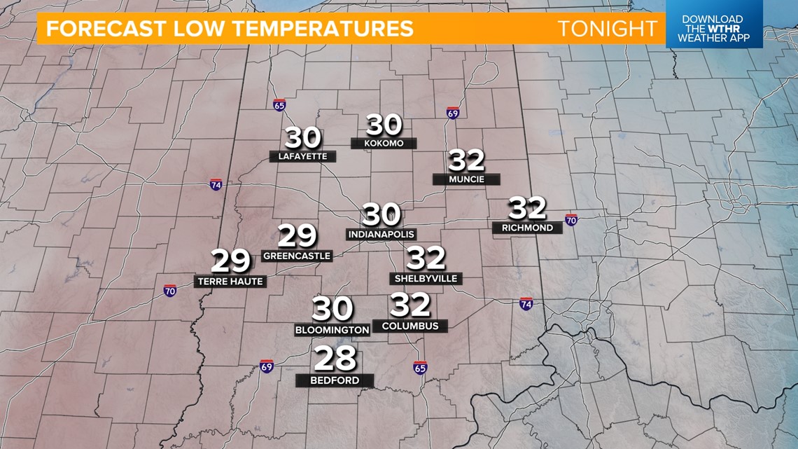
We'll stay mostly clear overnight and turning colder with lows near 30.

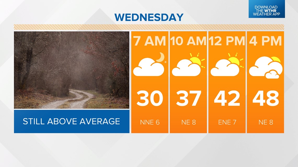
High temperatures drop into the mid to upper 40s Wednesday, which is still about 10 degrees above average for this time of year. We'll stay dry with partly to mostly cloudy skies.

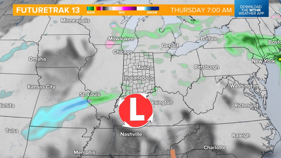
A slow-moving area of low pressure will eventually move in early Thursday morning, bringing rain back into the forecast. Temperatures should hold just above the freezing mark, keeping this an all-rain event. With highs in the low 40s Thursday afternoon, this will be a cold rain.


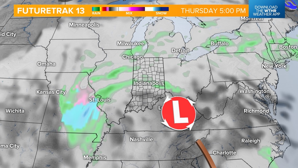
As this system lingers Thursday night into Friday, we'll see lows in the mid-30s and highs again in the low 40s, keeping the cold rain chance around.

We start the New Year's weekend off on a dry note with partly cloudy skies and highs in the low 40s Saturday. New Year's Eve will be mainly dry on Sunday with highs near 40. We're watching a weak wave possibly set to bring a light wintry mix late Sunday into New Year's Day.