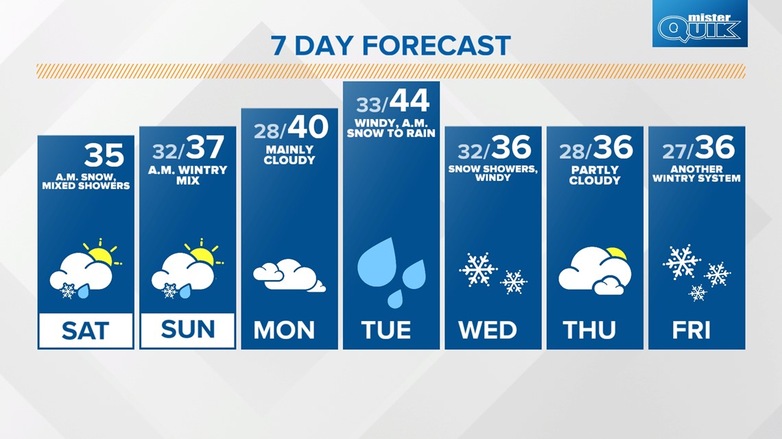
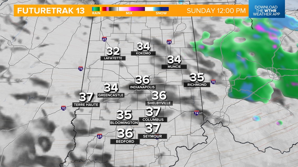
INDIANAPOLIS — Indianapolis officially received 1.9 inches of snowfall with many spots reporting up to 2 inches from our overnight snow system. Most of this wet snow will continue to compact and melt as temperatures rebound into the mid 30s this afternoon. We'll stay mainly dry for the rest of the afternoon with an isolated mixed shower possible.
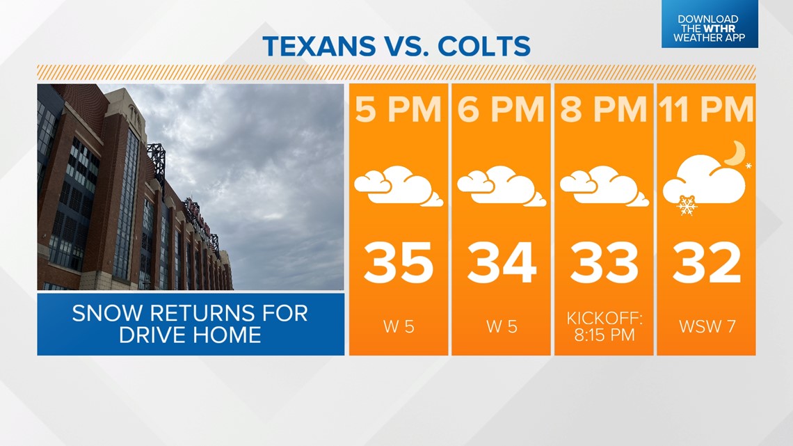
While it will remain fairly quiet throughout the afternoon for Colts tailgaters and those headed downtown for the Pacers game, another quick wave will arrive this evening, mainly after 10 p.m., bringing scattered snow along and north of the I-70 corridor and a rain mix south.


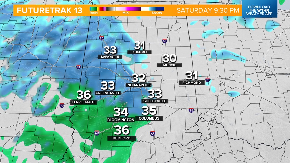
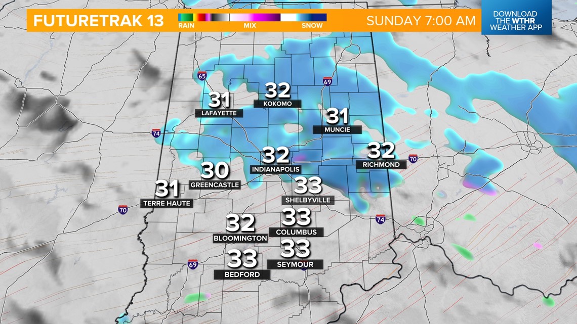
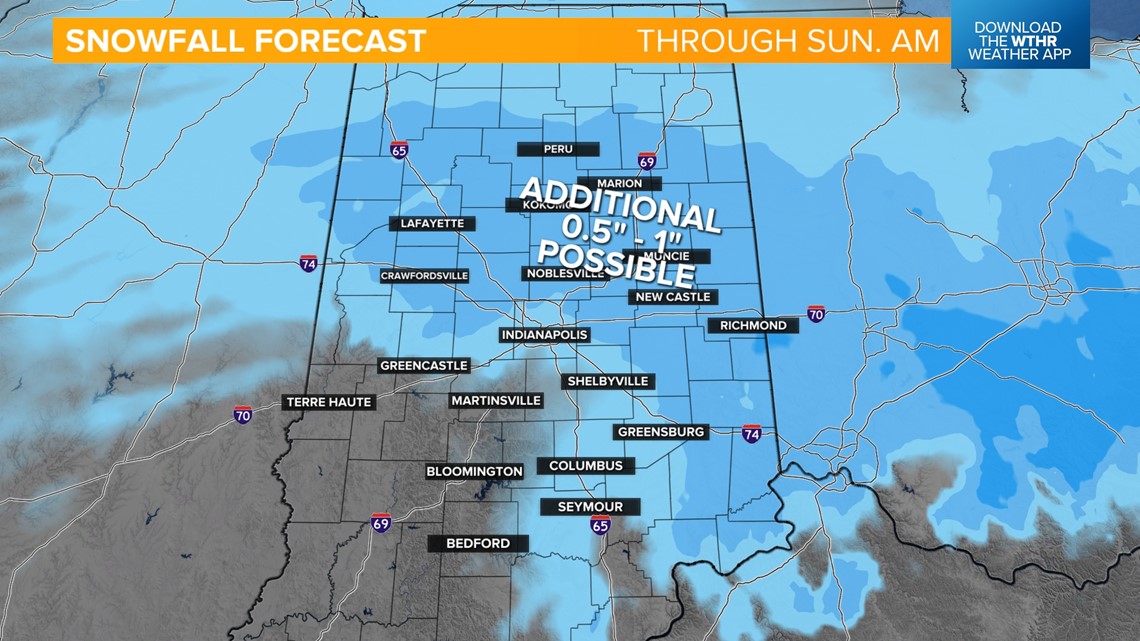
As temperatures drop back near freezing overnight, this changes into all snow. Most of the precipitation moves out by the late morning with mainly cloudy skies through the afternoon. Only minor additional accumulation -- up to 1" -- is expected with this overnight system. Temperatures recover to the upper 30s Sunday afternoon.


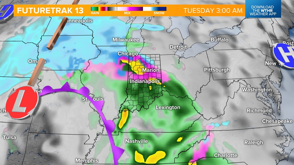
Looking ahead, Monday looks to be a mainly dry day ahead of a more potent storm complex set to return in the late evening Monday. We're monitoring the storm track closely as this will impact where the freezing line sets up. Initially this appears to start as snow quickly transitioning to rain showers becoming heavy rain at times Tuesday afternoon and evening as temperatures warm into the 40s in the "warm sector".


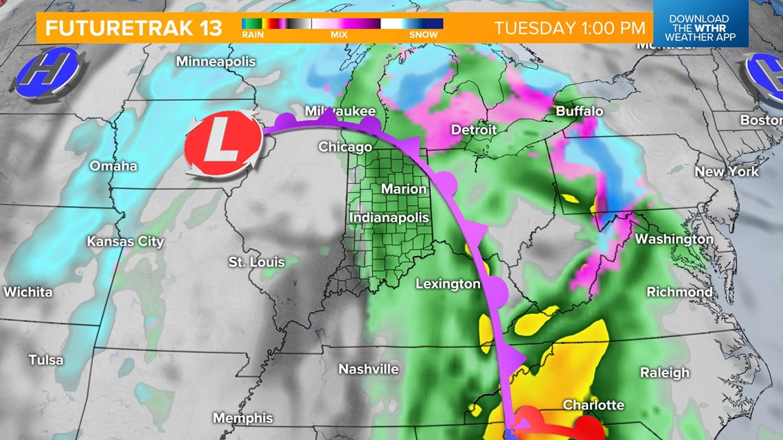
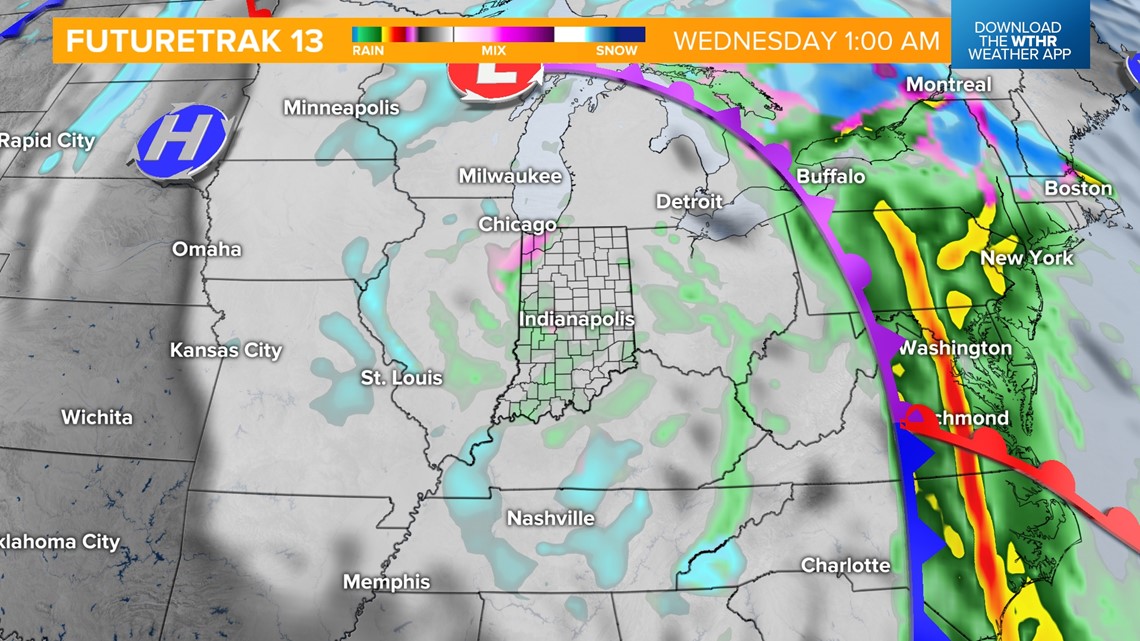
By early Wednesday, the core of the storm system will lift northeast allowing for colder air to wrap around the backside of this system. Remnant moisture will transition into mainly snow before exiting Wednesday afternoon. Wind gusts will increase to 30+ mph as well Wednesday as temperatures hold steady in the mid 30s.

The pattern remains active with another wintry system set to bring a rain/snow combination late Friday into Saturday. Also worth monitoring is a potential arctic blast expected to return next weekend behind this system. Much colder than average temperatures look likely. We'll continue to monitor these changes in the forecast.