INDIANAPOLIS — An active pattern starts the week with widespread rain and a few thunderstorms set to bring much-needed rain to central Indiana.

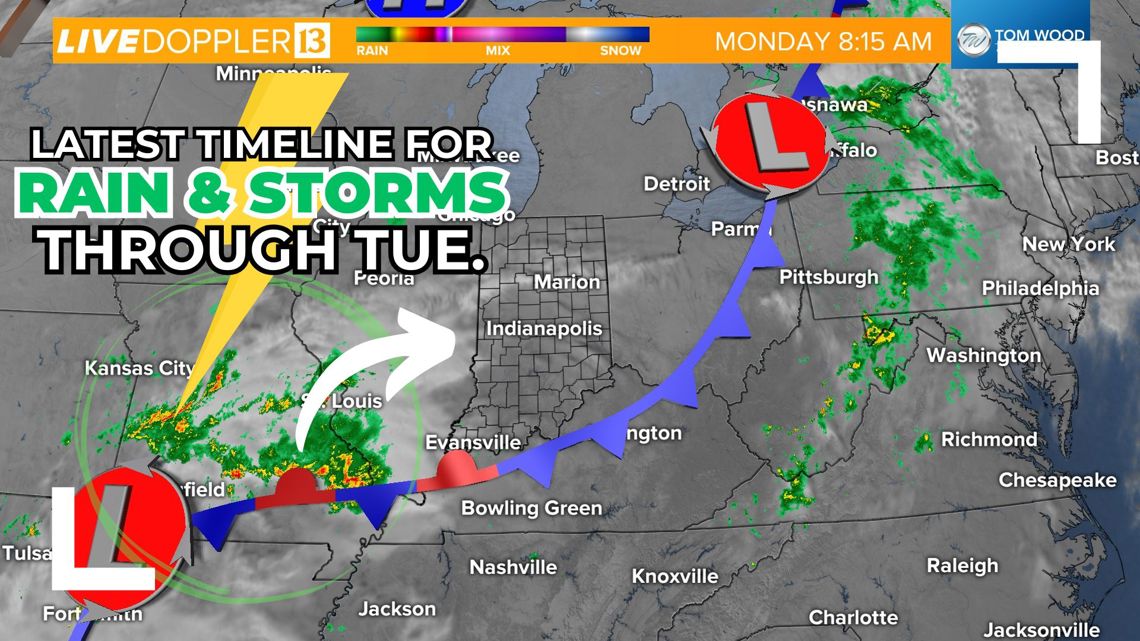
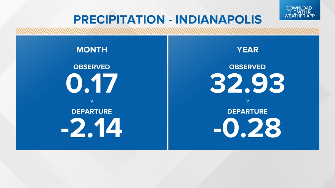
Rainfall yesterday was highest across north central parts of Indiana, ranging from a quarter inch to just shy of 0.5". Indianapolis only picked up 0.12", which keeps us in a 2"+ deficit for the month of September.

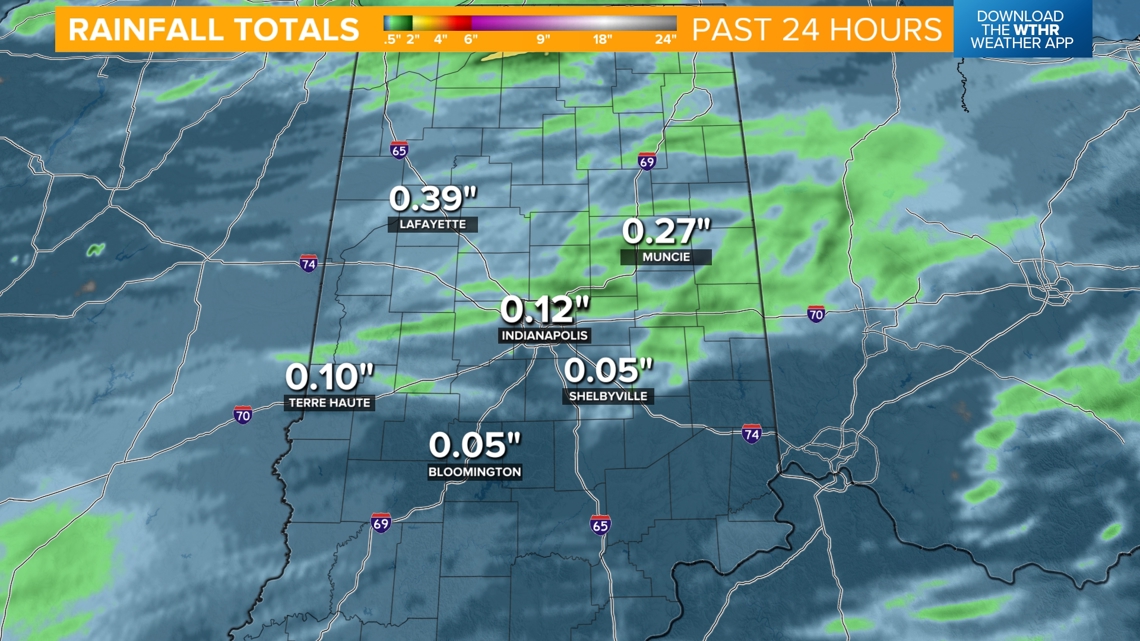

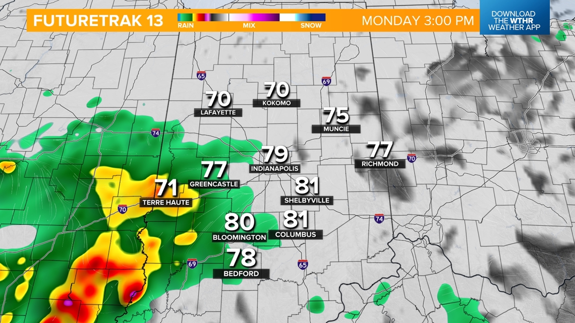
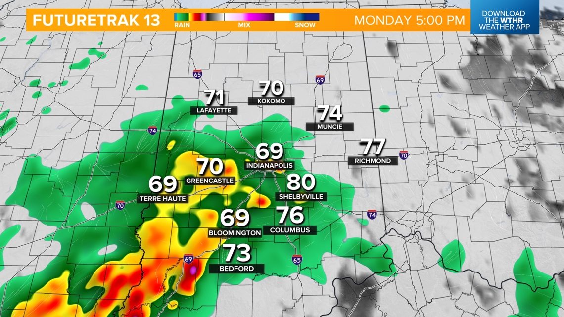
Rain timeline for today
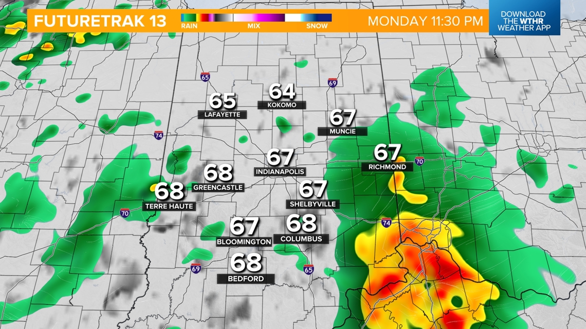
- Showers move in on the western side of the state first after 2 p.m.
- Rain becomes more widespread between 3-5 p.m., including the metro area and heavier bands in southern Indiana
- Steady rainfall mainly south of I-70 through the evening



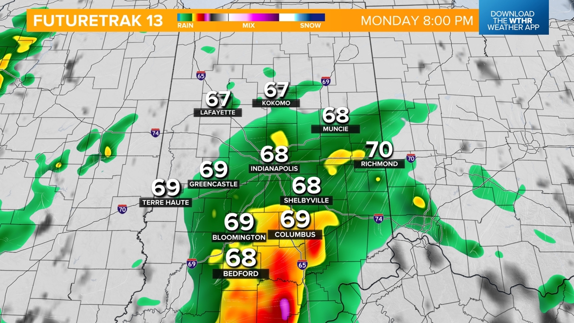

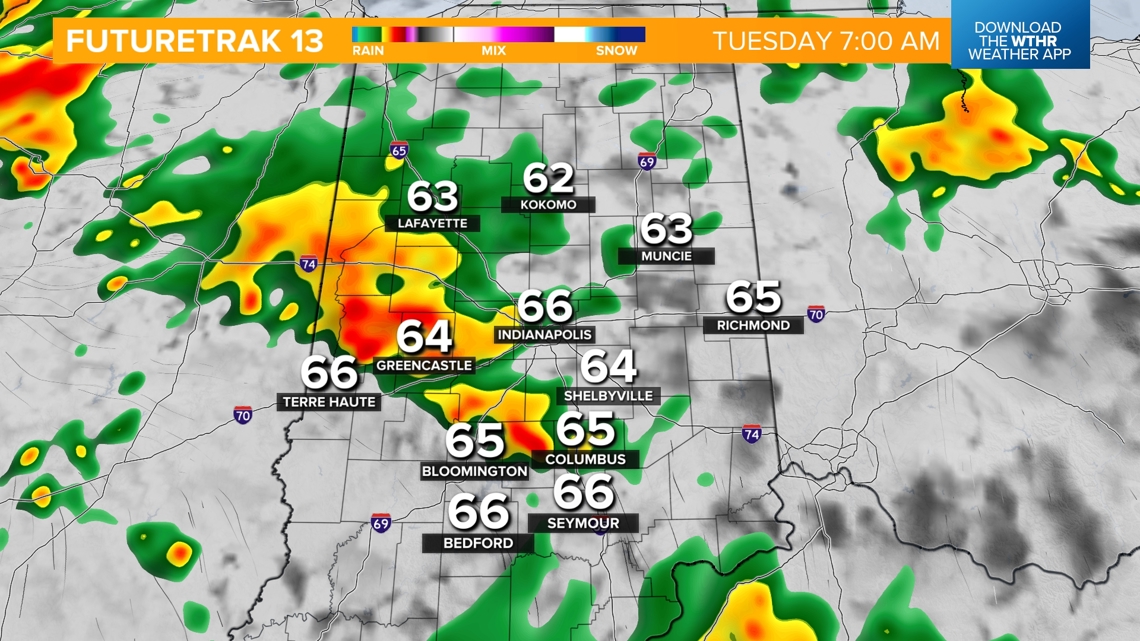
Heavier rain, isolated strong storms Tuesday morning
- A few stray showers possible overnight
- Heavier bands of rain set up by daybreak Tuesday
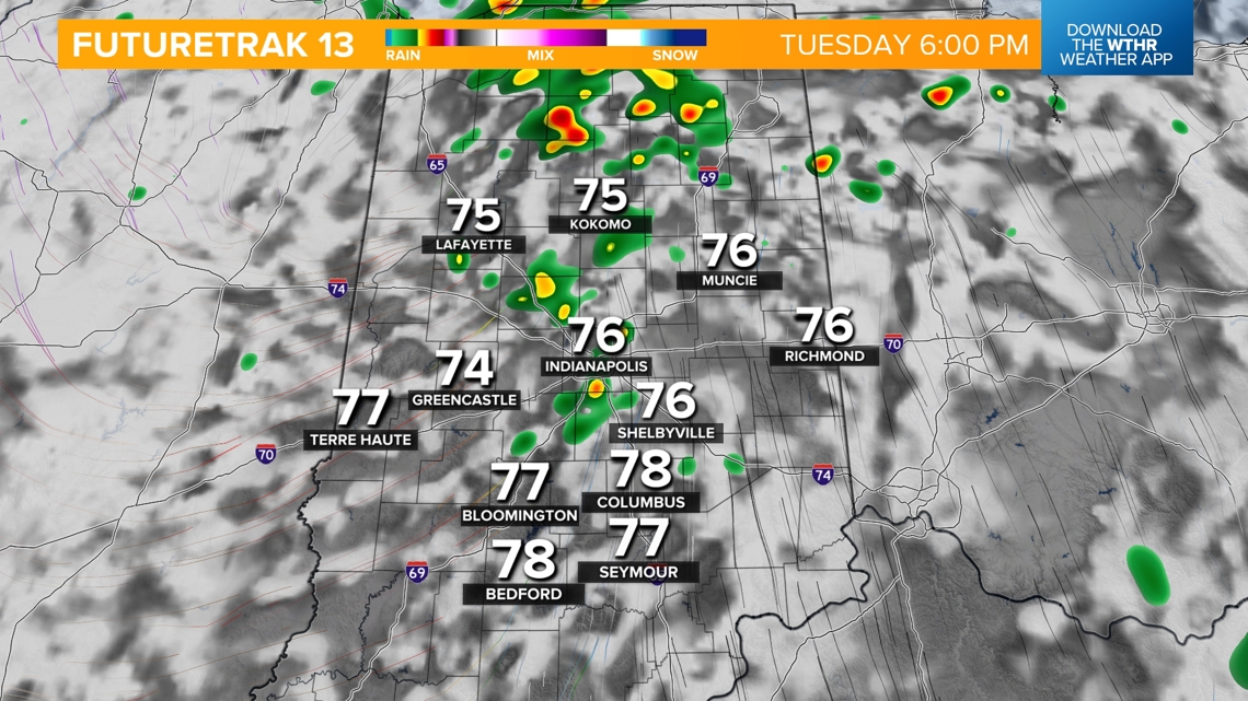
- A few isolated severe storms are possible through Tuesday afternoon with damaging wind gusts as the primary threat
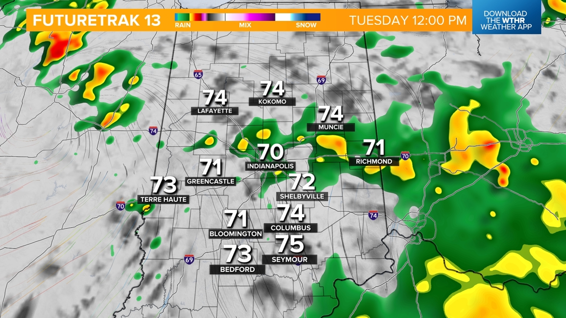
- Widespread rain tapers off after midday
- A few lingering stray storms through sunset

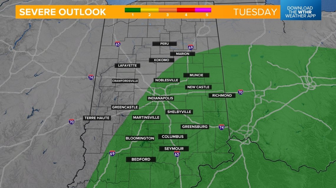



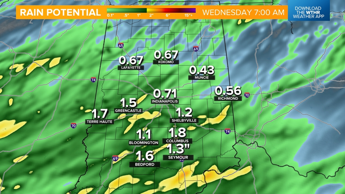
Rainfall potential through Wednesday morning
Most areas see 0.5"-1", but higher totals up to 1.5" are possible for those areas who see heavier rain bands. While this is helpful to the recent dry stretch, it will likely not be enough to completely wipe out the drought conditions across the state.

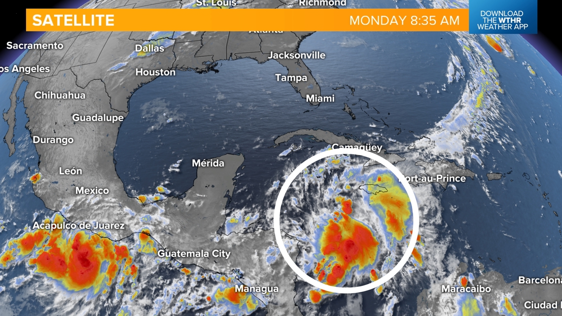
Tropical remnants bring more rain opportunities later this week
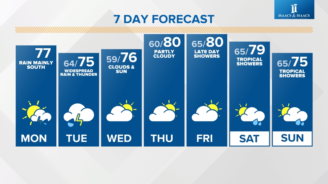
As this system departs on Wednesday, look for a mix of sun and clouds with highs still cooler in the mid 70s. Temperatures then recover to the upper 70s and low 80s starting Thursday, with only a stray shower possible as we track an incoming tropical system. The better chance of rain out of that tropical system will come late Friday night with scattered showers possible through the weekend.

