INDIANA, USA — Monday may bring the strongest storms of this slow-moving weather system, especially in the afternoon and evening. The worst thunderstorms may be in southern Indiana where temperatures are a bit warmer, closer to the warm front.
Threats in order of expected severity:
- Wind (gusts 60-70 MPH)
- Quick rain-wrapped tornadoes
- Large hail (more sporadic)
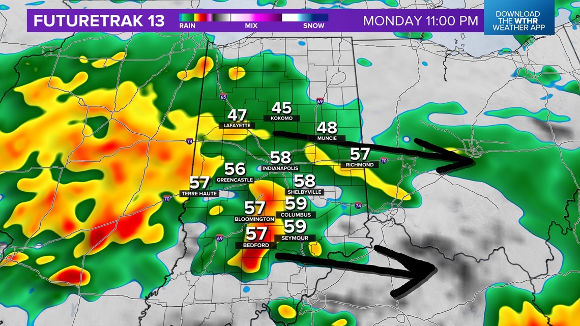
Tap HERE for our interactive radar to track the storm coming.
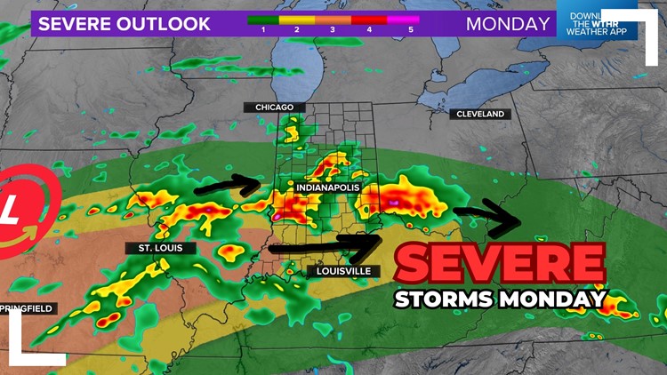
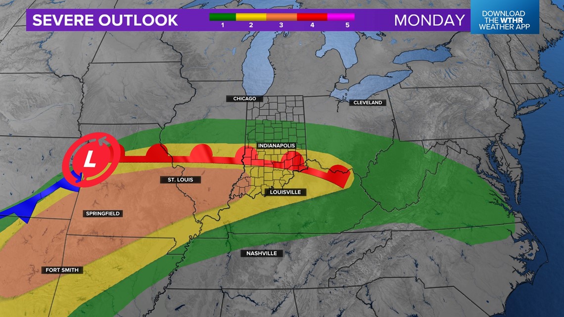
A level 1 and 2 out of 5 severe threat is in place Monday afternoon and night for central Indiana. A level 3 out of 5 severe threat is in place for extreme southwestern Indiana for Evansville. The farther south and west you go, the higher the chance for intense storms.

When are we expecting storms?
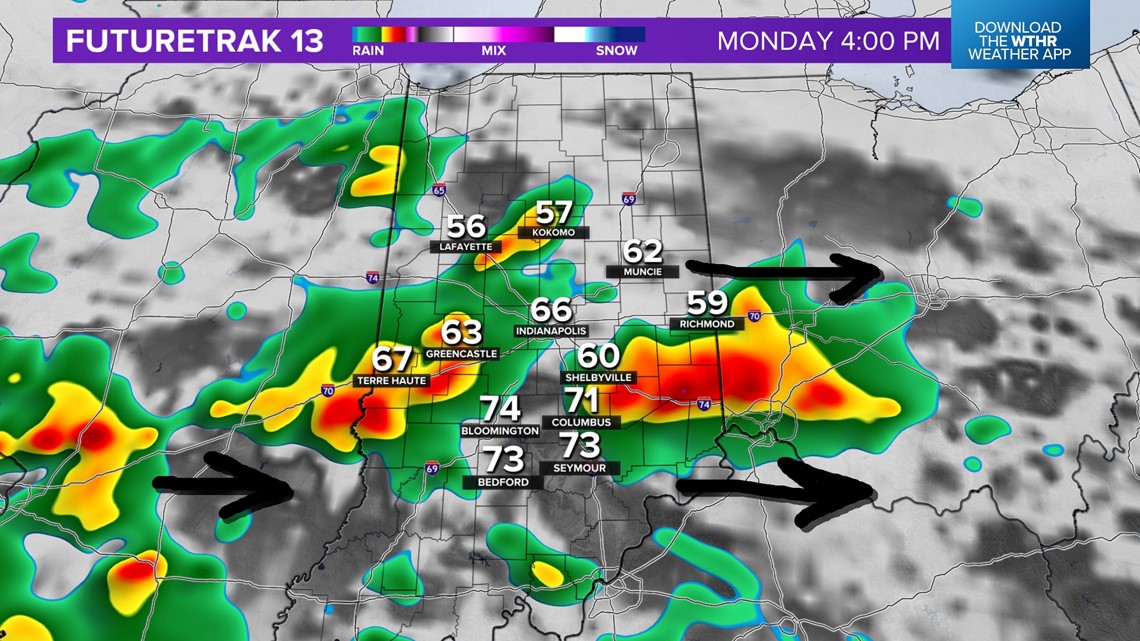
Our best guess for Monday storms will be in the late afternoon and evening. Generally, expect storm chances after 2 p.m. Don't be surprised if the timing changes by a couple hours. Generally, that's when we should spark some storms in Illinois and bring them into Indiana. The first few hours of storms may be the strongest with the highest chances for severe weather. Later into the evening and night, severe threats will slowly go down by very heavy rain and thunder fill in and waterlog the atmosphere.
- Severe storms: 2 p.m. - 10 p.m. Monday
- Heavy rain and thunder, lower severe risk: 10 p.m. Monday - Tuesday 6 p.m.
(Note: Check for tweaks to the timing. This storm is impacting many states and chain-reactions can impact timing of activity.)

Widespread heavy rain will push in after dark for the rest of Monday night. The severe threat will be lower during this time, but not zero.

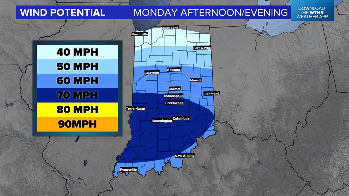
What are my chances for wind?
The highest wind potential will be in southern Indiana. A line of storms with gusty winds along the leading edge. At points these storms could produce 60-70 MPH gusts.

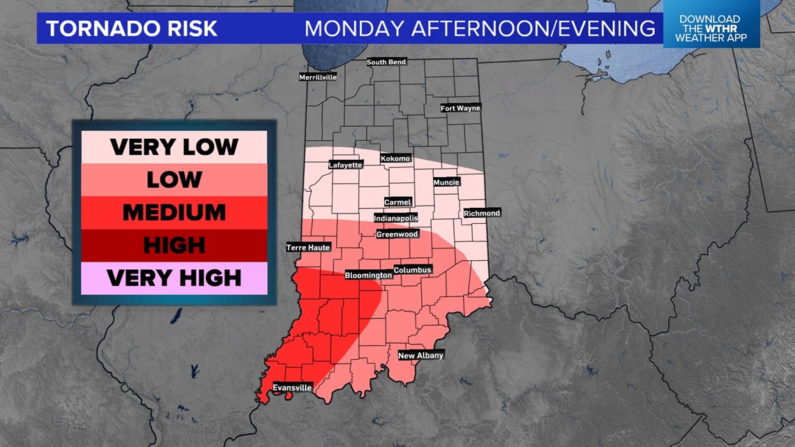
What are my chances for a tornado?
The highest tornado threat will be in southern Indiana. In the late afternoon, an isolated tornado is possible, but later in the evening there may be the chance for strong wind storms to start rotating along the edge and produce a rain-wrapped tornado.

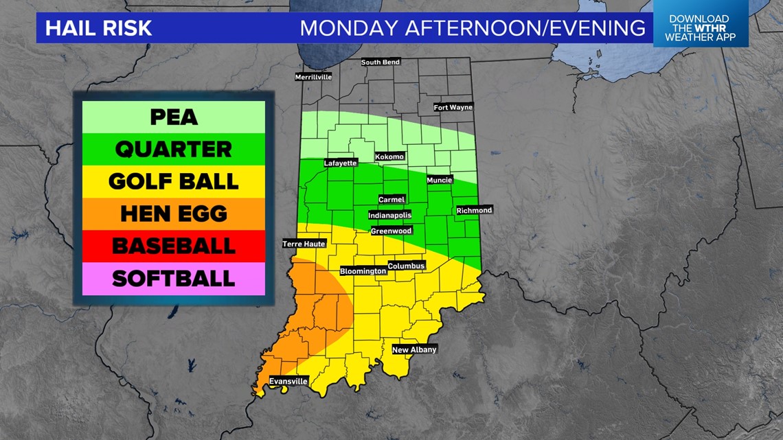
What are my chances for hail?
Hail is our lowest risk, however there is potential for large stones to fall. The hail will likely be more scattered. The best chance for hail will be south of I-70.

Storm chances may continue on Tuesday, especially for southeastern Indiana.
Check for more updates as the storm timeline gets closer. These are our best guesses as of Sunday evening.
— 13News Meteorologist Matt Standridge