INDIANAPOLIS — What a difference a day makes!
Central Indiana has transitioned from the deceivingly sunny weekend to above-average temperatures. The end result today was major melting of the snowpack of the heavy snow from last Friday.
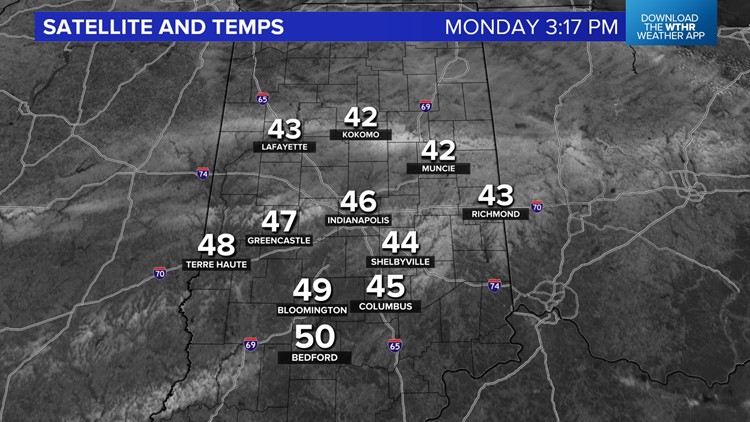
Temperatures are over 10° warmer than 24 hours ago and peaked in the 45°-50° range. You can definitely feel the difference today in central Indiana, and you can see it too! 13 Weather Camera Network time lapses from Tipton, Indianapolis and Carmel captured the snow diminishing.
This, combined with highs reaching the upper 40s, shows the snow losing its effectiveness on keeping our local atmosphere colder. We're just getting started on the latest warming trend.
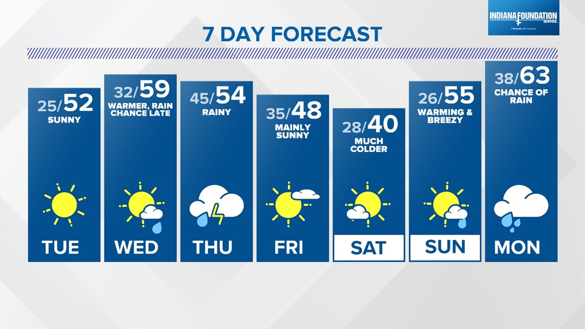
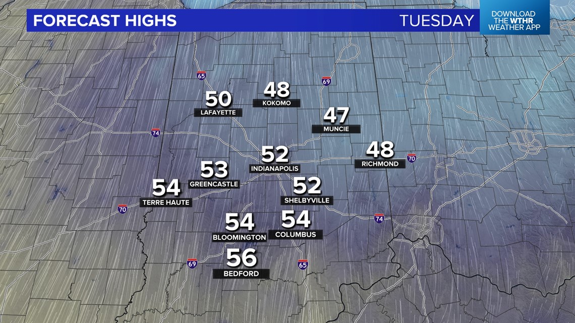
After starting out seasonably chilly in the 20s tomorrow, highs soar above 50° for most Tuesday afternoon. We're still circling Wednesday for the peak of the warmup this week, as highs near/exceed 60°, courtesy of a southwest wind and warm front.


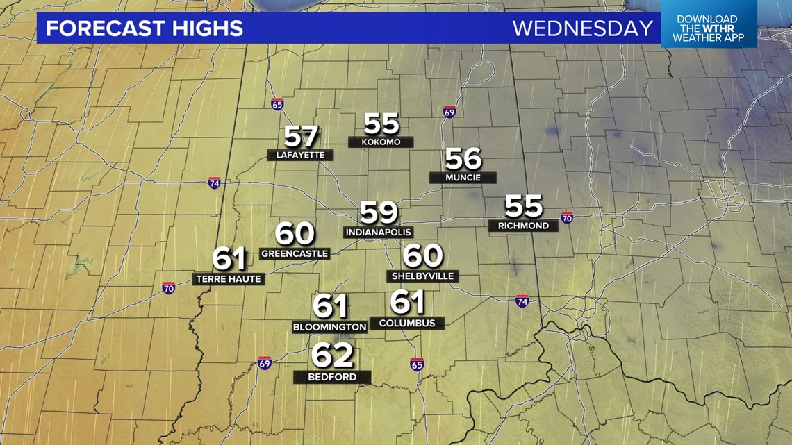

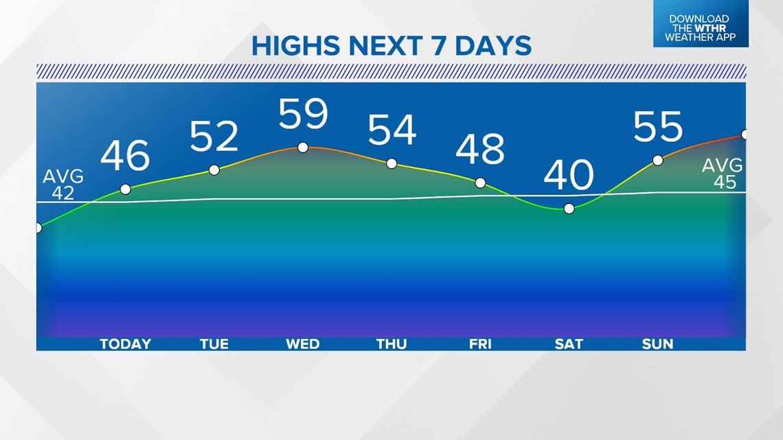
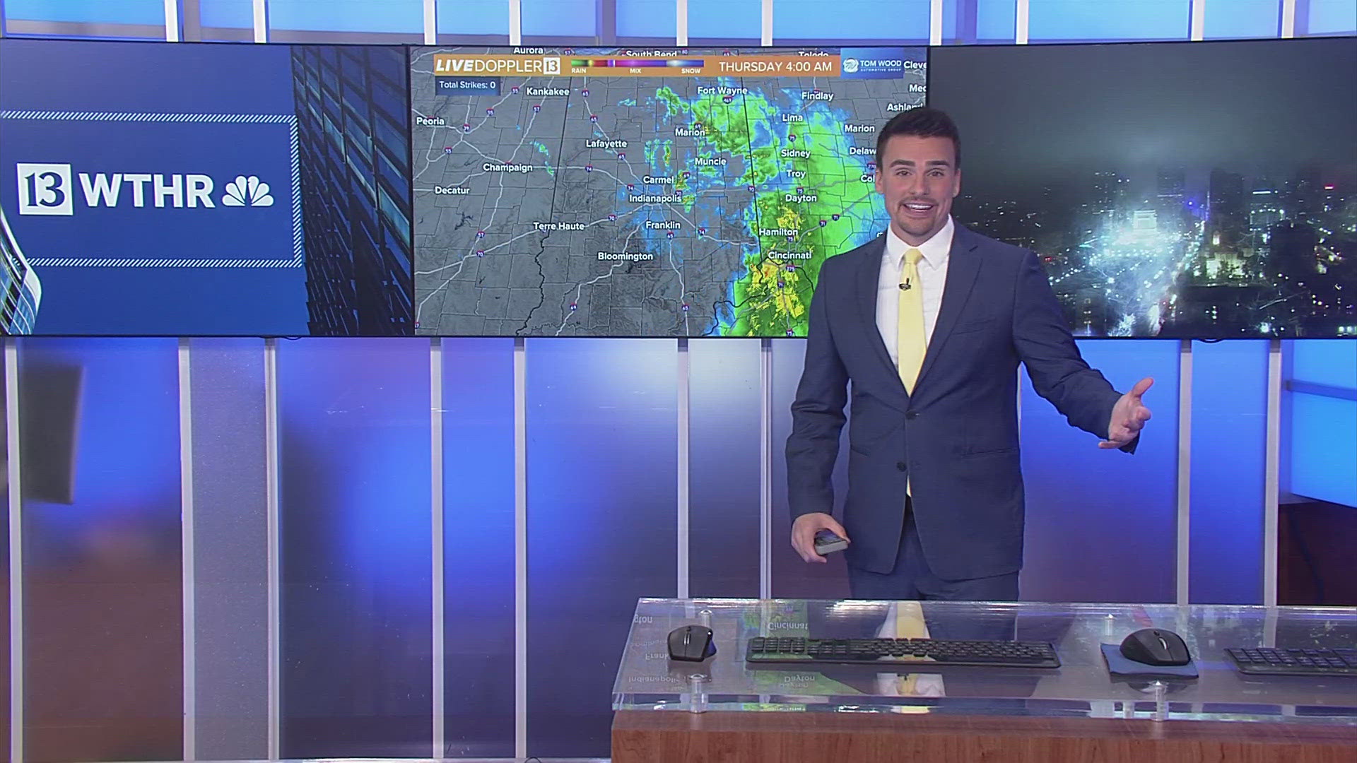
That front triggers some late-day rain and becomes a focal point for widespread rain and possibly some thunderstorms Wednesday night into Thursday. The passage of a cold front Thursday night/Friday delivers a quick shot of cold Friday night into Saturday.
We'll need to monitor model trends for later this week, with the possibility of an upper disturbance moving through the colder air to potentially trigger some snow showers early Saturday morning. The probability of that minute detail is low right now. Updates to come.
The cold quickly departs, and all signs point toward even warmer air emerging next week with a string of 60°+ days expected.

